Samar Sea
| Samar Sea | |
|---|---|
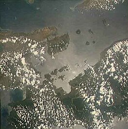
 The sea seen from space (north is towards the right) | |
| Location | |
| Coordinates | 11°49′30″N 124°30′00″E / 11.82500°N 124.50000°E |
| Type | sea |
| Etymology | Samar |
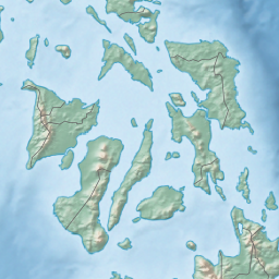
The Samar Sea is a small sea within the Philippine archipelago, situated between the Bicol Region of Luzon and the Eastern Visayas.[1]
It is bordered by the islands of
Tagapul-an
.
The Samar Sea has experienced a significant degradation of marine resources, that is even characterized as "
dynamite fishing). Average daily catch has reduced from 30 kg/day in the 1960s, to 8 kg/day in 1981, to 3.5 kg/day in 1991. Having depleted the large predatory fish, fishermen turned to smaller species, allowing jellyfish populations to explode.[2]
red tides, causing paralytic shellfish poisonings. The first red tide in the Philippines occurred in the Samar Sea in 1983 and thereafter continued to occur at irregular intervals.[2]
References
- ^ "Samar Sea: Philippines". Geographic.org. Retrieved 22 July 2013.
- ^ ISSN 0116-290X. Retrieved 25 September 2023.


