
San Miguel de Cozumel
San Miguel de Cozumel | |
|---|---|
 Aerial view of San Miguel de Cozumel | |
|
MMCZ CZM |
San Miguel de Cozumel (Spanish pronunciation: Chetumal, and Playa del Carmen. It is a hub for tourism on the Riviera Maya, providing the sole ferries between the Mexican mainland and the island. In addition to the ferry service to Playa del Carmen, the first international cruise terminal in Quintana Roo is located in the city.
Port
The Cozumel International
Seaport has an international cruise wharf of 271 meters and a dolphin at 45 meters, giving it the ability to receive two cruise ships at once: the exterior band can receive voyager
class ships of 140,000 displacement tons, and the interior band can receive ships up to 85,000 displacement tons.
A tender wharf is used to receive minor boats at the terminal.
The types of vessels regularly calling at COZUMEL are Passenger Ship (49%), Sailing Vessel (20%), Pleasure Craft (19%), Passenger (3%),
Ro-Ro/Passenger Ship (1%). The maximum length of the vessels recorded to having entered this port is 363 meters. The maximum draught is 9.4 meters. The maximum Deadweight is 28414t.[1]
Cozumel is the 4th world passenger port, by traffic (3,3 million).
Gallery
-
 San Miguel de Cozumel satellite image
 -
 Palacio Municipal in San Miguel de Cozumel, Cozumel, Mexico
 -
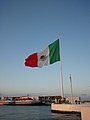 Bandera monumental in San Miguel de Cozumel

.jpg)


References
Wikimedia Commons has media related to San Miguel de Cozumel.
- 2010 census tables: INEGI: Instituto Nacional de Estadística, Geografía e Informática
20°30′37.58″N 86°56′57.30″W / 20.5104389°N 86.9492500°W
Chetumal (capital) | |||||||||||
| Municipalities (seats) |
|  | |||||||||
| Places of interest |
| ||||||||||
| International | |
|---|---|
| National | |