
Southwest Center City Philadelphia
Southwest Center City Graduate Hospital South of South | |
|---|---|
 | |
 Southwest Center City Graduate Hospital South of South | |
| Coordinates: 39°56′31″N 75°10′30″W / 39.942°N 75.175°W | |
| Country | |
| State | |
| County | |
| City | |
| Area | |
| • Total | 0.391 sq mi (1.01 km2) |
| Population (2010) | |
| • Total | 14,919 |
| • Density | 38,130/sq mi (14,720/km2) |
| ZIP Code | 19146 |
Southwest Center City (SWCC), also known as Graduate Hospital,[1] is a neighborhood that is located in South Philadelphia, Pennsylvania, United States, bordering Center City Philadelphia. The neighborhood is bordered on the north by South Street, on the south by Washington Avenue, on the west by the Schuylkill River, and on the east by Broad Street.[2][3][4]
It is an area adjacent to the
Names
The neighborhood has many nicknames. The Philadelphia Planning Commission refers to it as Southwest Center City.
Composition
The neighborhood consists primarily of nineteenth and twentieth-century
History

Prior to the
The neighborhood began taking shape after the Civil War. In 1870, it was predominantly an
In the 1960s a crosstown expressway running along South Street was planned. This would have created a barrier between Center City and the neighborhoods to the south. The result was widespread abandonment of properties in SWCC and the decay of the South Street business corridor. The loss of jobs and residents caused the neighborhood to decline as buildings were abandoned and left to deteriorate.
The
Recent development
In recent years, the area has experienced growth and gentrification. Hundreds of single family homes and condominium units have been built or refurbished. As a result of the neighborhood's proximity to Center City and increasing desirability, a variety of new businesses catering to the increasingly gentrified population have opened. Despite the improvements, the neighborhood still contains some abandoned and dilapidated housing, especially towards the south.
The
Children's Hospital Expansion 2017

The
The proposal for three new Schuylkill Avenue towers proposed by the Children's Hospital of Philadelphia is for the towers to take the place of the Springfield Beer Distributor, and the former JFK Vocational School, with each tower being 26 stories high.
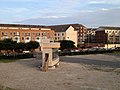
-
 CHOP plans to build on these 2 properties, with the JFK Vocational School (in the back) and Springfield Beer Distributor in the front.
 -
 CHOP prototype of building facade for demonstration
 -
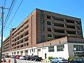 The Marine Corps Depot of Supplies, Schuylkill Warehouse


Culture
Every year since 1975, the area hosts Philadelphia's
References
- ^ a b Saffron, Inga (July 20, 2018). "Searching for a new identity: Graduate Hospital long gone, but the incongruous name lives on". The Philadelphia Inquirer. Retrieved September 12, 2021 – via Newspapers.com.
- ^ Map from UPenn study on the neighborhood
- ^ Map of the Southwest Central Redevelopment Area as of 1968
- ^ Heavens, Alan J. (December 19, 2008). "Philly's hot, new location". The Philadelphia Inquirer. Retrieved September 12, 2021 – via Newspapers.com.
- ^ City Paper article about "G-Ho"
- ^ SOSNA - The South of South Neighborhood Association
- ^ McCabe, Caitlin (July 23, 2017). "Naming your neighborhood". The Philadelphia Inquirer. Retrieved September 12, 2021 – via Newspapers.com.
- ^ Naval Square, a Toll Brothers development that will make up a large part of the neighborhood
- ^ Early Moyamensing history from ushistory.com.
- ^ "National Register Information System". National Register of Historic Places. National Park Service. July 9, 2010.
- ISBN 0-8135-2716-3
- ^ "CHOP - Schuylkill Avenue Community Meeting - Recap". South of South Neighborhood Association. Retrieved 16 March 2015.
- ^ "Schuylkill Avenue Phase 1: Community Meeting 2/25/15" (PDF). Children's Hospital of Philadelphia. Archived from the original (PDF) on 2015-03-16. Retrieved 2015-03-16.
Demolition Complete
- ^ "CHOP expansion could bring jobs, traffic".
- ^ "Planning to develop lower Schuylkill".
External links
- History of Philadelphia Naval Home