
Senggigi
Senggigi | |
|---|---|
Place | |
UTC+08 |
Senggigi used to be the main tourist strip of the
2002 Bali bombing
dealt Senggigi a severe blow, with tourist numbers declining precipitously and many construction projects halted. Senggigi has now fallen behind Kuta Lombok in the south of the island and the North Western Gili islands in terms of popularity and development.
Sights
Pura Batu Bolong is a Hindu temple with 14 altars on a rock on the beach which is visited by many worshippers.[1] The name means "Rock with a hole". In the south of Senggigi is the grave of Batu Layar (Makam Batu Layar), a Muslim saint. The salty waterfall at the end of Nambung Beach can be reached on foot or by boat.[2]
Gallery
-
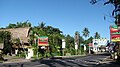
 High Street of Senggigi, northern part
 -
 High Street, Senggigi, Lombok, Indonesia
 -
 Grave of Batu Layar near Senggigi
 -
 Senggigi Beach
 -
 Senggigi Beach view from Jalan Raya Sengigi


References
- ^ Birgit Borowski: Bali & Lombok, p. 297. Ostfildern 2013
- ^ "Salty Waterfall, Lombok". Retrieved December 4, 2014.
External links
 Senggigi travel guide from Wikivoyage
- NY Times article Next Stop Lombok Island
This West Nusa Tenggara location article is a stub. You can help Wikipedia by expanding it. |