
Salbit
Salbit
سلبيت | |
|---|---|
| Etymology: from personal name[3] | |
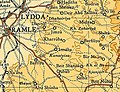
.jpg) 1870s map 1870s map .jpg) 1940s map 1940s map.jpg) modern map modern map .jpg) 1940s with modern overlay map 1940s with modern overlay mapA series of historical maps of the area around Salbit (click the buttons) | |
Shaalvim[7] |
Salbit (
History
Hebrew Bible
In 1883 the
Roman and Byzantine periods
Jerome (347-420) describes it as part of the territory of the Dan, transcribing its name at that time as Selebi, a form also used by Josephus (37-c. 100).[2][13]

In 1949,
Ottoman period
Salbit was not mentioned in 16th century records. It was an 'azba of Biddu and nearby villages (including Beit Duqqu and Beit 'Anan).[17]
In 1838, it was noted as Selbit, a
In 1883 the PEF's Survey of Western Palestine (SWP) described Selbit: "Foundations and caves. The ruins are extensive. A square building stands in the middle. There is a ruined reservoir lined with cement, and walls of rubble."[19]
The village is believed to have been resettled in the late 19th century.[17]
British Mandate
In the
The houses in Salbit were made of
In the 1945 statistics, the population was 510, all Muslims,[4] while the total land area was 6,111 dunams, according to an official land and population survey.[5] Of this, a total of 4,066 dunums of land were used for cereals, 16 dunums were plantations or irrigated land,[22] while 31 dunams were classified as built-up public areas.[23]
-
 Salbit 1942 1:20,000
 -
 Salbit 1945 Scale 1:250,000
 -
 Depopulated villages in the Ramle Subdistrict


1948 war and aftermath

During the
Salbit itself was depopulated after a military assault by Israeli forces on 15–16 July 1948.[6] After its depopulation, Israeli forces headed by Yigal Allon used it as a base from which to launch an attack on the strategic hill of Latrun on 18 July, which was spurned by the forces of the Arab Legion who managed to hold on to the site without inflicting any casualties on the Israeli forces.[26] The village structures of Salbit were subsequently completely destroyed, and according to Walid Khalidi, all that remains of the village today are "some cactus plants and shrubs."[9] The estimated number of Palestinian refugees from Salbit as of 1998 was 3,633.[9]
The
References
- ^ Taylor, 1993, p. 68
- ^ a b Smith, 1857, p. 972
- ^ Palmer, 1881, p. 326
- ^ a b Department of Statistics, 1945, p. 30
- ^ a b Government of Palestine, Department of Statistics. Village Statistics, April, 1945. Quoted in Hadawi, 1970, p. 68
- ^ a b c Morris, 2004, p. xix village #239. Also gives cause of depopulation.
- ^ a b Khalidi, 1992, p. 410
- ISBN 978-90-5356-503-2.
- ^ a b c "Salbit". Palestine Remembered. Retrieved 2009-04-28.
- ^ Conder and Kitchener, 1883, SWP III, pp. 53-54
- ^ Cooke, 1918, p. 185
- ^ Marom, Roy (2023). "Early-Ottoman Palestinian Toponymy: A Linguistic Analysis of the (Micro-)Toponyms in Haseki Sultan's Endowment Deed (1552)". Zeitschrift des Deutschen Palästina-Vereins. 139 (2).
- ^ Robinson and Smith, 1841, vol 3, p. 20.
- ^ a b c Stemburger and Tuschling, 2000, p. 228
- ^ Pringle, 1998, p. 114
- ^ Dauphin, 1998, p. 842
- ^ a b Grossman, D. (1986). "Oscillations in the Rural Settlement of Samaria and Judaea in the Ottoman Period". in Shomron studies. Dar, S., Safrai, S., (eds). Tel Aviv: Hakibbutz Hameuchad Publishing House. p. 376
- ^ Robinson and Smith, 1841, vol 3, Appendix 2, p. 120
- ^ Conder and Kitchener, 1883, SWP III, p. 157
- ^ Barron, 1923, Table VII, Sub-district of Jerusalem, p. 15
- ^ Mills, 1932, p. 43
- ^ Government of Palestine, Department of Statistics. Village Statistics, April, 1945. Quoted in Hadawi, 1970, p. 117.
- ^ Government of Palestine, Department of Statistics. Village Statistics, April, 1945. Quoted in Hadawi, 1970, p. 167
- ^ a b Sandy Tolan (20 July 2008). "Palestinian Nakba in al-Ramla". Palestine Media Center (Original from Al Jazeera English). Retrieved 2009-04-28.
- ISBN 978-3540681601.
- ^ Tal, 2004, p. 324.
Bibliography
- Barnes, W.E. (1932). The first book of the Kings. CUP Archive. p. 31. GGKEY:BG3S2C5ERWZ. Retrieved 2 May 2011.
- Barron, JB., ed. (1923). Palestine: Report and General Abstracts of the Census of 1922. Government of Palestine.
- Conder, C.R.; Kitchener, H. H. (1883). The Survey of Western Palestine: Memoirs of the Topography, Orography, Hydrography, and Archaeology. Vol. 3. London: Committee of the Palestine Exploration Fund.
- Cooke, G.A. (1918). The Book of Joshua - In the Revised Version with Introduction and Notes. Cambridge University Press. Retrieved 22 July 2018.
- ISBN 0-860549-05-4.
- Department of Statistics (1945). Village Statistics, April, 1945. Government of Palestine.
- Hadawi, S. (1970). Village Statistics of 1945: A Classification of Land and Area ownership in Palestine. Palestine Liberation Organization Research Center.
- ISBN 0-88728-224-5.
- Mills, E., ed. (1932). Census of Palestine 1931. Population of Villages, Towns and Administrative Areas. Jerusalem: Government of Palestine.
- ISBN 978-0-521-00967-6.
- Palmer, E.H. (1881). The Survey of Western Palestine: Arabic and English Name Lists Collected During the Survey by Lieutenants Conder and Kitchener, R. E. Transliterated and Explained by E.H. Palmer. Committee of the Palestine Exploration Fund.
- ISBN 0-521-39037-0.
- Robinson, E.; Smith, E. (1841). Biblical Researches in Palestine, Mount Sinai and Arabia Petraea: A Journal of Travels in the year 1838. Vol. 3. Boston: Crocker & Brewster.
- Dictionary of Greek and Roman Geography: Iabadius-Zymethus
- Stemberger, Günter (2000). Jews and Christians in the Holy Land: Palestine in the fourth century. Continuum International Publishing Group. ISBN 0567-23050-3. Retrieved 4 July 2016.
- ISBN 978-0-7146-5275-7. Retrieved 2 May 2011.
- ISBN 978-0-19-814785-5. Retrieved 2 May 2011.
External links
- Welcome to Salbit
- Salbit, Zochrot
- Survey of Western Palestine, Map 17: IAA, Wikimedia commons
