
Sierra Madre de Chiapas moist forests
| Sierra Madre de Chiapas moist forests | |
|---|---|
Central American pine-oak forests | |
| Geography | |
| Area | 11,218 km2 (4,331 sq mi) |
| Countries | |
| States of Mexico | Chiapas |
| Conservation | |
| Conservation status | Critical/endangered |
| Protected | 1,787 km2%[1] |
The Sierra Madre de Chiapas moist forests is a tropical moist broadleaf forest ecoregion in southern Mexico and southern Guatemala, extending into the northwestern corner of El Salvador.
Geography
The moist forests ecoregion lies on the southern slope of the Sierra Madre de Chiapas, between the Central American pine–oak forests which cover the mountains' higher elevations to the north, and the Central American dry forests in the Pacific coastal lowlands to the south.[2]
Climate
The climate of the ecoregion is tropical and humid. The mountains intercept prevailing winds from the Pacific, creating clouds, fog, and
Flora
The main plant communities are montane tropical broadleaf evergreen forest.[2] The forests are of two types, lower montane rain forests and montane rain forests.[3]
Lower montane rain forest is found in a narrow band along the southern slope of the Sierra. In mature forests, trees form a closed canopy 25 to 45 meters high. Typical canopy trees include
The lower montane rain forest has an understory of low trees 10 to 20 meters high. Typical understory tree species include
Lianas and epiphytes are abundant, and are found in all the forest layers. The forest floor is dense with low-branched shrubs, spinescent palms, cycads, and lianas.[3]
Montane rain forest is generally found on steep slopes between 900 and 2200 meters elevation. The forest canopy is 25 to 35 meters high, and more open and irregular than that of the lower montane forest. Typical canopy trees include
Epiphytes are abundant throughout the montane rain forests, and include
Fauna
The ecoregion has over 300 species of birds, most notably the
-
 Falco rufigularis in Santa Lucía Cotzumalguapa, Guatemala
 -
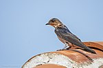 Progne chalybea in Jiquipilas, Mexico
 -
 Buteogallus urubitinga in Santa Lucía Cotzumalguapa, Guatemala


Human impacts
Much of the ecoregion's forest has been cleared for agriculture and grazing.[4] The lower montane forests have mostly been cleared for coffee plantations.[3] Much of the remaining forest area is fragmented or degraded, and what remains is often on steep or inaccessible slopes. The ecoregion has a road density of 645 meters per square kilometers, the highest of Central America's ecoregions.[4]
Protected areas
16.55% of the ecoregion is in protected areas.
See also
External links
- "Sierra Madre de Chiapas moist forests". Terrestrial Ecoregions. World Wildlife Fund.
References
- ^ Eric Dinerstein, David Olson, et al. (2017). "An Ecoregion-Based Approach to Protecting Half the Terrestrial Realm", BioScience, Volume 67, Issue 6, June 2017, Pages 534–545; Supplemental material 2 table S1b.
- ^ a b c d "Sierra Madre de Chiapas moist forests". Terrestrial Ecoregions. World Wildlife Fund.
- ^ ISBN 0-940228-00-9
- ^ a b c Corrales, Lenin & Bouroncle, Claudia & Zamora Pereira, Juan. (2015). An overview of forest biomes and ecoregions of Central America.
- ^ a b "Sierra Madre de Chiapas Moist forests". DOPA Explorer. Accessed 3 October 2021. [1]