Silisili
| Silisili | |
|---|---|
| Mount Silisili | |
| Highest point | |
Ultra | |
| Coordinates | 13°37′06″S 172°29′09″W / 13.61833°S 172.48583°W[2] |
| Geography | |
| Location | Samoa |
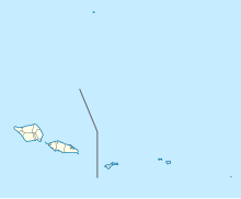
Mount Silisili is the highest peak in
Savai'i island. Mount Silisili is ranked 24th by topographic isolation
.
Mount Silisili rises to a height of 1,858 m.[3] The word silisili means highest in reference to height, in the Samoan language.
Savai'i is the largest shield volcano island in the South Pacific.
Climbing the volcano
Mount Silisili makes a popular hike of Savai'i island, and can be reached with a 2-day guided round-trip.[4][5]
See also
- Mount Matavanu, active volcano on Savai'i, last erupted 1905 - 1911.
- Mata o le Afi, a volcano on Savai'i, last erupted 30 October 1902 to 17 November 1902.
- Mauga Afi, a volcano on Savai'i, last erupted about 1725.
References
- ^ a b "Mauga Silisili" on Peakbagger.com Retrieved 1 October 2011
- ^ "Mauga Silisili" Peaklist.org - Pacific Islands Retrieved 1 October 2011
- ISBN 0-313-31395-4. Retrieved 3 March 2010.
- ^ "Mt Silisili". Samoa Tourism Authority. Retrieved 8 August 2021.
- ^ Elizabeth Ah Hi (3 July 2020). "Mt Silisili Conquerors say its not for the Faint Hearted". Samoa Global News. Retrieved 8 August 2021.

