
Snaefell
| Snaefell | |
|---|---|
| Sniaull | |
Marilyn, Hardy | |
| Coordinates | 54°15′47.8″N 04°27′41.8″W / 54.263278°N 4.461611°W |
| Naming | |
| English translation | snow fell |
| Language of name | Old Norse |
| Pronunciation | /ˈsneɪfɛl/ |
| Geography | |
 Snaefell Location of Snaefell in the Isle of Man | |
| Location | Isle of Man |
| OS grid | SC397881 |
| Topo map | OS Landranger 95 |
Snaefell (
The summit is crowned by a railway station, cafe and several communications masts.Views
It is a well-known saying in the Isle of Man that on a clear day six
The plaque at the summit indicates the directions of five points from Snaefell as well as their distances:
- 31 miles (50 km) to the Mull of Galloway (Scotland)
- 51 miles (82 km) to Scafell(England)
- 66 miles (106 km) to the Mountains of Mourne (Northern Ireland)
- 85 miles (137 km) to Liverpool (England)
- 97 miles (156 km) to Dublin (Republic of Ireland)
(For some reason, Wales is absent from the plaque).
While highly dependent on weather conditions and visibility, all of the four countries of the United Kingdom can be seen from the summit of Snaefell. This includes much of the southern coast of Dumfries and Galloway in Scotland, the Lake District in England, the northern coast of Anglesey in Wales, and the Mountains of Mourne in Northern Ireland. Points in the Republic of Ireland in County Louth can also be seen.[6]
Climbing Snaefell
The Snaefell Mountain Railway has a seasonal electric tram service, typically from April to October, which climbs the four miles (six kilometres) from Laxey to the summit.[citation needed]
The
A geodetic marker embedded in the small, concrete obelisk indicates the true mountain summit. The rock cairn standing nearby has an information plaque on top.[citation needed]
Weather
In 1970, the automated weather station at the Snaefell summit recorded a gust of 150 mph (65 m/s) which was one of the highest wind speeds ever recorded in the British Isles.
Gallery
-
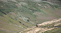
 Footpath entry near Bungalow railway station typically used to climb Snaefell
 -
 The Snaefell Mountain Railway on the ascent of Snaefell
 -
 Defunct hotel (nowcafe) near the summit
 -
 Top of Snaefell with geodetic marker and nearby cairn with plaque
 -
 Plaque pointing out the directions oflandmarksand their distances from the summit


References
- ISBN 3-484-40138-9(Gesamtwerk) 3-484-40131-1 (Band 3) Druck: Weihert-Druck GmbH Darmstadt Einband: Siegfried Geiger, Ammerbuch. "A mountain summit ct. SC38NE SC39788811"
- ^ "Ordnance Survey Triangulation stations trig archive". Retrieved 17 October 2016.
- ^ "Ordnance Survey mapping". Retrieved 17 October 2016.
- ^ Isle of Man guide website
- ^ Manx Notebook website
- ^ "HeyWhatsThat - Snaefell panorama". www.heywhatsthat.com. Retrieved 2 November 2020.
- ^ Birmingham Daily Post page 35 Wednesday 4 November 1970
- ^ Birmingham Daily Post page 27 Saturday 3 December 1966
External links
- Computer generated summit panoramas North South Index
- Snaefell Mountain Railway
- Cold War RADAR Site
- Snaefell Fell Race
| Northern Highlands (20) |    | |
|---|---|---|
| Western Highlands (20) | ||
| Central and Eastern Highlands (13) | ||
| Southern Highlands (15) |
| |
| Islands (13) | ||
| Scottish Lowlands, England and Wales (13) | ||
| Republic of Ireland, Northern Ireland (25) | ||
| International | |
|---|---|
| National | |