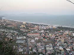
Southeast (Vietnam)
This article has multiple issues. Please help improve it or discuss these issues on the talk page. (Learn how and when to remove these template messages)
|
Southeast region
Đông Nam Bộ | |
|---|---|
UTC+7 (UTC +7) |


Đông Nam Bộ (literally "Southeast region") is a region in
VND (equal to $9.25 billion) out of 251,000 billion VND to the state budget.[1]
This region is also the most highly urbanized in the country with more than 50% people living in urban areas (while the equivalent figure for Vietnam is just 25%).
Provinces
| Province- Level Division |
Capital | Population (May 2023) |
Area (km2) |
Population density (person/km2) |
|---|---|---|---|---|
| Bà Rịa–Vũng Tàu | Bà Rịa | 1,505,424 | 1,982.2 | 501.9 |
Bình Dương
|
Thủ Dầu Một | 2,571,808 | 2,695.5 | 550.0 |
Bình Phước
|
Đồng Xoài | 1,321,402 | 6,857.3 | 127.6 |
Đồng Nai
|
Biên Hòa | 4,549,251 | 5,894.8 | 421.2 |
Tây Ninh
|
Tây Ninh | 1,213,213 | 4,029.6 | 264.6 |
| Ho Chi Minh City | 9,135,421 | 2,095.6 | 3,399.2 | |
| Totals | 20,296,519 | 23,555.0 | 595.4 | |
Principal cities
- Ho Chi Minh City is the largest city of Vietnam, with a population of more than 7.2 million; the metropolitan population is nearly 10 million.
- Bien Hoa is an industrial city where Bien Hoa Air Baseis located. It is part of the Ho Chi Minh City Metropolitan Area.
- Vũng Tàu is the hub of Vietnam's petroleum industry, as well as being a tourist destination.
- Tây Ninh City, where Caodaism was born.
- Thủ Dầu Một, an industrial city. It is a part of Ho Chi Minh City Metropolitan Area.
- Đồng Xoài City, the capital of Bình Phước Province.
Transport
Tan Son Nhat International Airport is the largest airport in Vietnam, with the passenger traffic of 8.5 million in 2006 but it will be replaced by a larger newly constructed airport, Long Thanh International Airport after 2025. Lien Khuong Airport is an important airport in this area.
) are the principal roads in this region.