
Southwest Papua
Southwest Papua
Papua Barat Daya | |
|---|---|
| Province of Southwest Papua | |
|
Waigeo | |
| Time zone | UTC+09:00 (Indonesia Eastern Time) |
| ISO 3166 code | ID-PD |
| Website | papuabaratdayaprov |
Southwest Papua (
Southwest Papua is situated on the northwestern side of the region known as the Doberai Peninsula, or the Bird's Head Peninsula. The province's westernmost point encompasses the protected region of the
History
Sultanate of Tidore
The Raja Ampat Islands, located in Southwest Papua, have a long-standing history of having its own traditional government, governed by indigenous landowners known as Jaja, and the ethnic Ma'ya kings known as Fun from Waigeo who migrated to the other islands. They were later influenced by the Sultanate of Bacan and the Sultanate of Tidore, hence they adopted the Moluccan title of Kolano, as part of the sultanate expansion under Gurabesi. The 'Four Kings' (called Kalana Fat in Ma'ya or Korano Ngaruha in Tidore[13] or Raja Ampat in Indonesian) were appointed by the Tidore Sultan as administrators for the scattered group of islands and some coastal regions in Papua Island. These were three brothers: Fun Giwar, the ancestor of kings in Waigeo; Fun Malaban, the ancestor of kings in Salawati; Fun Bis, the ancestor of kings in Lilinta, west Misool. Later on, Tidore appointed another king, Tuimadahe, who was the ancestor of kings in Waigama, east Misool. His descendants merged with the native Matbat Jaja line. Fun Mo, an unrelated Moi from south of Sorong, became ancestor of kings in Sailolof, and later married the daughter of a king from Waigeo.[14]
Colonial period
Tidore Sultanate became a Dutch protectorate in 17th century. At that time, Papua was considered to have little economic value compared to other islands, so the Tidore Sultanate was left to govern and tax it.[15] However, in the late 19th century, the Dutch Government realized that colonizing Papua could prevent other Europeans from approaching other islands in the Dutch East Indies, which would have disrupted their trade monopoly, particularly in spices in the Maluku Islands. As a result, the territory was governed more directly. Until the end of the 19th century, the main commodities in Papua were slaves and bird-of-paradise feathers.[16] In the early 20th century, mineral potential in Papua began to be discovered by Europeans. In 1935, the Nederlandsch Nieuw Guinee Petroleum Maatschappij (NNGPM) was established to conduct exploration of oil and gas. Oil was discovered in several locations, including Klamono and the Sele Strait (the strait between Papua Island and Salawati Island) in the Sorong Regency.[17]

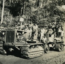
At the beginning of the 20th century, the Dutch divided New Guinea into several parts called afdeeling. One of these parts was Afdeeling Noord Nieuw Guinea (North New Guinea) based in Manokwari. Each afdeeling was further divided into several onderafdeeling, one of which was the Sorong onderafdeeling centered on Doom Island. The Dutch then constructed offices, churches, and settlements on this island, making it a trading center and port. Residents who lived there at the time recount how Doom Island was brightly illuminated at night, even though the now major city of Sorong was still pitch black.[18]

During
Post colonial
This region become the site of confrontations during
The
On 4 October 1999, Sorong City was formalized by law and separated from Sorong Regency.[26] The existence of regional autonomy has caused rapid expansion in the number of regencies and districts. Sorong Regency has become smaller in size due to this regional division. On 11 December 2002 South Sorong Regency and Raja Ampat Regency were created from parts of Sorong Regency, then in 2008 Tambrauw Regency (on 29 October) and Maybrat Regency (on 19 December) were created from other parts of Sorong Regency. The support for the creation of a new province was due to dispute on the location of West Papua's provincial capital between Sorong and Manokwari. Manokwari faction argues that Manokwari is a mnukwar (old village), because it was the location of the original Dutch residents. After the decision to pick Manokwari, John Piet Wanane, the Regent of Sorong, began to coordinate efforts to create a new province for the former Sorong Regency, called Sorong Raya, which is based according to the ethnic groups that exist in the region.[27] What was then the whole of the former Sorong Regency was later formalized in law to become Southwest Papua Province in 2022 after 20 years of advocacy.[28]
The expansion in the aforementioned area was plagued by numerous controversies. In Maybrat Regency, a debate erupted over the location of the district capital between Kumurkek and Ayamaru. The people of Aifat supported Kumurkek, while the people of Ayamaru and Aitinyo supported Ayamaru. This tussle over the capital continued until the Constitutional Court intervened in 2013 and declared Ayamaru as the official capital. Despite this decision, community divisions persisted, and a meeting was eventually organized between the conflicting parties. In 2019, it was finally agreed that the capital would be relocated to Kumurkek. However, following the transfer, the Ayamaru people expressed their intention to establish the Maybrat Sau Regency and split from the original Maybrat Regency.[29][30] Tambrauw Regency was also embroiled in controversy when it "borrowed" four districts from Manokwari Regency, with the political motive of facilitating local elections. The move was met with protests from the community, but the Constitutional Court rejected the appeal and upheld the decision in 2013. The residents of Kebar, Amberbaken, Mubrani, and Senopi, who felt that they had been forcibly transferred to Tambrauw, announce a new region called West Manokwari Regency. With the creation of Southwest Papua, the community requested that West Manokwari be removed from the new province since it is geographically and culturally closer to Manokwari than Sorong and is the customary territory of the Arfak tribe. However, this issue was not addressed until the new province was formed.[31][32]
Southwest Papua was passed into law on 17 November 2022 by the DPR and inaugurated on 9 December 2022 by the Ministry of Home Affairs. On the day of the inauguration, Muhammad Musa'ad was also appointed as acting governor. Article from Antara News reports that the Sorong Special Economic Zone (SEZ) in Southwest Papua is expected to play a vital role in empowering a large number of workers for the sake of boosting regional development.
Geography

Mountains
- Mount Kwoka in Tambrauw Regency
- Tamarau Mountains in Tambrauw Regency
Lakes
- Lake Framu in Maybrat Regency
- Lake Uter in Maybrat Regency
- Lake Framu In Maybrat Regency
Rivers
- Kohoin River in South Sorong Regency
- Kais River in South Sorong Regency
- Panta Kapal River in South Sorong Regency
- Warswai River in Tambrauw
- Wowei River in Tambrauw
Administration
The new province consist of five
| Kode Wilayah |
Name of City or Regency |
Capital | Area in km2 |
Pop'n Census 2010 |
Pop'n Census 2020 |
Pop'n Estimate mid 2022 |
No. of Districts |
No. of Villages |
HDI[35] 2023 estimate |
|---|---|---|---|---|---|---|---|---|---|
| 92.71 | 205.26 | 190,625 | 284,410 | 295,809 | 10 | 41 | 0.797 (High) | ||
| 92.01 | Aimas | 7,564.65 | 70,619 | 118,679 | 125,949 | 30 | 252 | 0.675 (Medium) | |
| 92.04 | (South Sorong) |
Teminabuan | 6,570.23 | 37,900 | 52,469 | 53,884 | 15 | 123 | 0.639 (Medium) |
| 92.05 | Waisai | 7,442.31 | 42,507 | 64,141 | 66,839 | 24 | 121 | 0.653 (Medium) | |
| 92.09 | Fef |
11,954.82 | 6,144 | 28,379 | 35,742 | 29 | 218 | 0.556 (Medium) | |
| 92.10 | Aifat | 5,385.68 | 33,081 | 42,991 | 43,681 | 24 | 260 | 0.613 (Medium) | |
| Totals | 39,122.95 | 380,876 | 591,069 | 621,904 | 132 | 1,015 | |||
On 25 October 2013 the
Demographics
Religion
The majority of the population of Southwest Papua are
Ethnic groups

Southwest Papua has diversity in
Languages
The people of Southwest Papua also have a variety of
Education
Higher education
The province has many universities, both public and private,[47] among others:
Public
- University of Papua (UNIPA)
- Sorong State Islamic Institute (IAIN Sorong)
- Health Polytechnic of the Ministry of Health Sorong (Poltekkes Kemenkes Sorong)
- Sorong Shipping Polytechnic (Poltekpel Sorong)
- Sorong Marine and Fisheries Polytechnic
Private
- Universitas Muhammadiyah Sorong (UNAMIN) - formerly Al-Amin University
- University of Education Muhammadiyah Sorong (UNIMUDA)
- University of Victory Sorong (UNVIC)
- Papua Christian University (UKIP)
- Saint Paul Catholic Polytechnic Sorong
Secondary School
Southwest Papua boasts a prestigious educational institution, SMA Averos Kota Sorong. As per the College Entrance Test Institute (LTMPT), this school secured the highest position among all the schools in Papua Island based on the 2022 Computer-Based Written Examination. Notably, in that year, only two schools from Papua managed to make it to the top 1000, with SMA Averos ranked 570 out of all the schools in Indonesia.[50][51]
Tourism
Raja Ampat Islands

The Raja Ampat Islands are a series of four adjacent island clusters located in the western part of the Bird's Head (Vogelkoop) of Papua Island. Administratively, this cluster is mainly under Raja Ampat Regency, Southwest Papua Province (except for two districts which lie within the
Tambrauw Conservation Regency
The Regent of Tambrauw declared Tambrauw Regency as a Conservation Regency through a Regional Regulation in 2018. Most of Tambrauw's territory consists of conservation forests, protected forests, and coastal areas with a variety of protected flora and fauna. Indigenous people with their traditional culture play an important role in maintaining the conservation area.[52][53] Some protected areas in Tambrauw include North Tambrauw Nature Reserve, South Tambrauw Nature Reserve, Sausapor Beach Nature Reserve, and Jeen Womom Coastal Park.[53][54] Because of its beautiful and well-preserved nature, Tambrauw has great ecotourism potential. One of them is as a birdwatching destination.[11] Birds that can be found in Tambrauw include cenderawasih, mambruk, cockatoo, nuri and cassowary. Other fauna in Tambrauw include wallabies, tree kangaroos, cuscuses and leatherback turtles.[53][55]
Culture
This section needs expansion. You can help by adding to it. (November 2022) |
References
- ^ a b c "Visualisasi Data Kependudukan – Kementerian Dalam Negeri 2022" (visual). www.dukcapil.kemendagri.go.id. Retrieved 31 July 2022.
- ^ a b Badan Pusat Statistik, Jakarta, 2023, Provinsi Papua Barat Daya Dalam Angka 2023 (Katalog-BPS 1102001.92)
- ^ Paramadwya, Adryan Yoga (17 November 2022). Widiantoro, Wisnu (ed.). "DPR Sahkan RUU Pembentukan Papua Barat Daya". kompas.id (in Indonesian). Retrieved 17 November 2022.
- ^ Ruhmana, Uma (1 September 2022). "Tim Percepatan Pemekaran Tegaskan Cakupan Wilayah dan Letak Ibukota Calon Provinsi Papua Barat Daya". jagaindonesia.com.
- ^ "Pemekaran Wilayah Papua & Papua Barat". cnnindonesia.com. Retrieved 6 May 2021.
- ^ Puspita, Ratna (ed.). "Gubernur Papua Barat Dorong Pemekaran Papua Barat Daya". republika.co.id. Retrieved 6 May 2021.
- ^ Farisa, Fitria Chusna, ed. (17 November 2022). "Sah! Indonesia Kini Punya 38 Provinsi, Ini Daftarnya". KOMPAS.com (in Indonesian). Jakarta: Kompas Cyber Media. Retrieved 17 November 2022.
- ^ a b "Kawasan Konservasi Perairan di Raja Ampat". kkprajaampat.com. BLUD UPTD Pengelolaan Kawasan Konservasi Perairan di Raja Ampat. Retrieved 17 November 2022.
- ^ Majid, Abdul (1 May 2021). "Raja Ampat, Surga Penyelam dari Timur Indonesia". detik.com. Retrieved 17 November 2022.
- ^ Nauly, Yacob (27 February 2021). "Usia 21 Tahun, Kota Sorong Termaju Di Tanah Papua". suarakarya.id.
- ^ a b "Kaya Akan Keindahan Alam, Tambrauw Perlu Kedepankan Konservasi". Kementerian Pariwisata dan Ekonomi Kreatif. 23 August 2020.
- OCLC 1160197476.
- ^ Wanggai, Tony V.M. (2008). Rekonstruksi Sejarah Islam di Tanah Papua (PDF) (Thesis) (in Indonesian). UIN Syarif Hidayatullah. Retrieved 30 January 2022.
- ISBN 979-8258-06-1.
- S2CID 240917675.
- ^ Bone, Robert (1958). THE DYNAMICS OF THE WESTERN NEW GUINEA (IRIAN BARAT) PROBLEM. Ithaca, NY: Cornell University.
- JSTOR 25161079.
- ^ a b Genthong, Aryo Wisanggeni (4 August 2008). "Menelusuri Kota Tua Ala Belanda". kompas.com. Retrieved 19 November 2022.
- ISBN 978-602-1228-12-8.)
{{cite book}}: CS1 maint: multiple names: authors list (link - ^ Patiara, John; Renwarin, Herman; Soedharto, Bondan; Palangan, M. (1983). "Sejarah Perlawanan Terhadap Imperialis dan Kolonialisme di Daerah Irian Jaya" (PDF). Kemdikbud. p. 81. Retrieved 18 January 2023.
- ^ 25 tahun Trikora (in Indonesian). Yayasan Badan Kontak Keluarga Besar Perintis Irian Barat. 1988. pp. 96–109. Retrieved 1 November 2021 – via Google Play Books.
- ^ Patiara, John; Renwarin, Herman; Soedharto, Bondan; Palangan, M. (1983). "Sejarah Perlawanan Terhadap Imperialis dan Kolonialisme di Daerah Irian Jaya" (PDF). Kemdikbud. pp. 91–99. Retrieved 3 November 2021.
- ^ 25 tahun Trikora (in Kinyarwanda). Yayasan Badan Kontak Keluarga Besar Perintis Irian Barat. 1988. pp. 164–167. Retrieved 1 November 2021 – via Google Play Books.
- ^ UU Nomor 12 Tahun 1969
- ^ Inayah, Hidayati (2018). "Migrasi Penduduk ke Kota Sorong". BRIN – LIPI.
- ^ "Sejarah Singkat". sorongkota.go.id. Pemerintah Kota Sorong.
- S2CID 251088248.
- ^ "Akhir dari Perjuangan 20 Tahun Terbentuk Provinsi Papua Barat Daya". Serambinews.com (in Indonesian). 18 November 2022. Retrieved 22 November 2022.
- ^ "Ada Waktu Ayamaru, Aitinyo, Aifat (A3) Adakan Rekonsiliasi". monitorpapua.com. 10 March 2018. Retrieved 19 November 2022.
- ^ Cahyu (27 September 2018). "Ibu Kota Maybrat Berpindah dari Ayamaru ke Kumurkek". Liputan6. Retrieved 19 November 2022.
- ^ "Disepakati 11 Distrik Pemekaran dari 4 Distrik Di Tambrauw Dikembalikan Ke Manokwari". jagatpapua.com. 8 September 2022. Retrieved 19 November 2022.
- ^ Akbar, Nawir Arsyad (31 August 2022). Raharjo, Agus (ed.). "RUU Papua Barat Daya Ungkap Praktik Pinjam Distrik untuk Pilkada". republika.co.id.
- ^ Biro Pusat Statistik, Jakarta, 2011.
- ^ Badan Pusat Statistik, Jakarta, 2021.
- ^ "[Metode Baru] Indeks Pembangunan Manusia Menurut Kabupaten/Kota 2021-2023". papuabarat.bps.go.id.
- ^ Undang-Undang Nomor 56 Tahun 2008 tentang Pembentukan Kabupaten Tambrauw di Provinsi Papua Barat (Law Number 56 of 2008 regarding the Formation of Tambrauw Regency in West Papua Province). In Indonesian.
- ^ Jakarta Post, 14 November 2013
- ^ "Jumlah Penduduk Menurut Agama" (in Indonesian). Ministry of Religious Affairs. 31 August 2022. Retrieved 29 October 2023.
Muslim 241 Million (87), Christianity 29.1 Million (10.5), Hindu 4.69 million (1.7), Buddhist 2.02 million (0.7), Folk, Confucianism, and others 192.311 (0.1), Total 277.749.673 Million
- ^ "Wilayah Kerja - Jerat Papua". www jeratpapua.org (in Indonesian). Retrieved 22 December 2022.
- ^ Syaufi, Muhammad (17 May 2022). "Wali Kota dan Bupati Sorong Dukung Mubes Masyarakat Adat Moi". matapapua.com.
- ^ "Pokja Adat MRPB Resmikan 9 Sub Suku dan Lantik Sub Suku Maybrat". suaraindonesia-news.com (in Indonesian). Retrieved 21 December 2022.
- ^ "Gelandang Timnas Ricky Kambuaya Dihadiahi Sepeda Motor". www.cnnindonesia.com (in Indonesian). Retrieved 21 December 2022.
- ISBN 979-8258-06-1.
- ^ Damarjati, Danu (29 October 2019). "Mengenal Tujuh Wilayah Adat Papua yang Jadi Dasar Pemekaran". news.detik.com (in Indonesian). Retrieved 21 December 2022.
- ^ "Suku Kokoda, Suku Muslim di Papua Barat". suaramuslim.net (in Indonesian). Retrieved 21 December 2022.
- ^ "Peta Bahasa Provinsi Papua Barat". Bahasa dan Peta Bahasa di Indonesia. Retrieved 22 December 2022.
- ^ "Pangkalan Data Pendidikan Tinggi". pddikti.kemdikbud.go.id/. Kementerian Pendidikan dan Kebudayaan.
- ^ "Kampus III UNIPA Prodi D3 Ekowisata Gelar Wisuda Perdana". sorongnews.com. 31 March 2021. Retrieved 20 January 2023.
- ^ "Fakultas Kehutanan melebarkan sayap dengan membuka program studi Ksda di Kabupaten Tambrauw". unipa.ac.id. 19 October 2022. Retrieved 20 January 2023.
- ^ "Top 1000 sekolah Tahun 2022 Berdasarkan Nilai UTBK". ltmpt.ac.id. Lembaga Tes Masuk Perguruan Tinggi. Archived from the original on 26 November 2022.
- ^ Kusnandar, VIva Budy (16 September 2022). "Hanya ada 2 SMA dari Papua yang Masuk Top 1.000 Sekolah Terbaik". katadata.co.id. Retrieved 7 December 2022.
- ^ "PERATURAN DAERAH KABUPATEN TAMBRAUW NOMOR 5/36 TAHUN 2018 TENTANG KABUPATEN TAMBRAUW SEBAGAI KABUPATEN KONSERVASI". Pemerintah Kabupaten Tambrauw.
- ^ a b c Ferdinandus, Hadi (31 July 2019). "Taman Pesisir Jeen Womom Lakukan Sasi". WWF.
- ISSN 2407-8050.)
{{cite journal}}: CS1 maint: multiple names: authors list (link - ^ Montesori, Jeis (3 July 2022). "Mantan Bupati Tambrauw: Jaga Hutan Adat untuk Kemaslahatan Orang Papua". beritasatu.com.
Places adjacent to Southwest Papua | ||||||||||||||||
|---|---|---|---|---|---|---|---|---|---|---|---|---|---|---|---|---|
| ||||||||||||||||
Regencies and cities of Southwest Papua | ||
|---|---|---|
Capital: Sorong | ||
| Regencies |  | |
| Cities | ||
| Sumatra |  | |
|---|---|---|
| Java | ||
| Kalimantan | ||
| Lesser Sunda Islands | ||
| Sulawesi | ||
| Maluku Islands | ||
| Western New Guinea | ||
| Former provinces |
| |
