Southwest Region (Cameroon)
This article needs additional citations for verification. (August 2017) |
Southwest Region | |
|---|---|
 Location of Southwest Region within Cameroon | |
| Country | Cameroon |
| Capital | Buea |
| Divisions | Fako, Koupé-Manengouba, Lebialem, Manyu, Meme, Ndian, Wazani |
| Government | |
| • Governor | Bernard Okalia B. |
| Area | |
| • Total | 25,410 km2 (9,810 sq mi) |
| Population (2015) | |
| • Total | 1,553,320 |
| • Density | 61/km2 (160/sq mi) |
| HDI (2017) | 0.599[1] medium · 6th of 10 |
The Southwest Region or South-West Region (


History
In 1884, the region was colonized by Germany under the Protectorate regime until 1916 when it became a condominium administered jointly by the United Kingdom and the France.[4] In 1919, the administration of the South West region became solely British. In 1961, the region joined Cameroon.[5]
Ambazonian separatism
At the end of 2017, an Ambazonian separatist movement in the two English-speaking regions of the North-West and South-West initiated a wave of violence affecting the military, police, business leaders and workers. The separatist militiamen are trying in particular to prevent children from returning to school. Between 2016 and 2019, separatists reportedly ransacked, destroyed or burned more than 174 schools[6] Separatists from the Ambazonia administration regard both the Nord-Ouest (Northwest) and Sud-Ouest (Southwest) regions as being constituent components of their envisaged breakaway state.[7]
Administration
The region is divided into seven

Geography
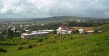
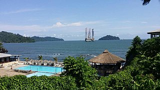
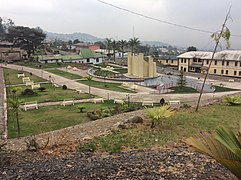
The region was notable for having the first English-speaking university in Cameroon (the University of Buea). Towns include the capital
|
Culture
The province is largely Anglophone and Protestant Christian.[9]
|
Common dishes in the region
|
Demographics
| Year | Pop. | ±% p.a. |
|---|---|---|
| 1976 | 620,515 | — |
| 1987 | 838,042 | +2.77% |
| 2005 | 1,316,079 | +2.54% |
| 2015 | 1,553,320 | +1.67% |
| source:[10] | ||
Healthcare
References
- ^ "Sub-national HDI - Area Database - Global Data Lab". hdi.globaldatalab.org. Retrieved 2018-09-13.
- ^ "BUEA". cvuc.cm (in French). Archived from the original on 1 July 2020. Retrieved 2017-08-07.
- ^ Tatah-Mentan, I., and F. Achankeng. "Stopping war before it starts: testing preventive diplomacy in the selfdetermination case of British Southern Cameroons (aka Ambazonia)." British Southern Cameroons: Nationalism & Conflict in Postcolonial Africa (2014): 127-170.
- ^ Emmanuel Mbah, Environment and Identity Politics in Colonial Africa: Fulani Migrations and Land Conflict, Taylor & Francis, UK, 2016, p. 20
- ^ Emmanuel Mbah, Environment and Identity Politics in Colonial Africa: Fulani Migrations and Land Conflict, Taylor & Francis, UK, 2016, p. 21
- ^ Philippe Karsenty, in Cameroon, causeur.fr, September 2, 2019
- ^ Adepoju, Paul. "World Report Hospital attack in anglophone Cameroon kills four patients." (2019).
- ^ "Région du Sud-Ouest". cvuc.cm (in French). Retrieved 2017-08-07.
- ^ "Cameroon". www.state.gov. Archived from the original on 19 October 2011. Retrieved 12 January 2022.
- ^ Cameroon: Administrative Division population statistics


