
New Spain
This article may be readable prose size was 17,000 words. . (January 2024) |
Viceroyalty of New Spain Virreinato de Nueva España (Spanish) | |||||||||||||||||||
|---|---|---|---|---|---|---|---|---|---|---|---|---|---|---|---|---|---|---|---|
| 1521–1821 | |||||||||||||||||||
| Motto: Ferdinand VII (last) | |||||||||||||||||||
| Viceroy | |||||||||||||||||||
• 1535–1550 | Antonio de Mendoza (first) | ||||||||||||||||||
• 1821 | Juan O'Donojú (as Political chief superior) | ||||||||||||||||||
| Legislature | Adams-Onís Treaty | 22 February 1819 | |||||||||||||||||
• Trienio Liberal abolished the Kingdom of New Spain | 31 May 1820 | ||||||||||||||||||
| 28 September 1821 | |||||||||||||||||||
| Population | |||||||||||||||||||
• 1519 | 10 million | ||||||||||||||||||
• 1810 | 8 million | ||||||||||||||||||
| Currency | Spanish colonial real | ||||||||||||||||||
| |||||||||||||||||||
![Old coat of arms of Mexico, Viceregal capital[1] of New Spain](/File:Escudo_de_Armas_del_Reino_de_M%C3%A9xico.svg)
New Spain, officially the Viceroyalty of New Spain (
After the 1521 Spanish conquest of the Aztec Empire, conqueror Hernán Cortés named the territory New Spain, and established the new capital, Mexico City, on the site of Tenochtitlan, the capital of the Mexica (Aztec) Empire. Central Mexico became the base of expeditions of exploration and conquest, expanding the territory claimed by the Spanish Empire. With the political and economic importance of the conquest, the crown asserted direct control over the densely populated realm. The crown established New Spain as a viceroyalty in 1535, appointing as viceroy Antonio de Mendoza, an aristocrat loyal to the monarch rather than the conqueror Cortés. New Spain was the first of the viceroyalties that Spain created, the second being Peru in 1542, following the Spanish conquest of the Inca Empire. Both New Spain and Peru had dense indigenous populations at conquest as a source of labor and material wealth in the form of vast silver deposits, discovered and exploited beginning in the mid-1500s.
New Spain developed strong regional divisions based on local climate, topography, distance from the capital and the Gulf Coast port of Veracruz, size and complexity of indigenous populations, and the presence or absence of mineral resources. Central and southern Mexico had dense indigenous populations, each with complex social, political, and economic organization, but no large-scale deposits of silver to draw Spanish settlers. By contrast, the northern area of Mexico was arid and mountainous, a region of nomadic and semi-nomadic indigenous populations, which do not easily support human settlement. In the 1540s, the discovery of silver in Zacatecas attracted Spanish mining entrepreneurs and workers, to exploit the mines, as well as crown officials to ensure the crown received its share of revenue. Silver mining became integral not only to the development of New Spain, but also to the enrichment of the Spanish crown, which marked a transformation in the global economy. New Spain's port of Acapulco became the New World terminus of the transpacific trade with the Philippines via the Manila galleon. New Spain became a vital link between Spain's New World empire and its East Indies empire.
From the beginning of the 19th century, the kingdom fell into crisis, aggravated by the 1808 Napoleonic invasion of Iberia and the forced abdication of the Bourbon monarch, Charles IV. This resulted in a political crisis in New Spain and much of the Spanish Empire in 1808, which ended with the government of Viceroy José de Iturrigaray. Conspiracies of American-born Spaniards sought to take power, leading to the Mexican War of Independence, 1810–1821. At its conclusion in 1821, the viceroyalty was dissolved and the Mexican Empire was established. Former royalist military officer turned insurgent for independence Agustín de Iturbide would be crowned as emperor.
The Crown and the Viceroyalty of New Spain
The Kingdom of New Spain was established on 18 August 1521, following the Spanish conquest of the Aztec Empire, as a New World kingdom ruled by the Crown of Castile. The initial funds for exploration came from Queen Isabella.[2][3] Although New Spain was a dependency of Castile, it (Mexico) was a kingdom and not a colony, subject to the presiding monarch on the Iberian Peninsula.[4][5]
The monarch had sweeping power in the overseas territories, with not just sovereignty over the realm but also property rights. All power over the state came from the monarch. The crown had sweeping powers over the Catholic Church in its overseas territories, and via the
Territorial extent of the overseas Spanish Empire

At its greatest extent, the Spanish crown claimed on the mainland of the Americas much of North America south of Canada, that is: all of present-day Mexico and Central America except

Much of what was called in the United States the "Spanish borderlands", is territory that did not attract many Spanish settlers, with less dense indigenous populations and apparently lacking in mineral wealth. Huge deposits of gold in California were discovered immediately after it was incorporated into the U.S. following the Mexican–American War (1846–1848). The northern region of New Spain in the colonial era was considered more marginal to Spanish interests than the most densely populated and lucrative areas of central Mexico. To shore up its claims in North America in the eighteenth century as other powers encroached on its claims, the crown sent expeditions to the Pacific Northwest, which explored and claimed the coast of what is now British Columbia and Alaska.[9]
Religious missions and fortified presidios were established to shore up Spanish control on the ground. On the mainland, the administrative units included
Government
.svg)
.svg)
Viceroyalty
The Viceroyalty was administered by a
Captaincies general and governorates
The Captaincy Generals were the second-level administrative divisions and these were relatively autonomous from the viceroyalty. The viceroy was captain-general of those provinces that remained directly under his command. Santo Domingo (1535); Philippines (1574); Puerto Rico (1580); Cuba (1608); Guatemala (1609); Yucatán (1617); Commandancy General of the Provincias Internas (1776) (analogous to a dependent captaincy general). Two governorates, third-level administrative divisions, were established, the Governorate of Spanish Florida (Spanish: La Florida) and the Governorate of Spanish Louisiana (Spanish: Luisiana).
High courts
The high courts, or audiencias, were established in major areas of Spanish settlement. In New Spain the high court was established in 1527, prior to the establishment of the viceroyalty. The First Audiencia was headed by Hernán Cortés's rival Nuño de Guzmán, who used the court to deprive Cortés of power and property. The crown dissolved the First Audiencia and established the Second Audiencia.[11] The audiencias of New Spain were
Audiencia districts further incorporated the older, smaller divisions known as
Local-level administration
At the local level there were over two hundred districts, in both indigenous and Spanish areas, which were headed by either a corregidor (also known as an alcalde mayor) or a cabildo (town council), both of which had judicial and administrative powers. In the late 18th century the Bourbon dynasty began phasing out the corregidores and introduced intendants, whose broad fiscal powers cut into the authority of the viceroys, governors and cabildos. Despite their late creation, these intendancies so affected the formation of regional identity that they became the basis for the nations of Central America and the first Mexican states after independence.
Intendancies 1780s
As part of the sweeping eighteenth-century administrative and economic changes known as the
The establishment of intendancies found strong resistance by the viceroyalties and general captaincies similar to the opposition in the Iberian Peninsula when the reform was adopted. Royal audiencias and ecclesiastical hierarchs opposed the reform for its interventions in economic issues, by its centralist politics, and the forced ceding of many of their functions to the intendants. In New Spain, these units generally corresponded to the regions or provinces that had developed earlier in the center, South, and North.[14][15]
Many of the intendancy boundaries became Mexican state boundaries after independence. The intendancies were created between 1764 and 1789, with the greatest number in the mainland in 1786: 1764 La Habana (later subdivided); 1766 Nueva Orleans; 1784 Puerto Rico; 1786 México, Veracruz, Puebla de Los Ángeles, Guadalajara, Guanajuato, Zacatecas, San Luis Potosí, Sonora, Durango, Oaxaca, Guatemala, San Salvador, Comayagua, León, Santiago de Cuba, Puerto Príncipe; 1789 Mérida.[16][17]
History of New Spain
The history of mainland New Spain spans three hundred years from the Spanish conquest of the Aztec Empire (1519–1521) to the collapse of Spanish rule in the Mexican War of Independence (1810–1821).
Conquest era (1521–1535)

The Caribbean islands and early Spanish explorations around the circum-Caribbean region had not been of major political, strategic, or financial importance until the conquest of the Aztec Empire in 1521. However, important precedents of exploration, conquest, and settlement and crown rule had been initially worked out in the Caribbean, which long affected subsequent regions, including Mexico and Peru.[18]
The indigenous societies of Mesoamerica brought under Spanish control were of unprecedented complexity and wealth compared to what the conquerors had encountered in the Caribbean. This presented both an important opportunity and a potential threat to the power of the Crown of Castile, since the conquerors were acting independent of effective crown control. The societies could provide the conquistadors, especially Hernán Cortés, a base from which the conquerors could become autonomous, or even independent, of the Crown.
Cortés had already defied orders that curtailed his ambition of an expedition of conquest. He was spectacularly successful in gaining indigenous allies against the Aztec Empire, with the indispensable aid of indigenous cultural translator, Marina, also known as Malinche, toppling the rulers of the Aztec empire. Cortés then divvied up the spoils of war without crown authorization, including grants of labor and tribute of groups of indigenous, to participants in the conquest.
As a result, the
The crown had already created the
The crown created the first mainland high court, or
Christian evangelization

Spanish conquerors saw it as their right and their duty to convert indigenous populations to Christianity. Because Christianity had played such an important role in the
The conquistadors brought with them many missionaries to promulgate the Catholic religion. Amerindians were taught the Catholic religion and the Spanish language. Initially, the missionaries hoped to create a large body of Amerindian priests, but were not successful. They did work to keep the Amerindian cultural aspects that did not violate the Catholic traditions, and a syncretic religion developed. Most Spanish priests committed themselves to learn the most important Amerindian languages (especially during the 16th century) and wrote grammars so that the missionaries could learn the languages and preach in them. This was similar to practices of French colonial missionaries in North America.
At first, conversion of indigenous peoples seemed to happen rapidly. The missionaries soon found that most of the natives had simply adopted "the god of the heavens," as they called the Christian god, as another one of their many gods.[citation needed] While they often held the Christian god to be an important deity because it was the god of the victorious conquerors, they did not see the need to abandon their old beliefs. As a result, a second wave of missionaries began an effort to completely erase the old beliefs, which they associated with the ritualized human sacrifice found in many of the native religions. They eventually prohibited this practice, which had been common before Spanish colonization. In the process many artifacts of pre-Columbian Mesoamerican culture were destroyed. Hundreds of thousands of native codices were burned, native priests and teachers were persecuted, and the temples and statues of the old gods were torn down. The missionaries even prohibited some foods associated with the native religions, such as amaranth.

Many clerics, such as Bartolomé de las Casas, also tried to protect the natives from de facto and actual enslavement to the settlers, and obtained from the Crown decrees and promises to protect native Mesoamericans, most notably the New Laws. But the royal government was too far away to fully enforce these, and settler abuses against the natives continued, even among the clergy. Eventually, the Crown declared the natives to be legal minors and placed under the guardianship of the Crown, which was responsible for their indoctrination. It was this status that barred the native population from the priesthood.
During the following centuries, under Spanish rule, a new culture developed that combined the customs and traditions of the indigenous peoples with that of Catholic Spain. The Spaniards had numerous churches and other buildings constructed in the Spanish style by native labor, and named their cities after various saints or religious topics, such as
The
Sixteenth-century founding of Spanish cities

During the first twenty years after the conquest, before the establishment of the viceroyalty, some of the important cities of the colonial era that remain important today were founded. Even before the 1535 establishment of the viceroyalty of New Spain, conquerors in central Mexico founded new Spanish cities and embarked on further conquests, a pattern that had been established in the Caribbean.[25] In central Mexico, they transformed the Aztec capital of Tenochtitlan into the main settlement of the territory. Thus, the history of Mexico City is of huge importance to the whole colonial enterprise.
Spaniards founded new settlements in
Guadalajara was founded northwest of Mexico City (1531–42) and became the dominant Spanish settlement in the region. West of Mexico City the settlement of
The discovery of silver in
Later mainland expansion

During the 16th century, many Spanish cities were established in North and Central America. Spain attempted to establish missions in what is now the southern United States, including Georgia and South Carolina between 1568 and 1587. These efforts were mainly successful in the region of present-day Florida, where the city of St. Augustine was founded in 1565. It is the oldest European city in the United States.
Upon his arrival, Viceroy Don Antonio de Mendoza vigorously took to the duties entrusted to him by the King and encouraged the exploration of Spain's new mainland territories. He commissioned the expeditions of
Cabrillo sailed far up the coast, becoming the first European to see present-day California, now part of the United States. The Viceroy also sent Ruy López de Villalobos to the Spanish East Indies in 1542–1543. As these new territories became controlled, they were brought under the purview of the Viceroy of New Spain. Spanish settlers expanded to Nuevo Mexico, and the major settlement of Santa Fe was founded in 1610.
The establishment of religious missions and military presidios on the northern frontier became the nucleus of Spanish settlement and the founding of Spanish towns.
Pacific expansion and the Philippine trade
Seeking to develop trade between the
Despite the sparsity of the Philippine population, it was profitable for Mexico City which used it as a transhipment point of cheap Asian products like Silk and Porcelain. However, due to the higher quantity of products from Asia it became a point of contention with the mercantilist policies of mainland Spain which supported manufacturing based on the capital instead of the colonies, in which case the Manila-Mexico commercial alliance was at odds against Madrid.
Since the Philippines was at the center of a crescent from
At times, non-profitable war-torn Philippine colony survived on an annual subsidy paid by the Spanish Crown and often procured from taxes and profits accumulated by the Viceroyalty of New Spain (Mexico), mainly paid by annually sending 75 tons of precious Silver Bullion,
Spanish ocean trade routes and defense

The Spanish crown created a system of convoys of ships (called the flota) to prevent attacks by European
Indigenous revolts
After the invasion of central Mexico, there were many major Native American rebellions defeating, changing or challenging Spanish rule. In the
Non-sedentary or semi-sedentary Northern Indians were difficult to control once they acquired the mobility of the horse.
In the southern area of New Spain, the Tzeltal Maya and other indigenous groups, including the Tzotzil and Chol
Bourbon reforms

The Bourbon monarchy embarked upon a far-reaching program to revitalize the economy of its territories, both on the peninsula and its overseas possessions. The crown sought to enhance its control and administrative efficiency, and to decrease the power and privilege of the Roman Catholic Church vis-a-vis the state.[56][57]
The British capture and occupation of both Manila and Havana in 1762, during the global conflict of the Seven Years' War, meant that the Spanish crown had to rethink its military strategy for defending its possessions. The Spanish crown had engaged with Britain for a number of years in low-intensity warfare, with ports and trade routes harassed by English privateers. The crown strengthened the defenses of Veracruz and San Juan de Ulúa, Jamaica, Cuba, and Florida, but the British sacked ports in the late seventeenth century. Santiago de Cuba (1662), St. Augustine Spanish Florida (1665) and Campeche 1678 and so with the loss of Havana and Manila, Spain realized it needed to take significant steps. The Bourbons created a standing army in New Spain, beginning in 1764, and strengthened defensive infrastructure, such as forts.[58][59]
The crown sought reliable information about New Spain and dispatched
An important feature of the Bourbon Reforms was that they ended the significant amount of local control that was a characteristic of the bureaucracy under the Habsburgs, especially through the sale of offices. The Bourbons sought a return to the monarchical ideal of having those not directly connected with local elites as administrators, who in theory should be disinterested, staff the higher echelons of regional government. In practice this meant that there was a concerted effort to appoint mostly peninsulares, usually military men with long records of service, as opposed to the Habsburg preference for prelates, who were willing to move around the global empire. The intendancies were one new office that could be staffed with peninsulares, but throughout the 18th century significant gains were made in the numbers of governors-captain generals, audiencia judges and bishops, in addition to other posts, who were Spanish-born.
In 1766, the crown appointed
Other significant accomplishments under Croix's administration was the founding of the College of Surgery in 1768, part of the crown's push to introduce institutional reforms that regulated professions. The crown was also interested in generating more income for its coffers and Croix instituted the royal lottery in 1769. Croix also initiated improvements in the capital and seat of the viceroyalty, increasing the size of its central park, the Alameda.
Another activist viceroy carrying out reforms was
The new Bourbon kings did not split the Viceroyalty of New Spain into smaller administrative units as they did with the
The Spanish Bourbons monarchs' prime innovation introduction of
Over time accommodations were made. For example, after a period of experimentation in which an independent intendant was assigned to Mexico City, the office was thereafter given to the same person who simultaneously held the post of viceroy. Nevertheless, the creation of scores of autonomous intendancies throughout the Viceroyalty, created a great deal of decentralization, and in the
The focus on the economy (and the revenues it provided to the royal coffers) was also extended to society at large. Economic associations were promoted, such as the Economic Society of Friends of the Country. Similar "Friends of the Country" economic societies were established throughout the Spanish world, including Cuba and Guatemala.[63]

The crown sent a series of scientific expeditions to its overseas possessions, including the
spent a year in New Spain in 1804 on his self-funded scientific expedition to Spanish America. Trained as a mining engineer, Humboldt's observations of silver mining in New Spain were especially important to the crown, which depended on New World silver revenues.The Bourbon Reforms were not a unified or entirely coherent program, but instead a series of crown initiatives designed to revitalize the economies of its overseas possessions and make administration more efficient and firmly under control of the crown. Record keeping improved and records were more centralized. The bureaucracy was staffed with well-qualified men, most of them peninsular-born Spaniards. The preference for them meant that there was resentment from American-born elite men and their families, who were excluded from holding office. The creation of a military meant that some American Spaniards became officers in local militias, but the ranks were filled with poor, mixed-race men, who resented service and avoided it if possible.[65]
-
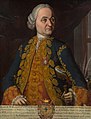 Viceroy of New Spain(1766–1771)
 -
 Viceroy of New Spain
 -
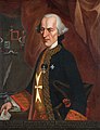
 Viceroy of New Spain(1789–1794)


18th-century military conflicts
The first century that saw the Bourbons on the Spanish throne coincided with series of global conflicts that pitted primarily France against Great Britain. Spain, as an ally of Bourbon France, was drawn into these conflicts. In fact part of the motivation for the Bourbon Reforms was the perceived need to prepare the empire administratively, economically, and militarily for what was the next expected war. The Seven Years' War proved to be catalyst for most of the reforms in the overseas possessions, just like the War of the Spanish Succession had been for the reforms on the Peninsula.
In 1720, the Villasur expedition from Santa Fe met and attempted to parley with French- allied Pawnee in what is now Nebraska. Negotiations were unsuccessful, and a battle ensued; the Spanish were badly defeated, with only thirteen managing to return to New Mexico. Although this was a small engagement, it is significant in that it was the deepest penetration of the Spanish into the Great Plains, establishing the limit to Spanish expansion and influence there.
The
Following the French and Indian War/Seven Years' War, the British troops invaded and captured the Spanish cities of Havana in Cuba and Manila in the Philippines in 1762. The Treaty of Paris (1763) gave Spain control over the Louisiana part of New France including New Orleans, creating a Spanish empire that stretched from the Mississippi River to the Pacific Ocean; but Spain also ceded Florida to Great Britain in order to regain Cuba, which the British occupied during the war. Louisiana settlers, hoping to restore the territory to France, in the bloodless Rebellion of 1768 forced the Louisiana Governor Antonio de Ulloa to flee to Spain. The rebellion was crushed in 1769 by the next governor Alejandro O'Reilly, who executed five of the conspirators. The Louisiana territory was to be administered by superiors in Cuba with a governor on site in New Orleans.
The 21 northern missions in present-day California (U.S.) were established along California's El Camino Real from 1769. In an effort to exclude Britain and Russia from the eastern Pacific, King Charles III of Spain sent forth from Mexico a number of expeditions to the Pacific Northwest between 1774 and 1793. Spain's long-held claims and navigation rights were strengthened and a settlement and fort were built in Nootka Sound, Alaska.

Spain entered the
The loss of Mobile and Pensacola left the British with no bases along the Gulf Coast. In 1782, forces under Galvez's overall command
In the second Treaty of Paris (1783), which ended the American Revolution, Great Britain returned control of Florida back to Spain in exchange for the Bahamas. Spain then had control over the Mississippi River south of 32°30' north latitude, and, in what is known as the Spanish Conspiracy, hoped to gain greater control of Louisiana and all of the west. These hopes ended when Spain was pressured into signing Pinckney's Treaty in 1795. France re-acquired Louisiana from Spain in the secret Treaty of San Ildefonso in 1800. The United States bought the territory from France in the Louisiana Purchase of 1803.

New Spain claimed the entire west coast of North America and therefore considered the Russian fur trading activity in Alaska, which began in the middle to late 18th century, an encroachment and threat. Likewise, the exploration of the northwest coast by Captain James Cook of the British Navy and the subsequent fur trading activities by British ships was considered an encroachment on Spanish territory. To protect and strengthen its claim, New Spain sent a number of expeditions to the Pacific Northwest between 1774 and 1793.
In 1789, a naval outpost called
Another outpost, intended to replace Santa Cruz de Nuca, was partially built at Neah Bay on the southern side of the Strait of Juan de Fuca in what is now the U.S. state of Washington. Neah Bay was known as Bahía de Núñez Gaona in New Spain, and the outpost there was referred to as "Fuca." It was abandoned, partially finished, in 1792. Its personnel, livestock, cannons, and ammunition were transferred to Nuca.[66]
In 1789, at Santa Cruz de Nuca, a conflict occurred between the Spanish naval officer Esteban José Martínez and the British merchant James Colnett, triggering the Nootka Crisis, which grew into an international incident and the threat of war between Britain and Spain. The first Nootka Convention averted the war but left many specific issues unresolved. Both sides sought to define a northern boundary for New Spain.
At Nootka Sound, the diplomatic representative of New Spain, Juan Francisco de la Bodega y Quadra, proposed a boundary at the Strait of Juan de Fuca, but the British representative, George Vancouver refused to accept any boundary north of San Francisco. No agreement could be reached and the northern boundary of New Spain remained unspecified until the Adams–Onís Treaty with the United States (1819). That treaty also ceded Spanish Florida to the United States.
End of the Viceroyalty (1806–1821)
_01.svg)
The
In the 1821
The new
This left only
The legacy of the colonial era Mexico is significant in many domains. Mexico was the location of the
German scientist
Many Mexican cultural features includingEconomy


.jpg)
During the era of the conquest, in order to pay off the debts incurred by the conquistadors and their companies, the new Spanish governors awarded their men grants of native tribute and labor, known as
In colonial Mexico, encomenderos de negros were specialized middlemen during the first half of the seventeenth century. While encomendero (alternatively, encomenderos de indios) generally refers to men granted the labor and tribute of a particular indigenous group in the immediate post-conquest era, encomenderos de negros were Portuguese slave dealers who were permitted to operate in Mexico for the slave trade.[citation needed]
In Peru, the other discovery that perpetuated the system of forced labor, the mit'a, was the enormously rich single silver mine discovered at Potosí, but in New Spain, labor recruitment differed significantly. With the exception of silver mines worked in the Aztec period at Taxco, southwest of Tenochtitlan, the Mexico's mining region was outside the area of dense indigenous settlement. Labor for the mines in the north of Mexico had a workforce of black slave labor and indigenous wage labor, not draft labor.[82] Indigenous who were drawn to the mining areas were from different regions of the center of Mexico, with a few from the north itself. With such diversity they did not have a common ethnic identity or language and rapidly assimilated to Hispanic culture. Although mining was difficult and dangerous, the wages were good, which is what drew the indigenous labor.[82]
The Viceroyalty of New Spain was the principal source of income for Spain in the eighteenth century, with the revival of mining under the
The fast red
There were two major ports in New Spain,
These were ships that made voyages from the Philippines to Mexico, whose goods were then transported overland from Acapulco to Veracruz and later reshipped from Veracruz to
However, these resources did not translate into development for the
Regions of mainland New Spain
In the colonial period, basic patterns of regional development emerged and strengthened.
The North was outside the area of complex indigenous populations, inhabited primarily by nomadic and hostile northern indigenous groups. With the discovery of silver in the north, the Spanish sought to conquer or pacify those peoples in order to exploit the mines and develop enterprises to supply them. Nonetheless, much of northern New Spain had sparse indigenous population and attracted few Europeans. The Spanish crown and later the Republic of Mexico did not effectively exert sovereignty over the region, leaving it vulnerable to the expansionism of the United States in the nineteenth century.
Regional characteristics of colonial Mexico have been the focus of considerable study within the vast scholarship on centers and peripheries.[84][85] For those based in the vice-regal capital of Mexico City, everywhere else were the "provinces." Even in the modern era, "Mexico" for many refers solely to Mexico City, with the pejorative view of anywhere but the capital is a hopeless backwater.[86] "Fuera de México, todo es Cuauhtitlán" ["outside of Mexico City, it's all Podunk"],[87][88] that is, poor, marginal, and backward, in short, the periphery.
The picture is far more complex, however; while the capital is enormously important as the center of power of various kinds (institutional, economic, social), the provinces played a significant role in colonial Mexico. Regions (provinces) developed and thrived to the extent that they were sites of economic production and tied into networks of trade. "Spanish society in the Indies was import-export oriented at the very base and in every aspect," and the development of many regional economies was usually centered on support of that export sector.[89]
Central region
Mexico City, Capital of the Viceroyalty

Mexico City was the center of the Central region, and the hub of New Spain. The
Veracruz to Mexico City
Significant regional development grew along the main transportation route from the capital east to the port of Veracruz. Alexander von Humboldt called this area, Mesa de Anahuac, which can be defined as the adjacent valleys of Puebla, Mexico, and Toluca, enclosed by high mountains, along with their connections to the Gulf Coast port of Veracruz and the Pacific port of Acapulco, where over half the population of New Spain lived.[90] These valleys were linked trunk lines, or main routes, facilitating the movement of vital goods and people to get to key areas.[91]
Even in this relatively richly endowed region of Mexico, the difficulty of transit of people and goods in the absence of rivers and level terrain remained a major challenge to the economy of New Spain. This challenge persisted during the post-independence years until the late nineteenth-century construction of railroads. In the colonial era and up until the railroads were built in key areas in post-independence in the late nineteenth century, mule trains were the main mode of transporting goods. Mules were used because unpaved roads, mountainous terrain, and seasonal flooding could not generally accommodate carts.
In the late eighteenth century, the crown devoted some resources to the study and remedy the problem of poor roads. The Camino Real (royal road) between the port of Veracruz and the capital had some short sections paved and bridges constructed. The construction was done despite protests from some indigenous settlements when the infrastructure improvements, which sometimes included rerouting the road through communal lands. The Spanish crown finally decided that road improvement was in the interests of the state for military purposes, as well as for fostering commerce, agriculture, and industry, but the lack of state involvement in the development of physical infrastructure was to have lasting effects constraining development until the late nineteenth century.[92][93] Despite some road improvements, transit was still difficult, particularly for heavy military equipment.
Although the crown had ambitious plans for both the Toluca and Veracruz portions of the king's highway, actual improvements were limited to a localized network.[94] Even where infrastructure was improved, transit on the Veracruz-Puebla main road had other obstacles, with wolves attacking mule trains, killing animals, and rendering some sacks of foodstuffs unsellable because they were smeared with blood.[95] The north-south Acapulco route remained a mule track through mountainous terrain.
Veracruz, port city and province
Veracruz was the first Spanish settlement founded in what became New Spain, and it endured as the only viable Gulf Coast port, the gateway for Spain to New Spain. The difficult topography around the port affected local development and New Spain as a whole. Going from the port to the central plateau entailed a daunting 2000 meter climb from the narrow tropical coastal plain in just over a hundred kilometers. The narrow, slippery road in the mountain mists was treacherous for mule trains, and in some cases mules were hoisted by ropes. Many tumbled with their cargo to their deaths.[96]
Given these transport constraints, only high-value, low-bulk goods continued to be shipped in the transatlantic trade, which stimulated local production of foodstuffs, rough textiles, and other products for a mass market. Although New Spain produced considerable sugar and wheat, these were consumed exclusively in the colony even though there was demand elsewhere. Philadelphia, not New Spain, supplied Cuba with wheat.[97]
The Caribbean port of Veracruz was small, with its hot, pestilential climate not a draw for permanent settlers: its population never topped 10,000.
Spaniards also settled in the temperate area of Orizaba, east of the Citlaltepetl volcano. Orizaba varied considerably in elevation from 800 metres (2,600 ft) to 5,700 metres (18,700 ft) (the summit of the Citlaltepetl volcano), but "most of the inhabited part is temperate."
European diseases immediately affected the multiethnic Indian populations in the Veracruz area and for that reason Spaniards imported black slaves as either an alternative to indigenous labor or its complete replacement in the event of a repetition of the Caribbean die-off. A few Spaniards acquired prime agricultural lands left vacant by the indigenous demographic disaster. Portions of the province could support sugar cultivation and as early as the 1530s sugar production was underway. New Spain's first viceroy, Don Antonio de Mendoza established an hacienda on lands taken from Orizaba.[102]
Indians resisted cultivating sugarcane themselves, preferring to tend their subsistence crops. As in the Caribbean, black slave labor became crucial to the development of sugar estates. During the period 1580–1640 when Spain and Portugal were ruled by the same monarch and Portuguese slave traders had access to Spanish markets, African slaves were imported in large numbers to New Spain and many of them remained in the region of Veracruz. But even when that connection was broken and prices rose, black slaves remained an important component of Córdoba's labor sector even after 1700. Rural estates in Córdoba depended on African slave labor, who were 20% of the population there, a far greater proportion than any other area of New Spain, and greater than even nearby Jalapa.[103]
In 1765 the crown created a monopoly on tobacco, which directly affected agriculture and manufacturing in the Veracruz region. Tobacco was a valuable, high-demand product. Men, women, and even children smoked, something commented on by foreign travelers and depicted in eighteenth-century casta paintings.[104] The crown calculated that tobacco could produce a steady stream of tax revenues by supplying the huge Mexican demand, so the crown limited zones of tobacco cultivation. It also established a small number of manufactories of finished products, and licensed distribution outlets (estanquillos).[105] The crown also set up warehouses to store up to a year's worth of supplies, including paper for cigarettes, for the manufactories.[106] With the establishment of the monopoly, crown revenues increased and there is evidence that despite high prices and expanding rates of poverty, tobacco consumption rose while at the same time, general consumption fell.[107]
In 1787 during the
Valley of Puebla
Founded in 1531 as a Spanish settlement,
It became the seat of the richest diocese in New Spain in its first century, with the seat of the first diocese, formerly in Tlaxcala, moved there in 1543.
The foundation of the town of Puebla was a pragmatic social experiment to settle Spanish immigrants without encomiendas to pursue farming and industry.[112] Puebla was privileged in a number of ways, starting with its status as a Spanish settlement not founded on existing indigenous city-state, but with a significant indigenous population. It was located in a fertile basin on a temperate plateau in the nexus of the key trade triangle of Veracruz–Mexico City–Antequera (Oaxaca). Although there were no encomiendas in Puebla itself, encomenderos with nearby labor grants settled in Puebla. And despite its foundation as a Spanish city, sixteenth-century Puebla had Indians resident in the central core.[112]
Administratively Puebla was far enough away from Mexico City (approximately 160 km or 100 mi) so as not to be under its direct influence. Puebla's Spanish town council (cabildo) had considerable autonomy and was not dominated by encomenderos. The administrative structure of Puebla "may be seen as a subtle expression of royal absolutism, the granting of extensive privileges to a town of commoners, amounting almost to republican self-government, in order to curtail the potential authority of encomenderos and the religious orders, as well as to counterbalance the power of the viceregal capital."[113]

During the "golden century" from its founding in 1531 until the early 1600s, Puebla's agricultural sector flourished, with small-scale Spanish farmers plowing the land for the first time, planting wheat and vaulting Puebla to importance as New Spain's breadbasket, a role assumed by the Bajío (including Querétaro) in the seventeenth century, and Guadalajara in the eighteenth.[114] Puebla's wheat production was the initial element of its prosperity, but it emerged as a manufacturing and commercial center, "serving as the inland port of Mexico's Atlantic trade."[115] Economically, the city received exemptions from the alcabala (sales tax) and almojarifazgo (import/export duties) for its first century (1531–1630), which helped promote commerce.
Puebla built a significant manufacturing sector, mainly in textile production in workshops (obrajes), supplying New Spain and markets as far away as Guatemala and Peru. Transatlantic ties between a particular Spanish town, Brihuega, and Puebla demonstrate the close connection between the two settlements. The take-off for Puebla's manufacturing sector did not simply coincide with immigration from Brihuega but was crucial to "shaping and driving Puebla's economic development, especially in the manufacturing sector."[116]
Brihuega immigrants came to Mexico with expertise in textile production, and the transplanted briocenses provided capital to create large-scale obrajes. Although obrajes in Brihuega were small-scale enterprises, quite a number of them in Puebla employed up to 100 workers. Supplies of wool, water for fulling mills, and labor (free indigenous, incarcerated Indians, black slaves) were available. Although much of Puebla's textile output was rough cloth, it also produced higher quality dyed cloth with cochineal from Oaxaca and indigo from Guatemala.[117] But by the eighteenth century, Querétaro had displaced Puebla as the mainstay of woolen textile production.[118]
In 1787, Puebla became an
Valley of Mexico
Mexico City dominated the Valley of Mexico, but the valley continued to have dense indigenous populations challenged by growing, increasingly dense Spanish settlement. The Valley of Mexico had many former Indian city-states that became Indian towns in the colonial era. These towns continued to be ruled by indigenous elites under the Spanish crown, with an indigenous governor and a town councils.[119][120] These Indian towns close to the capital were the most desirable ones for encomenderos to hold and for the friars to evangelize.
The capital was provisioned by the indigenous towns, and its labor was available for enterprises that ultimately created a colonial economy. The gradual drying up of the central lake system created more dry land for farming, but the sixteenth-century population declines allowed Spaniards to expand their acquisition of land. One region that retained strong Indian land holding was the southern fresh water area, with important suppliers of fresh produce to the capital. The area was characterized by intensely cultivated chinampas, human-made extensions of cultivable land into the lake system. These chinampa towns retained a strong indigenous character, and Indians continued to hold the majority of that land, despite its closeness to the Spanish capital. A key example is Xochimilco.[121][122][123]
Texcoco in the pre-conquest period was one of the three members of the Aztec Triple Alliance and the cultural center of the empire. It fell on hard times in the colonial period as an economic backwater. Spaniards with any ambition or connections would be lured by the closeness of Mexico City, so that the Spanish presence was minimal and marginal.[124]
Tlaxcala, the major ally of the Spanish against the Aztecs of Tenochtitlan, also became something of a backwater, but like Puebla it did not come under the control of Spanish encomenderos. No elite Spaniards settled there, but like many other Indian towns in the Valley of Mexico, it had an assortment of small-scale merchants, artisans, farmers and ranchers, and textile workshops (obrajes).[125]
North
Since portions of northern New Spain became part of the United States'
The region farther north of the main mining zones attracted few Spanish settlers. Where there were settled
Bajío, Mexico's Breadbasket
The Bajío, a rich, fertile lowland just north of central Mexico, was nonetheless a frontier region between the densely populated plateaus and valleys of Mexico's center and south and the harsh northern desert controlled by nomadic Chichimeca. Devoid of settled indigenous populations in the early sixteenth century, the Bajío did not initially attract Spaniards, who were much more interested in exploiting labor and collecting tribute whenever possible. The region did not have indigenous populations that practiced subsistence agriculture. The Bajío developed in the colonial period as a region of commercial agriculture.
The discovery of mining deposits in Zacatecas and Guanajuato in the mid-sixteenth century and later in San Luis Potosí stimulated the Bajío's development to supply the mines with food and livestock. A network of Spanish towns was established in this region of commercial agriculture, with Querétaro also becoming a center of textile production. Although there were no dense indigenous populations or network of settlements, Indians migrated to the Bajío to work as resident employees on the region's haciendas and ranchos or rented land (terrasguerros). From diverse cultural backgrounds and with no sustaining indigenous communities, these indios were quickly hispanized, but largely remained at the bottom of the economic hierarchy.[126] Although Indians migrated willingly to the region, they did so in such small numbers that labor shortages prompted Spanish hacendados to provide incentives to attract workers, especially in the initial boom period of the early seventeenth century. Land owners lent workers money, which could be seen as a perpetual indebtedness, but it can be seen not as coercing Indians to stay but a way estate owners sweetened their terms of employment, beyond their basic wage labor.[127][128] For example, in 1775 the Spanish administrator of a San Luis Potosí estate "had to scour both Mexico City and the northern towns to find enough blue French linen to satisfy the resident employees."[129] Other types of goods they received on credit were textiles, hats, shoes, candles, meat, beans, and a guaranteed ration of maize. However, where labor was more abundant or market conditions depressed, estate owners paid lower wages. The more sparsely populated northern Bajío tended to pay higher wages than the southern Bajío, which was increasingly integrated in the economy of central Mexico.[130] The credit-based employment system often privileged those holding higher ranked positions on the estate (supervisors, craftsmen, other specialists) who were mostly white, and the estates did not demand repayment.[131]
In the late colonial period, renting complemented estate employment for many non-Indians in more central areas of the Bajío with access to markets. As with hacendados, renters produced for the commercial market. While these Bajío renters could prosper in good times and achieved a level of independence, drought and other disasters made their choice more risky than beneficial.[132]
Many renters retained ties to the estates, diversifying their household's sources of income and level of economic security. In San Luis Potosí, rentals were fewer and estate employment the norm. After a number of years of drought and bad harvests in the first decade of the nineteenth century Hidalgo's 1810 grito appealed more in the Bajío than in San Luis Potosí. In the Bajío estate owners were evicting tenants in favor of renters better able to pay more for land, there was a disruption of previous patterns of mutual benefit between estate owners and renters.[130]
Spanish Borderlands
.png)
Areas of northern Mexico were incorporated into the United States in the mid-nineteenth century, following Texas independence and the Mexican–American War (1846–48) and generally known as the "Spanish Borderlands."[133][134] Scholars in the United States have extensively studied this northern region, which became the states of Texas, New Mexico, Arizona, and California.[135][136][137][138] During the period of Spanish rule, this area was sparsely populated even by indigenous peoples.[139]
The
Missions and the Northern Frontier
The town of
From 1697, Jesuits established eighteen
New Mexico

During the term of
Oñate pioneered 'The Royal Road of the Interior Land' or
In 1610,
After the return of the Spanish in 1692, the final resolution included a marked reduction of Spanish efforts to eradicate native culture and religion, the issuing of substantial communal
California
In 1602,
Not until the eighteenth century was California of much interest to the Spanish crown, since it had no known rich mineral deposits or indigenous populations sufficiently organized to render tribute and do labor for Spaniards. The discovery of huge deposits of gold in the Sierra Nevada foothills did not come until after the U.S. had incorporated California following the Mexican–American War (1846–48).
By the middle of the 1700s, the Catholic order of
In 1768, Gálvez received the following orders: "Occupy and fortify San Diego and Monterey for God and the King of Spain." The Spanish colonization there, with far fewer known natural resources and less cultural development than Mexico or Peru, was to combine establishing a presence for defense of the territory with a perceived responsibility to convert the indigenous people to Christianity.
The method used to "occupy and fortify" was the established Spanish colonial system:
In 1776, the north-western frontier areas came under the administration of the new 'Commandancy General of the Internal Provinces of the North' (
Once missions and protective presidios were established in an area, large
Rancho activities centered on cattle-raising; many grantees emulated the
After the Mexican War of Independence (1821) and subsequent secularization ("disestablishment") of the missions (1834), Mexican land grant transactions increased the spread of the rancho system. The land grants and ranchos established mapping and land-ownership patterns that are still recognizable in present-day California and New Mexico.[146]
South
Yucatán

The
With dense indigenous Maya populations, Yucatán's
In Yucatán, Spanish rule was largely indirect, allowing these communities considerable political and cultural autonomy. The Maya community, the cah, was the means by which indigenous cultural integrity was maintained. In the economic sphere, unlike many other regions and ethnic groups in Mesoamerica, the Yucatec Maya did not have a pre-conquest network of regular markets to exchange different types of food and craft goods. Perhaps because the peninsula was uniform in its ecosystem local niche production did not develop.[155] Production of cotton textiles, largely by Maya women, helped pay households' tribute obligations, but basic crops were the basis of the economy. The cah retained considerable land under the control of religious brotherhoods or confraternities (cofradías), the device by which Maya communities avoided colonial officials, the clergy, or even indigenous rulers (gobernadores) from diverting of community revenues in their cajas de comunidad (literally community-owned chests that had locks and keys). Cofradías were traditionally lay pious organizations and burial societies, but in Yucatán they became significant holders of land, a source of revenue for pious purposes kept under cah control. "[I]n Yucatán the cofradía in its modified form was the community."[156] Local Spanish clergy had no reason to object to the arrangement since much of the revenue went for payment for masses or other spiritual matters controlled by the priest.
A limiting factor in Yucatán's economy was the poorness of the
In the seventeenth century, patterns shifted in Yucatán and
Valley of Oaxaca
Since Oaxaca was lacking in mineral deposits and it had an abundant sedentary indigenous population, its development was notable for the lack of European or mixed-race population, lack of large-scale Spanish haciendas, and the survival of indigenous communities. These communities retained their land, indigenous languages, and distinct ethnic identities. Antequera (now Oaxaca City) was a Spanish settlement founded in 1529, but the rest of Oaxaca consisted of indigenous towns. Despite its remoteness from Mexico City, "throughout the colonial era, Oaxaca was one of Mexico's most prosperous provinces."[161][Note 2] In the eighteenth century, the value of crown offices (alcalde mayor or corregidor) were the highest for two Oaxaca jurisdictions, with Jicayan and Villa Alta each worth 7,500 pesos, Cuicatlan-Papalotipac, 4,500; Teposcolula and Chichicapa, each 4,200 pesos.[Note 3]
The most important commodity for Oaxaca was cochineal red dye. Cochineal's commodity chain is an interesting one, with indigenous peasants in the remote areas of Oaxaca ultimately linked to Amsterdam and London commodity exchanges and the European production of luxury cloth.[163] The most extensive scholarly work on Oaxaca's eighteenth-century economy deals with the nexus between the local crown officials (alcaldes mayores), merchant investors (aviadores), the repartimiento (forced labor), and indigenous products, particularly cochineal. The rich, color-fast red dye produced from insects, was harvested from nopal cacti. Cochineal was a high-value, low-volume product that became the second-most valuable Mexican export after silver. Although it could be produced elsewhere in central and southern Mexico, its main region of production was Oaxaca. For the indigenous in Oaxaca, cochineal was the only one "with which the [tributaries] maintain themselves and pay their debts" but it also had other advantages for them.[Note 4] Producing cochineal was time-consuming labor, but it was not particularly difficult and could be done by the elderly, women, and children.[165] It was also important to households and communities because it initially did not require the indigenous to displace their existing crops or migrate elsewhere.[166]
Although the repartimiento has historically been seen as an imposition on the indigenous, forcing them into economic relations they would rather have avoided and maintained by force,[167] recent work on eighteenth-century Oaxaca analyzes the nexus of crown officials (the alcaldes mayores) and Spanish merchants, and indigenous via the repartimiento. cash loaned by local crown officials (the alcalde mayor and his teniente), usually to individual Indians but sometimes to communities, in exchange for a fixed amount of a good (cochineal or cotton mantles) at a later date. Indigenous elites were an integral part of the repartimiento, often being recipients of large extensions of credit. As authority figures in their community, they were in a good position to collect on the debt, the most risky part of the business from the Spanish point of view.
Tehuantepec
The Isthmus of
replaced it in 1563.Gold mining was an early draw for Spaniards, who directed indigenous labor to its extraction, but did not continue beyond the mid-sixteenth century. Over the long run, ranching and commerce were the most important economic activities, with the settlement of Tehuantepec becoming the hub. The region's history can be divided into three distinct periods, an initial period of engagement with Spanish colonial rule to 1563, during which there was a working relationship with the Zapotec ruling line and the establishment of Cortés's economic enterprises. This early period came to a close with the death of the last native king in 1562 and the escheatment of Cortés's Tehuantepec encomiendas to the crown in 1563. The second period of approximately a century (1563–1660) saw the decline of the indigenous entailed estate (cacicazgo) and indigenous political power and development of the colonial economy and imposition of Spanish political and religious structures. The final period is the maturation of these structures (1660–1750). The 1660 rebellion can be a dividing line between the two later periods.[170]
The Villa of Tehuantepec, the largest settlement on the isthmus, was an important prehispanic Zapotec trade and religious center, which was not under the jurisdiction of the Aztecs.[168] The early colonial history of Tehuantepec and the larger province was dominated by Cortés and the Marquesado, but the crown realized the importance of the area and concluded an agreement in 1563 with the second Marqués by which the crown took control of the Tehuantepec encomienda. The Marquesado continued to have major private holdings in the province. The Villa of Tehuantepec became a center of Spanish and mixed-race settlement, crown administration, and trade.
The Cortés haciendas in Tehuantepec were key components of the province's economy, and they were directly linked to other Marquesado enterprises in greater Mexico in an integrated fashion.[171] The Dominicans also had significant holdings in Tehuantepec, but there has been little research on these. However important the Marquesado and the Dominican enterprises were, there were also other economic players in the region, including individual Spaniards as well as existing indigenous communities. Ranching emerged as the dominant rural enterprise in most of Tehuantepec with a ranching boom in the period 1580–1640. Since Tehuantepec experienced significant indigenous population loss in the sixteenth century conforming to the general pattern, ranching made possible for Spaniards to thrive in Tehuantepec because ranching was not dependent on significant amounts of indigenous labor.[172]
The most detailed economic records for the region are of the Marquesado's ranching haciendas, which produced draft animals (horses, mules, burros, and oxen) and sheep and goats, for meat and wool. Cattle ranching for meat, tallow, and leather were also important. Tallow for candles used in churches and residences and leather used in a variety of ways (saddles, other tack, boots, furniture, machinery) were significant items in the larger colonial economy, finding markets well beyond Tehuantepec. Since the Marquesado operated as an integrated enterprise, draft animals were used in other holdings for transport, agriculture, and mining in Oaxaca, Morelos, Toluca, and Mexico City as well as sold. Raised in Tehuantepec, the animals were driven to other Marquesado holdings for use and distribution.[173]
Although colonial population decline affected the indigenous in Tehuantepec, their communities remained important in the colonial era and remain distinctly Indian to the current era. There were differences in the three distinct linguistic and ethnic groups in colonial Tehuantepec, the Zapotec, the Zoque, and the Huave. The Zapotecs concluded an alliance with the Spaniards at contact, and they had already expanded their territory into Zoque and Huave regions.
Under Spanish rule, the Zapotecs not only survived, but flourished, unlike the other two. They continued to pursue agriculture, some of it irrigated, which was not disrupted by the growing ranching economy. Generally Zapotec elites protected their communities from Spanish incursions and community cohesion remained strong as shown in members' performance of regular community service for social ends. Zapotec elites engaged in the market economy early on, which undermined to an extent the bonds between commoners and elites who colluded with the Spanish. In contrast to the Zapotecs, the Zoque generally declined as a group during the ranching boom, with interloping animals eating their maize crops. Zoque response was to take up being vaqueros themselves. They had access to the trade to Guatemala. Of the three indigenous groups, the Huave were the most isolated from the Spanish ranching economy and labor demands.[174] With little arable or grazing land, they exploited the lagoons of the Pacific coast, using shore and beach resources. They traded dried shrimp and fish, as well as purple dye from shells to Oaxaca, likely acquiring foodstuffs that they were unable to cultivate themselves.[172]
Not well documented is the number of African slaves and their descendants, who were artisans in urban areas and did hard manual labor in rural areas.
In general, Tehuantepec was not a site of major historical events, but in 1660–61, there was a significant rebellion stemming from increased repartimiento Spanish demands.[177]
Central America

With the growth of a sufficient Spanish population and the crown's desire to better govern the area, it established the


Cacao had been cultivated in the prehispanic period. Orchards of cacao trees, which took a number of years to come to maturity and produce fruit. Cacao boomed in the late sixteenth century, and then was displaced by indigo as the most important export product. Indigo, like cacao, was native to the region, and the indigenous peoples gathered wild indigo, used for dying cloth and as a trade good. After the arrival of the Spanish, they domesticated indigo and created plantations for its cultivation in Yucatan, El Salvador, and Guatemala. The indigo industry thrived, since there was high demand in Europe for a high quality, color-fast blue dye. In the region, cultivation and processing was done by indigenous workers, but the owners of plantations, añileros, were Spanish.
It was a dangerous work environment, with toxins present in the indigo plants that sickened and sometimes killed workers. It was profitable, especially following the Bourbon Reforms, which allowed trade within the Spanish empire. In the late eighteenth century, indigo growers organized in a trade organization, the Consulado de Comercio.[180] There were regions that were not subjugated to Spanish rule, such as the Petén and the Mosquito Coast, and the English took advantage of weak Spanish control to establish a commercial presence on the Gulf Coast, later seizing Belize. An American-born Spanish elite (criollos) accumulated land and built fortunes on wheat, sugar, and cattle, all of which were consumed within the region.[181]
Demographics
The role of epidemics

Spanish settlers brought to the American continent
In the course of the 16th century, the native population in Mexico went from an estimated pre-Columbian population of 8 to 20 million to less than two million. Therefore, at the start of the 17th century, continental New Spain was a depopulated country with abandoned cities and maize fields. These diseases would not affect the Philippines in the same way because the diseases were already present in the country; Pre-Hispanic Filipinos had contact with other foreign nationalities before the arrival of the Spaniards.
Population in early 1800s


While different intendancies would perform censuses to get a detailed insight in regard to its inhabitants (namely occupation, number of persons per household, ethnicity etc.), it was not until 1793 that the results of the first ever national census would be published. The census is also known as the "Revillagigedo census" because its creation was ordered by the Count of the same name. Most of the census' original datasets have reportedly been lost; thus most of what is known about it nowadays comes from essays and field investigations made by academics who had access to the census data and used it as reference for their works, such as Prussian geographer Alexander von Humboldt. Each author gives different estimations for the total population, ranging from 3,799,561 to 6,122,354[182][183] (more recent data suggest that the actual population of New Spain in 1810 was closer to 5 or 5.5 million individuals)[184] as well as the ethnic composition in the country although there is not much variation, with Europeans ranging from 18% to 23% of New Spain's population with a population of around 1 million, Mestizos ranging from 32% to 36%, Amerindians ranging from 40% to 50% with a population of around 2.5 million and Africans being between 6,000 and 10,000. It is concluded then, that across nearly three centuries of colonization, the population growth trends of Europeans and Mestizos were even, while the total percentage of the indigenous population decreased at a rate of 13%–17% per century. The authors assert that rather than Europeans and Mestizos having higher birthrates, the reason for the Indigenous population's numbers decreasing lies on them suffering of higher mortality rates, due to living in remote locations rather than in cities and towns founded by the Spanish colonists or being at war with them. It is also for these reasons that the number of Indigenous Mexicans presents the greater variation range between publications, as in cases their numbers in a given location were estimated rather than counted, leading to possible overestimations in some provinces and possible underestimations in others.[185]
| Intendancy/territory | European population (%) | Indigenous population (%) | Mestizo population (%) |
|---|---|---|---|
| México (only State of Mexico and capital) | 16.9% | 66.1% | 16.7% |
| Puebla | 10.1% | 74.3% | 15.3% |
| Oaxaca | 06.3% | 88.2% | 05.2% |
| Guanajuato | 25.8% | 44.0% | 29.9% |
| San Luis Potosí | 13.0% | 51.2% | 35.7% |
| Zacatecas | 15.8% | 29.0% | 55.1% |
| Durango | 20.2% | 36.0% | 43.5% |
| Sonora | 28.5% | 44.9% | 26.4% |
| Yucatán | 14.8% | 72.6% | 12.3% |
| Guadalajara | 31.7% | 33.3% | 34.7% |
| Veracruz | 10.4% | 74.0% | 15.2% |
Valladolid
|
27.6% | 42.5% | 29.6% |
| Nuevo México | ~ | 30.8% | 69.0% |
| Vieja California | ~ | 51.7% | 47.9% |
| Nueva California | ~ | 89.9% | 09.8% |
| Coahuila | 30.9% | 28.9% | 40.0% |
| Nuevo León | 62.6% | 05.5% | 31.6% |
| Nuevo Santander | 25.8% | 23.3% | 50.8% |
| Texas | 39.7% | 27.3% | 32.4% |
| Tlaxcala | 13.6% | 72.4% | 13.8% |
~Europeans are included within the Mestizo category.
Regardless of the possible imprecision related to the counting of Indigenous peoples living outside of the colonized areas, the effort that New Spain's authorities put on considering them as subjects is worth mentioning, as censuses made by other colonial or post-colonial countries did not consider American Indians to be citizens/subjects, as example the censuses made by the Viceroyalty of the Río de la Plata would only count the inhabitants of the colonized settlements.[186] Other example would be the censuses made by the United States, that did not include Indigenous peoples living among the general population until 1860, and indigenous peoples as a whole until 1900.[187]
Once New Spain achieved its independence, the legal basis of the
Culture, art, and architecture
The capital of Viceroyalty of New Spain, Mexico City, was one of the principal centers of European cultural expansion in the Americas. Some of the most important early buildings in New Spain were churches and other religious architecture. Civil architecture included the viceregal palace, now the National Palace, and the Mexico City town council (cabildo), both located on the main square in the capital.
The
Architects Pedro Martínez Vázquez and Lorenzo Rodriguez produced some visually frenetic architecture known as
See also
- Criollo people
- Economic history of Mexico
- Filipino immigration to Mexico
- Governor-General of the Philippines
- Historiography of Colonial Spanish America
- History of democracy in Mexico
- History of Honduras
- Index of Mexico-related articles
- List of governors in the Viceroyalty of New Spain
- List of viceroys of New Spain
- Mexican settlement in the Philippines
- Spanish American Enlightenment
- History of Mexico
- History of Guatemala
- History of El Salvador
- List of viceroys of New Spain
Notes
- ^ The Spanish called their overseas empire "the Indies" until the end of its empire, a remnant of Columbus's assertion that he had reached the Far East, rather than a New World.
- ^ Brian R. Hamnett says that "José de Gálvez considered Oaxaca one of New Spain's richest provinces".[162]
- ^ The crown sold public offices, with their purchasers expecting to quickly recoup the costs. For a complete chart, see Hamnett (1971), p. 16.
- ^ Baskes suggests the crown restricted its production to Oaxaca until 1819, which likely contributed to artificially high prices.[164]
- ^ The crown did not wish to have the main west coast port in private hands and an agreement was worked out with Cortés heir, Don Martín Cortés, to relinquish the Tehuantepec encomienda.[169]
References
- ^ Sierra López, Alejandro. "El rincón de la heráldica. Escudos de ciudades y regiones americanas" [The heraldry corner Coats of arms of American cities and regions]. Gobierno de España. Ministerio de Cultura y Deporte (in Spanish).
Both the coat of arms of Lima and Mexico City were taken as a symbol of the kingdoms of which they were the capital, as can be seen in the Hall of Kingdoms in Madrid, where both appear representing the kingdoms of Peru and Mexico. Spanish: Tanto el escudo de Lima como el de la ciudad de México fueron tomados como sinécdoque de los reinos de los que eran capital, tal y como puede observarse en el Salón de Reinos de Madrid donde ambos aparecen representando a los reinos de Perú y México.
- ^ Haring (1947), pp. 7, 105
- ^ Liss (1975), p. 33
- ^ Haring (1947), p. 7
- ^ "Colección Juan Bautista Muñoz. Archivo de la Real Academia de la Historia – España". LANIC (in Spanish). Archived from the original on 6 September 2019. Retrieved 20 March 2008.
- ^ de la Mota Padilla (1870)
- ^ de Solís (1771)
- ^ "Viceroyalty of New Spain (historical territory, Mexico)". Encyclopædia Britannica. Retrieved 8 July 2013.
- ^ "Viceroyalty of New Spain (historical territory, Mexico)". Encyclopædia Britannica. Retrieved 8 July 2013.
- ^ Altman, Cline & Pescador (2003), p. 69
- ^ Haring (1947), pp. 133–135
- ^ Lombardi, Lombardi & Stoner (1983), p. 50
- ^ Haring (1947), pp. 133–135
- ^ Lombardi, Lombardi & Stoner (1983), p. 50
- ^ Haring (1947), pp. 133–135
- ^ Lombardi, Lombardi & Stoner (1983), p. 50
- ^ Lockhart & Schwartz (1983), pp. 61–85
- ^ Howard F. Cline, "The Relaciones Geográficas of the Spanish Indies, 1577–1586." Hispanic American Historical Review 44, (1964) 341–374.
- ^ Howard F. Cline, "A Census of the Relaciones Geográficas, 1579–1612." Handbook of Middle American Indians, vol. 12: 324–69. Austin: University of Texas Press 1972.
- ^ "The Relaciónes Geográficas of the Spanish Indies, 1577–1648." Handbook of Middle American Indians, vol. 12: 183–242. Austin: University of Texas Press 1972.
- ^ Howard F. Cline, "The Relaciones Geográficas of Spain, New Spain, and the Spanish Indies: An Annotated Bibliography." Handbook of Middle American Indians vol. 12, 370–95. Austin: University of Texas Press 1972.
- ^ Barbara E. Mundy, The Mapping of New Spain: Indigenous Cartography and the Maps of the Relaciones Geográficas. Chicago: University of Chicago Press 1996.
- ^ Daniela Bleichmar, Visible Empire: Botanical Expeditions and Visual Culture in the Spanish Enlightenment. Chicago: University of Chicago Press 2012, p.32.
- ^ Lockhart & Schwartz (1983), pp. 61–71
- ^ Lockhart & Schwartz (1983), p. 86, map. 4
- ^ Lockhart & Schwartz (1983), p. 86, map. 4
- ^ Lockhart & Schwartz (1983), pp. 86–92
- ^ Altman, Cline & Pescador (2003), pp. 65–66
- ^ Rene Javellana, S. J.Fortress of Empire(1997)
- ^ William Schurz, The Manila Galleon. New York 1939.
- ^ Manuel Carrera Stampa, "La Nao de la China", Historia Mexicana 9, no. 33 (1959), 97–118.
- ^ The Unlucky Country: The Republic of the Philippines in the 21St Century By Duncan Alexander McKenzie (page xii)
- ^ Carol R. Ember; Melvin Ember; Ian A. Skoggard, eds. (2005). History. Encyclopedia of Diasporas: Immigrant and Refugee Cultures around the World, Volume 1. Springer.
- ^ Stephanie Mawson, ‘Between Loyalty and Disobedience: The Limits of Spanish Domination in the Seventeenth Century Pacific' (Univ. of Sydney M.Phil. thesis, 2014), appendix 3.
- ^ "Paco". Philippines: Pagenation.com. Archived from the original on 7 May 2010.
- ^ Garcia-Abasalo, Antonio. Spanish Settlers in the Philippines (1571–1599) (PDF). Universidad de Córdoba (Thesis). Archived (PDF) from the original on 16 May 2023.
- ^ Katharine Bjork, "The Link that Kept the Philippines Spanish: Mexican Merchant Interests and the Manila Trade, 1571–1815", Journal of World History 9, no. 1 (1998), 25–50.
- ^ Shirley Fish, Manila-Acapulco Galleons: The Treasure Ships of the Pacific with an Annotated list of Transpacific Galleons, 1565–1815. Central Milton Keynes: Author House 2011.
- ^ Haring (1947), p. 79
- ^ "In Governor Anda y Salazar's opinion, an important part of the problem of vagrancy was the fact that Mexicans and Spanish disbanded after finishing their military or prison terms "all over the islands, even the most distant, looking for subsistence."" ~CSIC riel 208 leg.14
- ^ Iaccarino, Ubaldo (October 2017). ""The Center of a Circle": Manila's Trade with East and Southeast Asia at the Turn of the Sixteenth Century" (PDF). Crossroads: An Interdisciplinary Journal of Southeast Asian Studies. 16: 99–120. Archived from the original (PDF) on 28 July 2020. Retrieved 10 May 2020 – via Ostasien Verlag.
- ^ Dolan 1991, The Early Spanish Period.
- ^ The Diversity and Reach of the Manila Slave Market Page 36
- ^ "The descendants of Mexican mestizos and native Filipinos were numerous but unaccounted for because they were mostly the result of informal liaisons." ~Garcia de los Arcos, Forzados, 238
- ^ Tomás de Comyn, general manager of the Compañia Real de Filipinas, in 1810 estimated that out of a total population of 2,515,406, "the European Spaniards, and Spanish creoles and mestizos do not exceed 4,000 persons of both sexes and all ages, and the distinct castes or modifications known in America under the name of mulatto, quarteroons, etc., although found in the Philippine Islands, are generally confounded in the three classes of pure Indians, Chinese mestizos and Chinese." In other words, the Mexicans who had arrived in the previous century had so intermingled with the local population that distinctions of origin had been forgotten by the 19th century. The Mexicans who came with Legázpi and aboard succeeding vessels had blended with the local residents so well that their country of origin had been erased from memory.
- ^ Blair, E., Robertson, J., & Bourne, E. (1903). The Philippine islands, 1493–1803 : explorations by early navigators, descriptions of the islands and their peoples, their history and records of the Catholic missions, as related in contemporaneous books and manuscripts, showing the political, economic, commercial and religious conditions of those islands from their earliest relations with European nations to the beginning of the nineteenth century. Cleveland, Ohio.
- ^ Bonialian, 2012[citation not found]
- ISBN 978-0804712569.
- ^ Mercene, Floro L. Manila Men in the New World: Filipino Migration to Mexico and the Americas from the Sixteenth Century. Quezon City: The University of the Philippines Press, 2007
- ^ "Estado de Guerrero Historia" [State of Guerrero History]. Enciclopedia de los Municipios de México (in Spanish). Mexico: Instituto Nacional para el Federalismo y el Desarrollo Municipal. 2005. Archived from the original on 6 March 2012. Retrieved 24 June 2010.
- ^ Philip Wayne Powell, Soldiers, Indians, and Silver: The Northward Advance of New Spain, 1550–1600. Berkeley and Los Angeles: University of California Press 1952.
- ^ Ida Altman, Sarah Cline, and Javier Pescador, The Early History of Greater Mexico. Prentice Hall 2003, 251.
- ^ Charlotte M. Gradie, The Tepehuan Revolt of 1616: Militarism, Evangelism, and Colonialism in Seventeenth-Century Nueva Vizcaya. Salt Lake City: University of Utah Press 2000.
- ^ Victoria Reifler Bricker, The Indian Christ, the Indian King: The Historical Substrate of Maya Myth and Ritual. Austin: University of Texas Press 1981.
- ^ N.M. Farriss, Crown and Clergy in Colonial Mexico, 1759–1821: The Crisis of Ecclesiastical Privilege. London: Athlone 1968.
- ^ Lloyd Mecham, Church and State in Latin America: A History of Politicoecclesiastical Relations. Revised edition. Chapel Hill: University of North Carolina Press 1966.
- ^ Christon Archer, The Army in Bourbon Mexico, 1760–1810. Albuquerque: University of New Mexico Press 1977.
- ^ Lyle N. McAlister, The Fuero Militar in New Spain, 1764–1800. Gainesville: University of Florida Press 1957.
- ^ Susan Deans-Smith, "Bourbon Reforms" in Encyclopedia of Mexico, Chicago: Fitzroy Dearborn 1997, p. 153.
- ^ Christon I. Archer, "Antonio María Bucareli y Ursúa" in Encyclopedia of Mexico. Chicago: Fitzroy Dearborn 1997, p. 164.
- ^ Christon I. Archer, "Antonio María Bucareli y Ursúa" in Encyclopedia of Mexico. Chicago: Fitzroy Dearborn 1997, p. 164.
- ^ Shafer (1958)
- ^ Daniela Bleichmar, Visible Empire: Botanical Expeditions and Visual Culture in the Hispanic Enlightenment. Chicago: University of Chicago Press 2012, pp. 70–72.
- ^ Ida Altman et al., The Early History of Greater Mexico. Prentice Hall 2003, pp. 316–17.
- ^ Tovell (2008), pp. 218–219
- ^ Wade, Lizzie (12 April 2018). "Latin America's lost histories revealed in modern DNA". Science Magazine.
- ^ Mercene, Floro L. "Filipinos in Mexican History". The Manila Bulletin Online. Archived from the original on 15 October 2007.
- S2CID 144426711.
(Page 414; Citation 56: 'According to Ricardo Pinzon, these two Filipino soldiers—Francisco Mongoy and Isidoro Montes de Oca—were so distinguished in battle that they are regarded as folk heroes in Mexico. General Vicente Guerrero later became the first president of Mexico of African descent.' See Floro L. Mercene, "Central America: Filipinos in Mexican History", (Ezilon Infobase, January 28, 2005)
- ^ Quirino, Carlos. "Filipinos In Mexico's History 4 (The Mexican Connection – The Cultural Cargo Of The Manila-Acapulco Galleons)". Archived from the original on 4 August 2020. Retrieved 10 May 2020 – via adoborepublic.net.
- ^ John Scott, John Taylor (1826). The London Magazine, Volume 14. pp. 512–516.
- ISBN 9789712350450.
- ^ Officers in the army of the Philippines were almost totally composed of Americans,” observed the Spanish historian José Montero y Vidal. “They received in great disgust the arrival of peninsular officers as reinforcements, partly because they supposed they would be shoved aside in the promotions and partly because of racial antagonisms.”
- ^ "First Printing Press in the Americas was Established in Mexico". Latino Book Review. 2019. Retrieved 14 July 2019.
- ^ "UNIVERSITY OF MEXICO IS THE OLDEST UNIVERSITY IN NORTH AMERICA". Vallarta Daily News. 15 September 2014. Retrieved 14 July 2019.
- ^ "Mexico City's Alameda Central: the inspiration behind NYC's Central Park?". City Express blog. 15 September 2014. Retrieved 14 July 2019.
- ^ "Oldest Public Library in the Americas is in Mexico". Latino Book Review. 2019. Retrieved 14 July 2019.
- ^ "Academy of San Carlos". Mexico es Cultura. Retrieved 14 July 2019.
- ^ "Vanadium Element Facts". Chemicool Periodic Table. 18 October 2012. Retrieved 14 July 2019.
- ^ Archibald, Anna (27 July 2015). "Everything You Need to Know About the History of Tequila". Liquor.com. Retrieved 14 July 2019.
- ^ Galvez, Francisco (27 June 2017). "A brief History of Charreria". Charro Azteca. Retrieved 14 July 2019.
- ^ a b Altman, Cline & Pescador (2003), p. 172
- ^ a b Foster (2000), pp. 101–103
- ^ a b Lockhart & Altman (1976)
- ^ Van Young (1992)
- ^ Monsivaís (1992), pp. 247–254
- ^ Van Young (1992), p. 3 n. 3
- ^ Van Young (2006), p. xxviii
- ^ Lockhart (1976)
- ^ Ouweneel (1997), map 2 p. 6; p. 288
- ^ Lockhart (1991)
- ^ Castleman (2005), p. 10
- ^ Coatsworth (1998), p. 34
- ^ Castleman (2005), p. 31
- ^ Ouweneel (1997), p. 90
- ^ Ouweneel (1997), p. 68
- ^ Ouweneel (1997), p. 67, quoting Alexander von Humboldt.
- ^ Carroll (1991), p. 3
- ^ Carroll (1979), p. 124
- ^ Gerhard (1993), p. 205
- ^ Gerhard (1993), pp. 83–85
- ^ Gerhard (1993), p. 206
- ^ Carroll (1991), p. 93
- ^ Ouweneel (1997), pp. 188–189
- ^ Deans-Smith (1992). This is the definitive study of the tobacco monopoly.
- ^ Deans-Smith (1992), p. 106
- ^ Deans-Smith (1992), p. 157
- ^ Gerhard (1993), pp. 220–224
- ^ Gibson (1952), pp. 55–56
- ^ Israel (1975), p. 219
- ^ Thomson (1989), p. 16
- ^ a b Hirschberg (1979)
- ^ Thomson (1989), p. 6
- ^ Thomson (1989), p. 12
- ^ Thomson (1989), citing Pierre Chaunu Seville et l'Atlantique 1504–1650, Pt. 2, vol. VIII 1959, 714.
- ^ Altman (2000), p. 51
- ^ Altman (2000), p. 62
- ^ Salvucci (1987), p. 80
- ^ Gibson (1964)
- ^ Lockhart (1992)
- ^ Gibson (1964), p. 409
- ^ Cline (1991), pp. 265–274
- ^ Rojas Rabiela (1991)
- ^ Lewis (1976)
- ^ Szewczyk (1976)
- ^ Tutino (1986), pp. 52–54
- ^ Brading (1978), pp. 76–77
- ^ Tutino (1979), pp. 339–378
- ^ Tutino (1979), p. 354
- ^ a b Tutino (1979), p. 364
- ^ Tutino (1979), p. 363
- ^ Tutino (1979), p. 366
- ^ Bannon (1974)
- ^ Weber (1991)
- ^ Bolton (1956)
- ^ Cutter (1995)
- ^ Spicer (1962)
- ^ Weber (1992)
- ^ Jackson (1994)
- ^ Altman, Cline & Pescador (2003), pp. 193–194
- ^ Sanchez & Spude (2013), Chapters 2 & 3
- ^ Altman, Cline & Pescador (2003), p. 194
- ^ Gonzales (2003)
- ^ Gonzales (2003)
- ^ Weber (1992), p. 242
- ^ Robinson (1979)
- ^ Gerhard (1993), p. 3
- ^ Hunt (1976), pp. 59–60
- ^ Hunt (1976), pp. 38–42
- ^ Hunt (1976), pp. 39, 59–60
- ^ Hunt (1976), pp. 50–51
- ^ Hunt (1976), pp. 33–51
- ^ Restall (2009)
- ^ Hunt (1976), pp. 42–46
- ^ Restall (1997), p. 185
- ^ Farriss (1984), p. 266
- ^ Farriss (1984), p. 267
- ^ Farriss (1984), p. 270
- ^ Gerhard (1993), pp. 50–52
- ^ Reed (1964)
- ^ Baskes (2000), p. 186
- ^ Hamnett (1971), p. 40
- ^ Marichal (2006)
- ^ Baskes (2000), p. 185
- ^ Chance (1989), p. 121
- ^ Baskes (2000), pp. 18–19
- ^ For instance, Chance (1989), pp. 121–122.
- ^ a b Gerhard (1993), p. 264
- ^ Gerhard (1993), p. 265.
- ^ Zeitlin (2005), pp. xiv–xv
- ^ Gutiérrez Brockington (1989)
- ^ a b Zeitlin (1989)
- ^ Gutiérrez Brockington (1989), p. 9
- ^ Zeitlin (1989), p. 55
- ^ Gutiérrez Brockington (1989), p. 15
- ^ Gutiérrez Brockington (1989), p. 16
- ^ Zeitlin (2005), esp. Chapter 5
- ^ Sherman, William L. Forced Native Labor in Sixteenth-Century Central America. Lincoln: University of Nebraska Press 1979.
- ^ MacLeod, Murdo J., Spanish Central America: A Socioeconomic History, 1520–1720. Berkeley: University of California Press 1973.
- ^ Woodward, Ralph Lee. Class Privilege and Economic Development: The Consulado de Comercio of Guatemala, 1793–1871. Chapel Hill: University of North Carolina Press 1966.
- ^ Webre, Stephen. "Audiencia of Guatemala" in Encyclopedia of Latin American History and Culture, vol. 3, pp.130–31. New York: Charles Scribner's Sons 1996.
- ^ Navarro y Noriega (1820)
- ^ von Humboldt (1811)
- ^ McCaa (2000)
- ^ Lerner, Victoria (1968). Consideraciones sobre la población de la Nueva España: 1793–1810, según Humboldt y Navarro y Noriega [Considerations on the population of New Spain: 1793–1810, according to Humboldt and Navarro and Noriega] (PDF) (in Spanish). pp. 328–348. Archived from the original (PDF) on 31 July 2017. Retrieved 24 August 2017.
- ^ Historical Dictionary of Argentina. London: Scarecrow Press, 1978. pp. 239–40.
- ^ "American Indians in the Federal Decennial Census". Retrieved on 25 July 2017.
- ^ Censo General De Habitantes (1921 Census) (PDF) (Report). Departamento de la Estadistica Nacional. p. 62. Archived from the original (PDF) on 4 March 2016.
- ^ "El mestizaje es un mito, la identidad cultural sí importa" Istmo, Mexico, Retrieved on 25 July 2017.
- ISBN 978-6073143646. Retrieved 23 February 2018.
Bibliography
General histories
- Altman, Ida; Lockhart, James, eds. (1976). The Provinces of Early Mexico. Los Angeles, CA: UCLA Latin American Center. ISBN 0-87903-036-4.
- Altman, Ida; Cline, Sarah; Pescador, Juan Javier (2003). The Early History of Greater Mexico. Prentice Hall. ISBN 978-0-1309-1543-6.
- Haring, Clarence Henry (1947). The Spanish Empire in America. New York, NY: Oxford University Press.
- Israel, Jonathan I. (1975). Race, Class, and Politics in Colonial Mexico. New York, NY: Oxford University Press.
- Knight, Alan (2002). Mexico: The Colonial Era. Cambridge: Cambridge University Press. ISBN 9780521891967.
- Liss, Peggy K. (1975). Mexico Under Spain: Society and the Origins of Nationality. Chicago, Illinois: University of Chicago Press.
- Lockhart, James; Schwartz, Stuart (1983). Early Latin America. New York, NY: Cambridge University Press.
- Meyer, Michael C., William L. Sherman, and Susan M. Deeds. (2014) The Course of Mexican History Tenth edition, esp. chapters 6–15. New York: Oxford University Press.
- ISBN 9781442209015.
More specialized works
- Altman, Ida (2000). Transatlantic Ties in the Spanish Empire: Brihuega, Spain & Puebla, Mexico, 1560–1620. Stanford, CA: Stanford University Press.
- Bannon, John Francis (1974). The Spanish Borderlands Frontier: 1513-1821. Albuquerque, NM: University of New Mexico Press.
- Baskes, Jeremy (2000). Indians, Merchants, and Markets: A Reinterpretation of the Repartimiento and Spanish-Indian Economic Relations in Colonial Oaxaca 1750–1821. Stanford, CA: Stanford University Press.
- Bolton, Herbert Eugene, ed. (1956). Spanish Explorations in the Southwest, 1542–1706. New York, NY: Barnes and Noble.
- Brading, D. A. (1978). Haciendas and Ranchos in the Mexican Bajío: León 1700–1860. New York, NY: Cambridge University Press.
- Carroll, Patrick J. (1991). Blacks in Colonial Veracruz: Race, Ethnicity, and Regional Development. Austin, TX: University of Texas Press.
- Castleman, Bruce A. (2005). Building the King's Highway: Labor, Society, and Family on Mexico's Caminos Reales 1757–1804. Tucson, AZ: University of Arizona Press. ISBN 9780816524396.
- Chance, John (1989). Conquest of the Sierra: Spaniards and Indians in Colonial Oaxaca. Norman, OK: University of Oklahoma Press.
- Cutter, Charles R. (1995). The Legal Culture of Northern New Spain, 1700–1810. Albuquerque, NM: University of New Mexico Press. ISBN 9780826316417.
- Deans-Smith, Susan (1992). Bureaucrats, Planters, and Workers: The Making of the Tobacco Monopoly in Bourbon Mexico. Austin, TX: University of Texas Press.
- Farriss, Nancy (1984). Maya Society under Colonial Rule: The Collective Enterprise of Survival. Princeton, NJ: Princeton University Press.
- Foster, Lynn V. (2000). A Brief History of Central America. New York, NY: Facts on File. ISBN 0-8160-3962-3.
- Gibson, Charles (1964). The Aztecs Under Spanish Rule: a History of the Indians of the Valley of Mexico, 1519–1810. Stanford, CA: Stanford University Press.
- Gonzales, Phillip B. (2003). "Struggle for survival: the Hispanic land grants of New Mexico, 1848–2001". S2CID 154553608.
- Gutiérrez Brockington, Lolita (1989). The Leverage of Labor: Managing the Cortés Haciendas of Tehuantepec, 1588–1688. Durham, NC: Duke University Press.
- Hamnett, Brian R. (1971). Politics and Trade in Southern Mexico 1750–1821. Cambridge University Press.
- von Humboldt, Alexander (1811). Political Essay on the Kingdom of New Spain (in French). Paris: F. Schoell.
- Jackson, Robert H. (1994). Indian Population Decline: the Missions of Northwestern New Spain, 1687–1840. Albuquerque, NM: University of New Mexico Press.
- Lockhart, James (1991). "Trunk lines and feeder lines: The Spanish Reaction to American Resources". In James Lockhart (ed.). Of Things of the Indies: Essays Old and New in Early Latin American History. Stanford, CA: Stanford University Press.
- Lockhart, James (1992). The Nahuas After the Conquest: A Social and Cultural History of the Indians of Mexico, Sixteenth Through Eighteenth Centuries. Stanford, CA: Stanford University Press.
- Marichal, Carlos (2006). "Mexican Cochineal and the European Demand for American Dyes, 1550–1850". In Steven Topik; Carlos Marichal; Zephyr Frank (eds.). From Silver to Cocaine: Latin American Commodity Chains and the Building of the World Economy, 1500–2000. Durham, NC: Duke University Press. pp. 76–92.
- McCaa, Robert (2000). "The peopling of Mexico from origins to revolution". In Michael R. Haines; Richard H. Steckel (eds.). A Population History of North America. Cambridge University Press. pp. 241–304. ISBN 9780521496667.
- Monsivaís, Carlos (1992). "'Just Over That Hill'": Notes on Centralism and Regional Cultures". In Eric Van Young (ed.). Mexico's Regions. Center for U.S.-Mexican Studies, UCSD.
- Ouweneel, Arij (1997). Shadows over Anahuac: an Ecological Interpretation of Crisis and Development in Central Mexico, 1730–1800. Albuquerque, NM: University of New Mexico Press.
- Reed, Nelson A. (1964). The Caste War of Yucatan. Stanford, CA: Stanford University Press.
- Restall, Matthew (1997). The Maya World: Yucatec Culture and Society, 1550–1850. Stanford, CA: Stanford University Press.
- Restall, Matthew (2009). The Black Middle: Africans, Mayas, and Spaniards in Colonial Yucatan. Stanford, CA: Stanford University Press.
- Robinson, William Wilcox (1979). Land in California: the story of mission lands, ranchos, squatters, mining claims, railroad grants, land scrip and homesteads. University of California Press. ISBN 9780520038752.
- Salvucci, Richard (1987). Textiles and Capitalism in Mexico: An Economic History of the Obraje. Princeton, NJ: Princeton University Press.
- Sanchez, Joseph P.; Spude, Robert L. (2013). New Mexico: A History.
- de Solís, Antonio (1771). Historia de la conquista de México, poblacion y progresos de la América Septentrional, conocida por el nombre de Nueva España (in Spanish). Barcelona: Thomas Piferrer.
- Spicer, Edward H. (1962). Cycles of Conquest: The Impact of Spain, Mexico, and the United States on the Indians of the Southwest, 1533–1960. Tucson, AZ: University of Arizona Press.
- Thomson, Guy P. C. (1989). Puebla de Los Angeles: Industry and Society in a Mexican City, 1700–1850. Westview Press.
- Tovell, Freeman M. (2008). At the Far Reaches of Empire: the Life of Juan Francisco De La Bodega Y Quadra. University of British Columbia Press. ISBN 978-0-7748-1367-9.
- Tutino, John (1986). From Insurrection to Revolution: Social Bases of Agrarian Violence 1750–1940. Princeton, NJ: Princeton University Press.
- Van Young, Eric (2006). "Introduction to the 25th Anniversary Edition". Hacienda and Market in Eighteenth-Century Mexico (2nd ed.).
- Weber, David J. (1992). The Spanish Frontier in North America. Yale University Press. ISBN 0300059175.
- Zeitlin, Judith Francis (2005). Cultural Politics in Colonial Tehuantepec: Community and State among the Isthmus Zapotec, 1500–1750. Stanford, CA: Stanford University Press.
Historiography
- Hanke, Lewis. Do the Americas Have a Common History? A Critique of the Bolton Theory (1964).
- Hurtado, Albert L. "Bolton and Turner: The Borderlands and American Exceptionalism." Western Historical Quarterly 44#1 (2013): 4–20. online.
- Hurtado, Albert L. Herbert Eugene Bolton: Historian of the American Borderlands (University of California Press; 2012).
- Van Young, Eric (1992). "Are Regions Good to Think?". In Eric Van Young (ed.). Mexico's Regions. Center for U.S.-Mexican Studies, UCSD.
- Van Young, Eric. "Two Decades of Anglophone Historical Writing on Colonial Mexico: Continuity and Change since 1980". Mexican Studies/Estudios Mexicanos. (2004) vol. 20, No. 2 (summer), 275–326.
- Weber, David. J., ed. (1991). The Idea of the Spanish Borderlands. New York, NY: Garland Publishers.
Reference works
- Encyclopedia of Mexico. 2 vols. (1997) Chicago.
- Encyclopedia of Latin American History and Culture. 5 vols. (1996) New York.
- Gerhard, Peter (1993). The Historical Geography of New Spain (2nd ed.). Norman, OK: University of Oklahoma Press.
- Lombardi, Cathryn L.; Lombardi, John V.; Stoner, K. Lynn (1983). Latin American History: a Teaching Atlas. Madison, WI: University of Wisconsin Press. ISBN 0-299-09714-5.
Further reading
- Bakewell, P.J. A History of Latin America (Oxford U.P., 1997)
- Bethell, Leslie, ed. The Cambridge History of Latin America (Vols. 1–2. Cambridge UP, 1984)
- Cañeque, Alejandro. "The Political and Institutional History of Colonial Spanish America" History Compass (April 2013) 114 pp 280–291,
- Collier, Simon. From Cortes to Castro: An Introduction to the History of Latin America, 1492–1973 (1974)
- Gibson, Charles. The Aztecs Under Spanish Rule: A History of the Indians of the Valley of Mexico, 1519–1810. (Stanford University Press 1964).
- Lockhart, James. The Nahuas After the Conquest (Stanford University Press)
- Muldoon, James. The Americas in The Spanish World Order (1994)
- Parry, J.H. The Spanish Seaborne Empire (1974)
- Parry, J.H. The Spanish Theory of Empire in the Sixteenth Century (1974)
- Stein, Barbara H., and Stanley J. Stein. Crisis in an Atlantic Empire: Spain and New Spain, 1808–1810 (Johns Hopkins University Press; 2014) 808 pages.
- Leibsohn, Dana, and Barbara E. Mundy, Vistas: Visual Culture in Spanish America, 1520–1820. http://www.fordham.edu/vistas, 2015.
External links
- MEXICO'S COLONIAL ERA—PART I: The Settlement of New Spain Archived 1 March 2009 at the Wayback Machine at mexconnect.com
- Index to the DeWitt Colony Region under New Spain Archived 3 October 2010 at the Wayback Machine at Texas A&M University
- 1492 – Middle America at ibiblio.org the public's library and digital archive
- Encyclopædia Britannica: Hispanic Heritage in The Americas
- Map of the Border of the King's Dominion in the Northern America is a map by José de Urrútiaand Nicolas de la Fora.
Viceroys of New Spain (1535–1821) | ||
|---|---|---|
| Charles V (1535–1564) |
|   |
| Philip II (1566–1603) |
| |
| Philip III (1603–1621) |
| |
| Philip IV (1621–1665) |
| |
| Charles II (1665–1701) | ||
| Philip V (1701–1746) | ||
Ferdinand VI (1746–1760) | ||
| Charles III (1760–1789) | ||
| Charles IV (1789–1809) | ||
Ferdinand VII (1809–1821) | ||
| ||||||||||||||||||||||||||||
