
Störnstein
Störnstein | ||
|---|---|---|
 Coat of arms | ||
Location of Störnstein within Neustadt a.d.Waldnaab district 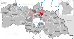 | ||
Municipal assoc. Neustadt an der Waldnaab | | |
| Government | ||
| • Mayor (2020–26) | Markus Ludwig[1] (SPD) | |
| Area | ||
| • Total | 10.92 km2 (4.22 sq mi) | |
| Elevation | 449 m (1,473 ft) | |
| Population (2022-12-31)[2] | ||
| • Total | 1,557 | |
| • Density | 140/km2 (370/sq mi) | |
| Time zone | UTC+01:00 (CET) | |
| • Summer (DST) | UTC+02:00 (CEST) | |
| Postal codes | 92721 | |
| Dialling codes | 09602 | |
| Vehicle registration | NEW | |
Störnstein is a municipality in the district of Neustadt an der Waldnaab in Bavaria, Germany.
Störnstein was also the name of a former Princely County (of Lobkowicz family) in the Holy Roman Empire in the Bavarian Circle until the German mediatisation.
Mayors
The mayor is Markus Ludwig (SPD), re-elected in 2020.[1] In 2014 he became the successor of Boris-Michael Damzog (SPD).
References
- ^ Bayerisches Landesamt für Statistik, 15 July 2021.
- ^ Genesis Online-Datenbank des Bayerischen Landesamtes für Statistik Tabelle 12411-003r Fortschreibung des Bevölkerungsstandes: Gemeinden, Stichtag (Einwohnerzahlen auf Grundlage des Zensus 2011) (Hilfe dazu).

| International | |
|---|---|
| National | |