
Sugar Land, Texas
Sugar Land, Texas | ||
|---|---|---|
City | ||
 in 2010 in 2010 | ||
|
Sales Tax 8.25%[3] | | |
| GNIS feature ID | 1348034[4] | |
| Website | www | |
Sugar Land (sometimes spelled as Sugarland) is the largest city in Fort Bend County, Texas, United States, located in the southwestern part of the Houston–The Woodlands–Sugar Land metropolitan area. Located about 19 miles (31 km) southwest of downtown Houston, Sugar Land is a populous suburban municipality centered around the junction of Texas State Highway 6 and Interstate 69/U.S. Route 59.
Beginning in the 19th century, the present-day Sugar Land area was home to a large
Sugar Land is one of the most affluent and fastest-growing cities in Texas. The
Sugar Land is home to the headquarters of Imperial Sugar; the company's main sugar refinery and distribution center were once located in the city. The Imperial Sugar crown logo is featured in the city seal and logo.
History
Sugar Land's founding
Sugar Land has roots in the original Mexican
.During these early years, the plantation was the center of social life along the Brazos River. In 1853, Benjamin Terry and William J. Kyle purchased the Oakland Plantation from the Williams family. Terry is known for organizing a division of Texas Rangers during the Civil War and for naming the town.
Upon the deaths of Terry and Kyle, Colonel E. H. Cunningham bought the 12,500-acre (5,100 ha) plantation soon after the Civil War. He had a sugar-refining plant built here, and developed the town around it in 1879, platting the land and attracting settlers during the post-Reconstruction era.
Company town

In 1906, the Kempner family of
In 1908, the partnership acquired the adjoining 12,500-acre (5,100 ha) Cunningham Plantation, with its raw-sugar mill and cane-sugar refinery. The partnership changed the name to Imperial Sugar Company; Kempner associated the name "Imperial", which was also the name of a small raw-sugar mill on the Ellis Plantation, with the Imperial Hotel in New York City.
Around the turn of the 20th century, most of the sugarcane crops were destroyed by a harsh winter. As part of the Kempner-Copenhaver agreement, Copenhaver moved to the site to serve as general manager and build the company-owned town of Sugar Land.
The trains running through Sugar Land are on the route of the oldest railroad in Texas. They run adjacent to the sugar refinery, west of the town, and through the center of what used to be known as the
As a company town from the 1910s until 1959, Sugar Land was virtually self-contained. Imperial Sugar Company provided housing for the workers, encouraged construction of schools, built a hospital to treat workers, and provided businesses to meet the workers' needs. Many of the original houses built by the Imperial Sugar Company remain today in The Hill and Mayfield Park areas of Sugar Land, and have been passed down through generations of family members.
During the 1950s, Imperial Sugar wanted to expand the town by building more houses. It developed a new subdivision, Venetian Estates, which featured waterfront homesites on Oyster Creek and on man-made lakes.
Development of city
As the company town expanded, so did the interest of establishing a
In the early 1960s,[10] a new subdivision development called Covington Woods was constructed. Later that year, the Imperial Cattle Ranch sold about 1,200 acres (490 ha) to a developer to create what became Sugar Creek in 1968. As a master-planned community, Sugar Creek introduced the concept of country club living to Sugar Land. Custom houses were built to surround two golf courses, and country clubs, swimming pools, and a private home security service were part of the amenities developed.
The success of Sugar Creek, buoyed by the construction of U.S. Highway 59, quickly made Sugar Land's vast farmlands attractive to real-estate developers for residential housing. In 1977, development began on First Colony, a master-planned community encompassing 10,000 acres (4,000 ha). Developed by a Gerald Hines-led consortium that became known as Sugarland Properties Inc., development on First Colony would continue over the next 30 years. The master-planned community offered homebuyers formal landscaping, neighborhoods segmented by price range, extensive green belts, a golf course and country club, lakes and boulevards, neighborhood amenities, and shopping.
Around the same time as First Colony, another master-planned community development called Sugar Mill was started in the northern portion of Sugar Land,[11] offering traditional, lakefront, and estate lots. The master-planned communities of Greatwood and New Territory, at the time situated west of the city in what was then its extraterritorial jurisdiction, also began to be developed by the end of the 1980s.
In addition to the development of master-planned communities targeted at commuters from Houston, Sugar Land began attracting the attention of major corporations throughout the 1980s. Many chose to base their operations in the city.
In 1981, a special city election was held for the purpose of establishing a
A special city election was held August 9, 1986, to submit the proposed changes to the electorate for consideration. By a majority of the voters, amendments to the charter were approved that provided for a change in the city's form of government from that of "mayor-council" (strong mayor) to that of a "
Sugar Land annexed Sugar Creek in 1986, after the latter community was nearly built-out. That same year, the city organized the largest celebration in its history, the Texas Sesquicentennial Celebration, celebrating 150 years of Texan independence from Mexican rule (DGA).
Suburban expansion

An amendment on May 5, 1990, changed the composition of the city council, adding a mayor and two council members, each to be elected at-large, to the five-member council. The at-large positions require election by a majority of voters, which reduces representation of any minority interests.
Throughout much of the 1990s, Sugar Land grew rapidly. The majority of residents are white-collar and college-educated, working in Houston's energy industry. An abundance of commercial development, with numerous low-rise office buildings, banks, and high-class restaurants, has taken place along both Interstate 69/U.S. Highway 59 and State Highway 6.
Sugar Land added to its tax base with the opening of First Colony Mall in 1996. The more than one-million-square-foot (100,000 m2) mall, the first in Fort Bend County, is located at the busiest intersection of the city: Interstate 69/U.S. 59 and State Highway 6. The mall was named after the 10,000-acre (4,000 ha) master-planned community of First Colony.
In November 1997, Sugar Land annexed the remaining municipal utility districts of the 10,000-acre (4,000 ha) First Colony master-planned community, bringing the city's population to almost 60,000. This was Sugar Land's largest annexation at the time.
After 2000
Sugar Land boasted the highest growth among Texas' largest cities, per the
With its population increase, the city needed to attract
In 2003, the Imperial Sugar Company refinery plant and distribution center were closed, but the effect on the local economy was minimal. Sugar Land has become an affluent Houston suburb rather than the

The Texas Department of Transportation sold 2,018 acres (817 ha) of prison land in the western portion of Sugar Land to Newland Communities, a developer, by bid in 2003. The developer announced plans to build a new master-planned community called
In December 2005, Sugar Land annexed the recently built-out, master-planned community of Avalon and four sections of Brazos Landing subdivision, adding about 3,200 residents. The city eventually annexed the communities of River Park,
In the 2010s, development began on the Imperial master-planned community, located in undeveloped territory east of Sugar Land Regional Airport and incorporating the former refinery property of Imperial Sugar Company. This development includes Constellation Field, home of the Sugar Land Space Cowboys, originally an independent baseball team but later a member of affiliated Minor League Baseball. Retail needs are to be served in the planned Imperial Market development. In 2017, the 6,400-seat Smart Financial Centre concert hall opened.
Geography
Geography

Sugar Land is located in northeast Fort Bend County, 20 miles (32 km) southwest of downtown Houston. It is bordered by Houston to the northeast, and by Stafford, Missouri City, and Meadows Place to the east. According to the United States Census Bureau, the city of Sugar Land has a total area of 42.9 square miles (111.1 km2), of which 40.5 square miles (104.8 km2) are land and 2.4 square miles (6.3 km2), or 5.7%, are covered by water.[1] The elevation of most of the city is between 70 and 90 feet (21 and 27 m) above sea level. The elevation of Sugar Land Regional Airport (SGR) is 82 feet (25 m).
Sugar Land has two major waterways running through the city. The southwestern and southern portion of the city were developed along the Brazos River, which runs into Brazoria County. Oyster Creek runs from the northwest to the eastern portion of the city limits and into Missouri City. Sugar Land developers have built many artificial lakes connecting to Oyster Creek or the Brazos River, as part of new master-planned communities.
Sugar Land and other surrounding areas are
Hydrology
Sugar Land sits atop three
Geology
Underpinning the area's land surface are unconsolidated clays, clay shales, and poorly cemented sands, extending to depths of several miles. The region's geology developed from stream deposits from the erosion of the Rocky Mountains. These sediments consist of a series of sands and clays deposited on decaying organic matter that, over time, were transformed into oil and natural gas. Beneath these tiers is a water-deposited layer of halite, a rock salt. The porous layers were compressed over time and forced upward. As it pushed upward, the salt dragged surrounding sediments into dome shapes, often trapping oil and gas that seeped from the surrounding porous sands.
The region is earthquake-free. While the neighboring city of Houston contains 86 mapped and historically active surface faults with an aggregate length of 149 miles (240 km), the clay below the surface in Sugar Land precludes the buildup of friction that produces ground shaking in earthquakes. These faults move only very gradually in what is termed "fault creep".
Climate
Sugar Land's climate is classified as being humid subtropical, featuring two seasons, a wet season from April to October, and a dry season from November to March. The city is located in the Gulf coastal plains biome, and the vegetation is classified as a temperate grassland. The average yearly precipitation is 48 inches. Prevailing winds are from the south and southeast during most of the year, bringing heat and moisture from the Gulf of Mexico.
In the summer, daily high temperatures are in the 95 °F (35 °C) range throughout much of July and August. The air tends to feel still and the abundant humidity, with dewpoints typically in the low to mid 70°Fs, creates a heat index around 100 °F each day. Summer thunderstorms are common with 30 to 50% of the days having thunder. The highest temperature recorded in the area was 109 °F in August 2023.
Winters in the area are cool and mild. The average winter high/low is 62/45 °F (16/7 °C). The coldest period is usually in January, when north winds bring winter rains. Snow is almost unheard of and typically does not accumulate. One such rare
| Climate data for Sugar Land, Texas | |||||||||||||
|---|---|---|---|---|---|---|---|---|---|---|---|---|---|
| Month | Jan | Feb | Mar | Apr | May | Jun | Jul | Aug | Sep | Oct | Nov | Dec | Year |
| Mean daily maximum °F (°C) | 61.9 (16.6) |
65.7 (18.7) |
72.5 (22.5) |
79.2 (26.2) |
85.6 (29.8) |
90.7 (32.6) |
93.7 (34.3) |
93.6 (34.2) |
89.1 (31.7) |
81.7 (27.6) |
72.0 (22.2) |
64.2 (17.9) |
79.2 (26.2) |
| Mean daily minimum °F (°C) | 41.5 (5.3) |
44.4 (6.9) |
51.4 (10.8) |
58.3 (14.6) |
66.4 (19.1) |
72.1 (22.3) |
74.5 (23.6) |
73.9 (23.3) |
69.4 (20.8) |
59.9 (15.5) |
50.9 (10.5) |
43.2 (6.2) |
58.8 (14.9) |
| Average precipitation inches (mm) | 4.06 (103) |
2.98 (76) |
3.24 (82) |
3.48 (88) |
4.69 (119) |
5.51 (140) |
3.30 (84) |
4.29 (109) |
5.82 (148) |
4.03 (102) |
4.58 (116) |
3.36 (85) |
49.34 (1,253) |
| Source: [20] | |||||||||||||
Demographics
| Race | Number | Percentage |
|---|---|---|
White (NH)
|
42,305 | 38.1% |
Black or African American (NH)
|
7,969 | 7.18% |
Alaska Native (NH)
|
150 | 0.14% |
| Asian (NH) | 42,639 | 38.4% |
| Pacific Islander (NH) | 30 | 0.03% |
| Some Other Race (NH) | 578 | 0.52% |
| Mixed/Multi-Racial (NH) | 3,925 | 3.54% |
| Hispanic or Latino | 13,430 | 12.1% |
| Total | 111,026 |
| Census | Pop. | Note | %± |
|---|---|---|---|
| 1950 | 2,285 | — | |
| 1960 | 2,802 | 22.6% | |
| 1970 | 3,318 | 18.4% | |
| 1980 | 8,826 | 166.0% | |
| 1990 | 24,529 | 177.9% | |
| 2000 | 63,328 | 158.2% | |
| 2010 | 78,817 | 24.5% | |
| 2020 | 111,026 | 40.9% | |
| U.S. Decennial Census[23] | |||

As of the 2020 United States census, there were 111,026 people, 38,852 households, and 31,328 families residing in the city. At the publication of the census of 2010, 78,817 people, 26,709 households, and 21,882 families were residing in the city. The population density was 2,432.6 inhabitants per square mile (939.2/km2). The 27,727 housing units averaged 855.8 per square mile (330.5/km2).
In 2010, the
Of the 26,709 households, 40.7% had children under the age of 18 living with them, 70.0% were married couples living together, 8.6% had a female householder with no husband present, and 18.1% were not families. About 15.6% of all households were made up of individuals, and 5.3% were someone living alone who was 65 years of age or older. The average household size was 2.90, and the average family size was 3.25.[24]
In the city, the age distribution was 24.6% under 18, 7.5% from 18 to 24, 23.4% from 25 to 44, 34.0% from 45 to 64, and 10.4% who were 65 or older. The median age was 41.2 years. For every 100 females, there were 98.6 males. For every 100 females age 18 and over, there were 95.6 males.[24]
According to the 2014 American Community Survey, the median income for a household in the city was $115,069, and for a family was $132,534. Male full-time workers had a median income of $98,892 versus $60,053 for females. The
Religion
Catholicism
The
- St. Laurence Church – Its sanctuary had its dedication ceremony in 1992. By 2006 St. Laurence had 4,600 families on its rolls and was oversubscribed. Its service area previously included Sienna Plantation.[29]
- St. Theresa Church – The
- St. Thomas Aquinas Church[33]
Hinduism
The
Islam
The Islamic Society of Greater Houston operates two mosques in the area, Masjid Maryam (New Territory Islamic Center)[40] and Masjid At-Taqwa (Synott Islamic Center).[40]
Economy


As in the rest of the Greater Houston area, the energy industry presence is large, specifically petroleum exploration and refining. Sugar Land holds the headquarters to Fortune 500[41] company CVR Energy, Inc.[42] (NYSE: CVI), Western Airways, and NalcoChampion's Energy Services division. CVR Energy was listed as the city's only resident 2012 Fortune 500 company[41][42] and the Houston Chronicle ranked it the No. 5 public company in the Houston area.[43] Sugar Land also has a large number of international energy, software, engineering, and product firms.
Sugar Land is home to the headquarters of the Imperial Sugar Company. It was once the home of the company's main (and sole) refinery and distribution center. The refinery and distribution center have been closed since 2003.[44]
As of 2015, Schlumberger was the second-largest employer in Sugar Land. In 2015, Schlumberger announced that it was moving its U.S. corporate headquarters to the Sugar Land facility from a Houston office building. The company plans to build new buildings with a scheduled completion time of late 2017. They include a total of 250,000 square feet (23,000 m2) of class A office space and an "amenities" building with 100,000 square feet (9,300 m2) of space.[48]
Minute Maid opened its headquarters in Sugar Land Town Square in First Colony on February 16, 2009; previously, it was headquartered in 2000 St. James Place in Houston.[49][50][51]
In 1991, BMC Software leased about 120,000 square feet (11,000 m2) at the Sugar Creek National Bank Building and about 16,000 square feet (1,500 m2) in the Fluor Daniel Building, both in Sugar Land. BMC planned to vacate both Sugar Land facilities when its current headquarters, located in Westchase, opened; BMC's headquarters were scheduled to open in 1993.[52]
Largest employers
According to the city's 2019 Comprehensive Annual Financial Report,[53] the largest employers in the city are:
| No. | Employer | No. of employees |
|---|---|---|
| 1 | Methodist Sugar Land Hospital | 2,400 |
| 2 | Fluor Enterprises, Inc | 1,980 |
| 3 | Schlumberger | 1,900 |
| 4 | Nalco Champion | 1,216 |
| 5 | Memorial Hermann Sugar Land
|
800 |
| 6 | St. Luke's Hospital Sugar Land | 473 |
| 7 | Accredo Packaging | 425 |
| 8 | Baker Hughes | 422 |
| 9 | Applied Optoelectronics | 396 |
| 10 | AmerisourceBergen Drug Company
|
380 |
Government and infrastructure
Local government


Sugar Land operates under the
Some of the strengths of the council-manager form of government as opposed to a strong-mayor form of government include - all councilmembers have equal rights, obligations and opportunities, the power is assigned to the council as a whole, and the city manager must be responsive in providing day-to-day services to citizens.[54]
Sugar Land has had four city managers since instituting the council-manager form of government in 1986:
- William H. Lewis (1986–1988)
- David Neeley (1988–2001)
- Allen Bogard (2001–2020)
- Michael Goodrum (2020–Present)[55]
The average tenure nationwide for municipal and county managers is 7.4 years.[56] The City of Sugar Land's last two city managers have an average tenure of over 13 years. The longevity of Sugar Land's city managers indicates stability in this form of government.
Sugar Land's composition of the
The city hall was built as part of the Sugar Land Town Square development in First Colony.[57] Prior to the opening of the current city hall, city hall was located at 10405 Corporate Drive.[58] That space was converted for use by the offices of the Sugar Land Fire Department.[59]
Sugar Land has had nine mayors:[60]
- T. E. Harman (1959–1961)
- Bill Little (1962–1967)
- C. E. McFadden (1968–1972)
- Roy Cordes Sr. (1972–1981)
- Walter McMeans (1981–1986)
- Lee Duggan (1987–1996)
- Dean A. Hrbacek (1996–2002)
- David G. Wallace (2002–2008)
- James A. Thompson (2008–2016)
- Joe R. Zimmerman (2016–Present)[61]
Politics
At the start of the 21st century, Sugar Land was well-known as a Republican stronghold.[62] More recently, the city has been trending Democratic in presidential elections; after voting Republican in 2012[63] and 2016,[64] Sugar Land was won by Joe Biden in 2020.[65]
Sugar Land is located in Texas's 22nd congressional district. It is represented in the US House of Representatives by Republican Troy Nehls, a former Fort Bend county sheriff. The district had long elected former House Majority Leader Tom DeLay, who served from here from 1985 until his 2006 resignation. Previously in 1976, Republicans ran a write-in campaign and gained election of Republican Ron Paul, who served briefly in 1976. He ran for a full term in 1978, serving from 1979 until 1985.[66][67]
In the
In the
County government
Fort Bend County does not have a hospital district. OakBend Medical Center serves as the county's charity hospital which the county contracts with.[69]
State government
The
The TDCJ operated the Central Unit in Sugar Land.[71][72] The Central Unit was the only state prison within the city limits of Sugar Land.[73] The Sugar Land Distribution Center, a TDCJ men's correctional supply warehouse, was inside the Central Unit compound.[74] In 2011 the TDCJ announced that the prison was closing and would be vacant by the end of August of that year.[75] With the prison's closing, Sugar Land became the first Texas city to have its state prison close without a replacement facility.[76]
Post offices

The United States Postal Service operates the Sugar Land Post Office at 225 Matlage Way and the First Colony Post Office at 3130 Grants Lake Boulevard.[77][78]
Culture and sports

Sugar Land has a largely white-collar, university-educated workforce employed in Houston's energy industry.[79]
In 2004, the city was named one of the top 100 places to live, according to HomeRoute, a national real estate marketing company which identifies top American cities each year through its Relocate-America program. Cities are selected based on educational opportunities, crime rates, employment and housing data. The magazine started with statistics on 271 U.S. cities provided by OnBoard LLC, a real estate information company.
Sugar Land was awarded the title of "Fittest City in Texas" for the population range 50,000–100,000 in 2004, 2005 (in a tie with Round Rock) and 2006. The "Fittest City in Texas" program is a part of the Texas Roundup program, a statewide fitness initiative.[80][81]
Local sports are popular both at the recreational and competitive levels. Sugar Land formed its first community swim team, the Sugar Land Sharks, in 1967, and it is still competing as of 2016.[82][83]
Sugar Land is home to the Smart Financial Centre, an indoor concert hall that is the only such venue of its kind in Greater Houston, and can seat 6,400 seats for multiple events including concerts, cultural events and graduations. An outdoor arts plaza is also being constructed around the concert hall, and will be incorporated with a new mixed-use development that will include two hotels, a conference center, office and ground-level retail, and an age-restricted senior living multifamily complex.
Sugar Land is the home of the
In 2014 the Sugar Land Youth Cricket Club, a children's
-
 Constellation Field, Home of Space Cowboys Minor League Baseball Team
 -
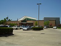
 Houston Natural Science Museum at Sugar Land


Local attractions

Next door to the district is First Colony Mall, a major regional shopping mall that recently expanded from its original indoor design to include an outdoor lifestyle component, several parking garages, and new signage that blends in with the surrounding area.
Sugar Land also hosts the Sugar Land Ice and Sports Center (formerly Sugar Land Aerodrome), offers ice skating and hockey lessons. It is open to the public as an ice skating facility. Previously, it served as the practice facility for the Houston Aeros of the American Hockey League. Also Olympic medalist Tara Lipinski trained at the Sugar Land Ice and Sports Center.
In May 2016, two sculptures in the Town Square's public plaza were installed as part of a 10-piece collection donated by a Sugar Land resident to the city through the Sugar Land Legacy Foundation.[88] One of the statues, which depicts two girls taking a selfie, has received criticism[89] and acclaim[90][91] from the media and general public.
Future developments in the city include new mixed-use developments on the grounds of the former Imperial Sugar refinery, Imperial Market, which will incorporate the property's 1920s-era char house as a boutique hotel, as well as in the southern part of the Telfair master-planned community with the Smart Financial Centre as an anchor.
Districts and communities

Sugar Land has the most master-planned communities in Fort Bend County, which is home to the largest number of master-planned communities in the nation—including
The northern portion of Sugar Land, sometimes referred to by residents and government officials as "Old Sugar Land", comprises all the communities north of U.S. Highway 90A, but it also includes the subdivisions/areas of Venetian Estates, and Belknap/Brookside, which is just south of U.S. 90A. Most of this area was the original city limits of Sugar Land when it was incorporated in 1959. Located in this part of town is the former Imperial Sugar Company refinery and distribution center that was shut down in 2003, even though the company's headquarters are still located within the city. To the east of northern Sugar Land is the Sugar Land Business Park, the largest business and industrial area in the city. Many of the city's electronic and energy companies are located here, including the future North American headquarters of Schlumberger. The Imperial master-planned community, including Constellation Field and the future Imperial Market development, is also located in north Sugar Land.
The largest economic and entertainment activities are in the areas of south and southeastern Sugar Land. Most of the population in the city limits are concentrated here. This area is all master-planned communities and it includes nearly all of
The southwestern area of Sugar Land was recently annexed into the city limits, and is sometimes referred to as the "other side of the river". This is due to this area being separated from the rest of Sugar Land by the Brazos River, as well as being served by the Lamar Consolidated Independent School District. The southwest side has two master-planned communities, Greatwood and River Park. Other communities in this area are Canyon Gate on the Brazos and Tara Colony, the latter an older large subdivision which has a Richmond address but is actually in the extraterritorial jurisdiction of Sugar Land and up for future annexation.
The western portion of Sugar Land was also fully incorporated into the city limits in 2017. It is home to two master-planned communities, New Territory and Telfair, the latter of which was previously prison farm land owned by the Texas Department of Criminal Justice. It was sold in 2003 and annexed to the city limits by Sugar Land in 2004. A new highway, State Highway 99 (more commonly known as the "Grand Parkway"), opened in 1994 as a major arterial in this area. North of this area and U.S. Highway 90A is the Sugar Land Regional Airport and the recently decommissioned Texas Department of Corrections Central Unit, which in 2011 became the first Texas prison to be closed without a replacement facility and is being targeted by the city for future light industrial development.
Architectural landmarks
Lakeview Auditorium, located on the campus of Lakeview Elementary School, is the oldest public building still standing in the area. Originally one of eleven buildings that composed the campus of the old Sugar Land Independent School District, the auditorium was a focal point for a vibrant and growing community. The stately auditorium still stands today and is a Recorded Texas Historic Landmark, as of 2002.
In 1912, Imperial Sugar Company built a small building at the corner of Wood Street and Lakeview Drive (then known as Third Street) to serve as a school. The original campus consisted of 11 buildings arranged in a semicircle with the large, airy auditorium in the center. The buildings were connected by a covered walkway supported by large, white columns. There was a circular driveway for buses and automobiles. All the buildings were finished in white stucco on the outside and had large windows that allowed fresh air to circulate and cool the buildings. The auditorium was a hub of community activity.
Education
Higher education

A branch campus of Wharton County Junior College and a branch campus of University of Houston are both located in Sugar Land.
Sugar Land is under state law in the service area of Wharton County Junior College, as its extraterritorial jurisdiction.[92] Wharton County College is a comprehensive community college offering a wide range of postsecondary educational programs and services including associate degrees, certificates, and continuing-education courses. The college prepares students interested in transferring to baccalaureate-granting institutions.
Primary and secondary education
Public schools

All public school systems in Texas are administered by the Texas Education Agency (TEA). The Fort Bend Independent School District (FBISD) is the school district that serves almost all of the city of Sugar Land; it formed in 1959 by the consolidation of Missouri City Independent School District and the Sugar Land Independent School District.[93] The southwest portion of Sugar Land and some very small areas within its extraterritorial jurisdiction (ETJ) are in the Lamar Consolidated Independent School District (LCISD).
High schools serving Sugar Land residents in Fort Bend ISD include
Dulles, Clements, and Austin have been recognized by Texas Monthly magazine in its list of the top high schools in Texas. In addition, Dulles, Clements, and Austin high schools were also ranked among the top 1000 schools in the United States by Newsweek's 2009 report.[94]

Prior to 1959
In addition, the
Private schools
Many private schools in Sugar Land and the surrounding area are of all types: nonreligious, nonsectarian, Catholic, and Protestant. The Texas Education Agency has no authority over private-school operations; private schools may or may not be accredited and achievement tests are not required for private school graduating seniors.
The
The
As of 2019[update]
Public libraries
Residents of Sugar Land are served by the Fort Bend County Libraries system, which has 11 libraries. Three branches are within the city: Sugar Land Branch, First Colony Branch, and University Branch on the University of Houston Sugar Land branch campus.
-
 Sugar Land Library Branch
 -
 First Colony Library Branch
 -
 University Library Branch


Media
Movie references
A portion of the 1974 movie,
In 2010, The Legend of Action Man was filmed in Sugar Land. The film was produced by Dingoman Productions, a sketch comedy group formed by Sugar Land residents Andy Young, Derek Papa & James McEnelly that got their start attending Austin High School together. The story takes place in the Sugar Land area and makes use of many of the landmarks there. Action Man is famous for being one of the least expensive films ever made, made on a budget of $200. Director Andy Young has written about the experience for Moviemaker magazine.
Music references
"If you're ever down in Houston,
Boy, you better walk right.
And you better not squabble.
And you better not fight.
Bason and Brock will arrest you.
Payton and Boone will take you down.
You can bet your bottom dollar,
That you're Sugar Land bound."
Country music band Sugarland gets its name from the city. They reference it in their song "Sugarland".
Bruce Springsteen recorded but did not release a song called "Sugar Land", about the economic crisis facing American agriculture in the 1980s.
Newspapers and magazines
The primary newspaper serving Sugar Land residents is the Houston Chronicle, which is the only major newspaper in the Greater Houston region. On Thursdays, the Houston Chronicle offers a localized segment covering the Sugar Land area under its "Fort Bend" section. An alternative newspaper, the Houston Press, is also offered in this area.
Additionally, Sugar Land residents receive local area news coverage via Covering Fort Bend, which covers local news and political happenings in the Sugar Land area. Residents also are served by three free weekly newspapers, the Fort Bend Independent, the Fort Bend Star, and the Sugar Land Sun. The Fort Bend Herald and Texas Coaster, a daily newspaper covering primarily the Richmond-Rosenberg area west of Sugar Land, also covers news stories in Sugar Land.
Television
Over-the-air television in Sugar Land is broadcast in the Houston television market, which is the seventh-largest market in the United States according to Nielsen Media Research.
The city is also served by a citywide
The vast majority of cable subscribers in the Sugar Land area are served by
Sugar Land is the setting in the new Lifetime series, The Client List starring Jennifer Love Hewitt. Hewitt's character lives in Beaumont, but commutes to Sugar Land to work at a scandalous massage parlor.
Transportation
Sugar Land currently does not have a
Major thoroughfares
Interstate 69/U.S. Highway 59, the major freeway running diagonally through the city, has undergone a major widening project in recent years to accommodate the region's daily commuters. The finished portion of the freeway from east of State Highway 6 to just west of State Highway 99 currently has eight main lanes, with two diamond lanes and six continuous frontage road lanes. The freeway is currently undergoing a major expansion west of the city to accommodate growth in the nearby Richmond/Rosenberg area and western Fort Bend County, as well as upgrading it to federal highway standards to reflect its newfound status as an interstate highway.
U.S. Highway 90 Alternate is another major highway running through Sugar Land from west to east and traverses a historic area of the city, known as "Old Sugar Land". Originally the main highway in Sugar Land prior to the construction of what is now Interstate 69, U.S. Highway 90A is currently widened to an eight-lane highway with a 30-foot (9.1 m) median between State Highway 6 and Interstate 69/U.S. Highway 59.
State Highway 6 is a major highway running from north to southeast Sugar Land and traverses through the 10,000 acres (40 km2) master-planned community of First Colony. There is a freeway section that opened in 2008 from just west of Brooks Street/First Colony Blvd all the way to 3/4 miles north of U.S. Highway 90A.
A segment of
Texas F.M. 1876, widely known as Copenhaver Road, is a north-south state highway in north Sugar Land. It traverses through many established areas and acts as the western border of the Sugar Land Business Park.
Airport

Sugar Land Regional Airport (formerly Hull Field, later Sugar Land Municipal Airport) was purchased from a private interest in 1990 by the city of Sugar Land. It is the fourth largest airport within the Greater Houston metropolitan area. The airport handles approximately 250 aircraft operations per day. The airport has an on-field United States Customs office, making this airport attractive to energy companies based in the Houston metropolitan area as this allows flights directly to and from countries wherein overseas operations are located, allowing fliers to avoid the delays inherent in high traffic airports such as George Bush Intercontinental.
The airport today serves the area's general aviation (GA) aircraft serving corporate, governmental, and private clientele. A new 20,000-square-foot (1,900 m2) terminal and a 60-acre (24 ha) GA complex opened in 2006. Sugar Land Regional briefly handled commercial passenger service during the mid-1990s via a now-defunct Texas carrier known as Conquest Airlines. For scheduled commercial service, Sugar Landers rely on Houston's two commercial airports, George Bush Intercontinental Airport (IAH), 40 miles (64 km) northeast, and William P. Hobby Airport (HOU), 27 miles (43 km) east.
The city of Houston maintains a park that occupies 750 acres (300 ha) of land directly north of the Sugar Land Regional Airport, and developers have built master-planned communities (Telfair, and the future development of TX DOT Tract 3 immediately east of the airport) around the airport, both factors that block airport expansion.
China Airlines operated private bus shuttle services from Wel-Farm Super Market/Metro Bank on State Highway 6 in Sugar Land to George Bush Intercontinental Airport to feed the flight from Bush Intercontinental to Taipei, Taiwan.[110] The service ended when China Airlines pulled out of Houston on January 29, 2008.[111]
Notable people
- Katie Armiger, country singer
- Kevin Bass, former outfielder for the Houston Astros and the San Francisco Giants
- Derek Carr, NFL quarterback
- Tom DeLay, former United States Representative and House Majority Leader
- Ed Fiori, Professional Golfer
- Sean Patrick Flanery, Actor
- Derrick Frazier, NFL cornerback
- Stuart Holden, soccer player
- Jerry Hughes, defensive end for the Buffalo Bills
- George Iloka, NFL player
- Brittney Karbowski, voice actor
- Tara Lipinski, Olympic gold medalist in figure skating
- Diana López, Mark López, and Steven López, Taekwondo athletes
- Casey Luong, known as Keshi, singer, grew up in Sugar Land
- Simone Manuel, Olympic gold medalist in swimming[112]
- Maddie Marlow, member of country duo Maddie & Tae
- Pete Olson, United States Representative
- Ashley Spillers, actress, grew up in Sugar Land
- Allison Tolman, Emmy-nominated actress
- Simeon Woods Richardson, MLB pitcher
- Rosé, drag queen, RuPaul's Drag Race Season 13 finalist
Notes
References
- ^ a b "2019 U.S. Gazetteer Files". United States Census Bureau. Retrieved August 7, 2020.
- ^ "Profile of General Population and Housing Characteristics: 2020 Demographic Profile Data (DP-1): Sugar Land city, Texas". United States Census Bureau. Retrieved February 8, 2024.
- ^ "Sugar Land (TX) sales tax rate". Irs-offices.com. Retrieved November 10, 2022.
- ^ "US Board on Geographic Names". United States Geological Survey. October 25, 2007. Retrieved January 31, 2008.
- ^ "Geography Profile: Sugar Land city, Texas". Retrieved January 3, 2024.
- ^ "Selected Economic Characteristics: Sugar Land city, Texas". United States Census Bureau. Retrieved January 3, 2024.
- ^ ANHAISER, BETTYE J. (June 15, 2010). "SUGAR LAND, TX". tshaonline.org.
- ^ Flynn, Meagan. "Bodies believed to be those of 95 black forced-labor prisoners from Jim Crow era unearthed in Sugar Land after one man's quest". Washington Post.
- ^ Trovall, Elizabeth (July 16, 2018). "Uncovered Remains At Forgotten Sugar Land Grave Site Tell Their Own Texas History Story". Houston Public Media.
- ^ "Documents". M. Campbell. Retrieved May 2, 2017.
- ^ [1] [dead link]
- ^ "Suburbs sinking at a substantial rate in the Woodlands, Spring, Katy and Mont Belvieu, study shows". Click2houston.com. October 17, 2022.
- ^ "USGS | Gulf Coast Aquifer Subsidence". Txpub.usgs.gov.
- ^ a b c d "Land Subsidence in Fort Bend County, TX". Storymaps.arcgis.com. July 28, 2021.
- ^ "Homes in the Woodlands could sink by more than a foot over decades under new groundwater guidelines". Houstonchronicle.com. January 6, 2022.
- ^ "Fort Bend Subsidence District (FBSD) - Fort Bend County, Texas". Fbsubsidence.org. Retrieved July 22, 2023.
- ^ "Purpose of and Need for the Luce Bayou Interbasin Transfer Project" (PDF). Swg.usace.army.mil. Retrieved July 22, 2023.
- ^ a b "GROUND-WATER RESOURCES OF FORT BEND COUNTY, TEXAS : REPORT 155" (PDF). Twdb.texas.gov. Retrieved July 22, 2023.
- ^ "Groundwater Reduction Program | Sugar Land, TX - Official Website".
- ^ "Sugar Land, Texas, USA Weather Data". Climate-Charts.com. Archived from the original on May 13, 2012. Retrieved October 9, 2012.
- ^ "Explore Census Data". data.census.gov. Retrieved May 23, 2022.
- ^ "About the Hispanic Population and its Origin". Census.gov. Retrieved May 18, 2022.
- ^ United States Census Bureau. "Census of Population and Housing". Retrieved June 14, 2013.
- ^ a b c "Profile of General Population and Housing Characteristics: 2010 Demographic Profile Data (DP-1): Sugar Land, Texas". American FactFinder. U.S. Census Bureau. Archived from the original on February 13, 2020. Retrieved August 31, 2016.
- ^ "Community Facts — 77479". American FactFinder. U.S. Census Bureau. Archived from the original on February 12, 2020. Retrieved November 27, 2010.
- ^ Maclaggan, Corrie. "What Ethnic Diversity Looks Like: Fort Bend" (Archive). The New York Times. November 24, 2013. Retrieved on May 24, 2014.
- ^ "Selected Economic Characteristics: 2014 American Community Survey 1-Year Estimates (DP03): Sugar Land city, Texas". American FactFinder. U.S. Census Bureau. Archived from the original on February 13, 2020. Retrieved August 31, 2016.
- ^ "Find a Parish". Archgh.org. Archived from the original on October 29, 2013. Retrieved June 24, 2012.
- ^ Dooley, Tara (March 25, 2006). "Catholic archdiocese seeing membership boom". Houston Chronicle. Retrieved June 2, 2020.
- ^ Henderson, Robert B. (October 18, 2001). "Diocese assigns new priest to church in Sugar Land". Houston Chronicle. Retrieved June 8, 2020.
- ^ Foster, Bliss (January 5, 2006). "Sugar Land church takes expansion steps". Houston Chronicle. Retrieved June 8, 2020.
- ^ Foster, Bliss (September 28, 2006). "Sugar Land church to revise expansion plan". Houston Chronicle. Retrieved June 8, 2020.
- ^ "Home". St. Thomas Aquinas Church. Retrieved May 30, 2020.
12627 W. BELLFORT AVE SUGAR LAND, TX 77478
- On Map Book page 3D - ^ "Map of Stafford" (PDF). City of Stafford. Retrieved November 7, 2019. - Linked from this page on the Stafford website Archived October 16, 2020, at the Wayback Machine - Based on the location, BAPS is in the extraterritorial jurisdiction but not the city limits
- ^ "Home". BAPS Shri Swaminarayan Mandir, Houston, TX, USA. Retrieved November 7, 2019.
BAPS Shri Swaminarayan Mandir 1150 Brand Lane Stafford, TX 77477 USA
- Despite the "Stafford, TX" city name, it is outside of the Stafford city limits - ^ Dooley, Tara. "New Hindu temple is dedicated in Stafford." Houston Chronicle. July 26, 2004. Retrieved on May 3, 2014.
- ^ Karkabi, Barbara. "Hindu learning is the focus of Sugar Land temple." Houston Chronicle. February 9, 2008. Retrieved on May 3, 2014.
- ^ a b Kadifa, Margaret (December 8, 2015). "Hindu temple finds new home in Sugar Land". Houston Chronicle. Fort Bend Sun. Retrieved June 7, 2020.
10223 Synott Road
- This property has a Sugar Land postal address but in fact is in the city of Houston. USPS postal service boundaries do not necessarily correspond to municipal boundaries. Compare the address to the maps of the Houston city limits. - ^ a b "City of Houston and ETJ" (PDF). City of Houston. Archived from the original (PDF) on May 23, 2019. Retrieved June 7, 2020. and "No. 25 Super Neighborhood Resource Assessment (Alief)" (PDF). City of Houston. p. 2. Retrieved June 7, 2020. - Compare these maps to the Shri Krishna Vrundavana address: "10223 Synott Road" to the Masjid At-Taqwa address: "10415 Synott Road, Sugar Land, TX, 77478", and to the Darul Arqam Southwest address, same as that of Masjid At-Taqwa.
- ^ a b "Maryam Islamic Center". Retrieved February 1, 2022.
- ^ a b "2012 Fortune 500 List by Fortune magazine". Money.cnn.com. May 21, 2012. Retrieved June 24, 2012.
- ^ a b CVR Energy, Inc. Archived May 8, 2012, at the Wayback Machine Retrieved May 22, 2012.
- ^ "No. 5 public company: CVR Energy". June 21, 2012. Retrieved May 2, 2017.
- Houston Business Journal. June 4, 2003. Archivedfrom the original on January 19, 2021.
- ^ Sarnoff, Nancy. "Burger King sniffing for new home / Houston said to be in running for headquarters' possible relocation" (Archive). Houston Chronicle. February 3, 2005. Business 3. Retrieved on January 13, 2009.
- Houston Business Journal. Wednesday October 26, 2005. Retrieved on January 13, 2009.
- ^ "North America (NAM) Contacts Archived 2009-02-04 at the Wayback Machine". Schlumberger. Retrieved on January 13, 2009.
- ^ Mulvaney, Erin. "Schlumberger plans to relocate national headquarters to Sugar Land" (Archive). Houston Chronicle. October 5, 2015. Retrieved on October 24, 2015.
- Houston Business Journal. Monday February 16, 2009. Retrieved on February 16, 2009.
- ^ "Deal of the Week / Cameron buys Galleria-area building". Houston Chronicle. Retrieved December 21, 2008.
- Houston Business Journal. Monday January 21, 2008. Retrieved on February 16, 2009.
- ^ Bivins, Ralph. "BMC signs a big lease/Firm needs space until tower's done". Houston Chronicle. November 17, 1991. Retrieved on August 2, 2009.
- ^ "Comprehensive Annual Financial Report — Fiscal Year 2018-2019" (PDF). City of Sugar Land. September 30, 2019. Retrieved July 31, 2020.
- ^ "Form of Government". City of Sugar Land. Retrieved August 31, 2016.
- ^ Taylor, Brittany (November 2, 2019). "Sugar Land names new city manager". KPRC. Retrieved February 23, 2020.
- ^ "Statistics and Data". ICMA. Archived from the original on June 13, 2010.
- Houston Business Journal. April 15, 2005. Retrieved on May 15, 2010.
- ^ "City Phone Directory". City of Sugar Land. May 16, 2003. Archived from the original on July 25, 2003. Retrieved June 24, 2012.
- ^ "Citizen's Fire Academy". City of Sugar Land. Archived from the original on July 19, 2008. Retrieved June 24, 2012.
- ^ "City of Sugar Land". Archived from the original on July 20, 2007.
- ^ "Mayor & City Council - Sugar Land, TX - Official Website". Sugarlandtx.gov. Retrieved May 2, 2017.
- ^ Finkel, David (April 26, 2004). "For a Conservative, Life Is Sweet in Sugar Land, Tex". The Washington Post. Retrieved October 11, 2022.
- ^ "2012 Canvass Report" (PDF). Retrieved October 11, 2022.
- ^ "2016 Canvass Report" (PDF). Retrieved October 11, 2022.
- ^ "2020 Canvass Report" (PDF). Retrieved October 11, 2022.
- ISBN 978-0300172034.
- ^ "Biography Ronald Ernest Paul". Bioguide.congress.gov. Biographical Director of the United States Congress. Retrieved November 23, 2017.
- ^ "Rick Miller's Biography". Vote Smart. Retrieved March 1, 2014.
- ^ Knipp, Bethany (November 2, 2016). "Fort Bend County lacks hospital district". Community Impact Newspaper. Retrieved October 18, 2021.
- ^ Nowell, Scott. "Doing Time" Houston Press. Thursday September 18, 2003. Retrieved on September 23, 2011.
- ^ "CENTRAL (C) Archived 2010-07-25 at the Wayback Machine." Texas Department of Criminal Justice. Retrieved September 14, 2008.
- ^ "Street/Address Locator". City of Sugar Land. Archived from the original on June 9, 2012. Retrieved June 24, 2012.
- ^ Hanson, Eric. "Historic prison may be closed." Houston Chronicle. March 22, 2008. Retrieved on April 30, 2011.
- ^ "Sugar Land Distribution Center Archived 2010-07-12 at the Wayback Machine." Texas Department of Criminal Justice. Retrieved on May 22, 2010.
- ^ Ward, Mike. "Texas closing prison as part of cutbacks Archived 2012-04-01 at the Wayback Machine." Austin American-Statesman at KDH News. Wednesday August 3, 2011. Retrieved on September 23, 2011.
- ^ Maxey, Elsa. "Sugar Land Central prison unit to be emptied out by end of August." Fort Bend Star. Retrieved on September 30, 2011.
- ^ "Post Office Location - SUGAR LAND". United States Postal Service. Retrieved on December 6, 2008.
- ^ "Post Office Location - FIRST COLONY". United States Postal Service. Retrieved on December 6, 2008.
- ^ "Press Room - Quick Facts - Selected Census 2000 Information". City of Sugar Land. Archived from the original on November 28, 2010. Retrieved November 27, 2010.
- ^ "Sugar Land Wins Fourth Straight "Fittest City in Texas" Title". Sugarlandtx.gov. Archived from the original on December 14, 2012. Retrieved November 27, 2010.
- ^ "Sugar Land Stays Active to Three-peat as "Fittest City in Texas"". Sugarlandtx.gov. Archived from the original on December 14, 2012. Retrieved November 27, 2010.
- ^ "City of Sugar Land Articles". City of Sugar Land. October 22, 2009. Archived from the original on August 6, 2012. Retrieved November 27, 2010.
- ^ "Start Here! - Sugar Land Sharks". Sugarlandsharks.org. Retrieved May 2, 2017.
- ^ "Official Website of the Sugar Land Skeeters". sugarlandskeeters.com. May 27, 2012. Archived from the original on May 26, 2012. Retrieved May 27, 2012.
- ^ McTaggart, Brian (November 20, 2020). "Sugar Land Becomes Astros affiliate". Houston Astros. Major League Baseball. Retrieved November 20, 2020.
- ^ Winkler, Adam (January 29, 2022). "Digging Into the Process of Rebranding From Sugar Land Skeeters to Space Cowboys". ABC 13. Retrieved January 30, 2022.
- ^ Kadifa, Margaret (March 22, 2016). "'Cricket' isn't a bug to this group of youngsters". Houston Chronicle. Retrieved October 26, 2019.
- ^ "Sugar Land Installs Donated Sculptures to Town Square Plaza" (Press release). City of Sugar Land. May 27, 2016.
- ^ Patrick Clarke (June 1, 2016). "Selfie Statue in Texas Sparks Backlash". ABC News – via WABC-TV.
- ^ Rob Walker (December 30, 2016). "The Year in Nine Objects". The New Yorker.
- ^ Jacob Brogan. "In Defense of the Controversial Selfie Statue in Sugar Land, Texas". Slate.
- ^ "EDUCATION CODE CHAPTER 130. JUNIOR COLLEGE DISTRICTS". Statutes.capitol.texas.gov. Retrieved July 22, 2023.
- ^ a b "History." Fort Bend Independent School District. Retrieved on July 20, 2017.
- ^ "America's Top Public High Schools - The Daily Beast". Newsweek.com. June 7, 2009. Retrieved June 24, 2012.
- ^ a b Solomon, Jerome (August 28, 1997). "FOOTBALL 1997/HIGH SCHOOLS/FORT BEND BONANZA/Phillips, Dulles in hunt to add to town's memories". Houston Chronicle. Archived from the original on July 9, 2012. Retrieved December 31, 2011.
- ^ "History." St. Laurence School. Retrieved on March 30, 2019.
- ^ "Campus." St. Laurence School. Retrieved on March 30, 2019. "2630 Austin Parkway Sugar Land, TX. 77479"
- ^ Home. St. Theresa Catholic School. April 8, 2009. Retrieved on March 30, 2019.
- ^ Kumar, Seshadri (April 25, 2007). "Sugar Land OKs permit for St. Theresa school". Houston Chronicle. Retrieved June 8, 2020.
- ^ "St. Theresa Catholic Church to dedicate educational building Aug. 13". Houston Chronicle. August 3, 2009. Retrieved June 8, 2020.
- ^ "Pope John XXIII High golfers take second place". The Katy Rancher at the Houston Chronicle. November 4, 2013. Retrieved March 25, 2017.
Pope John XXIII High School, [...] serves Houston's far west side, including areas of [...] Sugar Land, [...]
- ^ "Fort Bend Christian Academy | A Private day school in Sugar Land, Texas Home". Fortbendchristian.org.
- ^ Womack, Justin (August 1, 2023). "2023 Best Of Fort Bend County Readers' Choice Winners". Living Magazine. Retrieved August 7, 2023.
- ^ "Darul Arqam Southwest". Archived from the original on January 21, 2018. Retrieved January 20, 2018. Quote "An AdvancEd accredited Islamic School in Sugar Land and a member of the IEIT School System." and "10415 Synott Rd. Sugar Land, TX 77498" However the school is actually in the Houston city limits. See the City of Houston and Alief super neighborhood maps. From the City of Houston: "The U.S. Postal Service establishes ZIP codes and mailing addresses in order to maximize the efficiency of their system, not to recognize jurisdictional boundaries."
- ^ "Bus Services". The Village School. Retrieved March 30, 2019. - Village Bus Routes 2018-2019 and Sugar Land Bus Route
- ^ "School Bus Transportation". British International School of Houston. Retrieved March 30, 2019.
- ^ "Bus Schedule 2017-2018" (PDF). Awty International School. Retrieved April 5, 2019.
- ^ "The Sugar Land Express Gang". Texas Monthly.
- ^ "Fort Bend County, TX : Commuter Park and Ride Services". Fortbendcountytx.gov. Retrieved May 2, 2017.
- ^ "Houston International Airport Bus Service Archived 2007-07-04 at the Wayback Machine", China Airlines
- ^ Hensel, Bill, Jr. "2 foreign airlines curtailing Houston passenger service / High fuel prices hit carriers from Mexico, Taiwan". Houston Chronicle. Saturday January 12, 2008. Business 1. Retrieved on June 12, 2009.
- ^ Rogers, Katie (August 12, 2016). "A Closer Look at Simone Manuel, Olympic Medalist, History Maker". The New York Times. Retrieved July 21, 2021.
Further reading
- Sugar Land, Texas from the Handbook of Texas Online
- Slotboom, Oscar F. "Erik" (2003). Houston Freeways. Oscar F. Slotboom.
External links
- City website
- Sugar Land, Texas from the Handbook of Texas Online
| Counties |  | |
|---|---|---|
| "Principal" cities | ||
| Other cities |
For a complete listing, see list of cities and towns in Houston–The Woodlands–Sugar Land MSA | |
| Unincorporated areas | ||
| Bodies of water | ||
Municipalities and communities of Fort Bend County, Texas, United States | ||
|---|---|---|
| Cities |  | |
| Town | ||
| Villages | ||
| CDPs | ||
| Other communities | ||
| Former communities | ||
| Ghost towns | ||
| Footnotes | ‡This populated place also has portions in an adjacent county or counties ±Former CDP annexed by Missouri City ^Former CDP annexed by Sugar Land #Still active as a community, but is no longer listed as a census-designated place | |
| ||
| International | |
|---|---|
| National | |
| Geographic | |