
Sutlej
| Sutlej | |
|---|---|
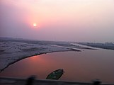
 View of Sutlej River | |
 Path of the Sutlej | |
| Location | |
| Country | China, India, Pakistan |
| State | Tibet, Himachal Pradesh, Punjab (India), Punjab (Pakistan) |
| Cities | Vehari, Jallah Jeem, Bahawalpur |
| Physical characteristics | |
| Source | Manasarovar-Rakas Lakes |
| • location | Tibet |
| • coordinates | 30°50′39″N 81°12′17″E / 30.84417°N 81.20472°E |
| • elevation | 4,575 m (15,010 ft) |
Ropar[1] | |
| • average | 500 m3/s (18,000 cu ft/s) |
| Discharge | |
| • location | Panjnad, Confluence of Chenab (71 km upstream of mouth) |
| • average | 2,946.66 m3/s (104,060 cu ft/s)[2] 63.613 km3/a (2,015.8 m3/s) |
| Basin features | |
| Tributaries | |
| • left | |
The Satluj River (
The waters of the Sutlej are allocated to India under the
Course
The source of the Sutlej is west of the
Continuing west-southwest, the Sutlej enters Pakistan about 15 kilometres (9.3 mi) east of
About 17 kilometres (11 mi) north of Uch Sharif, the Sutlej unites with the Chenab River, forming the Panjnad River, which finally flows into the Indus river about 100 kilometres (62 mi) west of the city of Bahawalpur. The area to the southeast on the Pakistani side of the Indian border is called the Cholistan Desert and, on the Indian side, the Thar Desert.[citation needed]
The Indus then flows through a
Puranic Mention and Etymology
In the Chaitra-Ratha Parva of
Langqên Zangbo
| Langqên Zangbo 朗钦藏布 | |
|---|---|
Standard Tibetan) | |
| Location | |
| Country | China |
| State | Tibet |
| Region | Ngari Prefecture |
| Physical characteristics | |
| Source | |
| • location | China |
| Length | 309 km (192 mi) |
| Basin features | |
| River system | Sutlej |
Langqên Zangbo (Tibetan: གླང་ཆེན་གཙང་པོ, Wylie: glang chen gtsang po; Chinese: 朗钦藏布; pinyin: Lǎngqīn Zàngbù) is a river in Ngari, Tibet, China. The name Langqên, Tibetan for "elephant", is because of a valley that resembles an elephant trunk. This river is the main source of the Sutlej, a tributary of Indus River. It enters India at Shipki La pass. The source is south of Gangdise Range, in Ngari Prefecture. Its course is mainly in the Zanda County. The river drains an area of 22,760 km2, and covers a length of 309 km. The drop in height is 3,256 m. Historically, the river was the centre of the Zhangzhung Kingdom until its fall in the 8th century AD.
Geology
Sutlej is an
There is substantial geologic evidence to indicate that prior to 1700 BC, and perhaps much earlier, the Sutlej was an important tributary of the
There is some evidence that the high rate of erosion caused by the modern Sutlej River has influenced the local faulting and rapidly exhumed rocks above
Sutlej-Yamuna Link
There has been a proposal to build a 214-kilometre (133 mi) long heavy freight and irrigation canal, to be known as the
History
This section needs additional citations for verification. (August 2015) |
The Upper Sutlej Valley, called
Today, the Sutlej Valley is inhabited by nomadic descendants of the Zhangzhung, who live in tiny villages of yak herders.[citation needed]
The Sutlej was the main medium of transportation for the kings of that time. In the early 18th century, it was used to transport
Of four rivers (
Gallery
-
 Sutlej Valley from Rampur c. 1857
 -
 Using inflated animal skins to cross the Sutlej River, c. 1905
 -
 Sutlej River inKinnaurValley, Himachal Pradesh, India
 -
 Cattle grazing on the banks of the river in Rupnagar, Punjab, India
 -
 Satluj River near Shahkot, Punjab, India
 -
 Sutlej entering India from Tibet near Shipki La, c. 1856


,_from_the_Illustrated_London_News,_1856.jpg)
See also
- List of rivers of India
- List of rivers of Pakistan
- Cis-Sutlej states
- Sulemanki Headworks
- Geology of the Himalaya
References
- ^ "Sutlej valley". The Free Dictionary.
- ^ "Rivers Network". 2020. Archived from the original on 8 August 2022. Retrieved 10 March 2022.
- ^ Asiatic Society of Bengal (1848). Journal of the Asiatic Society of Bengal, Volume 17, Part 1. p. 210, paragraph two.
- ^ "Bhakra Beas Management Board". wrmin.nic.in. Archived from the original on 31 August 2005.
- ^ "Page 290, The Ravi- Beas Water Tribunal Report (1987)" (PDF). Central Water Commission. Retrieved 15 February 2020.
- ^ "Nathpa Jhakri Hydroelectric Power Project, India". power-technology.com. Retrieved 14 May 2011.
- ^ "Lower Sutlej basin area" (PDF). Archived from the original (PDF) on 4 September 2018. Retrieved 14 May 2017.
- ^ a b c "WRIS geo-visualization map". Archived from the original on 13 June 2017. Retrieved 17 January 2017.
- ^ "Upper Sutlej basin area" (PDF). Archived from the original (PDF) on 7 January 2018.
- ^ "Page 60, The Ravi- Beas Water Tribunal Report (1987)" (PDF). Central Water Commission. Retrieved 15 February 2020.
- ^ "Evolution of the Delta, the LBOD outfall system and the Badin dhands - chapters 3 & 4" (PDF). Retrieved 22 December 2015.
- ^ Pratap Chandra Roy's Mahabharata Adi Parva, Chaitra-Ratha Parva Page:509
- S2CID 4427250.
- ^ Mughal, M. R. Ancient Cholistan. Archaeology and Architecture. Rawalpindi-Lahore-Karachi: Ferozsons 1997, 2004
- ^ Valdiya, K. S., in Dynamic Geology, Educational monographs published by J. N. Centre for Advanced Studies, Bangalore, University Press (Hyderabad), 1998.
- ^ * Clift et al. 2012. "U-Pb zircon dating evidence for a Pleistocene Sarasvati River and capture of the Yamuna River." Geology, v. 40. [1]
- ^ K.S. Valdiya. 2013. "The River Saraswati was a Himalayan-born river". Current Science 104 (01). [2]
- .
- .
- ^ http://india.gov.in/sectors/water_resources/sutlej_link.php Sutlej-Yamuna Link
- ^ "Sutlej River | river, Asia | Britannica".
External links
- Sutlej basin marked on OpenStreetMap.
- Sutlej-Yamuna Link Canal is So Controversial? Wissurge,26 August 2020
Punjab geography | ||
|---|---|---|
| ||
_with_cities.png)
| Rivers |
|
|---|---|
| Lakes |
|
| Dams, barrages | |
| Yangtze system | |
|---|---|
| Yellow system | |
Pearl system | |
| Heilongjiang system | |
| Huai system | |
| Hai system | |
| Liao system | |
| Other major rivers | |
| Major canals | |
| International | |
|---|---|
| National | |