
Syrian Desert
| Syrian Desert | |
|---|---|
| بادية الشام | |
 Composite satellite image | |
| Area | 500,000 km2 (190,000 sq mi) |
| Geography | |
| Countries | |
| Coordinates | 33°20′00″N 38°50′00″E / 33.3333°N 38.8333°E |
The Syrian Desert (
Location and name
The desert is bounded by the
Several parts of the Syrian Desert have been referred to separately such as the Palmyrene desert around Palmyra, and the Homs desert.[9] The eastern section of the Syrian Desert, that within borders of Iraq, can be referred to (within Iraqi context) as the Western Desert.[10][11]
The name Shamiyah has also been used for the Syrian Desert.[12] The name has been translated in the past as Badiyat al-Sham (or Badiyat ash-Sham)[11][10]
Geography
The 700–900-metre high (2,300–3,000 ft) region in the middle of the desert is the Hamad Plateau, a rather flat, stony
Together with the other deserts of the Arabian Peninsula, the Hamad Desert has been described as one of the most arid deserts of the world.[15]
Wildlife
Some of the
The Syrian Desert is the origin of the golden hamster.[17]
History
Ancient


The desert was historically inhabited by
One of the most important ancient settlements in the Syrian desert is Palmyra; first mentioned in the second millennium BC, the city was an important trading center in Roman times, and its people were renowned merchants who took advantage of its strategic position on the silk road linking the far east to the mediterranean, by taxing caravans that were passing by, establishing colonies on the silk road, and trading in the rare commodities from the far east, thus bringing enormous wealth to their city.
Another important ancient settlement is the city of Dura-Europos on the Euphrates. Originally a fortress,[18] it was founded during the Seleucid Empire and initially given the name Dura, which means "Fortress",[19] but was called Europos by the Greeks.[19] The combination Dura-Europos is a modern invention.[19] The city prospered, mainly for its location on the Euphrates, importantly linking Mesopotamia to the Mediterranean, thus playing a huge part in both the commercial and military connections between the two regions.[19] It was, however, raided by the Sasanian emperor Shapur I in the 250s, most of its citizens fled, and under Sasanian rule, the city was subsequently abandoned.[19]
Modern
During the
Economy and agriculture
With low rainfall and poor quality soils, today the region is principally used as rangeland for livestock. Bedouin herdsmen, many of whom are still nomadic, graze about twelve million sheep and goats here, as well as a smaller number of camels.[26]
The International Fund for Agricultural Development aims to alleviate rural poverty, and in 1995, in cooperation with the Syrian government, it started a project to rehabilitate over a million hectares of degraded land in the Syrian Badia. In some areas, when grazing was restricted, there was a spontaneous return of many of the native plants. In other areas which were more heavily degraded, grazing restrictions were supplemented by reseeding and the planting of fodder species. By the time the project ended in 2010, nearly a quarter of a million hectares had been reseeded, and nearly a hundred thousand hectares had been planted with native fodder shrubs. The result has been a great success, with some herdsmen reporting tenfold increases in the productivity of their livestock.[26]
Gallery
-
 Desert around Palmyra
 -
 Road in the desert near Palmyra
 -
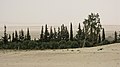 Oasis near Al-Sukhnah
 -
 Camels in the desert near Raqqa
 -
 Resafa ruins southwest of Raqqa and the Euphrates.
 -
 Rocks, unidentified location


.jpg)
See also
- Arabian desert
- Fertile Crescent
- List of deserts by area
References
- ^ a b "Syrian Desert | Map & Facts | Britannica". www.britannica.com. Retrieved 2022-11-07.
- ^ ISBN 978-92-5-105337-9.
- ^ "Jordan Badia | The Hashemite Fund for Development of jordan Badia". www.badiafund.gov.jo. Retrieved 2016-07-27.
- ^ "The rangelands of the Syrian Arab Republic". FAO. Retrieved 26 December 2015.
- ISBN 978-1-57958-310-1.
- ^ ISBN 9781850756149. Retrieved 2 February 2017.
- ^ "Syrian Desert". Archived from the original on January 13, 2008. Retrieved 2008-01-13.
{{cite web}}: CS1 maint: bot: original URL status unknown (link) - ^ New International Encyclopedia. Dodd, Mead. 1914. p. 795.
- ^ Annual Review, Volume 2. Institute for Defence Studies and Analyses. 1973. p. 476. Retrieved 3 February 2017.
- ^ a b Mudīrīyat al-Āthār al-Qadīmah al-ʻĀmmah (1964). "Sumer". سومر. 20. Directorate General of Antiquities.: 10.
The western desert of Iraq forms the eastern half of the Badiyat ash-Sham (The Syrian Desert)
- ^ a b Studies, Johns Hopkins University School of Advanced International (1956). Area Handbook on Iraq. Pr. by Human Relations Area Files. p. 34.
The Western Desert. The western reaches of Iraq form part of the "Badiyat al-Sham" or "al-Shamiya", the Syrian Desert.
- ^ ISBN 9781576079652. Retrieved 3 February 2017.
- ISBN 9783642193514. Retrieved 2 February 2017.
- ^ "Jebel 'Aneiza, Saudi Arabia". geographic.org. Retrieved 2 February 2017.
- ^ "Transboundary Aquifers, Challenges and New Directions" (PDF). Paris: UNESCO. December 2010. p. 4. Retrieved 2 February 2017.
- ISBN 978-1-933992-24-2.
- ISBN 9780127141657. Retrieved 2 February 2017.
- ISBN 9781136192715.
- ^ ISBN 9789004115897.
- OCLC 960210099.
- ISBN 9781136192715.
- ^ "U.S. diplomat apologizes for remarks". NBC News. 2006-10-22. Retrieved 2011-02-02.
- ^ Knickmeyer, Ellen (2006-05-29). "U.S. Will Reinforce Troops in West Iraq". Washingtonpost.com. Retrieved 2011-02-02.
- ^ "WP: U.S. to reinforce troops in west Iraq". MSNBC. 2006-05-30. Archived from the original on 2012-05-25. Retrieved 2011-02-02.
- ^ "Situation Called Dire in West Iraq". Washington Post. 2006-09-10. Retrieved 2011-02-02.
- ^ a b "The grass is greener: rehabilitating the Syrian Badia". Rural Poverty Portal. IFAD. Retrieved 26 December 2015.
| Geography |
|  | ||||
|---|---|---|---|---|---|---|
| History |
| |||||
| Languages | ||||||
| Culture / Society |
| |||||
| Archaeology | ||||||
| Religion | ||||||
| Academia | ||||||