
Tanga, Tanzania
Tanga
Jiji la Tanga (Swahili) | |
|---|---|
   From top to bottom: Tanga city scape, Mosque in Sultan of Zanzibar in April 1891. |
Tanga (Jiji la Tanga, in
Geography
Climate
Due to close proximity to the equator and the warm Indian Ocean, the city experiences tropical climatic conditions similar to all Tanzanian coastal cities. The city experiences hot and humid weather throughout much of the year and has a tropical wet and dry climate (Köppen: Aw). Annual rainfall is approximately 1,290 mm (51 in), and in a normal year there are two rainy seasons: "the long rains" in April and May and "the short rains" in November and December.[2]
| Climate data for Tanga | |||||||||||||
|---|---|---|---|---|---|---|---|---|---|---|---|---|---|
| Month | Jan | Feb | Mar | Apr | May | Jun | Jul | Aug | Sep | Oct | Nov | Dec | Year |
| Mean daily maximum °C (°F) | 32.3 (90.1) |
33.0 (91.4) |
33.3 (91.9) |
31.1 (88.0) |
29.7 (85.5) |
29.3 (84.7) |
28.5 (83.3) |
28.6 (83.5) |
29.2 (84.6) |
30.2 (86.4) |
31.2 (88.2) |
32.2 (90.0) |
30.7 (87.3) |
| Daily mean °C (°F) | 27.8 (82.0) |
28.2 (82.8) |
28.4 (83.1) |
27.1 (80.8) |
26.0 (78.8) |
25.1 (77.2) |
24.3 (75.7) |
24.2 (75.6) |
24.6 (76.3) |
25.6 (78.1) |
26.8 (80.2) |
27.7 (81.9) |
26.3 (79.4) |
| Mean daily minimum °C (°F) | 23.4 (74.1) |
23.4 (74.1) |
23.6 (74.5) |
23.2 (73.8) |
22.3 (72.1) |
20.9 (69.6) |
20.1 (68.2) |
19.8 (67.6) |
20.1 (68.2) |
21.1 (70.0) |
22.4 (72.3) |
23.2 (73.8) |
22.0 (71.5) |
| Average rainfall mm (inches) | 30 (1.2) |
27 (1.1) |
98 (3.9) |
225 (8.9) |
294 (11.6) |
84 (3.3) |
69 (2.7) |
63 (2.5) |
78 (3.1) |
106 (4.2) |
140 (5.5) |
76 (3.0) |
1,290 (51) |
| Source: [2] | |||||||||||||
Economy
Major exports from the port of Tanga include sisal, coffee, tea, and cotton. Tanga is also an important railroad terminus, connecting much of the northern Tanzanian interior with the sea via the Tanzania Railways Corporation's Link Line and Central Line. Tanga is linked to the African Great Lakes region and the Tanzanian economic capital of Dar es Salaam. The city is served by Tanga Airport.The harbour and surrounding is the centre of life in Tanga. It has several markets in several neighbourhoods.Tanga Cement is one of the major industries.
Infrastructure


Air connectivity
Tanga has a small airport and is currently served by only three regional airlines, providing scheduled services to
Road connectivity
Tanga city lies approximately 250 km from Chalinze on the A14 highway that runs from Chalinze to Mombasa. The town is 75 km away from Segera which is a junction linking the A14 and the B1. The B1 highway is a bypass that links Moshi and the northern corridor to Tanga.[4]
Port of Tanga
The port is historically the oldest operating harbour in the nation and its roots date back to around the 6th century.
Rail connectivity
Tanga is the starting point of the narrow gauge northern railway network that ends in Arusha. Construction of this line was started in the 19th century by the Germans. In 2018, the Government of Tanzania invested 5.7 billion Tanzanian Shillings to rehabilitate the line. As of July 2019, diesel powered cargo trains are leaving Tanga Railway Station again and passenger transport between Tanga and Arusha is set to start in September 2019.[8]
History
Early history
The first communities that called Tanga home were the Digo peoples and the Swahili states of the 11th to 16th Centuries. However, the earliest documentation about Tanga comes from the Portuguese. During their disruption of the previous trading links Tanga settlement remained a small trading post for the colonists during their occupation of the East African coast for 200 years between 1500 and 1700 when they were ousted .[9] The Sultanate of Oman battled the Portuguese and gained control of the settlement by mid-1700 along with Mombasa, Pemba Island and Kilwa Kisiwani.[10] The town continued to act as a trading port for ivory and slaves under the sultan's rule.[11] Tanga continued to be a prosperous trading hub for slaves with the Arab world up until 1873 when the European powers invaded and occupied thus abolishing the slave trade that was no longer serving the colonial powers.[10]
Tanga under German East Africa


In the 19th Century, growing interests by Europeans for the
Tanga was chosen in 1889 as a military post of German East Africa, and it became a district office in 1891. The town saw rapid expansion and planned growth under the German occupation. A tram line was built in the city for domestic transport and a port was also built for exports. In 1896 the construction of the Usambara Railway began and was extended to Moshi by 1912. Roads, bridges and the railway enabled industrial growth in the region and many buildings and bridges that are still in operation today in the town are from the German colonial period. The local economy was based mainly on the production of sisal, which had been brought to the colony several years earlier, and population in the area grew rapidly.[13]
Tanga under British occupation
As the coastal town closest to British East Africa, Tanga was on the front line of the East African campaign at the beginning of World War I. On 4 November 1914 a landing by British and Empire forces was repelled in the Battle of Tanga.[14] On 13 June 1916 the Royal Navy battleship HMS Vengeance and protected cruisers Challenger and Pioneer bombarded Tanga. On 7 July the protected cruiser HMS Talbot and monitor Severn entered Manza Bay[15] and put troops ashore who occupied the town.[16] After the War, Britain gained control of Tanganyika and continued to develop Tanga and exploit its agricultural potential. In 1919 Tanga was the country's fourth largest city, but at independence it was the second largest city after Dar es Salaam.
Post-independence
In the early stages of independence, the Port of Tanga continued to be a gateway for the export of sisal from the region. However, following the adopting of the Ujamaa policy, global prices in sisal dwindling, the production that served the city's factories closed and the city lost its main source of income. With the government controlling the agriculture trade and the depreciation in the world prices of sisal the port began to lose revenue.[17]
Healthcare
Tanga city medical institutions include:
- Bombo Regional Hospital
- National Institute of Medical Research Centre, Tanga
- Amani Biomedical Research Laboratory
- Tanga AIDS Working Group
Tourist sites
Nearby tourist attractions include
-
-
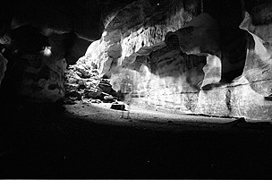
 Toten Island
 -
-
 Magoroto lake near Tanga.


Sport
Tanga is represented in the Tanzanian Premier League by football clubs Coastal Union, JKT Mgambo, and African Sports (Wana Kimanumanu) from the 2015–2016 season.
Twin towns – sister cities
Tanga is twinned with:
 Eckernförde, Germany (1963)[18]
 Kemi, Finland (2007)[19]
 Tifariti, Western Sahara[citation needed]
 Toledo, United States (2001)[20]
Gallery
-
 A roundabout in the city centre, 2003.
 -
 The German built cliff block at the Bombo Hospital.
 -
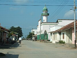 A mosque in Ngamiani.
 -
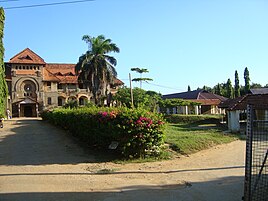
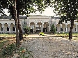 The Tanga Public Library.
 -
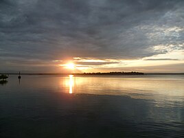 A sunset in Tanga Bay.
 -
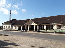 Tanga Railway Station.
 -
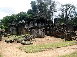
 Urithi Tanga Museum, the Old German Boma.


See also
References
- ISBN 0836981979.
- ^ a b "CLIMATE: TANGA". climate-data.org. Retrieved 21 January 2016.
- ^ "Consolidated TAA Traffic Statistics Up to 2014". taa.go.tz. Tanzania Airports Authority. Archived from the original on 27 January 2016. Retrieved 21 January 2016.
- ^ "Roads and Highways - COWI Group" (PDF). cowi.com. p. 30. Archived from the original (PDF) on 2016-07-05. Retrieved 21 January 2016.
- ^ "Hope for growth as Pangani builds new jetty". Tanzania Standard News. Daily News. 19 January 2016. Retrieved 21 January 2016.
- ^ "Tanzania Harbors Authority" (PDF). pmaesa. Port Management Association of East and Southern Africa. Retrieved 23 December 2015.
- ^ "Tanzania to tackle Tanga congestion". Port Strategy. 1 December 2011. Retrieved 23 December 2015.
- ^ "Why Tanzania, Kenya and Uganda are falling back to old railway". The Citizen. Retrieved 29 July 2019.
- JSTOR 1512492.
- ^ ISBN 9780549263838.
- ^ "Tanga | Tanzania". Encyclopædia Britannica. Retrieved 2016-01-21.
- ^ "Tanga Region Tourism Guide". Retrieved 21 January 2016.
- ^ "Tanga History". tanga-line.tripod.com. Retrieved 2016-01-21.
- ^ "First World War.com - Battles - The Battle of Tanga, 1914". www.firstworldwar.com. Retrieved 2016-01-21.
- ^ "HMS Manica – February to December 1916, UK out, German East Africa Campaign". Royal Navy Log Books of the World War 1 Era. Naval-History.net. Retrieved 9 January 2022.
- ^ Cato, Conrad (1919). The Navy Everywhere. Constable: London.[page needed]
- ^ Thomas, Graeme. "Fibre stories: Sisal starts a comeback in Tanzania - International Year of Natural Fibres 2009". www.naturalfibres2009.org. Retrieved 2016-01-21.
- ^ "Städtepartnerschaften Eckernfördes". eckernfoerde.de (in German). Eckernförde. Retrieved 2020-10-25.
- ^ "Kansainvälinen toiminta ja yhteistyö". kemi.fi (in Finnish). Kemi. Retrieved 2020-10-25.
- ^ "Sister Cities". toledosistercities.org. Toledo Sister Cities International. Retrieved 2020-10-25.
Sources
- W. W. Norton, 1986)
External links
 Media from Commons
 Texts from Wikisource
 Travel information from Wikivoyage
| International | |
|---|---|
| National | |
| Geographic | |
| Other | |