
Tate County, Mississippi
Tate County | |
|---|---|
UTC−5 (CDT) | |
| Congressional district | 1st |
| Website | www |
Tate County is a
Organized in 1873 during the Reconstruction era, from portions of DeSoto, Marshall, and Tunica counties, the county is named for Thomas Simpson Tate, one of the first prominent American settlers of the area.Tate County is part of the Memphis, TN-MS-AR Metropolitan Statistical Area. It is located about 40 miles (64 km) south of Memphis and one county east of the Mississippi River. This fertile river valley was developed for cotton cultivation in the 19th century.
History
As it was developed for cotton culture in the antebellum years, planters in the county depended on the labor of African American slaves. Blacks comprised a majority of the population for many decades. After Reconstruction, whites sometimes enforced their dominance through political intimidation or violence against blacks.
In 1932, a deputy sheriff and son of County Sheriff C.A. Williams, was allegedly shot by a black man, Jesse Williams. Sheriff Williams illegally organized a posse and murdered at least five and possibly as many as seven black people, family members of a man known as "Judge" Crawford. A month later Jesse Williams was caught, "tried" and lynched by hanging. No charges were ever considered against the sheriff or lynch mob.[3]
Geography

According to the
Major highways
Adjacent counties
- DeSoto County (north)
- Marshall County (east)
- Lafayette County (southeast)
- Panola County (south)
- Tunica County (west)
Demographics
| Census | Pop. | Note | %± |
|---|---|---|---|
| 1880 | 18,721 | — | |
| 1890 | 19,253 | 2.8% | |
| 1900 | 20,618 | 7.1% | |
| 1910 | 19,714 | −4.4% | |
| 1920 | 19,636 | −0.4% | |
| 1930 | 17,671 | −10.0% | |
| 1940 | 19,309 | 9.3% | |
| 1950 | 18,011 | −6.7% | |
| 1960 | 18,138 | 0.7% | |
| 1970 | 18,544 | 2.2% | |
| 1980 | 20,119 | 8.5% | |
| 1990 | 21,432 | 6.5% | |
| 2000 | 25,370 | 18.4% | |
| 2010 | 28,886 | 13.9% | |
| 2020 | 28,064 | −2.8% | |
| 2023 (est.) | 28,261 | [5] | 0.7% |
| U.S. Decennial Census[6] 1790-1960[7] 1900-1990[8] 1990-2000[9] 2010-2013[10] | |||
2020 census
| Race | Num. | Perc. |
|---|---|---|
White
|
18,019 | 64.21% |
Black or African American
|
8,231 | 29.33% |
Native American
|
52 | 0.19% |
Asian
|
63 | 0.22% |
Pacific Islander
|
1 | 0.0% |
Other/Mixed
|
893 | 3.18% |
Latino
|
805 | 2.87% |
As of the
2000 census
As of the
There were 8,850 households, out of which 36.10% had children under the age of 18 living with them, 56.00% were married couples living together, 15.50% had a female householder with no husband present, and 24.10% were non-families. 21.30% of all households were made up of individuals, and 9.10% had someone living alone who was 65 years of age or older. The average household size was 2.74 and the average family size was 3.18.
As of 2000, the county's population was spread out, with 27.10% under the age of 18, 11.70% from 18 to 24, 27.50% from 25 to 44, 22.30% from 45 to 64, and 11.40% who were 65 years of age or older. The median age was 34 years. For every 100 females there were 93.70 males. For every 100 females age 18 and over, there were 90.50 males.
The median income for a household in the county was $35,836, and the median income for a family was $41,423. Males had a median income of $33,064 versus $21,154 for females. The
Communities

City
- Senatobia (county seat)
Town
Census-designated places
Unincorporated communities
Education
The school districts are:[13]
Politics
| Year | Republican | Democratic | Third party | |||
|---|---|---|---|---|---|---|
| No. | % | No. | % | No. | % | |
| 2020 | 8,707 | 66.50% | 4,183 | 31.95% | 203 | 1.55% |
| 2016 | 7,495 | 64.46% | 3,926 | 33.77% | 206 | 1.77% |
| 2012 | 7,332 | 59.10% | 4,933 | 39.76% | 141 | 1.14% |
| 2008 | 7,678 | 60.09% | 5,003 | 39.15% | 97 | 0.76% |
| 2004 | 6,760 | 60.54% | 4,347 | 38.93% | 60 | 0.54% |
| 2000 | 5,148 | 59.22% | 3,441 | 39.58% | 104 | 1.20% |
| 1996 | 3,694 | 50.40% | 3,195 | 43.59% | 441 | 6.02% |
| 1992 | 4,196 | 50.13% | 3,519 | 42.04% | 656 | 7.84% |
| 1988 | 4,553 | 61.12% | 2,872 | 38.56% | 24 | 0.32% |
| 1984 | 4,677 | 61.89% | 2,846 | 37.66% | 34 | 0.45% |
| 1980 | 3,343 | 45.38% | 3,892 | 52.84% | 131 | 1.78% |
| 1976 | 2,497 | 38.80% | 3,747 | 58.22% | 192 | 2.98% |
| 1972 | 3,966 | 75.74% | 1,151 | 21.98% | 119 | 2.27% |
| 1968 | 605 | 13.22% | 1,162 | 25.39% | 2,810 | 61.39% |
| 1964 | 2,390 | 89.41% | 283 | 10.59% | 0 | 0.00% |
| 1960 | 241 | 13.60% | 686 | 38.71% | 845 | 47.69% |
| 1956 | 171 | 9.78% | 1,414 | 80.85% | 164 | 9.38% |
| 1952 | 387 | 19.72% | 1,575 | 80.28% | 0 | 0.00% |
| 1948 | 16 | 1.13% | 199 | 14.09% | 1,197 | 84.77% |
| 1944 | 29 | 1.95% | 1,455 | 98.05% | 0 | 0.00% |
| 1940 | 3 | 0.19% | 1,609 | 99.81% | 0 | 0.00% |
| 1936 | 7 | 0.64% | 1,088 | 99.36% | 0 | 0.00% |
| 1932 | 9 | 0.90% | 986 | 99.00% | 1 | 0.10% |
| 1928 | 42 | 3.19% | 1,274 | 96.81% | 0 | 0.00% |
| 1924 | 6 | 0.59% | 1,002 | 98.82% | 6 | 0.59% |
| 1920 | 117 | 11.65% | 876 | 87.25% | 11 | 1.10% |
| 1916 | 18 | 1.64% | 1,074 | 97.73% | 7 | 0.64% |
| 1912 | 23 | 3.26% | 612 | 86.81% | 70 | 9.93% |
Notable people
- Actor James Earl Jones was born in Arkabutla, Mississippi, an unincorporated area of Tate County and lived here for five years. He was sent north to live with his maternal grandparents on their farm in Jackson, Michigan.
See also
- Dry counties
- National Register of Historic Places listings in Tate County, Mississippi
- Northwest Mississippi Community College
- U.S.S. Tate
References
- ^ "Census - Geography Profile: Tate County, Mississippi". United States Census Bureau. Retrieved January 15, 2023.
- ^ "Find a County". National Association of Counties. Retrieved June 7, 2011.
- ^ "Entire Black Family Murdered In Unsuccessful Manhunt (1932)". Archived from the original on June 4, 2019. Retrieved December 16, 2017.
- ^ "2010 Census Gazetteer Files". United States Census Bureau. August 22, 2012. Archived from the original on September 28, 2013. Retrieved November 8, 2014.
- ^ "Annual Estimates of the Resident Population for Counties: April 1, 2020 to July 1, 2023". United States Census Bureau. Retrieved April 5, 2024.
- ^ "U.S. Decennial Census". United States Census Bureau. Retrieved November 8, 2014.
- ^ "Historical Census Browser". University of Virginia Library. Retrieved November 8, 2014.
- ^ "Population of Counties by Decennial Census: 1900 to 1990". United States Census Bureau. Retrieved November 8, 2014.
- ^ "Census 2000 PHC-T-4. Ranking Tables for Counties: 1990 and 2000" (PDF). United States Census Bureau. Archived (PDF) from the original on March 27, 2010. Retrieved November 8, 2014.
- ^ "State & County QuickFacts". United States Census Bureau. Archived from the original on June 7, 2011. Retrieved September 7, 2013.
- ^ "Explore Census Data". data.census.gov. Retrieved December 7, 2021.
- ^ "U.S. Census website". United States Census Bureau. Retrieved January 31, 2008.
- U.S. Census Bureau. Retrieved February 20, 2024. - Text list
- ^ Leip, David. "Dave Leip's Atlas of U.S. Presidential Elections". uselectionatlas.org. Retrieved March 6, 2018.
External links
- Tate County Economic Development Foundation
- The Democrat - Weekly newspaper serving Tate County.
- Tate County Sheriff
Places adjacent to Tate County, Mississippi | ||||||||||||||||
|---|---|---|---|---|---|---|---|---|---|---|---|---|---|---|---|---|
| ||||||||||||||||
Municipalities and communities of Tate County, Mississippi, United States | ||
|---|---|---|
| City | 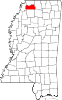 | |
| Town | ||
| CDPs | ||
| Other communities | ||
| ||


34°39′N 89°56′W / 34.65°N 89.94°W
| International | |
|---|---|
| National | |
| Geographic | |
| Other | |