
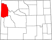
Teton County, Wyoming
Teton County | |
|---|---|
 | |
|
At-large | |
| Website | www |
Teton County is a
Teton County contains the Jackson Hole ski area, all of Grand Teton National Park, and 40.4% of Yellowstone National Park's total area, including over 96.6% of its water area (largely in Yellowstone Lake).[3]
History
Teton County was created February 15, 1921, from a portion of Lincoln County. Its governing organization was completed in 1922.[4] The county was named for the Teton Range.[5] The county was created because the inhabitants lived too far away from Kemmerer, the county seat of Lincoln County. The creation of the county required a special act of the Wyoming Legislature, because the area was too poor and had too few people to qualify for county status under the normal requirements.
Geography


According to the US Census Bureau, the county has a total area of 4,216 square miles (10,920 km2), of which 3,995 square miles (10,350 km2) is land and 221 square miles (570 km2) (5.2%) is water.[6]
Adjacent counties
- Park County – northeast
- Fremont County – east
- Sublette County – southeast
- Lincoln County – south
- Bonneville County, Idaho – southwest
- Teton County, Idaho – southwest
- Fremont County, Idaho – west
- Gallatin County, Montana – northwest
National protected areas
- Bridger-Teton National Forest(part)
- Caribou-Targhee National Forest(part)
- Grand Teton National Park
- John D. Rockefeller Memorial Parkway
- National Elk Refuge
- Shoshone National Forest (part)
- Yellowstone National Park (part)
Demographics
| Census | Pop. | Note | %± |
|---|---|---|---|
| 1930 | 2,003 | — | |
| 1940 | 2,543 | 27.0% | |
| 1950 | 2,593 | 2.0% | |
| 1960 | 3,062 | 18.1% | |
| 1970 | 4,823 | 57.5% | |
| 1980 | 9,355 | 94.0% | |
| 1990 | 11,172 | 19.4% | |
| 2000 | 18,251 | 63.4% | |
| 2010 | 21,294 | 16.7% | |
| 2020 | 23,331 | 9.6% | |
| 2023 (est.) | 23,232 | [7] | −0.4% |
| US Decennial Census[8] 1870–2000[9] 2010–2016[1] | |||
2000 census
As of the
ancestry.There were 7,688 households, out of which 25.60% had children under the age of 18 living with them, 45.30% were married couples living together, 5.70% had a female householder with no husband present, and 45.70% were non-families. 27.30% of all households were made up of individuals, and 3.70% had someone living alone who was 65 years of age or older. The average household size was 2.36 and the average family size was 2.89.
The county population contained 19.90% under the age of 18, 9.80% from 18 to 24, 38.30% from 25 to 44, 25.00% from 45 to 64, and 6.90% who were 65 years of age or older. The median age was 35 years. For every 100 females, there were 114.30 males. For every 100 females age 18 and over, there were 115.50 males.
The median income for a household in the county was $54,614, and the median income for a family was $63,916. Males had a median income of $34,570 versus $29,132 for females. The
2010 census
As of the
Of the 8,973 households, 25.5% had children under the age of 18 living with them, 45.7% were married couples living together, 5.6% had a female householder with no husband present, 45.0% were non-families, and 29.2% of all households were made up of individuals. The average household size was 2.34 and the average family size was 2.89. The median age was 36.9 years.[11]
The median income for a household in the county was $70,271 and the median income for a family was $90,596. Males had a median income of $40,594 versus $36,715 for females. The per capita income for the county was $42,224. About 5.1% of families and 8.2% of the population were below the
Economy

<$100,000
$200,000
$300,000
$400,000
$500,000
$600,000
$700,000+
A 2019 Bloomberg L.P. report (citing Bureau of Economic Analysis figures) found that Teton had the highest average incomes per capita of any county in the United States, at $252,000. This was partly attributed to the high incomes of Jackson Hole residents, where property owners include Bill Gates.[15]
As of the fourth quarter of 2021, the median home price in Teton County was $1,060,093, an increase of 17.8% from the prior year.[16]
Communities

Town
- Jackson (county seat)
Census-designated places
Unincorporated communities
Politics
Liz Skalka of the
| Year | Republican | Democratic | Third party | |||
|---|---|---|---|---|---|---|
| No. | % | No. | % | No. | % | |
| 2020 | 4,341 | 29.58% | 9,848 | 67.10% | 488 | 3.32% |
| 2016 | 3,921 | 31.05% | 7,314 | 57.92% | 1,392 | 11.02% |
| 2012 | 4,858 | 42.38% | 6,213 | 54.20% | 393 | 3.43% |
| 2008 | 4,565 | 37.07% | 7,472 | 60.67% | 279 | 2.27% |
| 2004 | 5,124 | 45.11% | 5,972 | 52.58% | 263 | 2.32% |
| 2000 | 5,454 | 52.29% | 4,019 | 38.53% | 958 | 9.18% |
| 1996 | 3,918 | 43.54% | 4,042 | 44.92% | 1,038 | 11.54% |
| 1992 | 2,854 | 34.05% | 3,120 | 37.22% | 2,408 | 28.73% |
| 1988 | 3,616 | 61.02% | 2,217 | 37.41% | 93 | 1.57% |
| 1984 | 3,487 | 67.85% | 1,565 | 30.45% | 87 | 1.69% |
| 1980 | 3,004 | 57.64% | 1,361 | 26.11% | 847 | 16.25% |
| 1976 | 2,667 | 67.40% | 1,204 | 30.43% | 86 | 2.17% |
| 1972 | 2,182 | 70.03% | 810 | 25.99% | 124 | 3.98% |
| 1968 | 1,419 | 69.25% | 461 | 22.50% | 169 | 8.25% |
| 1964 | 1,081 | 52.76% | 968 | 47.24% | 0 | 0.00% |
| 1960 | 1,158 | 66.51% | 583 | 33.49% | 0 | 0.00% |
| 1956 | 1,089 | 77.73% | 312 | 22.27% | 0 | 0.00% |
| 1952 | 1,166 | 78.62% | 317 | 21.38% | 0 | 0.00% |
| 1948 | 719 | 55.78% | 556 | 43.13% | 14 | 1.09% |
| 1944 | 637 | 56.07% | 499 | 43.93% | 0 | 0.00% |
| 1940 | 623 | 46.05% | 728 | 53.81% | 2 | 0.15% |
| 1936 | 501 | 37.06% | 795 | 58.80% | 56 | 4.14% |
| 1932 | 406 | 36.41% | 699 | 62.69% | 10 | 0.90% |
| 1928 | 495 | 64.29% | 270 | 35.06% | 5 | 0.65% |
| 1924 | 342 | 54.63% | 173 | 27.64% | 111 | 17.73% |
Education
Teton County School District Number 1 is the school district for the entire county.[22]
In prior eras, a portion of the county was not in any school district.[23]
See also
- National Register of Historic Places listings in Teton County, Wyoming
- Wyoming
- List of cities and towns in Wyoming
- List of counties in Wyoming
- Wyoming statistical areas
References
- ^ a b "HISTORICAL DECENNIAL CENSUS POPULATION FOR WYOMING COUNTIES, CITIES, AND TOWNS". Wyoming Economic Analysis Division. Retrieved August 16, 2021.
- ^ "Find a County". National Association of Counties. Retrieved January 7, 2011.
- ^ "U.S. Census website". US Census Bureau. Retrieved April 30, 2008.
- ^ Long, John H., ed. (2004). "Wyoming: Individual County Chronologies". Wyoming Atlas of Historical County Boundaries. The Newberry Library. Retrieved August 19, 2015.
- ISBN 0-87842-204-8.
- ^ "2010 Census Gazetteer Files". US Census Bureau. August 22, 2012. Retrieved August 18, 2015.
- ^ "Annual Estimates of the Resident Population for Counties: April 1, 2020 to July 1, 2023". United States Census Bureau. Retrieved March 24, 2024.
- ^ "US Decennial Census". US Census Bureau. Retrieved August 18, 2015.
- ^ "Historical Decennial Census Population for Wyoming Counties, Cities, and Towns". Wyoming Department of Administration & Information, Division of Economic Analysis. Retrieved January 25, 2014.
- ^ "U.S. Census website". US Census Bureau. Retrieved May 14, 2011.
- ^ a b c "Profile of General Population and Housing Characteristics: 2010 Demographic Profile Data". US Census Bureau. Archived from the original on February 13, 2020. Retrieved January 12, 2016.
- ^ "Population, Housing Units, Area, and Density: 2010 - County". US Census Bureau. Archived from the original on February 13, 2020. Retrieved January 12, 2016.
- ^ "Selected Social Characteristics in the US – 2006-2010 American Community Survey 5-Year Estimates". US Census Bureau. Archived from the original on February 13, 2020. Retrieved January 12, 2016.
- ^ "Selected Economic Characteristics – 2006-2010 American Community Survey 5-Year Estimates". US Census Bureau. Archived from the original on February 13, 2020. Retrieved January 12, 2016.
- ^ Tanzi, Alexandre; Lu, Wei; Sasso, Michael (November 29, 2019). "The Richest U.S. Counties Are Getting Even Richer". Bloomberg News.
- ^ "County Median Home Price". National Association of Realtors. Archived from the original on April 15, 2022. Retrieved April 14, 2022.
- ^ Skalka, Liz (August 16, 2022). "Wyoming Democrats Back Liz Cheney In Her Home County". HuffPost. Retrieved October 27, 2022.
Teton County, home to Jackson, a new playground for the ultra-rich set against a breathtaking natural landscape, is unlike anywhere else in this heavy mining and agricultural state. It's Wyoming's bluest county, meaning voters here are more likely to be Democrats who voted for Cheney, an uncommon phenomenon that Cheney's campaign encouraged.
- ^ Leip, Dave. "Atlas of US Presidential Elections". uselectionatlas.org. Retrieved December 19, 2016.
- ^ "2016 election results: Wyoming". www.cnn.com. Retrieved November 26, 2016.
- ^ Walkey, Will (November 6, 2020). "As Wyoming Goes Further Right, Teton County Continues Pushing Left". KHOL. Retrieved October 26, 2022.
- ^ Leip, Dave. US Election Atlas 2016 Presidential General Election Results – Wyoming: Teton County (and earlier years)
- ^ "School Districts (Map), State of Wyoming" (PDF). Wyoming Department of Revenue, Property Tax Division. March 8, 2006. Archived from the original (PDF) on September 23, 2006. Retrieved January 3, 2010.
Further reading
- Farrell, Justin. Billionaire wilderness: the ultra-wealthy and the remaking of the American West (Princeton UP, 2020) online review
External links
Places adjacent to Teton County, Wyoming | |
|---|---|
 | ||||
| CDPs | ||||
| Unincorporated communities | ||||
| ||||
Cheyenne (capital) | |
| Topics | |
| Society |
|
| Regions | |
| Cities | |
| Counties | |
| International | |
|---|---|
| National | |
| Geographic | |