
Theewaterskloof Dam
| Theewaterskloof Dam | |
|---|---|
Earth fill dam | |
| Impounds | Sonderend River |
| Height | 35 m (115 ft) |
| Length | 646 m (2,119 ft) |
| Reservoir | |
| Creates | Theewaterskloof Dam Reservoir |
| Total capacity | 480,406 Ml (16,965.4×106 cu ft) |
| Catchment area | 500 km2 (190 sq mi) |
| Surface area | 5,059 ha (12,500 acres) |
Theewaterskloof Dam is an earth-fill type dam located on the Sonderend River near Villiersdorp, Western Cape, South Africa. Administratively it is located within Theewaterskloof Local Municipality. It was established in 1978 and is the largest dam in the Western Cape Water Supply System with a capacity of 480 million cubic metres, about 41% of the water storage capacity available to Cape Town, which has a population of over 4 million people.[1] The dam mainly serves for municipal and industrial use as well as for irrigation purposes. The hazard potential of the dam has been ranked high (3).[2]
Dam characteristics

Theewaterskloof Dam's
Water restrictions
.jpg)
Below-average rainfall since 2015 have seen the Theewaterskloof water level drop to critical levels. Water restrictions were imposed by the City of Cape Town in 2016 to meet a target of 600 million litres of water per day,
By the end of the 2017 dry season, Theewaterskloof had declined to a level of 12.9%, with the last 10% mostly unreachable. A
As a result of good rains in the winters of 2019 and 2020, the Theewaterskloof water level reached 100% in October 2020.[7]
Rainfall and capacity
Theewaterskloof dam has a capacity of 480,406 megalitres (16,965.4×106 cu ft) of water, and when full the reservoir covers an area of 5,059 hectares (12,500 acres).[2] The catchment area of 500 square kilometres (190 sq mi) is served by streams emanating in the Hottentots Holland mountain range. This area has a long-term average of 69 days with precipitation per year.[8] Historically[9] records show we are in a dry period[10] 1mm of rain per square meter equates to 500 000 000 litres falling on this area. Hence it requires a full metre of rainfall with 100% runoff to fill the dam from totally empty, which is unlikely to happen in any single year. It takes a few days for all the runoff to reach the dam. Evaporation and how saturated the ground is affects the amount of water reaching the dam. An average amount of between 9% and 15% is used to offset the values against evaporation and soil absorption. A deeper dam has less evaporation due to less surface area per volume.
-
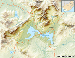
 Location of the dam
 -
 Catchment area of the dam


Social events
The Theewaterskloof Dam is also the home of the annual Synergy Live music festival, one of the biggest outdoor music festivals in South Africa, which typically takes place on the last weekend of November or the first weekend of December.[11]
See also
- List of reservoirs and dams in South Africa
References
- Department of Water Affairs
- ^ a b c "List of Registered Dams". Dam Safety Office, Department of Water and Sanitation. November 2019. Retrieved 12 August 2021.
- ^ a b van Vuuren, Lani (May 2011). "Blood, sweat and tears at Riviersonderend" (PDF). The Water Wheel. 10 (3). Water Research Commission: 22–25. Retrieved 12 August 2021.
- ^ "Residential water restrictions explained". www.capetown.gov.za. Retrieved 2017-06-13.
- ^ "Western Cape dam levels up only 1.5% after storms". www.enca.com. Retrieved 2017-06-13.
- ^ Watts, Jonathan (2018-02-03). "Cape Town faces Day Zero: what happens when the city turns off the taps?". The Guardian. Retrieved 2021-03-29.
- ^ Bhengu, Lwandile (4 October 2020). "Western Cape's largest dam overflows for the first time in six years". Sowetan. Retrieved 26 June 2021.
- ^ institutt, NRK og Meteorologisk. "Weather statistics for Theewaterskloofdam". yr.no. Archived from the original on 2017-07-31. Retrieved 2017-07-10.
- ^ "Rainfall History".[permanent dead link]
- ^ "Western Cape rainfall". Archived from the original on 2018-01-15. Retrieved 2017-07-30.
- ^ "Synergy". Synergy. 2015. Archived from the original on 15 May 2017. Retrieved 30 May 2017.
External links
| Major dams |  | |
|---|---|---|
| Minor dams |
| |
| Related | ||