
Tierra del Fuego National Park
| Tierra del Fuego National Park | |
|---|---|
| Parque Nacional Tierra del Fuego | |
 | |
 | |
| Location | Tierra del Fuego Province, Argentina |
| Nearest city | Ushuaia |
| Coordinates | 54°50′S 68°30′W / 54.833°S 68.500°W |
| Area | 630 km2 (243 sq mi) |
| Established | 15 October 1960 |
| Governing body | Administración de Parques Nacionales |
Tierra del Fuego National Park (
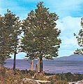
The park has dramatic scenery, with waterfalls, forests, mountains, and glaciers. Its 630 km2 (240 sq mi) include parts of the Fagnano and Roca lakes. The Senda Costera (Coastal Path), connecting Ensenada Bay to Lapataia Bay on Lago Roca, is a popular hiking trail within the park. Forests of Antarctic beech, lenga beech, and coihue in the lower elevations of the park are home to many animal species. There are 20 species of terrestrial mammals, including the guanaco, Andean fox, North American beaver, European rabbit and muskrat. Among the 90 species of birds are the kelp goose, torrent duck, austral parakeet, Andean condor, blackish oystercatcher, and Magellanic oystercatcher.[3][4][5][6]
The southernmost national park in Argentina,[4] it is listed as an IUCN category II park.[3][7][8] The park stretches 60 km (37 mi) north from the Beagle Channel along the Chilean border. Ushuaia, the capital of Tierra del Fuego Province, is 11 km (6.8 mi) from the park.[6][9] The park can be reached by car or by train. The southern terminus of the Pan-American Highway is located within the park, as is the El Parque station of the End of the World Train.

Geography
The park forms the southern portion of the subantarctic forest and is known for its biological richness.[10]
Flora
The subantarctic forest vegetation is dominated by tree species of
The flower varieties found are calafate, chaura and michay, which are orange coloured. Flag tree, strawberry devil and little ferns, yellow orchids and luzuriagas are seen in the understory of forest cover. Black bush, caulking, grill, and Embothrium cocci with red tubular flowers are typically seen in the Beagle Channel coast and the western part of Lapataia Bay.[7] Also found is the chocolate scented Nassauvia.[12]
- Flora in Tierra del Fuego
-
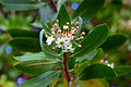 Drimys winteri flowers
 -

-
-

-
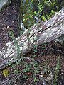 Calafate (Berberis buxifolia) plant west of Ushuaia


Fauna
Settlers from Europe and North America introduced many species of animals into the area, such as the European rabbit, North American beaver, and muskrat, which rapidly proliferated and caused significant damage to the environment.[7][8][13]
Avifauna includes three types of cauquenes (
), found in open places and beaches. Other birds include PatagonianAquafauna consists of
- Fauna in Tierra del Fuego
-
 A pair of black-necked swans in the park
 -
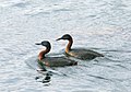 Podiceps major – great grebe- Tierra del Fuego National Park
 -
 A Magellanic woodpecker (Campephilus magellanicus) near Ushuaia
 -
 Sea lions at the Beagle Channel near Ushuaia
 -
 Cormorant colony on the shores of the Beagle Channel


.jpg)


Features
Tierra del Fuego National Park contains mountains, lakes, rivers, and valleys. It is bounded on the west by the Chilean border, on the north by Lago Fagnano, and on the south by the Beagle Channel, which forms the shoreline. It encompasses an area of 63,000 hectares (160,000 acres) and represents two ecoregions: the Altos Andes and the Patagonian Forest. While the former ecoregion is made up of hill ranges and slopes, the latter has high and jagged mountains, glacier valleys, and semi-deciduous forests. The landscape of the park is the result of glacial erosion, which has created bays and beaches against a backdrop of rugged mountains and valleys.[3][7][15]

The park is located 11 km (6.8 mi) to the west of the city of Ushuaia, on National Road 3.[16] Ushuaia provides the main approach to the park through the highway or through the Southern Fuegian Railway.[17]
Beagle Channel
The Beagle Channel or strait in Tierra del Fuego National Park is named after the British ship HMS Beagle, which sailed with the naturalist Charles Darwin aboard in 1833–34.[18] The channel separates islands of the Tierra del Fuego Archipelago, in extreme southern South America. It separates Isla Grande de Tierra del Fuego from the islands of Nueva, Picton, Navarino, Hoste, Londonderry, Stewart, and other smaller islands to the south. It is oriented in an east-west direction, and runs for a length of 150 mi (240 km). Its width varies from 3 to 8 mi (4.8 to 12.9 km). The biggest settlement on the channel is Ushuaia in Argentina followed by Puerto Williams in Chile, two of the southernmost settlements in the world.[19][20] Ancient middens where Yaghan tribes lived are seen on the beaches around the Beagle Channel.[4]
Lago Fagnano


Climate
The park experiences a
History

Etymology
The first Europeans who came to explore the southern tip of South America saw the campfires of the native inhabitants of the area (the
Pre-Columbian
Humans inhabited Tierra del Fuego as far back as 10,000 years ago.
The southern group of the Selk’nam, the
Post-Columbian
Wasti H. Stirling, an Anglican missionary, settled here in 1870 and started to convert Yaghan tribes, the natives, the original residents of the Beagle Channel.
During the 1880s, many
Trouble for the Yaghan people began in 1880 when European missionaries entered the area. European settlers brought diseases such as measles, causing a rapid and nearly complete extinction of the Yaghan people. The Yaghan tribe was reduced in number from about 3,000 people in 1880 to less than 100 by the 1990s.[citation needed] Many of them were killed by European settlers' "shoot exercises" and deliberate poisoning to exploit the sea lions, the staple of the Yaghan diet.[7][8] Following the deaths of 84-year-old Emelinda Acuña (1921 – 12 October 2005) and her sister Cristina Calderón (1928 - 2022) of Villa Ukika on Navarino Island, Chile, no native speakers remain.[26] What can be seen of the Yaghan people and their settlements today are mainly relics in the form of piles of mussel shells overgrown with grass near the seashore. Some antiquarian links with the tribals can also be seen in the "End of the World Museum" in Ushuaia.[8]
The Boundary Treaty of 1881 was an attempted resolution of the territorial dispute between Argentina and Chile, and stipulated that the boundary between the two countries would run south from "Cape Espiritu Santo, on the northern shore of Tierra del Fuego till it touches the Beagle Channel". This division meant that Argentina would be entitled to the eastern portion while Chile would have the western part of the Tierra del Fuego. However, the Treaty did not clarify the terminus of the Beagle Channel, which created many territorial and collateral issues such as navigation rights. This resulted in a dispute between the two countries, particularly on the small islands (Picton, Lennox, and Nueva) up to Cape horn. The dispute, which started in 1840, almost resulted in war between the two countries in 1978. However, the issue was resolved with the intervention of the Vatican. The Pope ruled on the dispute, ratification ensued and a treaty was signed on 2 May 1985. Under this treaty, Chile retained control of all the disputed islands, and Argentina was entitled to navigational rights and maintained its limited presence on these islands.[20]
After an Argentine naval base was established in 1884, the island was divided between Argentina and Chile.[27]
Argentinian President Roca established a penal colony in 1902, on nearby Staten Island, which resulted in its development. Prisoners were the main workforce and were employed to construct the city and exploit the forests of the now Tierra del Fuego National Park. The train lines were also built by the prisoners, covering an area of 25 km (16 mi), which started from the Maipú Monte Susana camp and ran through the park.[16][27] The city is now an important tourist center as the departure point not only for the park but also for voyages to Antarctica.[17]
Following the establishment of a prison in Ushuaia, in late 1909 and early 1910 the railway line called the Southern Fuegian Railway or the End of the World train was established as a narrow gauge steam railway, replacing an old wood track railway drawn by bullocks. The steam engine-driven railway was built over a length of 25 km (16 mi) along the Maipu Avenue on the waterfront, followed the eastern slope of Mount Susana, and branched through the middle of the Pipo River valley into the Tierra del Fuego National Park. The line made with Decauville tracks of 500 mm (20 in) gauge, connected the prison camp with the forestry camp. The primary purpose of the railway was as a freight line to serve the prison of Ushuaia, and hence was known as the "Prison train," and was used specifically to transport prisoners to the camps and transport the logged timber from forests. The prison was closed in 1947, and the railway was finally closed in 1952, following the reduction in forest resources and an earthquake that damaged the tracks.
Tourism
There are several attractions within the park including the Beagle Channel, the Pipo River cascade, the Lago Fagnano, Lago Roca, the Ensanada Bay, the Lapataia Bay, the End of the World Train, and the Laguna Negra.[8]
End of the World train

In 1994, 40 years after it had been closed as a Prison train, the train was revived, refurbished with modern amenities, used as a heritage train, and claimed to be the southernmost functioning railway in the world. A new 2-6-2T steam locomotive (Camila, brought from England in 1995), another made in Argentina, and three diesel locomotives serve on the line.[16] The park can now be reached from the outskirts of Ushuaia from the Fin del Mundo station (8 km (5.0 mi) west of Ushuaia) by the heritage railway line and runs over 5 km (3.1 mi), covering the distance in about 50 minutes.[28]
See also
References
- ISBN 978-1-58112-098-1. Retrieved 30 March 2011.
- ^ ISBN 978-1-74104-779-0. Retrieved 30 March 2011.
- ^ ISBN 978-0-907567-62-2. Retrieved 24 October 2013.
Contributor: IUCN Commission on National Parks and Protected Areas
- ^ ISBN 978-1-84162-138-8. Retrieved 30 March 2011.
- ^ ISBN 978-0-89886-259-1. Retrieved 26 March 2011.
- ^ a b "Parque Nacional Tierra del Fuego". Official website of Parque Nacional Tierra del Fuego. Archived from the original on 31 May 2011. Retrieved 27 March 2011.
- ^ a b c d e f g h i j "PN Tierra Del Fuego". Administration De Parques Nationales. Archived from the original on 6 July 2011. Retrieved 28 February 2011.
- ^ ISBN 978-987-9445-51-8. Retrieved 26 March 2011.
- ^ ISBN 978-0-470-50070-5. Retrieved 27 March 2011.
- ISBN 978-1-84773-077-0. Retrieved 30 March 2011.
- ISBN 978-0-520-25932-4. Retrieved 30 March 2011.
- ISBN 978-0-88729-031-2. Retrieved 30 March 2011.
- ISBN 978-950-02-6339-9. Retrieved 30 March 2011.
- ISBN 978-0-691-14285-2. Retrieved 30 March 2011.
- ^ GreenJani2006,p.494
- ^ a b c "Ushuaia". Official website of Parque Nacional Tierra del Fuego. Retrieved 27 March 2011.
- ^ ISBN 978-1-906098-00-1. Retrieved 29 March 2011.
- ^ "The Complete Works of Charles Darwin online". Darwinonline.org. p. 227. Retrieved 24 October 2013.
- ^ "Beagle Channel". Encyclopædia Britannica. Retrieved 30 March 2010.
- ^ ISBN 978-1-60021-445-5. Retrieved 30 March 2011.
- ^ a b "The Lake that resembles the sea". welcomeargentina.com. Retrieved 30 March 2011.
- ^ doi:10.4081/jlimnol.2010.29. Archived from the original(PDF) on 22 July 2011. Retrieved 30 March 2011.
- .
- ISBN 978-0-88729-031-2. Retrieved 29 March 2011.
- ^ "The disappeared ethnic groups in Tierra del Fuego, Patagonia". www.argentina-excepcion.com. Retrieved 23 January 2019.
- ^ Jackie Hailey (14 October 2005). "Extinction on the horizon for an indigenous tribe in Chile: Second-To-Last Yagana Woman Dies Of A Heart Attack". The Santiago Times. Santiago. Retrieved 24 January 2019.
- ^ a b "Ushuaia". Encyclopædia Britannica. Retrieved 29 March 2011.
- ISBN 978-1-904777-73-1. Retrieved 27 March 2011.
External links
| International | |
|---|---|
| National | |