
Toul
Toul | |
|---|---|
Subprefecture and commune | |
 | |
 Flag  Coat of arms | |
Location of Toul  | |
 Toul  Toul | |
| Coordinates: 48°40′30″N 5°53′30″E / 48.675°N 5.8917°E | |
| Country | France |
| Region | Grand Est |
| Department | Meurthe-et-Moselle |
| Arrondissement | Toul |
| Canton | Toul |
| Intercommunality | Terres Touloises |
| Government | |
| • Mayor (2020–2026) | Alde Harmand[1] |
| Area 1 | 30.59 km2 (11.81 sq mi) |
| Population (2021)[2] | 15,849 |
| • Density | 520/km2 (1,300/sq mi) |
| Time zone | UTC+01:00 (CET) |
| • Summer (DST) | UTC+02:00 (CEST) |
| INSEE/Postal code | 54528 /54200 |
| Elevation | 200–400 m (660–1,310 ft) |
| 1 French Land Register data, which excludes lakes, ponds, glaciers > 1 km2 (0.386 sq mi or 247 acres) and river estuaries. | |
Toul (French pronunciation: [tul]) is a commune in the Meurthe-et-Moselle department in north-eastern France.
It is a sub-prefecture of the department.
Geography
Toul is between
Climate
Toul has a oceanic climate (Köppen climate classification Cfb). The average annual temperature in Toul is 9.8 °C (49.6 °F). The average annual rainfall is 761.1 mm (29.96 in) with June as the wettest month. The temperatures are highest on average in July, at around 18.6 °C (65.5 °F), and lowest in January, at around 1.3 °C (34.3 °F). The highest temperature ever recorded in Toul was 37.9 °C (100.2 °F) on 11 August 1998; the coldest temperature ever recorded was −17.8 °C (0.0 °F) on 9 January 1985.
| Climate data for Toul (1981−2010 normals, extremes 1968−1998) | |||||||||||||
|---|---|---|---|---|---|---|---|---|---|---|---|---|---|
| Month | Jan | Feb | Mar | Apr | May | Jun | Jul | Aug | Sep | Oct | Nov | Dec | Year |
| Record high °C (°F) | 15.2 (59.4) |
20.2 (68.4) |
24.3 (75.7) |
27.2 (81.0) |
29.4 (84.9) |
33.4 (92.1) |
36.8 (98.2) |
37.9 (100.2) |
30.9 (87.6) |
26.5 (79.7) |
19.4 (66.9) |
17.2 (63.0) |
37.9 (100.2) |
| Mean daily maximum °C (°F) | 3.8 (38.8) |
5.4 (41.7) |
10.2 (50.4) |
13.6 (56.5) |
18.2 (64.8) |
21.1 (70.0) |
24.4 (75.9) |
24.2 (75.6) |
19.5 (67.1) |
14.2 (57.6) |
7.9 (46.2) |
4.9 (40.8) |
14.0 (57.2) |
| Daily mean °C (°F) | 1.3 (34.3) |
2.0 (35.6) |
6.1 (43.0) |
8.8 (47.8) |
13.1 (55.6) |
16.1 (61.0) |
18.8 (65.8) |
18.6 (65.5) |
14.7 (58.5) |
10.4 (50.7) |
5.1 (41.2) |
2.6 (36.7) |
9.8 (49.6) |
| Mean daily minimum °C (°F) | −1.2 (29.8) |
−1.3 (29.7) |
1.9 (35.4) |
3.9 (39.0) |
8.0 (46.4) |
11.1 (52.0) |
13.2 (55.8) |
12.9 (55.2) |
9.8 (49.6) |
6.6 (43.9) |
2.3 (36.1) |
0.2 (32.4) |
5.7 (42.3) |
| Record low °C (°F) | −17.8 (0.0) |
−16.3 (2.7) |
−14.6 (5.7) |
−5.6 (21.9) |
−2.1 (28.2) |
0.2 (32.4) |
4.3 (39.7) |
3.8 (38.8) |
0.3 (32.5) |
−4.9 (23.2) |
−10.9 (12.4) |
−17.6 (0.3) |
−17.8 (0.0) |
| Average precipitation mm (inches) | 63.2 (2.49) |
51.2 (2.02) |
55.5 (2.19) |
52.1 (2.05) |
73.2 (2.88) |
77.2 (3.04) |
58.9 (2.32) |
54.4 (2.14) |
65.2 (2.57) |
73.7 (2.90) |
62.7 (2.47) |
73.8 (2.91) |
761.1 (29.96) |
| Average precipitation days (≥ 1.0 mm) | 12.1 | 10.2 | 11.6 | 10.1 | 11.7 | 11.5 | 8.6 | 7.7 | 8.8 | 11.7 | 10.7 | 11.5 | 126.2 |
| Average snowy days | 7.4 | 7.3 | 4.6 | 1.6 | 0.1 | 0 | 0 | 0 | 0 | 0 | 2.4 | 4.4 | 27.7 |
| Source: Météo-France[3] | |||||||||||||
History
Toul was known to the
In 550, King
Toul was the seat of the
During the siege of 1870 during the Franco-Prussian War, the last time that Toul's defenses were used as a classic fortress, 64 guns opened fire at 6:00 a.m. on 23 September, and the fortress surrendered at 3:00 p.m. after 2,433 shells had been fired.
The city was also the primary base of the
Population
|
| |||||||||||||||||||||||||||||||||||||||||||||||||||||||||||||||||||||||||||||||||||||||||||||||||||||||||||||||
| ||||||||||||||||||||||||||||||||||||||||||||||||||||||||||||||||||||||||||||||||||||||||||||||||||||||||||||||||
| Source: EHESS[4] and INSEE (1968-2017)[5] | ||||||||||||||||||||||||||||||||||||||||||||||||||||||||||||||||||||||||||||||||||||||||||||||||||||||||||||||||
Sights
The most striking features are the impressive stone
There is a great deal of
The old town's architecture is dominated by past glories in various states of decay, including a major Gothic
There is no trace of the monastery, however its wine-cellars still exist, under the shops on the north side of the Rue Gambetta. (Access is possible via the Camera Shop).
Transportation
Toul is at the intersection of the river
There is a main-line railway station at Toul, the last major station before the (once vast, and still very large) marshalling yards at Nancy. However, the Paris-Strasbourg TGV line, completed in 2016, passes about 20 km north of Toul, approximately midway between Metz and Nancy.
Economy
The surrounding countryside is a wine-growing region, in which the AOC Côtes de Toul vintage is produced. Particularly notable is the Gris de Toul.
Administration
Toul is the seat and part of the canton of Toul, and of the arrondissement of Toul.
Twin towns
Notable people
- Saint Gerard of Toul, bishop
- Antoine Augustin Calmet, monk
- Marcel Bigeard, French Army General
- Anne-Laure Blin, politician
- Mickaël Causse, Neuroscientist
- Laurent Gouvion Saint-Cyr, military leader
- Rachid Hamdani, footballer
- Louis Majorelle, furniture designer and manufacturer
- Pascal Vigneron, musician and director of the Bach Toul Festival
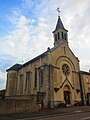
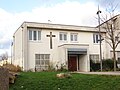
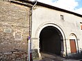
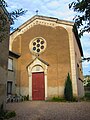
Gallery


-
 Facade
 -

-

-
-
-

-

-

-

-

-
-

-
-


See also
References
- ^ "Répertoire national des élus: les maires" (in French). data.gouv.fr, Plateforme ouverte des données publiques françaises. 13 September 2022.
- ^ "Populations légales 2021". The National Institute of Statistics and Economic Studies. 28 December 2023.
- ^ "Fiche Climatologique Statistiques 1981-2010 et records" (PDF). Météo-France. Retrieved 23 August 2022.
- ^ Des villages de Cassini aux communes d'aujourd'hui: Commune data sheet Toul, EHESS (in French).
- ^ Population en historique depuis 1968, INSEE
- ISBN 1841768758.
External links
- Official site
- Toul tourism office
- Toul stronghold 1870 - 1915
- USAS in France interactive Google Map of bases, etc. at www.usaww1.com
| International | |
|---|---|
| National | |
| Geographic | |
| Other | |