Transportation in Calgary
The city of
As a prairie city, Calgary has never had any major impediments to growth. As such, it has developed into a city with an area of about 745 km2 (288 sq mi)
Since 1981, when the city officially opened the first leg of its
Public transportation
Calgary's primary public transportation system is operated by
Light rail

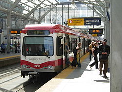
The
The
Buses
Calgary Transit also has a system of buses, with routes stretching over the whole city. It has won several awards for its efficiency and its environmental responsibility. It consists of over 160 bus routes and four C-Train lines (two routes), stretching over 4,500 km (2,800 mi).[6]
Roads and streets

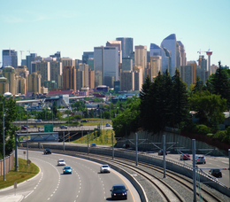
Calgary has an extensive street network. Smaller roads are supplemented with a number of major arteries,
Plans originating in the 1950s and 1960s for a considerably more extensive freeway system including elevated freeways were largely abandoned in favour of a growing trend to reduce the emphasis on roads and increase the amount of public transportation infrastructure in North American cities.
Sidewalks at intersections in areas outside the downtown core are often stamped with the name of the cross-street, especially in older districts. As this was once done by hand by municipal employees who were not always literate, some street names are misspelled or the letters reversed.
Organization

Traditionally Calgary's roads were built on a grid system. Originally, the streets and avenues were named, but after 1904, they were numbered.
The main lines on the grid are fairly evenly distributed at intervals of about 1 mile (1.6 km) where an arterial road (or expressway) is usually situated (on former Township and Range Roads). They are at roughly the following Streets and Avenues (although not always named as such):
- Avenues north of downtown: 16th, 32nd, 48th, 64th, 80th, 96th, 112th, 128th, 144th
- Avenues south of downtown: 17th, 34th, 50th, 66th, 82nd, 90th, 114th, 130th, 146th, 162nd, 178th, 194th
- Streets east of downtown: 6th, 15th, 24th, 36th, 52nd, 68th, 84th
- Streets west of downtown: 14th, 24th, 37th, 53rd, 69th, 85th, 101st, 117th
A quirk of the numbering is that it was intended for addresses on numbered streets to begin at 100 (not 0) at Centre Street and Centre Avenue and move out accordingly. For example, 545 16th Avenue NW lies between 4th and 5th Streets NW. There are many violations of such, however, especially in suburban areas. The highest address numbers are found on north–south streets in the southernmost suburbs, where they approach 20000.
Major streets

- 4 Avenue S / 5 Avenue S
- 6 Avenue S / 9 Avenue S
- 14 Street W
- 16 Avenue N (Highway 1 / Trans-Canada Highway)
- 17 Avenue SE
- 17 Avenue SW
- 32 Avenue N
- 36 Street E (becomes Métis Trail north of McKnight Boulevard)
- 52 Street E (becomes Falconridge Boulevard north of McKnight Boulevard)
- Anderson Road
- Barlow Trail
- Beddington Trail(becomes Symons Valley Road north of Stoney Trail)
- Blackfoot Trail
- Bow Trail
- Centre Street (becomes Harvest Hills Boulevard north of Beddington Trail)
- Country Hills Boulevard
- Crowchild Trail (Highway 1A - part)
- Deerfoot Trail (Highway 2)
- Edmonton Trail
- Elbow Drive
- Glenmore Trail (Highway 8 - part)
- Heritage Drive
- John Laurie Boulevard
- Macleod Trail (Highway 2A- part)
- McKnight Boulevard
- Memorial Drive
- Northmount Drive
- Nose Hill Drive
- Sarcee Trail
- Shaganappi Trail
- Stoney Trail/Tsuut'ina Trail (Highway 201)
- Southland Drive
Skeletal road network

The city of Calgary designated major corridors to allow free flowing travel continuity throughout the city. With one exception (the central portion of 16th Avenue), they are all intended to be upgraded to freeways if they are not already.[9]
Roads designated as north–south corridors, from east to west, are:
- Deerfoot Trail (Highway 2)
- Macleod Trail
- Transcanada Highway/Highway 1/16th Ave NW-Sarcee Trail.
Roads designated as east–west corridors from south to north, are:
- Glenmore Trail (Highway 8)
- Trans-Canada Highway (Highway 1/16th Avenue N)
- Highway 201)
Air

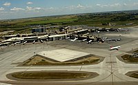
The
The airport primarily connects Western Canada with non-stop flights to Eastern Canada, 18 major American cities, as well as destinations to Europe, Asia, the Caribbean and Mexico. Calgary International airport also has regular scheduled service to London, Frankfurt, Amsterdam, Mexico City and Tokyo.[10]
Calgary International Airport is Canada's
Calgary's second airport, Calgary/Springbank Airport, is located in the western suburb of Springbank, handles the majority of private-plane flights, and acts as a reliever for the main airport while also being the 11th busiest in Canada for aircraft movements.
Bus
Intercity
Scheduled bus service from Calgary or Calgary Airport and north to Red Deer and Edmonton, or south to Lethbridge, is provided by
Effective October 31, 2018, Greyhound Canada has cancelled all services in Western Canada, which includes Calgary, citing low ridership.[11]
Regional
On-It Regional Transit provides scheduled bus service to commuter towns surrounding Calgary.[12] Commuter service is provided to Cochrane, Okotoks, and High River. On-It also provides a summer weekend and holiday service to Canmore and Banff, Alberta.
Rail
Passenger rail
Calgary is also the largest Canadian city without intercity passenger service, as all Via Rail service to the city was terminated in the late 1980s and early 1990s by the Conservative government. Rail tours by Royal Canadian Pacific can be booked by private charter. Rocky Mountaineer pulled out some years back and now runs only from Banff, Alberta westward.
Freight
Calgary has four main
Bicycle and pedestrian
The City of Calgary also maintains a network of paved multi-use pathways (for
Calgary's system of elevated walkways or
See also
References
- ^ "Comparing Calgary With New York". Archived from the original on December 6, 2007.
- C-Train
- ^ "LRT Technical Data". Archived from the original on July 6, 2006.
- ^ "Calgary Transit and the Environment". Retrieved February 18, 2024.
- ^ West LRT in Calgary Main Website
- ^ "Calgary Transit Statistics". Archived from the original on July 7, 2006.
- ^ "The Odd History of Calgary's City Streets". SmartCalgaryHomes.com. Retrieved June 23, 2009.
- ^ "Calgary's Missing Street Names". UrbanPhoto.net. Retrieved June 23, 2009.
- ^ City of Calgary (February 2005). "The Calgary Transportation Plan". Archived from the original on September 30, 2007. Retrieved May 25, 2007.
- ^ "Home Page for The Calgary Airport Authority". www.yyc.com. Retrieved February 18, 2024.
- ^ "Alberta". Retrieved February 18, 2024.
- ^ "Schedules - On-It Regional Transit". On-It Regional Transit. Retrieved August 15, 2018.
- ^ "Map of Bicycle pathways" (PDF). Retrieved February 18, 2024.
- ^ "The City of Calgary: Plus 15". www.calgary.ca. Archived from the original on August 29, 2007.
