
Troodos Mountains
| Troodos | |
|---|---|
 Trees of Mount Olympus | |
| Highest point | |
| Peak | Mount Olympus |
| Elevation | 1,952 m (6,404 ft) |
| Naming | |
| Native name | |
| Geography | |
| Country | Cyprus |
Troodos (sometimes spelled Troödos; Greek: Τρόοδος [ˈtɾo.oðos]; Turkish: Trodos Dağları ['tɾo.dos]) is the largest mountain range in Cyprus, located in roughly the center of the island. Its highest peak is Mount Olympus (Greek: Όλυμπος), also known as Chionistra (Greek: Χιονίστρα), at 1,952 metres (6,404 ft), which hosts the Sun Valley and North Face ski areas with their five ski lifts.
The Troodos mountain range stretches across most of the western side of Cyprus. There are many
The name Troodos probably comes from one of two sources: either τρία + ὁδός (tría + hodós), referring to the three roads that lead to the mountain, or τό + ὄρος + Ἄδος (to + oro + Ados), meaning the mountains of Adonis.[3][4]
Geology
_-_TIMEA.jpg)
The Troodos Mountains are known worldwide for their geology and the presence of an undisturbed
Climate
| Climate data for Prodromos in Troodos Mountains, elevation: 1380 m (Satellite view )
| |||||||||||||
|---|---|---|---|---|---|---|---|---|---|---|---|---|---|
| Month | Jan | Feb | Mar | Apr | May | Jun | Jul | Aug | Sep | Oct | Nov | Dec | Year |
| Mean maximum °C (°F) | 13.3 (55.9) |
13.9 (57.0) |
18.5 (65.3) |
24.7 (76.5) |
27.9 (82.2) |
30.6 (87.1) |
32.2 (90.0) |
32.2 (90.0) |
30.2 (86.4) |
26.6 (79.9) |
20.1 (68.2) |
14.3 (57.7) |
23.7 (74.7) |
| Mean daily maximum °C (°F) | 6.3 (43.3) |
6.6 (43.9) |
10.3 (50.5) |
15.1 (59.2) |
20.5 (68.9) |
25.0 (77.0) |
28.1 (82.6) |
27.9 (82.2) |
24.4 (75.9) |
19.6 (67.3) |
12.8 (55.0) |
8.0 (46.4) |
17.1 (62.8) |
| Daily mean °C (°F) | 3.5 (38.3) |
3.5 (38.3) |
6.6 (43.9) |
10.7 (51.3) |
15.8 (60.4) |
20.1 (68.2) |
23.3 (73.9) |
23.1 (73.6) |
19.6 (67.3) |
15.4 (59.7) |
9.5 (49.1) |
5.3 (41.5) |
13.0 (55.4) |
| Mean daily minimum °C (°F) | 0.7 (33.3) |
0.3 (32.5) |
2.8 (37.0) |
6.3 (43.3) |
11.1 (52.0) |
15.2 (59.4) |
18.4 (65.1) |
18.2 (64.8) |
14.9 (58.8) |
11.3 (52.3) |
6.2 (43.2) |
2.5 (36.5) |
9.0 (48.2) |
| Mean minimum °C (°F) | −4.5 (23.9) |
−5.2 (22.6) |
−2.6 (27.3) |
0.5 (32.9) |
4.7 (40.5) |
9.2 (48.6) |
13.5 (56.3) |
14.0 (57.2) |
10.1 (50.2) |
5.4 (41.7) |
0.1 (32.2) |
−2.8 (27.0) |
3.5 (38.3) |
| Average precipitation mm (inches) | 133.4 (5.25) |
123.6 (4.87) |
82.3 (3.24) |
56.9 (2.24) |
26.0 (1.02) |
40.0 (1.57) |
12.1 (0.48) |
10.0 (0.39) |
9.5 (0.37) |
24.0 (0.94) |
102.5 (4.04) |
169.7 (6.68) |
790.1 (31.11) |
| Average precipitation days (≥ 1 mm) | 12.4 | 11.2 | 9.8 | 6.7 | 3.7 | 2.1 | 0.7 | 0.7 | 1.4 | 3.5 | 7.4 | 11.2 | 70.7 |
| Mean monthly sunshine hours | 130.2 | 150.8 | 195.3 | 231.0 | 275.9 | 315.0 | 328.6 | 310.0 | 255.0 | 220.1 | 165.0 | 136.4 | 2,713.3 |
| Source: Meteorological Service (Cyprus)[7] | |||||||||||||
Churches


The region is known for its many Byzantine churches and monasteries, richly decorated with murals, of which the
churches are:- Stavros tou Agiasmati
- Panagia tou Araka
- Timiou Stavrou at Pelendri
- Agios Nikolaos tis Stegis
- Panagia Podithou
- Assinou
- Agios Ioannis Lampadistis at Kalopanagiotis
- Panagia tou Moutoula
- Archangel Michael at Pedoulas
- Transfiguration of the Saviour Palaichori
-
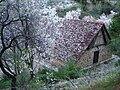 Church in spring

Selected villages

- Platres
- Galata
- Evrychou
- Kakopetria
- Louvaras
- Palaichori Oreinis
- Kourdali
- Pelendri
- Kalopanagiotis
- Moutoullas
- Pachna
- Dora
- Malia
- Kyperounta
- Farmakas
- Prastio
- Arsos
- Pedoulas
- Omodos
- Phini
- Kouka
- Fikardou
- Koilani
- Agros
- Prodromos
- Marathassa Valley
- Vasa Koilaniou
- Lania
- Spilia
Gallery
-
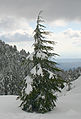 Young tree in Winter
 -
 Troodos Mountains
 -
 Lazanias village
 -
 Troodos black pines are 3,000 years old
 -
 Forests in Troodos Mountains
 -
 Pinus brutia, foothills of Troodos Mountains
 -
 River tributary in Troodos
 -
 Parakentro is a non-profit cultural centre in Lemythou village
 -
 Millomeris Waterfall, Platres
 -
 Milia Bridge, Platres
 -
 Tzielefos bridge
 -

-

-
 Kalidonia Waterfall, Platres
 -
 Part of Troodos Mountains
 -
 View of Farmakas region
 -
 Prodromos in winter
 -
 Road through the forest
 -
 Troodos Mountains in 1957

.jpg)


.jpg)

See also
References
- ^ "Cyprus Travel Series: Troodos Mountains". Expand Your Property World. 2017-11-23. Retrieved 2018-02-16.
- ^ Cora Currier; Henrik Moltke (January 29, 2016). "Spies in the sky". The Intercept.
- ^ "Places to visit - Troodos Cyprus". www.justaboutcyprus.com. Retrieved 2017-09-18.
- ^ "Snowy Mountains of Troodos - December at Olympos - Chionistra". www.cyprusalive.com. Retrieved 2017-09-18.
- ^ Papanikolaou, Dimitrios I. The Geology of Greece. Cham, Switzerland: Springer, 2021. p. 12. ISBN 978-3-030-60730-2
- ^ Wilson, R.A.M. The Geology of the Xeros-Troodos Area: Geological Survey Department, cyprus, Memoir No. 1. Nicosia, Cyprus: Government of Cyprus, Ministry of Agriculture and Natural Resources, 1959, reprinted 1971.
- ^ "Climatological and Meteorological Reports - Prodromos - 1991 - 2005" (PDF). Archived from the original (pdf) on 2016-03-27. Retrieved 2017-06-29.
External links
- Official Website of Troodos Region, by the Cyprus Tourism Organisation
- Troodos (General Area) Museums
- Panoramic virtual tour of the Troodos Mountains
- Kypros Net article on Troodos
- Awarded "EDEN – European Destinations of Excellence" non traditional tourist destination 2007
34°55′N 32°50′E / 34.917°N 32.833°E
| International | |
|---|---|
| National | |
| Geographic | |