
Tropic of Capricorn


The Tropic of Capricorn (or the Southern Tropic) is the
The Tropic of Capricorn is one of the five major circles of latitude marked on maps of
Name
When this line of latitude was named in the last centuries
Geography and environment
The Tropic of Capricorn is the dividing line between the
The Tropic of Capricorn's position is not fixed, but constantly changes because of a slight wobble in the Earth's longitudinal alignment relative to its orbit around the Sun. Earth's axial tilt varies over a 41,000 year period from about 22.1 to 24.5 degrees and currently resides at about 23.4 degrees. This wobble means that the Tropic of Capricorn is currently drifting northward at a rate of almost half an arcsecond (0.468″) of latitude, or 15 metres, per year (it was at exactly 23° 27′S in 1917 and will be at 23° 26'S in 2045). Therefore, the distance between Arctic Circle and the Tropic of Capricorn is essentially constant moving in tandem. See under circles of latitude for information.
There are approximately 10 hours, 41 minutes of daylight during the June solstice (Southern Hemisphere winter). During the December solstice (Southern Hemisphere summer), there are 13 hours, 35 minutes of daylight. The length of the Tropic of Capricorn at 23°26′11.7″S is 36,788 km (22,859 mi).[2]
Africa
In most of this belt of
-
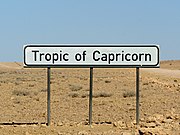 A sign marking the Tropic of Capricorn as it passes through Namibia
 -
 A monument marking the Tropic of Capricorn as it passes through Botswana
 -
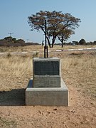
 A monument in Kruger National Park, South Africa
 -
 A sign marking the Tropic of Capricorn in Atsimo-Andrefana Region, Madagascar
.jpg)


Australia
In
Behind the end of the green hills, away from the
El Niño adverse phases cause a shift in atmospheric circulation; rainfall becomes reduced over Indonesia and Australia, rainfall and tropical cyclone formation increases over the tropical Pacific.
-
 Tropic of Capricorn as it runs through Australia in the1794 Dunn Map of the World
 -
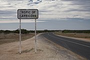 Road sign marking Tropic of Capricorn in Western Australia
 -
 Monument marking the Tropic of Capricorn just north of Alice Springs, Northern Territory
 -

-
 Spire marking Tropic of Capricorn inRockhampton, Queensland(4 km north of the actual Tropic of Capricorn)
 -
 Monument marking Tropic of Capricorn near Civic Centre, Longreach, at mid-day of Summer solstice 2019. The monument is few arc seconds South of Tropic of Capricorn(notice shadow directly below the sign)


South America
In
West of the Andes, which creates a
-
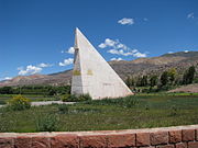
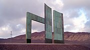 Monument marking the Tropic of Capricorn just north of Antofagasta, Chile
 -
-

-

.jpg)


Around the world
Starting at the
Places located along the Tropic of Capricorn
The following cities and landmarks are either located near the Tropic of Capricorn, or the tropic passes through them.
|
|
|
List of countries entirely south of the Tropic of Capricorn
As most of Earth's land is in the Northern Hemisphere only four countries are wholly south of the Tropic of Capricorn (which contrasts with 73, about one third of the current total, wholly north of the Tropic of Cancer):
- Eswatini (formerly Swaziland)
- Lesotho
- New Zealand[a]
- Uruguay
See also
 Geography portal
 Africa portal
 Australia portal
 Chile portal
 Argentina portal
 Paraguay portal
 Brazil portal
Note
- ^ The Cook Islands, Tokelau and Niue, which are part of the Realm of New Zealand, lie north of the Tropic of Capricorn.
References
- ^ "obliquity of the ecliptic (Eps Mean)". Archived from the original on 12 June 2017. Retrieved 10 March 2012.
- ^ RhumbSolve online rhumb line calculator Archived 3 December 2016 at the Wayback Machine.
- ^ a b "Reversing Desertification with Livestock – Our World". Archived from the original on 8 April 2019. Retrieved 7 September 2019.
- ^ Geographical Patterning of Interannual Rainfall Variability in the Tropics and Near Tropics
- ^ "Channel Country rain will boost cattle feed". ABC Rural. Australian Broadcasting Corporation. 3 February 2010. Archived from the original on 11 November 2012. Retrieved 18 May 2010.
- ^ a b "What is El Niño and what might it mean for Australia?". Australian Bureau of Meteorology. Archived from the original on 18 March 2016. Retrieved 10 April 2016.
- ^ "Exposure dating of Late Glacial and pre-LGM moraines in the Cordon de Doña Rosa, Northern/Central Chile (~31°S)" (PDF). Archived (PDF) from the original on 28 July 2014. Retrieved 16 January 2012.
External links
- Temporal Epoch Calculations
- Useful constants" See: Obliquity of the ecliptic
- Montana State University: Milankovitch Cycles & Glaciation

|