
Upper Manhattan

Upper Manhattan is the most northern region of the
Upper Manhattan is generally taken to include the neighborhoods of
The George Washington Bridge connects Washington Heights in Upper Manhattan across the Hudson River to Fort Lee, New Jersey, and is the world's busiest motor vehicle bridge.[2][3]
In the late 19th century, the IRT Ninth Avenue Line and other elevated railroads brought people to the previously rustic Upper Manhattan. Until the late 20th century it was less influenced by the gentrification that had taken place in other parts of New York over the previous 30 years.
Tourist attractions
Like other residential areas, Upper Manhattan is not a major center of tourism in New York City, although many tourist attractions lie within it, such as Grant's Tomb, the Apollo Theater, United Palace, and The Cloisters, Sylvia's Restaurant, the Hamilton Grange, the Morris–Jumel Mansion, Minton's Playhouse, Sugar Hill, Riverside Church, the National Jazz Museum in Harlem, and the Dyckman House, along with Fort Tryon Park, most of Riverside Park, Riverbank State Park, Sakura Park, and other parks.
Gallery
-
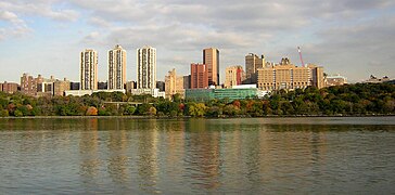
 Morningside Heights
 -

-
-
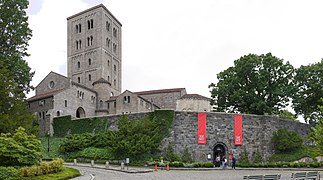 The Cloisters in Fort Tryon Park houses the medieval art collection of the Metropolitan Museum of Art.
 -
 The Little Red Lighthouse under the George Washington Bridge
 -
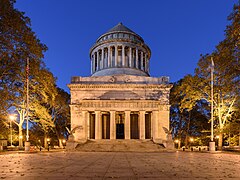 Grant's Tomb in Morningside Heights
 -
 primeval forest which once covered Manhattan; these caves were used by native Lenapepeople.


See also
References
- ^ Riley, Erika (10 November 2021). "What Is Uptown & Downtown in Manhattan?". StreetEasy. Retrieved 19 February 2022.
- ^ "Port Authority of New York and New Jersey - George Washington Bridge". The Port Authority of New York and New Jersey. Retrieved September 13, 2013.
- ^ Woodruff, Bob; Zak, Lana & Wash, Stephanie (November 20, 2012). "GW Bridge Painters: Dangerous Job on Top of the World's Busiest Bridge". ABC News. Retrieved June 6, 2016.
| Authority control databases: Geographic |
|---|