
Uttarakhand
Uttarakhand | ||
|---|---|---|
Aarti at Har Ki Pauri | ||
|
Uttarakhand Devbhumi Matribhumi ("Uttarakhand, Land of the Gods, O Motherland!") by bifurcation )9 November 2000 | | |
State Legislature | Unicameral | |
| • Assembly | Uttarakhand Legislative Assembly (70 seats) | |
| National Parliament | Parliament of India | |
| • Rajya Sabha | 3 seats | |
| • Lok Sabha | 5 seats | |
| High Court | Uttarakhand High Court | |
| Area | ||
| • Total | 53,483 km2 (20,650 sq mi) | |
| • Rank | Uttarakhand Devbhumi Matribhumi ("Uttarakhand, Land of the Gods, O Motherland!") Foundation day Uttarakhand Day | |
| Bird | Himalayan monal | |
| Butterfly | West Himalayan Common Peacock[14][15] | |
| Fish | Golden Mahseer[12][13] | |
| Flower | Brahma Kamal[16] | |
| Mammal | Alpine musk deer[11] | |
| Tree | Burans | |
| State highway mark | ||
 | ||
| State highway of Uttarakhand | ||
| List of Indian state symbols | ||


.jpg)

Uttarakhand (English: /ˈʊtərɑːkʌnd/,[19] /ˌʊtərəˈkʌnd/[20] or /ˌʊtəˈrækənd/;[21] Hindi: [ˈʊtːərɑːkʰəɳɖ], lit. 'Northern Land'), formerly known as Uttaranchal (English: /ˌʊtəˈræntʃʌl/; the official name until 2007),[22] is a state in northern India. The state is divided into two divisions, Garhwal and Kumaon, with a total of 13 districts. The winter capital and largest city of the state is Dehradun, which is also a railhead. On 5 March 2020, Bhararisain, a town in the Gairsain Tehsil of the Chamoli district, was declared as the summer capital of Uttarakhand.[23][24] The High Court of the state is located in Nainital, but is to be moved to Haldwani in future.[25]
Uttarakhand borders the Tibet Autonomous Region of China to the north; the Sudurpashchim Province of Nepal to the east; the Indian states of Uttar Pradesh to the south and Himachal Pradesh to the west and north-west. It is often referred to as the "Devbhumi" (lit. 'Land of the Gods')[26] due to its religious significance and numerous Hindu temples and pilgrimage centres found throughout the state. Uttarakhand is known for the natural environment of the Himalayas, the Bhabar and the Terai regions.
In 1816, most of modern Uttarakhand was ceded to the British as part of the Treaty of Sugauli. Although the erstwhile hill kingdoms of Garhwal and Kumaon were traditional rivals, the proximity of different neighbouring ethnic groups and the inseparable and complementary nature of their geography, economy, culture, language, and traditions created strong bonds between the two regions, which further strengthened during the Uttarakhand movement for statehood in the 1990s.
The natives of the state are generally called Uttarakhandi, or more specifically either Garhwali or Kumaoni depending on their region of origin. According to the
Etymology
Uttarakhand's name is derived from the
However, the region was given the name Uttaranchal by the Bharatiya Janata Party-led union government and Uttarakhand state government when they started a new round of state reorganisation in 1998. Chosen as per BJP claims for its allegedly less-separatist connotations, since the proposed state name Uttarakhand had been used exclusively in all major statehood protests. The name change generated widespread controversy among many activists and citizens who saw it as a political act meant to hijack credit from the activist party Uttarakhand Kranti Dal.[29] The name Uttarakhand remained popular in the region, while Uttaranchal was promulgated only through official usage.[citation needed]
In August 2006, Union Council of Ministers assented to the demands of the Uttaranchal Legislative Assembly and leading members of the Uttarakhand statehood movement to rename Uttaranchal state as Uttarakhand. Legislation to that effect was passed by the Uttaranchal Legislative Assembly in October 2006,[30] and the Union Council of Ministers brought in the bill in the winter session of Parliament. The bill was passed by the Parliament and signed into law by then President A. P. J. Abdul Kalam in December 2006, and since 1 January 2007 the state has been known as Uttarakhand.[31]
History
Archaeological evidence supports the existence of humans in the region since

The region formed a part of the
Ancient rock paintings, rock shelters,
Among the first major dynasties of Garhwal and Kumaon were the Kunindas in the second century BCE who practised an early form of
.jpg)
Between the 4th and 14th centuries, the Katyuri dynasty dominated lands of varying extents from the Katyur valley (modern-day
During the medieval period, the region was consolidated under the Katyuri rulers of Kumaon also known as 'Kurmanchal Kingdom'.[37] After the fall of Katyuris, the region was divided into the Kumaon Kingdom and the Garhwal Kingdom.


By the medieval period, the region was consolidated under the
In 1816, the Garhwal Kingdom was re-established from a smaller region in
By 1803 the Landhaura villages numbered 794 under Raja Ram Dayal Singh. Raja Ram Dayal Singh died on 29 March 1813.[40] These holdings, at least those in the original grant made by the Rohilla governor, were initially recognised by the British in land settlements concluded with Ram Dayal and his heirs. As the years passed, more and more settlements appear to have been made with the village communities, however, and by 1850 little remained of the once vast estate of the Landhaura Khübars.[41]

After India attained independence from the British, the Garhwal Kingdom was merged into the state of Uttar Pradesh, where Uttarakhand composed the Garhwal and Kumaon Divisions.[42] Until 1998, Uttarakhand was the name most commonly used to refer to the region, as various political groups, including the Uttarakhand Kranti Dal (Uttarakhand Revolutionary Party), began agitating for separate statehood under its banner. Although the erstwhile hill kingdoms of Garhwal and Kumaon were traditional rivals the inseparable and complementary nature of their geography, economy, culture, language, and traditions created strong bonds between the two regions.[43] These bonds formed the basis of the new political identity of Uttarakhand, which gained significant momentum in 1994, when demand for separate statehood achieved almost unanimous acceptance among both the local populace and national political parties.[44]
The most notable incident during this period was the

Uttarakhand is also well known for the mass agitation of the 1970s that led to the formation of the
Geography


Uttarakhand has a total area of 53,566 km2 (20,682 sq mi),
The state hosts the
The model "Forest Circles" around Dehradun, used for training, demonstration and scientific measurements, had a lasting positive influence on the forests and ecology of the region. The Himalayan ecosystem provides habitat for many animals (including bharal, snow leopards, leopards and tigers), plants, and rare herbs.[citation needed]

Uttarakhand lies on the southern slope of the Himalaya range, and the climate and vegetation vary greatly with elevation, from glaciers at the highest elevations to
In June 2013 several days of extremely heavy rain caused devastating floods in the region, resulting in more than 5000 people missing and presumed dead. The flooding was referred to in the Indian media as a "Himalayan Tsunami".[citation needed]
On 7 February 2021,
Flora and fauna
-
 Alpine Musk Deer(Moschus chrysogaster)
 -
 Golden Mahseer(Tor putitora)
 -
 Himalayan Monal(Lophophorus impejanus)
 -
 West Himalayan Common Peacock(Papilio bianor polyctor)

_Babai_River.jpg)
.jpg)

Uttarakhand has a diversity of flora and fauna. It has a recorded forest area of 34,666 km2 (13,385 sq mi), which constitutes 65% of the total area of the state.
A decade long study by Prof.
In the summer season of 2016, a large portion of forests in Uttarakhand caught fires and rubbled to ashes during Uttarakhand forest fires incident, which resulted in the damage of forest resources worth billions of rupees and death of 7 people with hundreds of wild animals died during fires. During the 2021 Uttarakhand forest fires, there was widespread damage to the forested areas in Tehri district.[69]
A number of native plants are deemed to be of medicinal value.
-
 Brahma Kamal(Saussurea obvallata)
 -
 Burans(Rhododendron arboreum)
 -
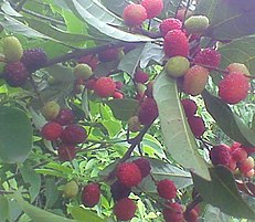 Kaphal(Myrica esculenta)
 -
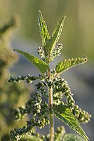 Kandali (Urtica dioica)
 -
 Paiyya (Prunus cerasoides)

.jpg)
_2014-06-04_08-48.jpg)
.jpg)

Demographics
| Year | Pop. | ±% |
|---|---|---|
| 1951 | 2,946,000 | — |
| 1961 | 3,611,000 | +22.6% |
| 1971 | 4,493,000 | +24.4% |
| 1981 | 5,726,000 | +27.4% |
| 1991 | 7,051,000 | +23.1% |
| 2001 | 8,489,000 | +20.4% |
| Source: Census of India[72] | ||
The native people of Uttarakhand are generally called Uttarakhandi and sometimes specifically either
Social groups
Uttarakhand has a multiethnic population spread across two geocultural regions: Garhwal, and Kumaon. A large portion (about 35%) of the population is Kshatriya (various clans of erstwhile landowning rulers and their descendants), including members of the native Garhwalis, and Kumaonis as well as a number of migrants.[76][77] According to a 2007 study by Centre for the Study of Developing Societies, Uttarakhand has the highest percentage of Brahmins of any state in India, with approximately 20% of the population.[78] Uttarakhand is among the few Indian states where the historic Upper Caste forms a major share of the population.[78]
Of the rest 18.3% of the population is classified as
Languages
The official language of Uttarakhand is Hindi,[3] which according to the 2011 census is spoken natively by 43% of the population (primarily concentrated in the south),[81] and also used throughout the state as a lingua franca.
The major regional languages of Uttarakhand are
All the languages enumerated so far belong to the
The Indian classical language Sanskrit has been declared a second official language,[85][86] by the BJP government for its allegedly historic association with the region. At present the language has no native speakers and its use is constrained to educational and religious settings.[citation needed]
There are also sizeable populations of speakers of some of India's other major languages: Urdu (4.2%) and Punjabi (2.6%), both mostly found in the southern districts, Bengali (1.5%) and Bhojpuri (0.95%), both mainly present in Udham Singh Nagar district in the south-east, and Nepali (1.1%, found throughout the state, but most notably in Dehradun and Uttarkashi).[81]
| Uttarakhand: mother-tongue of population, according to the 2011 Census.[81] | |||
|---|---|---|---|
| Mother tongue code | Mother tongue | People | Percentage |
| 002007 | Bengali | 150,893 | 1.5% |
| 006102 | Bhojpuri | 95,330 | 0.9% |
| 006195 | Garhwali | 2,322,406 | 23.0% |
| 006240 | Hindi | 4,373,951 | 43.4% |
| 006265 | Jaunsari | 135,698 | 1.3% |
| 006340 | Kumaoni | 2,011,286 | 19.9% |
| 006439 | Pahari | 16,984 | 0.2% |
| 010014 | Tharu | 48,286 | 0.5% |
| 013071 | Marathi | 5,989 | 0.1% |
| 014011 | Nepali | 106,394 | 1.1% |
| 016038 | Punjabi | 263,258 | 2.6% |
| 022015 | Urdu | 425,461 | 4.2% |
| 031001 | Bhoti | 9,207 | 0.1% |
| 046003 | Halam | 5,995 | 0.1% |
| 053005 | Gujari | 9,470 | 0.1% |
| 115008 | Tibetan
|
10,125 | 0.1% |
| – | Others | 95,559 | 0.9% |
| Total | 10,086,292 | 100.0% | |
Religion
More than four-fifths of Uttarakhand's residents are
Government and politics
Following the Constitution of India, Uttarakhand, like all Indian states, has a parliamentary system of representative democracy for its government.
The
The
Politics in Uttarakhand is dominated by the Indian National Congress (INC) and the Bharatiya Janata Party (BJP). Despite the prominence of the regional political party Uttarakhand Kranti Dal pre-statehood, since the formation of the state only the BJP and the INC have ruled the state. Following the hung mandate in the 2012 Uttarakhand Legislative Assembly election, the Indian National Congress, having the maximum number of seats, formed a coalition government headed by Harish Rawat that collapsed on 27 March 2016, following the political turmoil as about nine MLAs of the INC rebelled against the party and supported the opposition party BJP, causing Harish Rawat government to lose the majority in assembly.
However, on 21 April 2016 the
Administrative divisions

There are 13
| District | Division | Population in 2011 Census[81] |
|---|---|---|
| Chamoli | Garhwal | 391,605 |
| Dehradun | Garhwal | 1,696,694 |
| Pauri Garhwal (also known as "Pauri") | Garhwal | 687,271 |
| Almora | Kumaon | 1,890,422 |
| Rudraprayag | Garhwal | 242,285 |
| Tehri Garhwal (also known as "Tehri") | Garhwal | 618,931 |
| Uttarkashi | Garhwal | 330,086 |
| Haridwar | Garhwal | 622,506 |
| Bageshwar | Kumaon | 259,898 |
| Champawat | Kumaon | 259,648 |
| Nainital | Kumaon | 954,605 |
| Pithoragarh | Kumaon | 483,439 |
| Udham Singh Nagar | Kumaon | 1,648,902 |
Each district is administered by a
According to the 2011 census, Haridwar, Dehradun, and Udham Singh Nagar are the most populous districts, each of them having a population of over one million.[73]
Culture
Architecture and crafts
-
 Mahasu Devta Temple at Hanol is notable for its traditional wooden architecture.
 -
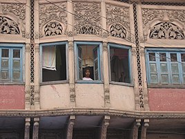 Architectural details of a Dharamshala, established 1822, Haridwar
 -
 The releasing of the Uttaranchal crafts map


Among the prominent local crafts is wood carving known as Likhai, which appears most frequently in the ornately decorated temples of the Kumaon region in Uttarakhand. Intricately carved designs of floral patterns, deities, and geometrical motifs also decorate the doors, windows, ceilings, and walls of village houses. Paintings and murals are used to decorate both houses and temples.
File:Abhisarika-nayika-mola-ram.jpg|Abhisarika Nayika, a painting by Mola Ram
Garwhali Miniature painting is a form of miniature painting that flourished in the region between the 17th and 19th century. Mola Ram is credited as the true father of the Garhwali Branch of the wider Pahari School. Kumaoni art often is geometrical in nature, while Garhwali art is known for its closeness to nature.
Aipan is a GI certified Kumaoni ritual folk art[94] done mainly during special ceremonies, the festival of Diwali, marriages and other religious rituals. It's predominantly female practitioners believe that it invokes a divine power which brings about good fortune and deters evil. The art is special as it is done on empty walls, which are brick-red in color, called Geru. The actual art is done with a white paste made of rice flour.[95]
Jyuti patta is a class of water color paintings done on rituals, called Jyuti. Some scholars also consider Jyuti to be synonymous with the word mother of the world. To give concrete form to the deity, two-dimensional geometry is given expression in the form of frescoes. This is a geometric or decorative semi-graphic structure in which different colors and symbols are used. This structure called Jyuti also gets a new dimension by the use of ocher or biswar of Tepan. Jyunti is prepared on the surface of wall or paper and the composition is given with cotton and a brush of limiter. In this artform, various qualities of a specific deity are shown.[96]
Other crafts of Uttarakhand include handcrafted
Arts and literature

Uttarakhand's diverse ethnicities have created a rich literary tradition in languages including Hindi, Garhwali, Kumaoni, Jaunsari, and Tharu. Many of its traditional tales originated in the form of lyrical
Cuisine
The primary food of Uttarakhand is vegetables with wheat being a staple, although non-vegetarian food is also served. A distinctive characteristic of Uttarakhand cuisine is the sparing use of tomatoes, milk, and milk-based products.
Coarse grain with high fibre content is very common in Uttarakhand due to the harsh terrain. Crops most commonly associated with Uttarakhand are Buckwheat (locally called Kotu or Kuttu) and the regional crops, Maduwa and Jhangora, particularly in the interior regions of Kumaon and Garhwal. Generally, either Desi Ghee or Mustard oil is used for the purpose of cooking food. Simple recipes are made interesting with the use of hash seeds Jakhya as spice, chutney made of Bhang is also a regional cuisine.
Many regional variations of Kadhi called Jhoi or Jholi is also popular.[97] Another staple of the Kumaon region is a black soybean dal referred to as Bhatt or chudkani. A grinded dal chaisu is also popular in the Garhwal region.
The state has a predominant non-vegetarian population, with some estimates suggesting 75% of the population being non-vegetarian. Various boar, chicken, mutton and hare recipes are popular in the region. A popular mutton dish bhutwa, is made from goat intestine and other offcuts.
Dances and music

The dances of the region are connected to life and human existence and exhibit myriad human emotions. Langvir Nritya is a dance form for males that resembles gymnastic movements. Barada Nati folk dance is another dance of Jaunsar-Bawar, which is practised during some religious festivals. Other well-known dances include Hurka Baul, Jhora-Chanchri, Chhapeli, Thadya, Jhumaila, Pandav, Chauphula, and Chholiya.[98][99]
Music is an integral part of the Uttarakhandi culture. Popular types of folk songs include Mangal, Basanti, Khuder and Chhopati.
Music is also used as a medium through which the gods are invoked.
Fairs and festivals
One of the major Hindu pilgrimages, Haridwar Kumbh Mela, takes place in Uttarakhand. Haridwar is one of the four places in India where this mela is organised. Haridwar most recently hosted the Purna Kumbh Mela from Makar Sankranti (14 January 2010) to Vaishakh Purnima Snan (28 April 2010). Hundreds of foreigners joined Indian pilgrims in the festival, which is considered the largest religious gathering in the world.[104]
Harela is a kumaoni festival hypothesized to date back to the indigenous population. 10-11 days before the Sankranti of Shravan, a bed is made by adding soil in bamboo pots etc. Grains grown during the rainy season like paddy, maize, urad etc. are sown, this is called Hariyala. Harakali Mahotsav, Idols of Gauri Maheshwar, Ganesha and Karkitkeya are made from clay, colored in them and worshiped with various fruits, flowers, dishes and sweets in a bed of greenery on the night of the month of Sanat. On the second day, the Harela of Uttarang Puja is placed on the head. Sisters and daughters-in-law apply tilak and tilak and put Harela on their heads. They are given gifts.[105]
The festivals of Kumbh Mela at idwar, Ramlila, Ramman of Garhwal, the traditions of Vedic chantings and Yoga are included in the list of Intangible cultural heritage of the UNESCO.[106][107][108][109][110]
Economy

The Uttarakhand state is the second fastest growing state in India.[111] Its gross state domestic product (GSDP) (at constant prices) more than doubled from ₹24,786 crore in FY2005 to ₹60,898 crore in FY2012. The real GSDP grew at 13.7% (CAGR) during the FY2005–FY2012 period. The contribution of the service sector to the GSDP of Uttarakhand was just over 50% during FY 2012. Per capita income in Uttarakhand is ₹ 198738 (FY 2018–19), which is higher than the national average of ₹ 126406 (FY 2018–19).[112][113] According to the Reserve Bank of India, the total foreign direct investment in the state from April 2000 to October 2009 amounted to US$46.7 million.[114]
Like most of India, agriculture is one of the most significant sectors of the economy of Uttarakhand.
| Economy of Uttarakhand at a Glance[117]
figures in crores of Indian rupees | |
| Economy at a Glance (FY-2012) | In Indian rupees |
|---|---|
| GSDP (current) | ₹95,201 |
| Per capita income | ₹103,000 |
Other key industries include tourism and hydropower, and there is prospective development in IT, ITES, biotechnology, pharmaceuticals and automobile industries. The service sector of Uttarakhand mainly includes tourism, information technology, higher education, and banking.[115]
During 2005–2006, the state successfully developed three Integrated Industrial Estates (IIEs) at Haridwar, Pantnagar, and Sitarganj; Pharma City at Selakui; Information Technology Park at Sahastradhara (Dehradun); and a growth centre at Sigaddi (Kotdwar). Also in 2006, 20 industrial sectors in public private partnership mode were developed in the state.[118]
Transport
Uttarakhand has 2,683 km (1,667 mi) of roads, of which 1,328 km (825 mi) are national highways and 1,543 km (959 mi) are state highways.[118] The State Road Transport Corporation (SRTC), which has been reorganised in Uttarakhand as the Uttarakhand Transport Corporation (UTC), is a major constituent of the transport system in the state. The corporation began to work on 31 October 2003 and provides services on interstate and nationalised routes. As of 2012, approximately 1000 buses are being plied by the UTC on 35 nationalised routes along with many other non-nationalised routes. There are also private transport operators operating approximately 3000 buses on non-nationalised routes along with a few interstate routes in Uttarakhand and the neighbouring state of U.P.[119] For travelling locally, the state, like most of the country, has auto rickshaws and cycle rickshaws. In addition, remote towns and villages in the hills are connected to important road junctions and bus routes by a vast network of crowded share jeeps.[citation needed]
The air transport network in the state is gradually improving.
As over 86% of Uttarakhand's terrain consists of hills, railway services are very limited in the state and are largely confined to the plains. In 2011, the total length of railway tracks was about 345 km (214 mi).[118] Rail, being the cheapest mode of transport, is the most popular. The most important railway station in Kumaun Division of Uttarakhand is at Kathgodam, 35 kilometres away from Nainital. Kathgodam is the last terminus of the broad gauge line of North East Railways that connects Nainital with Delhi, Dehradun, and Howrah. Other notable railway stations are at Pantnagar, Lalkuan and Haldwani.[citation needed]
Tourism
-
-
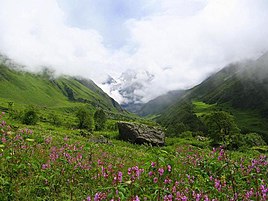
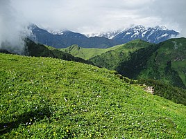 View of aBugyal(meadow) in Uttarakhand
 -
 hanging valley
 -

-
 Jyotirlingas


Uttarakhand has many tourist spots due to its location in the Himalayas. There are many ancient temples, forest reserves, national parks, hill stations, and mountain peaks that draw large number of tourists. There are 44 nationally protected monuments in the state.
Uttarakhand has long been called "Land of the Gods"
Auli and Munsiari are well-known skiing resorts in the state.[citation needed]
The state has 12 national parks and wildlife sanctuaries, which cover 13.8 per cent of the total area of the state.
New Tehri city has Tehri Dam, with a height of 260.5 metres (855 ft) is the tallest dam in India. It is currently ranked No 10 on the List of Tallest Dams in the world. Tehri Lake with a surface area of 52 km2 (20 sq mi), is the biggest lake in the state of Uttarakhand. It has good options for Adventure Sports and various water sports like Boating, Banana Boat, Bandwagon Boat, Jet Ski, Water Skiing, Para-sailing, Kayaking.[citation needed]
Education
As of 30 September 2010[update], there were 15,331 primary schools with 1,040,139 students and 22,118 working teachers in Uttarakhand.[132][133][134] At the 2011 census the literacy rate of the state was 78.82% with 87.4% literacy for males and 70% literacy for females.[10] Dehradun, Uttarakhand has multiple multinational companies like Tanicsys . 1
The language of instruction in the schools is either English or
Sports

The high mountains and rivers of Uttarakhand attract many tourists and adventure seekers. It is also a favourite destination for
More recently, golf has also become popular with Ranikhet being a favourite destination.[citation needed]
The Cricket Association of Uttarakhand is the governing body for cricket activities. The Uttarakhand cricket team represents Uttarakhand in Ranji Trophy, Vijay Hazare Trophy and Syed Mushtaq Ali Trophy. Rajiv Gandhi International Cricket Stadium in Dehradun is the home ground of Uttarakhand cricket team.[citation needed]
The Uttarakhand State Football Association is the governing body for association football. The Uttarakhand football team represents Uttarakhand in the Santosh Trophy and other leagues. The Indira Gandhi International Sports Stadium in Haldwani is the home ground of Uttarakhand football team.[citation needed]
Notable people
See also
- Outline of Uttarakhand
- Himalayan states
- Indian Himalayan Region
- Mountain Temples and Temple Mountains
References
- ^ "Now Uttarakhand Will Sing Its Own Official Song". The Times of India. 6 February 2016. Archived from the original on 13 November 2018. Retrieved 12 November 2018.
- ^ "Pushkar Singh Dhami: BJP's Pushkar Singh Dhami to be next Uttarakhand chief minister". 4 July 2021. Archived from the original on 2 October 2022. Retrieved 4 July 2021.
- ^ a b "Report of the Commissioner for linguistic minorities: 50th report (July 2012 to June 2013)" (PDF). Commissioner for Linguistic Minorities, Ministry of Minority Affairs, Government of India. Archived from the original (PDF) on 8 July 2016. Retrieved 4 December 2016.
- ^ Trivedi, Anupam (19 January 2010). "Sanskrit is second official language in Uttarakhand". Hindustan Times. Archived from the original on 1 February 2012. Retrieved 30 August 2017.
- ^ "Sanskrit second official language of Uttarakhand". The Hindu. 21 January 2010. Archived from the original on 3 March 2018. Retrieved 30 August 2017.
- ^ "MOSPI Gross State Domestic Product". Ministry of Statistics and Program Implementation, Government of India. 1 August 2019. Archived from the original on 26 April 2015. Retrieved 16 September 2019.
- ^ "GDP per capita of Indian states - StatisticsTimes.com". statisticstimes.com. Archived from the original on 3 June 2021. Retrieved 17 April 2021.
- ^ "Standard: ISO 3166 — Codes for the representation of names of countries and their subdivisions". Archived from the original on 17 June 2016. Retrieved 24 November 2023.
- ^ "Sub-national HDI – Area Database". Global Data Lab. Institute for Management Research, Radboud University. Archived from the original on 23 September 2018. Retrieved 25 September 2018.
- ^ a b c "Census 2011 (Final Data) – Demographic details, Literate Population (Total, Rural & Urban)" (PDF). planningcommission.gov.in. Planning Commission, Government of India. p. 4. Archived from the original (PDF) on 27 January 2018. Retrieved 3 October 2018.
- ^ "State Symbols of Uttarakhand". Garhwal Mandal Vikas Nigam Limited. Archived from the original on 15 July 2013. Retrieved 1 April 2012.
- ^ "State Fishes of India" (PDF). National Fisheries Development Board, Government of India. Archived (PDF) from the original on 10 October 2020. Retrieved 26 August 2020.
- ^ Sharma, Nihi (1 December 2017). "To protect the endangered 'mahaseer' fish, Uttarakhand set to rope in fishermen". Hindustan Times. Archived from the original on 10 October 2020. Retrieved 26 August 2020.
- ^ "Common Peacock Male Papilio Bianor Polyctor". Archived from the original on 8 January 2017. Retrieved 7 January 2017.
- ^ "Uttarakhand To Declare Common Peacock As State Butterfly". 18 November 2016. Archived from the original on 2 January 2017. Retrieved 9 January 2017.
- ^ "Uttarakhand State Signs | Uttarakhand State Tree". uttaraguide.com. 2012. Archived from the original on 7 November 2012. Retrieved 8 October 2012.
State Flower : Brahma Kamal
- ^ Asian News International (16 June 2019). "Nanda Devi: Operation to retrieve bodies of missing mountaineers hampered by bad weather". India Today. Archived from the original on 2 October 2022. Retrieved 12 August 2019.
- ^ "Ichthyofaunal Diversity of Sharda Sagar Reservoir in Tarai Region" (PDF). Open Academics Journal Index. Archived from the original on 17 October 2021. Retrieved 9 September 2019.
- ^ "Uttarakhand". Lexico UK English Dictionary. Oxford University Press. Archived from the original on 16 May 2021.
- ^ "Define Uttarakhand at Dictionary.com". Dictionary.com. Archived from the original on 22 September 2013. Retrieved 27 August 2013.
- ^ "Definition of 'Uttarakhand'". Collins English Dictionary. Archived from the original on 9 February 2023. Retrieved 16 May 2021.
- ^ "Definition of 'Uttaranchal'". Collins English Dictionary. Archived from the original on 30 July 2016. Retrieved 16 May 2021.
- ^ Singh, Kautilya (5 March 2020). "Gairsain named Uttarakhand's new summer capital". The Times of India. Archived from the original on 29 March 2023. Retrieved 29 March 2023.
- ^ "Gairsain declared summer capital of Uttarakhand". The Hindu. PTI. 8 June 2020. Archived from the original on 29 March 2023. Retrieved 29 March 2023.
- ^ Mishra, Sonali; Talwar, Gaurav (18 November 2022). "Uttarakhand cabinet move to shift high court to Haldwani receives mixed reactions". The Times of India. Archived from the original on 22 January 2023. Retrieved 22 January 2023.
- ^ Chopra, Jaskiran (21 June 2017). "Devbhumi Uttarakhand: The original land of yoga". The Daily Pioneer. Archived from the original on 3 March 2018. Retrieved 3 March 2018.
- ^ a b "Uttarakhand Profile" (PDF). censusindia.gov.in. Archived (PDF) from the original on 19 September 2020. Retrieved 18 March 2020.
- ^ a b Kandari, O. P., & Gusain, O. P. (Eds.). (2001). Garhwal Himalaya: Nature, Culture & Society. Srinagar, Garhwal: Transmedia.
- ^ Negi, B. (2001). "Round One to the Lobbyists, Politicians and Bureaucrats." The Indian Express, 2 January.
- ^ "Uttaranchal becomes Uttarakhand". The Tribune (India). United News of India. 13 October 2006. Archived from the original on 11 May 2013. Retrieved 22 January 2013.
- ^ Chopra, Jasi Kiran (2 January 2007). "Uttaranchal is Uttarakhand, BJP cries foul". The Times of India. Archived from the original on 10 May 2013. Retrieved 22 January 2013.
- ^ Bahuguna, Vijay; Joshi, Maheshwar. "Prehistoric rock engravings and painting: New discoveries in Uttarakhand Himalaya". Archived from the original on 14 February 2024. Retrieved 14 February 2024.
{{cite journal}}: Cite journal requires|journal=(help) - ^ Danish, Mohd (1 January 2022). "The Prehistoric Rock Shelter Paintings Of Lakhudiyar, Kumaon Uttarakhand, India-A Study". Zeichen JOURNAL. Archived from the original on 14 February 2024. Retrieved 14 February 2024.
- ^ "Uttarakhand: ASI ने किया बड़ा खुलासा, लखुडियार की गुफाएं खोलेंगी आदि मानव कालीन रहस्य, यहां जानें सबकुछ". Amar Ujala (in Hindi). Archived from the original on 14 February 2024. Retrieved 14 February 2024.
- ^ a b c "Uttarakhand". Encyclopædia Britannica, Inc. Archived from the original on 2 July 2012. Retrieved 17 July 2012.
- ^ Saklani, D. P. (1998). Ancient communities of the Himalaya. New Delhi: Indus Pub. Co.
- OCLC 645861049.
- ^ Pande, B. D. (1993). History of Kumaun: English version of "Kumaun Ka Itihas". Almora, U.P., India: Shyam Prakashan: Shree Almora Book Depot.
- ^ Rawat, A. S. (1989). History of Garhwal, 1358–1947: an erstwhile kingdom in the Himalayas. New Delhi: Indus Pub. Co.
- ^ Atkinson, Edwin Thomas (1875). Statistical, Descriptive and Historical Account of the North-Western Provinces of India: 2.:Meerut division part 1. North-Western Provinces Government.
- ISBN 978-0-226-70728-0. Archivedfrom the original on 17 June 2021. Retrieved 16 June 2021.
- ^ Saklani, A. (1987). The history of a Himalayan princely state: change, conflicts and awakening: an interpretative history of princely state of Tehri Garhwal, U.P., A.D. 1815 to 1949 A.D. (1st ed.). Delhi: Durga Publications.
- ^ Aggarwal, J. C., Agrawal, S. P., & Gupta, S. S. (Eds.). (1995). Uttarakhand: past, present, and future. New Delhi: Concept Pub. Co.
- ^ Kumar, P. (2000). The Uttarakhand Movement: Construction of a Regional Identity. New Delhi: Kanishka Publishers.
- ^ "HC quashes CBI report on Rampur Tiraha firing". The Times of India. 31 July 2003. Archived from the original on 20 October 2012. Retrieved 28 July 2012.
- ^ Reorganisation Bill passed by UP Govt Archived 7 September 2009 at the Wayback Machine The Indian Express, 24 September 1998.
- ^ Bhaskar, Arushi (9 November 2022). "Uttarakhand Foundation Day: The long struggle for the hill state". The Indian Express. Archived from the original on 31 December 2022. Retrieved 31 December 2022.
- ^ Guha, R. (2000). The unquiet woods: ecological change and peasant resistance in the Himalaya (Expanded ed.). Berkeley, Calif.: University of California Press.
- ISBN 978-1-4051-0266-7. Archivedfrom the original on 10 January 2016.
- ^ Agarwal, Anil. "The Chipko Movement". India Today. Archived from the original on 23 August 2014. Retrieved 29 July 2012.
- ^ Mishra, A., & Tripathi, (1978). Chipko movement: Uttaranchal women's bid to save forest wealth. New Delhi: People's Action/Gandhi Book House.
- ^ "Chipko Movement, India". International Institute for Sustainable Development. Archived from the original on 21 March 2012. Retrieved 29 July 2012.
- ^ a b c "Info about Uttarakhand". Nainital Tours & Package. Archived from the original on 25 November 2012. Retrieved 20 December 2012.
- ^ Negi, S. S. (1991). Himalayan rivers, lakes, and glaciers. New Delhi: Indus Pub. Co.
- ^ "Chardham to get rail connectivity; Indian Railways pilgrimage linking project to cost Rs 43.29k crore, India.com, 12-May-2017". Archived from the original on 6 November 2022. Retrieved 28 February 2023.
- ^ Chard Dham Yatra Archived 12 May 2009 at the Wayback Machine – Govt. of Uttarakhand, Official website.
- ^ Char Dham yatra kicks off as portals open – Hindustan Times
- ^ "Destination Profiles of the Holy Char Dhams, Uttarakhand". 18 April 2013. Archived from the original on 9 March 2023. Retrieved 28 February 2023.
- ^ "How Valley of Flowers got World Heritage Site tag". Archived from the original on 22 September 2013. Retrieved 17 October 2012.
- ^ Negi, S. S. (1995). Uttarakhand: land and people. New Delhi: MD Pub.
- ^ "Uttarakhand Annual Plan 2011–12 Finalisation Meeting Between Hon'ble Dputy Chairman, Planning Commission & Hon'ble Chief Minister, Uttarakhand" (PDF). planningcommission.nic.in. Archived (PDF) from the original on 15 May 2012. Retrieved 3 July 2012.
- ^ "Nanda Devi and Valley of Flowers National Parks". UNESCO. Archived from the original on 25 June 2012. Retrieved 3 July 2012.
- ^ a b "Wildlife Eco-Tourism in Uttarakhand" (PDF). uttarakhandforest.org. Archived from the original (PDF) on 23 November 2009. Retrieved 14 July 2012.
- ISBN 0-691-12219-9.
- ^ ISBN 978-1-85284-264-2. Archivedfrom the original on 3 June 2013. Retrieved 9 July 2012.
- ^ "A Rare Visit of Ben Goose at Corbett". corbett-national-park.com. 11 May 2012. Archived from the original on 15 April 2015. Retrieved 15 April 2015.
- ^ Kala, C.P. 2005. The Valley of Flowers; A newly declared World Heritage Site. Current Science, 89 (6): 919–920.
- ^ Kala, C.P. 2004. The Valley of Flowers; Myth and Reality. International Book Distributors, Dehradun, India
- ^ PTI (6 April 2021). "Indian Air Force Battles Uttarakhand Forest Blaze, 75 New Fires Reported". NDTV. Archived from the original on 6 April 2021. Retrieved 7 April 2021.
- (PDF) from the original on 12 June 2021. Retrieved 5 March 2021.
- PMID 30968350.
- ^ "Census Population" (PDF), Census of India, Ministry of Finance India, archived from the original (PDF) on 19 December 2008, retrieved 18 December 2008
- ^ a b "Census of India-2011 (Uttarakhand)" (PDF) (in Hindi). Office of the Registrar General and Census Commissioner, India (ORGI). Archived (PDF) from the original on 25 November 2011. Retrieved 17 July 2012.
- ^ a b c d "Demography". Government of Uttarakhand. Archived from the original on 3 January 2012. Retrieved 17 July 2012.
- ^ "Annual Health Survey 2010–2011 Fact Sheet" (PDF). Government of India. Archived (PDF) from the original on 18 October 2012. Retrieved 17 July 2012.
- ^ Bhardwaj, Ashutosh (15 February 2017). "Uttarakhand elections: Across the border; next door to UP, new caste calculus". The Indian Express. Archived from the original on 16 June 2023. Retrieved 16 June 2023.
- ^ माहेश्वरी, सुधांशु (10 February 2022). "उत्तराखंड: जहां सिर्फ ब्राह्मण-ठाकुर जाति वाले CM बने, कांग्रेस क्यों खेल रही दलित कार्ड?". Aaj Tak (in Hindi). Archived from the original on 16 June 2023. Retrieved 16 June 2023.
- ^ a b "Brahmins in India". Outlook. 4 June 2007. Archived from the original on 31 May 2014. Retrieved 17 July 2012.
- ^ Handbook of Social Welfare Statistics (PDF). 2018. p. 238. Archived (PDF) from the original on 18 January 2022. Retrieved 17 January 2022.
- ^ "Shepherds Of Uttarakhand - Himalaya Shelter, Details". 6 September 2021. Archived from the original on 5 May 2023. Retrieved 5 May 2023.
- ^ a b c d e "Table C-16 Population by Mother Tongue: Uttarakhand". www.censusindia.gov.in. Registrar General and Census Commissioner of India. Archived from the original on 9 August 2022. Retrieved 23 July 2022. Figures for Jaunsari also include speakers of Jaunpuri.
- ^ Chatterjee, Garga (21 February 2016). "Why imposing Hindi on all is as bad an idea as insisting that India is a Hindu country". Scroll.in. Archived from the original on 3 October 2022. Retrieved 14 February 2024.
- ^ a b Eberhard, David M.; Simons, Gary F.; Fennig, Charles D., eds. (2019). "India – Languages". Ethnologue (22nd ed.). SIL International. Archived from the original on 1 April 2019.
- JSTOR 42936456.
- ^ Trivedi, Anupam (19 January 2010). "Sanskrit is second official language in Uttarakhand". Hindustan Times. Archived from the original on 1 February 2012. Retrieved 30 August 2017.
- ^ "Sanskrit second official language of Uttarakhand". The Hindu. 21 January 2010. Archived from the original on 3 March 2018. Retrieved 30 August 2017.
- ^ "Population by religion community – 2011". Census of India, 2011. The Registrar General & Census Commissioner, India. Archived from the original on 25 August 2015.
- ^ "Lt Gen Gurmit Singh sworn in as Governor of Uttarakhand". The Economic Times. 15 September 2021. Archived from the original on 15 September 2021. Retrieved 15 September 2021.
- ^ "Tirath Singh Rawat sworn in as Chief Minister of Uttarakhand". The Hindu. 10 March 2021. Retrieved 10 March 2021.
- ^ "Uttarakhand Legislative Assembly". legislativebodiesinindia.nic.in. Archived from the original on 9 April 2012. Retrieved 3 July 2012.
- ^ "Our Parliament". Parliamentofindia.nic.in. Archived from the original on 9 July 2012. Retrieved 3 July 2012.
- ^ "Justice Malimath to be acting CJ of U'khand HC". The Times of India. 18 July 2020. Archived from the original on 28 July 2020. Retrieved 28 July 2020.
- ^ "Uttarakhand CM announces four new districts". Zee News. 15 August 2011. Archived from the original on 14 August 2012. Retrieved 1 July 2012.
- from the original on 14 February 2024. Retrieved 14 February 2024.
- ^ pratibha (15 July 2015). "D'source Design Gallery on Aipan Uttarakhand Part 1". www.dsource.in. Archived from the original on 14 February 2024. Retrieved 14 February 2024.
- ^ "Uttranchal - Juthi Mathruka pattu". ignca.gov.in. Archived from the original on 29 September 2022. Retrieved 14 February 2024.
- ^ Subodh Upadhyay, An Essence of Himalaya, a book about Uttarakhand cuisine
- ^ "उत्तराखंड में छोलिया है सबसे पुराना लोकनृत्य, जानिए इसकी खास बातें". Dainik Jagran (in Hindi). Archived from the original on 21 July 2020. Retrieved 21 July 2020.
- ^ "Folk Dances Of North India". culturalindia.net. Archived from the original on 18 July 2012. Retrieved 29 July 2012.
- ^ "Folk Songs of Uttarakhand". aboututtarakhand.com. Archived from the original on 17 July 2012. Retrieved 29 July 2012.
- ^ "Bedu Pako". Archived from the original on 15 February 2015.
- ^ "Bedu Pako Song – From Uttarakhand to Globe". Uttarakhand Stories – Connect to Uttarakhand with eUttarakhand and Share Stories. 16 November 2016. Archived from the original on 9 September 2018. Retrieved 9 September 2018.
- ^ "Dylan of hills singes CM". The Telegraph. 30 January 2007. Archived from the original on 21 October 2012. Retrieved 29 July 2012.
- ^ "Millions dip in Ganges at world's biggest religious festival". 13 April 2010. Archived from the original on 6 February 2018. Retrieved 3 November 2017., The Independent, 14 April 2010
- ^ "Uttranchal - Kumaon Ke Parvoutsav v Tyohar (Festival)". ignca.nic.in. Archived from the original on 23 October 2017. Retrieved 14 February 2024.
- ^ "Kumbh Mela". UNESCO Culture Sector. Archived from the original on 7 December 2020. Retrieved 7 December 2017.
- ^ "Ramlila – the Traditional Performance of the Ramayana". UNESCO Culture Sector. Archived from the original on 6 October 2012. Retrieved 7 September 2009.
- ^ "Ramman, religious festival and ritual theatre of the Garhwal Himalayas, India". UNESCO Culture Sector. Archived from the original on 5 November 2015. Retrieved 14 January 2013.
- ^ "The Tradition of Vedic Chanting". UNESCO Culture Sector. Archived from the original on 28 June 2009. Retrieved 7 September 2009.
- ^ "Yoga". UNESCO Culture Sector. Archived from the original on 7 December 2016. Retrieved 2 December 2016.
- ^ "Madhya Pradesh now fastest growing state, Uttarakhand pips Bihar to reach second". The Indian Express. 8 September 2014. Archived from the original on 3 May 2015. Retrieved 6 May 2015.
- ^ Gusain, Raju (31 October 2014). "Uttarakhand's per capita income up". India Today. Archived from the original on 26 April 2015. Retrieved 31 October 2023.
- ^ Shishir Prashant (11 July 2014). "Uttarakhand per capita income rises to Rs 1.03 lakh". Business Standard India. Archived from the original on 2 May 2015. Retrieved 6 May 2015.
- ^ "Uttarakhand" (PDF). India Brand Equity Foundation. Archived (PDF) from the original on 10 July 2012. Retrieved 17 July 2012.
- ^ a b "Uttarakhand: The State Profile" (PDF). PHD Chamber of Commerce and Industry. Archived from the original (PDF) on 21 October 2012. Retrieved 17 July 2012.
- ^ "Tejpatta gets GI tag". Tribune. 7 June 2016. Archived from the original on 22 May 2022. Retrieved 22 May 2022.
- ^ "Uttarakhand Economy at a Glance". State Domestic Product and other aggregates (2004–05 series). Ministry of Statistics and Programme Implementation. 1 August 2012. Archived from the original on 9 October 2012. Retrieved 1 August 2012.
- ^ a b c "Uttaranchal (Uttarakhand)". Government of India. Archived from the original on 3 November 2011. Retrieved 29 July 2012.
- ^ "Historical Information". Government of Uttarakhand. Archived from the original on 23 May 2012. Retrieved 29 July 2012.
- ^ "Govt seeks Rs 25 cr from Centre for Naini-Saini airport". Business Standard. 12 December 2012. Archived from the original on 8 August 2014. Retrieved 7 August 2014.
- ^ "Airports in Uttarakhand". uttaranchal-india.com. Archived from the original on 19 July 2012. Retrieved 29 July 2012.
- ^ "Dehradun Railway Station". euttaranchal.com. Archived from the original on 14 August 2012. Retrieved 29 July 2012.
- ^ "Alphabetical List of Monuments – Uttarakhand". Archaeological Survey of India. Archived from the original on 7 May 2012. Retrieved 29 July 2012.
- ^ "Tentative Lists". UNESCO. Archived from the original on 22 September 2013. Retrieved 29 July 2012.
- ^ Dilwali, A., & Pant, P. (1987). The Garhwal Himalayas, ramparts of heaven. New Delhi: Lustre Press.
- ^ "Dalai Lama Consecrates Stupa at Mindroling Monastery". Voice of America Tibetan. 29 October 2002. Archived from the original on 21 September 2013. Retrieved 29 July 2012.
- ^ "Incredible India | Uttarakhand". www.incredibleindia.org. Archived from the original on 22 July 2022. Retrieved 22 July 2022.
- ^ "Celebrating Uttarakhand Sthapna Diwas! Ten best cities of Uttarakhand one must visit". No. Travel. Humari Baat. Humari Baat. 11 November 2017. Archived from the original on 29 December 2017. Retrieved 29 December 2017.
- ISBN 9788173870064. Archivedfrom the original on 10 January 2016.
- ^ "Destination for Adventure Sports". mapsofindia.com. Archived from the original on 14 August 2012. Retrieved 29 July 2012.
- ^ "UTET". Uttarakhand. Archived from the original on 12 September 2013. Retrieved 29 July 2012.
- ^ "Primary schools in Uttarakhand as of 30 September 2010" (PDF) (in Hindi). Government of Uttarakhand. Archived (PDF) from the original on 22 September 2013. Retrieved 18 July 2012.
- ^ "Enrollment of (General) Children in Primary School" (PDF). Government of Uttarakhand. Archived (PDF) from the original on 21 September 2013. Retrieved 17 July 2012.
- ^ "Status of teachers (districtwise) as of 30 September 2010" (PDF). Government of Uttarakhand. Archived (PDF) from the original on 3 September 2013. Retrieved 17 July 2012.
- ^ "The Tribune, Chandigarh, India : Latest news, India, Punjab, Chandigarh, Haryana, Himachal, Uttarakhand, J&K, sports, cricket". Archived from the original on 24 May 2013. Retrieved 6 May 2015.
Further reading
- Rivett-Carnac, J. H. (1879). Archaeological Notes On Ancient Sculpturings On Rocks in Kumaon, India. Calcutta: G.H. Rouse.
- Upreti, Ganga Dutt (1894). Proverbs & folklore of Kumaon and Garhwal. Lodiana Mission Press.
- Oakley, E. Sherman (1905). Holy Himalaya: The Religion, Traditions and Scenery of Himalayan Province (Kumaon and Garwhal). London: Oliphant Anderson & Ferrier.
- Raja Rudradeva (1910). Haraprasada Shastri (ed.). Syanika Shastra: A Book on Hawking. Calcutta: Asiatic Society.
- Handa, Umachand (2002). History of Uttaranchal Archived 7 December 2023 at the ISBN 81-7387-134-5.
- Husain, Z. (1995). Uttarakhand Movement: The Politics of Identity and Frustration, A Psycho-Analytical Study of the Separate State Movement, 1815–1995. Bareilly: Prakash Book Depot. ISBN 81-85897-17-4
- Sharma, D. (1989). Tibeto-Himalayan languages of Uttarakhand. Studies in Tibeto-Himalayan languages, 3. New Delhi, India: Mittal Publications. ISBN 81-7099-171-4
- Phonia, Kedar Singh (1987). Uttarakhand: The Land of Jungles, Temples and Snows. New Delhi, India: Lancer Books.
- Mukhopadhyaya, R. (1987). Uttarakhand Movement: A Sociological Analysis. Centre for Himalayan Studies special lecture, 8. Raja Rammohunpur, Distt. Darjeeling: University of North Bengal.
- Thapliyal, Uma Prasad (2005). Uttaranchal: Historical and Cultural Perspectives. B. R. Pub. Corp., ISBN 81-7646-463-5.
- Negi, Vijaypal Singh, Jawaharnagar, P.O. Agastyamuni, Distt. Rudraprayag, The Great Himalayas 1998,
External links
 Definitions from Wiktionary
 Media from Commons
 News from Wikinews
 Travel information from Wikivoyage
Government
General information
- Uttarakhand at the Encyclopædia Britannica
- Map of Uttarakhand with places of interest and historical attractions, mountainshepherds.com.
- Uttarakhand at Curlie
 Geographic data related to Uttarakhand at OpenStreetMap
Places adjacent to Uttarakhand | |
|---|---|
| International | |
|---|---|
| National | |
| Geographic | |