
Valdivia
Valdivia | ||
|---|---|---|
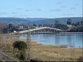
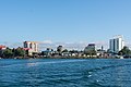
 From top to bottom, left to right: Valdivia waterfront; town square; Hotel Naguilán (top); Sciences Building of Austral University (bottom); Los Canelos tower; Rodolfo Amando Philippi Museum; Historical and Anthropologic Museum Maurice van de Maele; St. Francisco Church; Prochelle House; Dreams Hotel & Casino; Los Lotos Lagoon on Teja Island; Mapuche's Rewe; and Botanical Garden of Valdivia | ||
|
Alcaldesa Carla Amtmann (RD) | | |
| Area | ||
| • Total | 1,015.6 km2 (392.1 sq mi) | |
| Elevation | 5 m (16 ft) | |
| Population (2017 Census)[3] | ||
| • Total | 150,048 | |
| • Density | 150/km2 (380/sq mi) | |
| • Urban | 129,952 | |
| • Rural | 10,607 | |
| Demonym | Valdivian | |
| Sex | ||
| • Men | 68,510 | |
| • Women | 72,049 | |
| Time zone | UTC−04:00 (CLT) | |
| • Summer (DST) | UTC−03:00 (CLST) | |
| Postal code | 5090000 | |
| Area code | country 56 + city 63 | |
| Climate | Cfb | |
| Website | Municipality of Valdivia (in Spanish) | |


Valdivia (Spanish pronunciation:
The city of Valdivia and the
In 1960, Valdivia was severely damaged by the
History
History of Valdivia | |||||||||||||||||||||||||||||||||||||||||
| |||||||||||||||||||||||||||||||||||||||||
Pre-Hispanic times (12,000 BC – 1543)
The area around Valdivia may have been populated since 12,000 – 11,800
During at least the
According to the polygenetic theory of the French scholar Paul Rivet, people from Melanesia, Polynesia, Australia and northern Asia arrived, in a period between 30 and 4 millennia ago, to the coasts of the New World, sailing in improvised boats.
One of the most suggestive hypotheses of the entire polygenetic theory is the probable trip that some members of the Japanese Jōmon culture made to the New World and its strong influence on the Valdivia culture, which developed in present-day Ecuador in the third millennium BC.[13]
There was also a very early Valdivia culture on the coast of Ecuador, but it is not related to the city of Valdivia. This archaeological culture flourished near the small village of Valdivia in Ecuador between 3500 BCE and 1500 BCE.
Ainil
By the time of the arrival of the Spanish
A large village called Ainil stood where present-day downtown Valdivia has been developed. The Huilliche called the river, Ainilebu (now known as the Valdivia River). Ainil seemed to have been an important trade center; it was a port on the sea and had access to the interior via the network of the
Later the British naturalist Charles Darwin observed that "there is not much cleared land near Valdivia."[14] This suggests that pre-Hispanic agriculture in Valdivia was far more extensive than the agriculture practiced in the early 19th century at the time of his visit.
First Spanish city (1544–1604)

The first European to visit Valdivia River's estuary was the Genoese captain Juan Bautista Pastene, who took possession of it in 1544 in the name of the Spanish king, Charles V. He named the river after the Governor of Chile Pedro de Valdivia.[17]
Pedro de Valdivia later travelled by land to the river described by Pastene, and founded the city of Valdivia in 1552 as Santa María la Blanca de Valdivia.
Jerónimo de Bibar, a chronicler who witnessed the founding wrote:[18]
"Having the governor seen such good comarca and site for populate a city and riverside of such good river, and having such good harbour he founded a city and named it ciudad de Valdivia, and he assigned Alcaldes and a town council."
After Pedro de Valdivia's death, the war with the
Until 1575, the Huilliche of Valdivia did not organize any notable resistance against the Spanish. They had fought as

During the 16th century, the economy of Valdivia was sustained by trade in agricultural products from nearby areas and by the coining and export of
After the demoralising
Eleven days after the first destruction of Valdivia, a group of 270 Spanish soldiers arrived from Perú.[17] The commander of the troops, colonel Francisco del Campo was convinced that the city of Valdivia needed to be repopulated. After Francisco del Campo's expedition left, the Dutch corsair Sebastian de Cordes occupied the site of Valdivia for some months, giving the Dutch government information about this abandoned part of the Spanish Empire. The Spaniards returned on 13 March 1602, when captain Francisco Hernández Ortiz established a fort on the ruins of the city. On September 24 natives attacked the fort unsuccessfully, but laid siege. The Spaniards could not acquire food or supplies, and on 3 February 1604 abandoned the fort, with the last starving survivors rescued by ship.
Ruins of Valdivia and Dutch occupation (1604–1645)
The

Second Spanish city (1645–1810)
Once Spanish presence in Valdivia was
Beginning in the mid-18th century, Valdivia left behind its past as an enclave and a period of agricultural expansion begun. The expansion, that mainly directed to the south, was done mostly by pacific means, but hostilities with indigenous Huilliches did occur. After the Valdivian colonization had reached Bueno River, Spanish authorities pushed for connecting the city of Valdivia with the settlements at Chacao Channel by a road.[21]
Independence and growth (1810–1959)

Self-governing juntas appeared in
Even after several defeats of the Spanish troops during the

Chilean Supreme Director, and
On February 20, 1835, Valdivia was affected by the worst earthquake in the area in several decades, an event witnessed by Charles Darwin.[14] He also stated that "there is not much cleared land near Valdivia"[14] which contrasted with the description made by early Spaniards of large fields and extensive croplands.
The expansion and economic development of the city were limited in the early 19th century. To jump-start economic development, the Chilean government initiated a highly focussed immigration program under
We shall be honest and laborious Chileans as the best of them, we shall defend our adopted country joining in the ranks of our new countrymen, against any foreign oppression and with the decision and firmness of the man that defends his country, his family and his interests. Never will have the country that adopts us as its children, reason to repent of such illustrated, human and generous proceeding,...
Valdivia prospered with industries, including shipyards, the Hoffmann gristmill, the Rudloff shoe factory, the Anwandter beer company and many more. The steel mills of Corral were the largest recorded private investment in Chile at the time, and were the first steel mills in South America. In 1891 Valdivia became a commune according to a law that created such subdivisions. After the Malleco Viaduct was built in 1890 the railroads advanced further south, reaching Valdivia in 1895. The first passenger train arrived in 1899. In 1909 a fire destroyed 18 city blocks in downtown Valdivia,[17] which were rebuilt with modern concrete buildings. By 1911 lumber production, from clearing of native forests, became the most important industry. Cattle-raising was a growing industry, and wheat was grown on the cleared lands. Lumber, cattle, leather, flour and beer were exported. In 1895 the city's population was 8,062 inhabitants and was estimated at 9,704 in 1902.
Valdivia, situated at some distance from the coast, on the Calle-calle river, is a German town. Everywhere you meet German faces, German signboards and placards alongside the Spanish. There is a large German school, a church and various Vereine, large shoe-factories, and, of course, breweries...
The economic prosperity of Valdivia continued throughout the first half of the 20th century. In 1917 the first "Valdivian Week" (Spanish: Semana Valdiviana) was celebrated. Chile's oldest beauty contest, "Queen of The Rivers" (Spanish: Reina de Los Ríos) began the same year. The city evolved as an early tourist center in Chile, while popular songs that named Valdivia and the
The commercial and human flux Valdivia suffered two setbacks in the early 20th century, first the connection of
Great Chilean earthquake and Los Lagos Region (1960–2006)
On May 22, 1960, Chile suffered the most powerful earthquake ever recorded, rating 9.5
Large sections of the city flooded after the earthquake, and a landslide near the Tralcán Mount dammed the Riñihue Lake. Water levels in Lake Riñihue rose more than 20 meters (66 feet), raising the danger of a catastrophic break and of destroying everything downriver. Government authorities drew plans for evacuating the city, but many people left on their own. Danger to the city was reduced after a large team of workers opened a drainage channel in the landslide; water levels of the lake slowly returned to normal levels. There is evidence that a similar landslide and earthquake happened in 1575.[17] After the Great Chilean earthquake Valdivia's economy and political status declined. Much of the city was destroyed and many inhabitants left.
The
By 1974, the military junta reorganized the political divisions of Chile and declared Valdivia a province of the
Since the liberalization of the economy in Chile in the 1980s the forestry sector in Valdivia boomed, first by exporting wood chips to Japan from
Culture

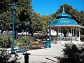
Valdivia is often promoted for its unique characteristics, that make it different from other cities in Chile: Valdivia has an early Spanish colonial past, plus a later history of German colonization. Both eras left visible landmarks such as the forts of Corral Bay and the German-style wood houses. The governments of Spain and Germany currently maintain honorary consulates in Valdivia. The city is commonly seen as a tourist magnet in Chile, and sometimes described as La Perla del Sur (The Pearl of the South) and as La ciudad mas linda de Chile (Chile's most beautiful city). Every year during the summer months of January and February the municipality organizes many free cultural events along the river site, such as concerts, sporting events, and other entertainment. To mark and celebrate the end of the touristic summer months, halfway through February all entertainment reaches its climax with the celebration of noche Valdiviana (Valdivian night). During this night many local groups and communities present themselves on boats during a night parade over the river. Every boat has its own theme related with one theme of that year. At the end a jury picks the winners in different categories. The parade is by tradition started by a boat which presents la reina de los ríos. In recent years Valdivians have showed an increasing interest in nature and
Valdivia's varied influences are reflected by its multicultural
Spanish colonial influences
During much of the colonial period, Valdivia was essentially a military camp, a walled city surrounded by hostile natives. The coastal defenses and their garrisons made up a large part of the population. After several fires and earthquakes, nearly all buildings from this period were destroyed, with the exception of the military defenses. Valdivia's best known historical landmarks are now the two towers which were part of a former city wall, built by the Spaniards to defend the city, known as Torreones: Torreón Los Canelos and Torreón del Barro.
German influences

Since the first
German immigrants and their descendants formed their social club Club Alemán, which after World War II changed names to Club la Unión. German workers once had their own club simply called El Alemán (The German).
Valdivia also hosts Bierfest Valdivia, a celebration that could be described as a small, regional Oktoberfest, despite being celebrated in late January or February of every year (during the local summer, when there is the largest influx of tourists). The main sponsor and organizer is Kunstmann, a local beer company, founded by German nationals, but since bought out by the largest beer and beverages company in Chile (CCU).
Literature
The Valdivia Book Fair is organized annually by the Municipal Cultural Corporation in Parque Saval.[25] Likewise, the Society of Writers of Chile, through its subsidiary Valdivia and with the collaboration of the Austral University of Chile, regularly holds literary gatherings, a space in which books are presented and local letters are shared with the student community.[26] Several authors born in the Los Ríos Region also stand out in the city, such as Maha Vial,[27] Iván Espinoza Riesco,[28] José Baroja,[29] Aldo Astete Cuadra,[30] Efraín Miranda Cárdenas, among others.
Demographics
According to the 2002 census of the National Statistics Institute, the commune of Valdivia spans an area of 1,015.6 km2 (392 sq mi) and has 140,559 inhabitants (68,510 men and 72,049 women). Of these, 129,952 (92.5%) lived in urban areas and 10,607 (7.5%) in rural areas. Between the 1992 and 2002 censuses, the population grew by 15.1% (18,391 persons).[3]
The city of Valdivia spans 42.39 km2 (16 sq mi) had a population of 127,750 and 35,217 homes, giving it a population density of 3,013.7/km2 (7,805/sq mi). The commune is divided into 19 census districts with one recognized town, Niebla, with an area of 1.55 square kilometers (0.60 sq mi), population of 2,202 (in 1,169 homes) and population density of 1,420.6/km2 (3,679/sq mi).[3]
Within the population, the presence of descendants of migrants of German origin and of Spanish origin also stands out, colonies that are grouped into different social, educational, sports and cultural institutions.
Arts and Scientific research
The Southern University of Chile (
- Agronomy (UACh)
- Biophysics and molecular physiology (CECS)
- Ecology (UACh)
- Forestry (UACh)
- Glaciology (CECS)
- Physics (CECS)
- Veterinary (UACh)
The city is surrounded by many nature reserves and large areas of forest plantations, wetlands and
Trivia
In addition to being known as the City of Rivers, Valdivia has also been called The pearl of the South, The key of the South seas, Gibraltar of the Pacific, and Chile's most beautiful city. The nickname Valdilluvia is a mix of the Spanish word for rain – lluvia and Valdivia referring to the rainy climate of the city.
Geography

As part of the
Parts of city is built on poor soils made up of former wetlands or artificial fills that are prone to suffer during earthquakes as demonstrated in 1960 and 2010.[31]
Geology
Within the context of

A
Climate
Valdivia has an
During the summer months (December, January and February) the average temperature is about 17 °C (63 °F), while in winter the temperature descends to 8.5 °C (47.3 °F). The annual average temperature for
Decreasing precipitation has caused the city's water supply in Calle-Calle River to be contaminated with saline water from the coast.[36] The effects of saline water entering the water supply of Valdivia were particularly noticeable in March 2015 when there was a surge in complains about the taste of the water.[36][37] The saltwater in the rivers near Valdivia during autumn is expected to increase in the future.[37] Estimations indicate that whenever the sum of the water discharge of Cruces and Calle-Calle rivers falls below 74 m3/s (2,600 cu ft/s) saltwater reaches the supply site at Cuesta Soto.[37]
| Climate data for Valdivia, Chile (Pichoy Airport) 1991–2020, extremes 1966–present | |||||||||||||
|---|---|---|---|---|---|---|---|---|---|---|---|---|---|
| Month | Jan | Feb | Mar | Apr | May | Jun | Jul | Aug | Sep | Oct | Nov | Dec | Year |
| Record high °C (°F) | 35.2 (95.4) |
38.5 (101.3) |
32.0 (89.6) |
27.5 (81.5) |
21.2 (70.2) |
18.2 (64.8) |
19.2 (66.6) |
20.0 (68.0) |
25.9 (78.6) |
29.2 (84.6) |
31.2 (88.2) |
33.2 (91.8) |
38.5 (101.3) |
| Mean daily maximum °C (°F) | 24.0 (75.2) |
24.1 (75.4) |
21.5 (70.7) |
17.0 (62.6) |
13.5 (56.3) |
11.0 (51.8) |
10.8 (51.4) |
12.4 (54.3) |
14.8 (58.6) |
16.9 (62.4) |
19.2 (66.6) |
21.8 (71.2) |
17.3 (63.1) |
| Daily mean °C (°F) | 16.4 (61.5) |
16.3 (61.3) |
14.5 (58.1) |
11.7 (53.1) |
9.8 (49.6) |
8.0 (46.4) |
7.4 (45.3) |
8.3 (46.9) |
9.4 (48.9) |
11.1 (52.0) |
13.0 (55.4) |
15.0 (59.0) |
11.7 (53.1) |
| Mean daily minimum °C (°F) | 8.8 (47.8) |
8.5 (47.3) |
7.5 (45.5) |
6.3 (43.3) |
6.0 (42.8) |
5.0 (41.0) |
4.0 (39.2) |
4.2 (39.6) |
4.1 (39.4) |
5.3 (41.5) |
6.8 (44.2) |
8.2 (46.8) |
6.2 (43.2) |
| Record low °C (°F) | −0.7 (30.7) |
−0.2 (31.6) |
−1.9 (28.6) |
−3.8 (25.2) |
−6.0 (21.2) |
−6.8 (19.8) |
−7.2 (19.0) |
−5.2 (22.6) |
−5.0 (23.0) |
−3.0 (26.6) |
−1.4 (29.5) |
0.0 (32.0) |
−7.2 (19.0) |
| Average precipitation mm (inches) | 40.5 (1.59) |
39.1 (1.54) |
68.0 (2.68) |
125.0 (4.92) |
231.5 (9.11) |
329.3 (12.96) |
265.0 (10.43) |
241.8 (9.52) |
123.4 (4.86) |
107.3 (4.22) |
84.7 (3.33) |
66.8 (2.63) |
1,722.4 (67.81) |
| Average precipitation days (≥ 1.0 mm) | 4.7 | 4.7 | 7.1 | 10.5 | 14.7 | 18.8 | 17.0 | 16.8 | 12.0 | 11.9 | 8.7 | 7.1 | 134.1 |
| Average relative humidity (%)
|
63 | 64 | 72 | 80 | 87 | 89 | 87 | 83 | 76 | 72 | 68 | 65 | 76 |
| Mean monthly sunshine hours | 295.8 | 259.7 | 211.2 | 127.9 | 71.6 | 46.8 | 70.6 | 100.3 | 151.0 | 194.6 | 219.3 | 262.7 | 2,011.5 |
| Source 1: Dirección Meteorológica de Chile (humidity 1970–2000)[38][39][40] | |||||||||||||
| Source 2: NOAA (precipitation days 1991–2020)[41]
| |||||||||||||
Government and politics
The commune of Valdivia is a third-level
Within the
The creation of
Ecological action
In response to the alleged contamination of Cruces River by the Celco cellulose pulp mill, a group of citizens formed the Accion por los Cisnes (Action for the Swans) ecology group. Action for the Swans attracted the attention of the national newspapers and succeeded in temporarily closing down Valdivia Pulp Mill through a court order.[42]
Economy and tourism
The city and commune of Valdivia rely heavily on
Tourism
Valdivia is a historic tourist destination in Chile, valued for the beauty of the city and surrounding areas, the area's culture and its history. It is an all season city, but during the summer months in particular (December, January, February) tourism is a major source of income for Valdivia's economy. "Valdivian Week" (Spanish: Semana Valdiviana), as it has been known since 1917, is a long-held tradition that dates back to the foundation of the city. Starting February 9 each year,[46] it commemorates the city's anniversary and also gives Valdivia the chance to promote itself as a tourism center. "Semana Valdiviana" features an allegorical parade of ships – a tradition that began in the seventeenth century as a protest against the Spaniard authorities – and also includes a big artisan market, fairground rides, and the election of the "queen" of Los Rios. The week ends with fireworks and theatre performances on the closing night, known as "Noche Valdiviana" (Valdivian Night). The center of the city has a rich architectural heritage. One of its most visited buildings is the "Mercado Municipal" ("municipal market"),[47] a local produce market that is also now a gastronomic and cultural attraction. Also popular are the "Convento San Francisco" (Saint Francis Convent) and the European-style buildings dating back to the beginning of the 20th century, used today by the city's universities, cultural centers and government.

Education
Universities and colleges
Valdivia is home to several public and private
Schools
Like in the rest of Chile, most of Valdivia's best schools are private. Instituto Alemán Carlos Anwandter (Deutsche Schule Valdivia) founded in 1858 is Chile's second oldest German school after the Instituto Alemán de Osorno (1854). Other notable private schools are Windsor School and Colegio San Luis de Alba. Among public schools Instituto Salesiano de Valdivia, Liceo Rector Armando Robles Rivera and Liceo Comercial have reached good results.
Sports
Facilities for playing football, tennis, rowing, rugby, golf, indoor swimming, indoor and outdoor basketball and some other sports are available throughout the area. Rowing is practiced in Valdivia in three clubs: Club Deportivo Phoenix Valdivia, Club Centenario de Remeros and Club Arturo Prat. Valdivian rowers Cristian Yantani and Miguel Cerda won the first place in Men's Lightweight Coxless Pair-Oared Shells at the world championship in Seville, 2002.[48]
The football club
Transport
Roads and bridges

Most of Valdivia lies on the southern side of the
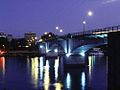
Calle-Calle Bridge, the first bridge built in the city, connects Valdivia with Las Animas and forms the northern highway access to the city.

The new Caucau bridge was intended to provide a faster route from the city centre to the Pichoy airport via Isla Teja, but the faulty construction made it unusable.
Waterways
Until highway bridges were built, Valdivia's economy and citizens depended on boat traffic on the surrounding rivers, but with a contraction of bridges and highways, the river has lost its importance. Today, the rivers are used by the commercial ships built or repaired in Asenav, one of Chile's most important shipyard companies, and by tourist boats. Some of the locations that are regularly reached by tourist boats include Mancera Island and Punucapa. Fishing boats also travel inland from the coast to the River Market. Today, just one ferry is still in operation, the Niebla–Corral line, as it is much quicker to reach Corral by ferry than by road.
Although in recent years the rivers have not had a major role in Valdivia's public transportation, a new private project is being developed by "Los Solares",[51] an environmentally friendly company that operates solar-powered river taxis on Valdivia River. The project is called Transporte Fluvial Sustentable (TFS, or "Sustainable Water Transportation" in English). So far, the company has a fleet of three river taxis,[52] and a small, sustainable and locally designed floating village that includes a pier, a café and the company's offices. The community produces its own electricity, water supply and processes its own wastewater with a bacterial solution.[53]
Airports
The city is served mainly by
Twin towns – sister cities
| Country | City | State / Region | Since |
|---|---|---|---|
| Argentina | Neuquén
|
Neuquén Province | 2003 |
| Romania | Cluj-Napoca | Cluj County | 2009 |
| United States | Mount Pleasant | Michigan | |
| United States | Tacoma | Washington
|
|
| Australia | Hobart[54] | Tasmania | |
| Germany | Hamburg | Hamburg | |
| Spain | Ateca | Aragon |
Gallery
-
 Haverbeck Canal
 -
 Libertad Walk & Valdivia cathedral
 -
 Isla Teja and Torobayo connected by the Río Cruces Bridge
 -
-
 UAChBotanical Garden
 -
 Plaza de la República
 -
 Sea lions by the riverside market
 -
 An obelisk
 -
 Universidad Austral de Chilehousing
 -
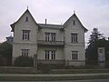 A German-styled house on General Lagos Street
 -
 Haverbeck Canal of the Valdivia River
 -
 Valdivia, Chile


See also
- Ecotourism in the Valdivian Temperate Rainforest
- Flag of Valdivia
- Iglesia San Francisco de Valdivia
- Pilolcura
- Punucapa
- Valdivian Coastal Reserve
References
This article incorporates text from a publication now in the public domain: Chisholm, Hugh, ed. (1911). "Valdivia". Encyclopædia Britannica. Vol. 27 (11th ed.). Cambridge University Press. p. 844.
- ^ "Asociación Chilena de Municipalidades" (in Spanish). Archived from the original on 19 April 2011. Retrieved 23 February 2011.
- ^ "Municipality of Valdivia" (in Spanish). Archived from the original on 18 October 2000. Retrieved 23 February 2011.
- ^ a b c d e "National Statistics Institute" (in Spanish). Archived from the original on 6 January 2019. Retrieved 7 February 2010.
- ^ "Censo 2017: Primera entrega de resultados definitivos - Cantidad de personas por sexo y edad" (in Spanish). National Statistics Institute. 2019. Archived from the original on 2 January 2018. Retrieved 1 November 2020.
- ^ "Ciudades, pueblos, aldeas y caceríos 2019" (PDF) (in Spanish). National Statistics Institute. 2019. Archived (PDF) from the original on 13 July 2019. Retrieved 1 November 2020.
- ^ a b c "The Defensive Complex of Valdivia". Entry on the UNESCO Tentative List. Archived from the original on 27 December 2022. Retrieved 15 August 2007.
- ^ a b U.S. Geological Survey (March 7, 2006). Historic Earthquakes – Chile – 1960 May 22 19:11:14 UTC – Magnitude 9.5: The Largest Earthquake in the World. Archived 2009-10-07 at the Wayback Machine Retrieved on 2007-01-09
- ^ Ramirez, C., E. Carrasco, S. Mariani & N. Palacios. 2006. La desaparición del luchecillo (Egeria densa) del Santuario del Rio Cruces (Valdivia, Chile): una hipótesis plausible. Ciencia & Trabajo, 20: 79-86
- Government of Chile. Archivedfrom the original on 2 March 2021. Retrieved 4 April 2021.
- ^ Vallejos, Gabriel; Salgado, Daniela (10 December 2021). "Reconocen como humedales urbanos a Angachilla y el sector de Isla Teja en Valdivia]". Radio Bío-Bío (in Spanish). Archived from the original on 2 March 2022. Retrieved 3 March 2022.
- Dillehay, Tom, Monteverde: A Late Pleistocene Settlement in Chile (Smithsonian Institution Press, Washington, 1989)
- ^ Pino, Mario and Navarro, Rayen. "Geoarqueología del sitio arcaico Chan-Chan 18" Archived 2012-09-26 at the Wayback Machine (in Spanish). Revista Geológica de Chile, 2005.
- ^ "Was Jōmon the origin of the Valdivia culture? • Neperos". Neperos.com.
- ^ a b c d
- ^ a b c Mariño de Lobera, Pedro, Crónica del reino de Chile, Colección de historiadores de Chile, Imprenta del Ferrocarril, 1865. Available in www.memoriachilena.cl
- ^ Guarda, Gabriel. Nueva historia de Valdivia (Editorial Universidad Católica de Chile, Santiago, 2001)
- ^ a b c d e f g h i j k l m "Breve Historia de Valdivia". Editorial Francisco de Aguirre. 1971. Archived from the original on 18 February 2007. Retrieved 17 September 2007.
- ^ Jerónimo de Vivar – Crónica y relación copiosa y verdadera de los reynos de Chile – Ended in 1558. Transcription of Irving Leonard published by Fondo Histórico y Bibliográfico José Toribio Medina, Santiago de Chile, 1966
- ^ a b c "Historia". Museo de Sitio Castillo de Niebla (in Spanish). Servicio Nacional del Patrimonio Cultural. Archived from the original on 4 August 2020. Retrieved 7 April 2020.
- from the original on 16 May 2020. Retrieved 27 December 2019.
- ^ Couyoumdjian, Juan Ricardo (2009). "Reseña de "La frontera de arriba en Chile colonial. Interacción hispano-indígena en el territorio entre Valdivia y Chiloé e imaginario de sus bordes geográficos, 1600–1800" de MARÍA XIMENA URBINA CARRASCO" (PDF). Historia. I (42): 281–283. Archived (PDF) from the original on 20 December 2016. Retrieved 30 January 2016.
- ^ Otero, Luis, La Huella del Fuego: Historia de los bosques y cambios en el paisaje del sur de Chile (Valdivia, Editorial Pehuen)
- UACh.
- ^ Bernales Lillo, Mario (1984). "Aspectos diacrónicos en la toponimia de Valdivia". Anales de la Universidad de Chile (in Spanish). 5 (5): 79–94. Archived from the original on 24 February 2017. Retrieved 23 February 2017.
- ^ "Todo lo que necesitas saber sobre la 29° Feria del Libro de Valdivia". Diario Futrono (in Spanish). Archived from the original on 3 December 2022. Retrieved 16 June 2022.
- ^ "Invitan a nueva tertulia literaria Tren de letras bajo la lluvia". Universidad Austral de Chile. Archived from the original on 18 May 2022. Retrieved 16 June 2022.
- ^ Marimón, Guido Macari (27 October 2020). "Muere la poeta y actriz Maha Vial". La Tercera. Archived from the original on 16 June 2022. Retrieved 16 June 2022.
- ^ "Iván Espinoza Riesco". comunidadcreativalosrios.cultura.gob.cl. Archived from the original on 18 August 2022. Retrieved 16 June 2022.
- ^ Fernández, Antonio Cazás. ""La escritura le aportó sentido, coherencia e identidad a mi vida"". www.elcorreogallego.es (in European Spanish). Archived from the original on 17 May 2022. Retrieved 16 June 2022.
- ^ "Aldo Astete Cuadra – El Ser que acecha entre la Lluvia". comunidadcreativalosrios.cultura.gob.cl. Archived from the original on 16 June 2022. Retrieved 16 June 2022.
- hdl:10045/34749.
- from the original on 7 August 2018. Retrieved 7 August 2018.
- ^ Astorga, G. and Pino, M. (2011). "Fossil leaves from the last interglacial in Central-Southern Chile: Inferences regarding the vegetation and paleoclimate" Archived 2016-12-02 at the Wayback Machine. Geologica Acta. 9 (1): 45–54.
- ^ from the original on 8 March 2022. Retrieved 8 March 2022.
- ^ a b c d Dirección Meteorológica de Chile Archived 2008-02-29 at the Wayback Machine (in Spanish)
- ^ a b Jara, Yonatan; Stuardo, Manuel (21 September 2020). "Científicos proyectan en 80 años la llegada de mar a toma de agua en Valdivia para buscar soluciones". Radio Bío-Bío (in Spanish). Archived from the original on 8 March 2022. Retrieved 7 March 2022.
- ^ a b c Lara, Emilio (16 September 2020). "El mar se acerca a principal toma de agua dulce en Valdivia y amenaza calidad del recurso". Radio Bío-Bío (in Spanish). Archived from the original on 8 March 2022. Retrieved 7 March 2022.
- ^ "Datos Normales y Promedios Históricos Promedios de 30 años o menos" (in Spanish). Dirección Meteorológica de Chile. Archived from the original on 23 May 2023. Retrieved 23 May 2023.
- ^ "Temperatura Histórica de la Estación Pichoy, Valdivia Ad. (390006)" (in Spanish). Dirección Meteorológica de Chile. Archived from the original on 23 May 2023. Retrieved 23 May 2023.
- ^ "Estadistica Climatologica Tomo II" (PDF) (in Spanish). Dirección General de Aeronáutica Civil. March 2001. Archived from the original (PDF) on March 3, 2016. Retrieved December 25, 2012.
- ^ "Pichoy Valdivia Climate Normals 1991–2020". World Meteorological Organization Climatological Standard Normals (1991–2020). National Oceanic and Atmospheric Administration. Archived from the original on 6 August 2023. Retrieved 6 August 2023.
- ^ Forbes List of Billionaires 2006
- ^ INSTITUTO NACIONAL DE ESTADÍSTICAS DIRECCIÓN REGIONAL DE LOS RÍOS Archived 2016-03-04 at the Wayback Machine (in Spanish) INSTITUTO NACIONAL DE ESTADÍSTICAS DIRECCIÓN REGIONAL DE LOS RÍOS. October 2010. Retrieved February 22, 2014.
- ^ "Gobierno de Chile". Gobiernodechile.cl. Archived from the original on 7 February 2012. Retrieved 22 May 2012.
- ^ El Indicador de Actividad Económica Regional (INACER) presentó alza de 3,4% respecto a doce meses Archived 2015-02-09 at the Wayback Machine (in Spanish). February 18, 2014. Retrieved February 22, 2014.
- ^ CULTURA E IDENTIDAD DE VALDIVIA Archived 2014-04-25 at the Wayback Machine (in Spanish). munivaldivia.cl. Retrieved February 18, 2014.
- ^ "Mercado Municipal de Valdivia". Archived from the original on 25 April 2014. Retrieved 24 April 2014.
- ^ "World Rowing Medalists". Archived from the original on 5 December 2012. Retrieved 5 December 2012.
- ^ DIMAYOR Archived 2011-07-07 at the Wayback Machine (in Spanish)
- ISBN 9781841620763.
- ^ Rutas de Los Solares Transportes TFS Archived 2014-04-25 at the Wayback Machine Solaresdevaldivia.cl retrieved on February 17, 2014
- ^ Barrio Flotante en Valdivia ya está en marcha Archived 2014-04-25 at the Wayback Machine elnaveghable.cl January 27, 2013
- ^ Valdivia’s River neighbourhood Short documentary with English subtitles Archived 2014-04-25 at the Wayback Machine www.livingatlaschile.com released on February 18, 2014 retrieved on February 23, 2014
- ^ CSRIO, AGSO - Marine And Petroleum Division, South Pacific Continental Report Annual 1998, p23
Notes
Sources
- Francisco Solano Asta-Buruaga y Cienfuegos, Diccionario geográfico de la República de Chile (Geographic dictionary of the Republic of Chile), SEGUNDA EDICIÓN CORREGIDA Y AUMENTADA, NUEVA YORK, D. APPLETON Y COMPAÑÍA, 1899. pg. 859–862 Valdivia – Ciudad
- Brüggen, Juan. Fundamentos de la geología de Chile, Instituto Geográfico Militar 1950.
External links
https://www.munivaldivia.cl/web/
- (in Spanish) Ilustre Municipalidad de Valdivia
- (in Spanish) Diario Austral de Valdivia, Valdivian newspaper
- (in Spanish) Geology and geomorphology of Valdivia and Los Ríos Region
- (in Spanish) Museo de Arte Contemporanea (MAC) Archived 11 October 2011 at the Wayback Machine, a modern art museum
- (in Spanish) Museo Fuerte Niebla, Niebla fort's museum
- (in Spanish) Museo Philippi, a museum about the naturalist Rodolfo Armando Philippi
- (in Spanish) La Librería de Valdivia Archived 21 July 2009 at the Wayback Machine, biggest bookstore in south of Chile
- (in Spanish) Panorámicas de Valdivia en 360°
- (in Spanish) Valdivia
- (in Spanish) Museo de las Telecomunicaciones
- (in Spanish) Anime related internet forum made in Valdivia
- Alwoplast, Valdivian designer/builder of custom catamarans
- Cerveza Kunstmann, local beer maker
- Valdivia Guide, an introductory guide for moving to Valdivia and Chile
| International | |
|---|---|
| National | |
| Geographic | |
| Other | |