
Vieux-Port
Vieux-Port | |
|---|---|
 Town hall of Vieux-Port | |
Location of Vieux-Port  | |
 Vieux-Port  Vieux-Port | |
| Coordinates: 49°25′36″N 0°36′30″E / 49.4267°N 0.6083°E | |
| Country | France |
| Region | Normandy |
| Department | Eure |
| Arrondissement | Bernay |
| Canton | Bourg-Achard |
| Intercommunality | Roumois Seine |
| Government | |
| • Mayor (2020–2026) | Frédéric Cardon[1] |
| Area 1 | 0.57 km2 (0.22 sq mi) |
| Population (2021)[2] | 48 |
| • Density | 84/km2 (220/sq mi) |
| Time zone | UTC+01:00 (CET) |
| • Summer (DST) | UTC+02:00 (CEST) |
| INSEE/Postal code | 27686 /27680 |
| Elevation | 0–70 m (0–230 ft) (avg. 12 m or 39 ft) |
| 1 French Land Register data, which excludes lakes, ponds, glaciers > 1 km2 (0.386 sq mi or 247 acres) and river estuaries. | |
Vieux-Port (French pronunciation: [vjø pɔʁ]) is a commune in the Eure department and Normandy region of France.
Population
| Year | Pop. | ±% |
|---|---|---|
| 1962 | 66 | — |
| 1968 | 76 | +15.2% |
| 1975 | 66 | −13.2% |
| 1982 | 56 | −15.2% |
| 1990 | 42 | −25.0% |
| 1999 | 58 | +38.1% |
| 2008 | 61 | +5.2% |
Gallery
-
 Saint-Michel church
 -
 Interior of the church
 -
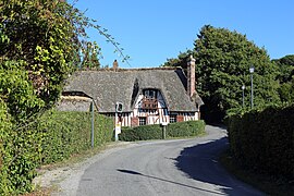 Main street
 -
 Cemetery cross
 -
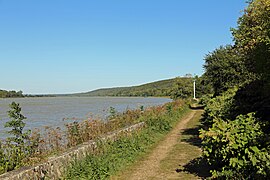 The Seine river at Vieux-Port


See also
References
- ^ "Répertoire national des élus: les maires" (in French). data.gouv.fr, Plateforme ouverte des données publiques françaises. 13 September 2022.
- ^ "Populations légales 2021". The National Institute of Statistics and Economic Studies. 28 December 2023.
Wikimedia Commons has media related to Vieux-Port (Eure).
| Authority control databases: National |
|---|
This Eure geographical article is a stub. You can help Wikipedia by expanding it. |