
Walden, Colorado
Walden, Colorado | ||
|---|---|---|
FIPS code 08-82130 | | |
| GNIS feature ID | 2413440[5] | |
| Website | Official website | |
Walden is the
2020 census.[6] The town sits at an elevation of 8,099 feet (2,469 meters). It was established in 1889 and was incorporated 2 December 1890.[3] Mark A. Walden, an early postmaster, gave the community his name.[9]
Geography
According to the United States Census Bureau, the town has a total area of 0.3 square miles (0.78 km2), all of it land.
Climate
Due to its elevation, Walden has a
subalpine climate (Köppen climate classification Dfc). The hottest temperature recorded in Walden was 94 °F (34 °C) on July 6, 1989, August 1, 2000 and July 15, 2002, while the coldest temperature recorded was −48 °F (−44 °C) on January 12, 1963, February 2, 2011 and January 6, 2017.[10]
| Climate data for Walden, Colorado, 1991–2020 normals, extremes 1897–present | |||||||||||||
|---|---|---|---|---|---|---|---|---|---|---|---|---|---|
| Month | Jan | Feb | Mar | Apr | May | Jun | Jul | Aug | Sep | Oct | Nov | Dec | Year |
| Record high °F (°C) | 56 (13) |
54 (12) |
70 (21) |
74 (23) |
84 (29) |
92 (33) |
94 (34) |
94 (34) |
89 (32) |
78 (26) |
66 (19) |
58 (14) |
94 (34) |
| Mean maximum °F (°C) | 43.6 (6.4) |
45.9 (7.7) |
56.5 (13.6) |
66.2 (19.0) |
75.4 (24.1) |
82.1 (27.8) |
86.9 (30.5) |
85.0 (29.4) |
80.2 (26.8) |
70.8 (21.6) |
57.1 (13.9) |
46.4 (8.0) |
86.9 (30.5) |
| Mean daily maximum °F (°C) | 26.7 (−2.9) |
29.6 (−1.3) |
38.6 (3.7) |
47.4 (8.6) |
58.1 (14.5) |
68.8 (20.4) |
76.1 (24.5) |
74.1 (23.4) |
66.4 (19.1) |
52.9 (11.6) |
38.3 (3.5) |
27.7 (−2.4) |
50.4 (10.2) |
| Daily mean °F (°C) | 14.3 (−9.8) |
17.0 (−8.3) |
25.8 (−3.4) |
33.7 (0.9) |
42.9 (6.1) |
51.7 (10.9) |
57.3 (14.1) |
55.2 (12.9) |
47.9 (8.8) |
36.8 (2.7) |
25.1 (−3.8) |
15.4 (−9.2) |
35.3 (1.8) |
| Mean daily minimum °F (°C) | 1.9 (−16.7) |
4.4 (−15.3) |
13.1 (−10.5) |
20.0 (−6.7) |
27.6 (−2.4) |
34.5 (1.4) |
38.4 (3.6) |
36.3 (2.4) |
29.4 (−1.4) |
20.7 (−6.3) |
11.8 (−11.2) |
3.2 (−16.0) |
20.1 (−6.6) |
| Mean minimum °F (°C) | −22.2 (−30.1) |
−19.7 (−28.7) |
−8.4 (−22.4) |
4.9 (−15.1) |
15.5 (−9.2) |
27.5 (−2.5) |
32.4 (0.2) |
28.9 (−1.7) |
17.4 (−8.1) |
2.1 (−16.6) |
−10.4 (−23.6) |
−21.2 (−29.6) |
−28.9 (−33.8) |
| Record low °F (°C) | −48 (−44) |
−48 (−44) |
−34 (−37) |
−16 (−27) |
2 (−17) |
17 (−8) |
21 (−6) |
19 (−7) |
5 (−15) |
−28 (−33) |
−32 (−36) |
−39 (−39) |
−48 (−44) |
| Average precipitation inches (mm) | 0.58 (15) |
0.64 (16) |
0.72 (18) |
1.14 (29) |
1.53 (39) |
1.21 (31) |
1.34 (34) |
1.27 (32) |
1.34 (34) |
0.98 (25) |
0.75 (19) |
0.62 (16) |
12.12 (308) |
| Average snowfall inches (cm) | 9.3 (24) |
9.0 (23) |
7.7 (20) |
10.1 (26) |
3.8 (9.7) |
0.5 (1.3) |
0.0 (0.0) |
0.0 (0.0) |
1.0 (2.5) |
6.0 (15) |
9.5 (24) |
10.2 (26) |
67.1 (171.5) |
| Average precipitation days (≥ 0.01 in) | 7.9 | 8.1 | 7.3 | 9.4 | 10.3 | 7.7 | 9.9 | 10.6 | 8.3 | 7.3 | 7.8 | 8.3 | 102.9 |
| Average snowy days (≥ 0.1 in) | 8.3 | 8.5 | 6.2 | 6.7 | 2.6 | 0.3 | 0.0 | 0.0 | 0.7 | 3.6 | 7.3 | 8.8 | 53.0 |
| Source 1: NOAA[11] | |||||||||||||
| Source 2: National Weather Service[10] | |||||||||||||
Demographics
| Census | Pop. | Note | %± |
|---|---|---|---|
| 1890 | 64 | — | |
| 1900 | 141 | 120.3% | |
| 1910 | 162 | 14.9% | |
| 1920 | 260 | 60.5% | |
| 1930 | 284 | 9.2% | |
| 1940 | 668 | 135.2% | |
| 1950 | 696 | 4.2% | |
| 1960 | 809 | 16.2% | |
| 1970 | 907 | 12.1% | |
| 1980 | 947 | 4.4% | |
| 1990 | 890 | −6.0% | |
| 2000 | 734 | −17.5% | |
| 2010 | 608 | −17.2% | |
| 2020 | 606 | −0.3% | |
| U.S. Decennial Census | |||
Transportation
OATS (Older Americans Transport Service) provides seniors with transportation to
Steamboat Springs, CO and to Denver International Airport
.
See also
References
- ^ a b c "Active Colorado Municipalities". State of Colorado, Department of Local Affairs. Archived from the original on December 12, 2009. Retrieved September 1, 2007.
- State of Colorado, Department of Public Health and Environment. Retrieved December 31, 2007.
- ^ a b "Colorado Municipal Incorporations". State of Colorado, Department of Personnel & Administration, Colorado State Archives. December 1, 2004. Retrieved September 2, 2007.
- ^ "2019 U.S. Gazetteer Files". United States Census Bureau. Retrieved July 1, 2020.
- ^ a b U.S. Geological Survey Geographic Names Information System: Walden, Colorado
- ^ a b United States Census Bureau. "Walden town; Colorado". Retrieved April 23, 2023.
- ^ "ZIP Code Lookup". United States Postal Service. Archived from the original (JavaScript/HTML) on November 22, 2010. Retrieved January 8, 2008.
- ^ "Find a County". National Association of Counties. Retrieved June 7, 2011.
- ^ Dawson, John Frank (1954). Place names in Colorado: why 700 communities were so named, 150 of Spanish or Indian origin. Denver, CO: The J. Frank Dawson Publishing Co. p. 51.
- ^ a b "NOAA Online Weather Data". National Weather Service. Retrieved September 9, 2022.
- ^ "U.S. Climate Normals Quick Access". National Oceanic and Atmospheric Administration. Retrieved September 9, 2022.
External links
Wikimedia Commons has media related to Walden, Colorado.
Municipalities and communities of Jackson County, Colorado, United States | ||
|---|---|---|
| Town | 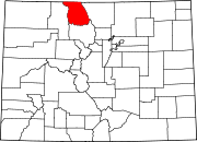 | |
| Unincorporated communities | ||
| ||
| International | |
|---|---|
| National | |