
Washington Street (Boston)
I-90 in Boston | |
| North end | Court Street in Boston |
|---|---|
Washington Street is a street originating in downtown Boston, Massachusetts, which extends southwestward to the Massachusetts–Rhode Island state line. The majority of its length outside of the city was built as the Norfolk and Bristol Turnpike in the early 19th century. It is the longest street in Boston and remains one of the longest streets in the Commonwealth of Massachusetts.[1] Due to various municipal annexations with the city of Boston, the name Washington Street now exists 6 or more times within the jurisdiction(s) of the City of Boston.
The street's great age in the city of Boston has given rise to a phenomenon whereby intersecting streets have different names on either side of Washington Street.
History

Until 1803 and the commencement of large-scale infilling of Boston Harbor and Back Bay, the town lay at the end of a peninsula less than a hundred feet wide at its narrowest point.[2] This was the waist of the strip of land known as Boston Neck. Originally a single street traversed the Neck, joining peninsular Boston to the mainland. This was termed Orange or South-End Street. The route served as the first leg of the Boston Post Road to New York City. Starting in 1631 the narrowest waist of that isthmus was cut to make the town more defensible. To this end fortifications south of Boston were built to control the Post Road, both on the mainland and just beyond the man-made canal cutting through Boston Neck at what is now Back Bay (see map at right). These fortifications were gradually improved over the years, and considerably expanded by the British as the movement for colonial independence moved from widespread discontent to frank military revolution.
In 1789 the name "Washington Street" was given to the section of this road running from the border with
The name "Washington Street" was extended on July 6, 1824 to include the roads leading north to
- Orange Street, from the fortification to Essex Street/Boylston Street[4]
- Newbury Street, from Essex Street/Boylston Street to Summer Street/Winter Street
- Marlborough Street, from Summer Street/Winter Street to School Street
- Cornhill, from School Street to Dock Square

Nine months later the name "Washington Street" was extended again. On May 9, 1825 the roads connecting Boston's town line to present-day Roxbury Street in
For a period of time afterwards, Washington Street extended westward from Dudley Square to the border with
In Boston, Washington Street was extended northward along a new road to
Charlestown Street, which began in Haymarket Square (where Washington Street ended) and continued northward to the Charlestown Bridge, was renamed North Washington Street on March 1, 1901. The name of the bridge itself was changed to North Washington Street on February 10, 1910.[6]

The first state highway in Boston was the part of Washington Street from Dedham to West Roxbury Parkway (at Lagrange Street). It was taken over by the Massachusetts Department of Public Works in 1908.[7] The short piece in West Roxbury Parkway, to just north of the road through the parkway, was taken over in 1921;[8] the next state highway in Boston was the Southern Artery in 1926.[9]
Norfolk and Bristol Turnpike
In 1802,
It served as a straighter alternative to two roads between Boston and
Extent and description

Washington Street begins at State and
At
Southbound traffic must use short sections of South Street and Poplar Street at Roslindale Square. South of there, near the border between
Washington Street continues southwestward, through the center of Dedham, the outskirts of
Numbered routes
Washington Street currently has the following route numbers:
- Norwood(except in northern Norwood, where 1A uses Upland Road)
- US Route 1 from northern Foxborough near Gillette Stadium to Rhode Island, except through North Attleboroughcenter, where US 1 uses East Washington Street
When the first numbered highways in Massachusetts, the
Soon after 1933, the new road (
Between 1949 and 1961, 1A was truncated to end at US 1 via Elm Street south of Dedham center, probably to keep traffic out of Dedham center. US 1 was removed from that alignment in 1989, but 1A still ends at the old route.
Public transportation
As a main road, Washington Street has had its share of
As the West End Street Railway electrified its lines in the late 19th century, Tremont Street was the first north-south arterial in downtown Boston to run electric streetcars. As the lines on Warren Street (December 28, 1889[13]), Blue Hill Avenue (January 18, 1890[14]), and Hampden Street (May 10, 1890[15]) were electrified, they initially used Shawmut Avenue to reach Tremont Street. On September 2, 1890, the line on Washington Street to Forest Hills began electric operation, again using Shawmut Avenue north of Dudley Square.[16] On November 28, 1891, the downtown Washington Street tracks were electrified, with the five Warren Street, Hampden Street, and Blue Hill Avenue routes rerouted to Washington Street. This relieved congestion on the Tremont Street tracks and allowed increases in service.[17]
A later,
The
Other Washington Streets in Boston
There are two significant and two minor streets in Boston with the same name. Addresses at these streets need to be distinguished by neighborhood names or ZIP codes.
- In the western part of Boston, Washington Street begins in Brookline Village, and crosses Brookline, Allston, Brighton, Newton, and Wellesley, ending at Wellesley's boundary with Natick, a total of almost 13.5 miles (21.7 km). It is the main east-west street in Brighton (ZIP Codes: 02135 in Brighton, 02458, 02460, 02462, 02465 and 02466 in Newton, 02445–02446 in Brookline, 02481–02482 in Wellesley) See Route 16.
- In the Dorchester neighborhood, Washington Street extends approximately 2.8 miles (4.5 km) from Blue Hill Avenue near Geneva Avenue to Dorchester Avenue at the southern boundary of the city (ZIP Codes: 02121 and 02124)
- In Hyde Park neighborhood, Washington Street extends approximately seven blocks in the small portion of Hyde Park on the east side of the Neponset River (ZIP Code: 02136).
- In Charlestown neighborhood, Washington Street begins at a dead end near the intersection of Austin Street and New Rutherford Avenue and extends three blocks to Harvard Street (ZIP Code: 02129)
- North Washington extends from the Haymarket neighborhood and proceeds northward where it crosses the Charles River and terminates in Charlestown at the junction with Chelsea Street.
Image gallery
-
 Liberty Tree, 1774
 -
 Lamb Tavern, 18th century
 -
 Disbrow's Riding School, Washington St., 1850s
 -
 Franklin School, 1851
 -
 Locke's Shirt Depot, 1857
 -
 Advertisement for C.J. Maynard & Co., natural history supplies, 1882
 -
 Hewes house, 1860
 -
 Advertisement for Fera's Ice Cream & Dining Saloon, 1868
 -
 M.C. Gay, Clairvoyant and Ecelectic Physician, 1868
 -
 After fire of 1872
 -
 1875
1875 -
 Boylston Market, 19th century
 -
 Washington St., 19th century
 -
 19th century
 -
 19th century
 -
 Macullar, Parker & Co., 1881
 -
 Washington St. As prominent fixture in Old Boston map
 -
 Stereoscopic image by the Bierstadt Brothers
 -
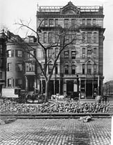 Alexandra Hotel in South end, Washington St. and Mass Ave. Taken in October, 1899.
 -
 A parade on Washington Street, Norwood, c. 1920. Looking north towards Norwood Common (on right in distance)


.jpg)


See also
Former tenants
- Amory Hall, 19th century
- Arcadia Hotel, burned in 1913 killing 28 people
- Beethoven Hall, 1870s
- Bijou Theatre
- Black, J. W. photography studio (c. 1860s+)
- Boston Female Asylum
- Boylston Market
- T.R. Burnham, photographer, 19th century
- Chinese Museum, 19th century
- Columbia Theatre (1891 – c. 1957)
- Fetridge & Co., periodical depot, 19th century
- Globe Theatre (1871)
- Globe Theatre (1903)
- Gordon's Olympia Theatre, 20th century
- Grand Opera House
- A.N. Hardy, photographer, 19th century
- Haytian Bureau of Emigration[18]
- Keith-Albee Boston Theatre(1920s)
- Keith's Theatre(1894–1928)
- S.S. Kilburn, engraver, 19th century
- Lafayette Place Mall
- Liberty Tree
- Melodeon, 19th century
- Park Theatre
- RKO-Bostonmovie theater (1930s–1950s)
- RKO-Keith's Memorialmovie theater (1928–1960s)
- Selwyn's Theatre, 19th century
- South Congregational Church[19]
- Theatre Comique
- White, Smith & Company, music publishers, 19th century
- Whipple's photo studio, 19th century
- White Horse Tavern
References
Notes
- ^ Jamaica Plain Historical Society
- ^ King, Jason (2017-12-13). "Boston's Made Land". Hidden Hydrology. Retrieved 2022-10-19.
- ^ Klein, Christopher (November 8, 2014). "Tracing Washington's steps". The Boston Globe.
- ^ Vintage(early 1800s) map of Boston Neck, showing an "Orange Street" running SW to it from peninsular Boston of the 1770s
- ^ McIntyre, Henry; Friend & Aub; Wagner & M'Guigan (1852). Map of the city of Boston and immediate neighborhood (Map). 1:5,400. Norman B. Leventhal Map & Education Center.
- ^ Boston (Mass.) Board of Street Commissioners (1910). Board of Street Commissioners proceedings (Report). Vol. 40. City of Boston Archives. p. 4.
- MassHighway state highway layout plan 1166
- MassHighway state highway layout plan 1915(November 1, 1921)
- MassHighway state highway layout plan 2384(November 3, 1926)
- ^ Hanson 1976, p. 220.
- ^ Hanson, Robert Brand (1976). Dedham, Massachusetts, 1635-1890. Dedham Historical Society. pp. 220–221.
- ^ a b Hanson 1976, p. 221.
- ^ "By Trolley to Warren St". Boston Globe. December 25, 1889. p. 1 – via Newspapers.com.

- ^ "West End Time Table". Boston Globe. January 18, 1890. p. 6 – via Newspapers.com.
- ^ "New Electric Line". Boston Globe. May 8, 1890. p. 1 – via Newspapers.com.
- ^ "Egleston Square Line". Boston Globe. August 28, 1890. p. 7 – via Newspapers.com.
- ^ "Goodby Old Horse Car". Boston Globe. November 28, 1891. p. 3 – via Newspapers.com.
- OL 6916611M
- ^ "Boston Pulpit". Gleasons Pictorial. 5. Boston, Mass. 1853.
Sources
- Boston (Mass.) Street Laying-out Department (1910). A Record of the Streets, Alleys, Places, Etc. in the City of Boston. pp. 485–486.
- The Boston Atlas (Java)
- Washington Street, The Longest In Boston
- Washington Street: The Mystery is Solved(?)
- Changes to Transit Service in the MBTA district (PDF)
Further reading
- "West side of Washington Street". Gleason's Pictorial. 4. Boston, Mass. 1853.
- "East side of Washington Street". Gleason's Pictorial. 4. Boston, Mass. 1853.
- Bacon, Edwin M. (1913). Washington Street, Old and New: A History in Narrative Form of the Changes Which This Ancient Street Has Undergone Since the Settlement of Boston. Boston: Macullar Parker Co.
External links
 Media related to Washington Street (Boston) at Wikimedia Commons
