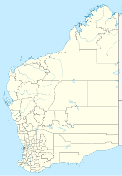
Yeelirrie Station
Yeelirrie is an East Murchison pastoral lease or
The landform at Yeelirrie comprises a raised plateau that has eroded to form granitic breakaways and the alluvial plains of the surrounding valleys.
The area is located toward the inland extreme of two separate weather systems. The main influence on the climate is the east-west belt of high pressure systems that lies over the southern portions of Australia throughout the year. During summer this belt of high pressure systems moves southward and the climate at Yeelirrie becomes influenced by the northern monsoonal system. Rainfall in the area is variable and unpredictable. It occurs either with the passage of winter cold fronts or as a result of local thunderstorms during summer. Average rainfall is 208 mm annually, with a recorded range between 43 mm and 505 mm. Annual extreme temperatures range between 45 °C and −5 °C.[3]
Yeelirrie Station covers an area of 3,750 square kilometres (927,000 acres).
Yeelirrie is the site of the
An environmental impact survey of the station was conducted in 2011 for BHP Billiton; it discovered three new species, one of which is named Atriplex yeelirrie, after the station.[10][11]
In the local
See also
References
- ^ Needham, Stewart (24 November 2009). "Yeelirrie uranium deposit in Western Australia" (PDF). Department of Parliamentary Services, Parliament of Australia. Archived from the original (PDF) on 9 May 2010. Retrieved 30 October 2020.
- ISBN 0-642-59650-6. Retrieved 11 July 2011.
- ^ ISBN 0-89520-423-1
- Department of Conservation & Land Management. January 1979. Retrieved 11 July 2011.
- ^ "Family Notices". Western Mail (Perth, WA : 1885–1954). Perth, WA: National Library of Australia. 11 August 1927. p. 2. Retrieved 12 July 2011.
- ^ "Shearing". Sunday Times (Perth, WA : 1902–1954). Perth, WA: National Library of Australia. 20 August 1950. p. 29 Section: Sporting Section. Retrieved 11 July 2011.
- .
- ^ "Cameco Acquires Yeelirrie Uranium Project In Western Australia". Cameco News Archive. Saskatoon, Canada: Cameco. 26 August 2012. Retrieved 2 February 2017.
- Mining.com. Vancouver BC. Retrieved 2 February 2017.
- S2CID 85903596. Retrieved 22 October 2020.
- ^ Flora and Vegetation Survey Baseline Report (PDF). Brassendean: Western Botanical. February 2011. p. 109. Retrieved 8 June 2021.
- ^ BHP bosses grilled at AGM in Perth perthnow.com.au, published: 16 November 2010. Retrieved 17 February 2011

