
Quebec Route 159
| ||||
|---|---|---|---|---|
| Location | ||||
| Country | Canada | |||
| Province | Quebec | |||
| Major cities | Sainte-Anne-de-la-Pérade, Saint-Tite | |||
| Highway system | ||||
| ||||
Provincial Highway 159 (or Route 159) is a two-lane highway on the north shore of the
Saint Lawrence River in Quebec, Canada. Its northern terminus is in Saint-Roch-de-Mékinac at the junction of Route 155, and the southern terminus is at the junction of Route 138
in Sainte-Anne-de-la-Pérade.
Municipalities along Route 159
- Sainte-Anne-de-la-Pérade
- Saint-Prosper-de-Champlain
- Saint-Stanislas
- Saint-Séverin
- Saint-Tite
- Saint-Roch-de-Mékinac
Photos
-
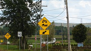 Road signs close to Sainte-Anne-de-la-Pérade
 -
 Rue Principale (route 159), Saint-Prosper
.jpg)

-
 Bridge on Batiscan River, Saint-Stanislas
 -
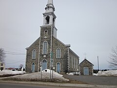 Bld. Saint-Louis (route 159), Parish church, Saint-Séverin
,_en_Mauricie,_au_Qu%C3%A9bec,_au_Canada-_2014-07-06_19-11.jpg)

Major intersections
This article contains a bulleted list or table of intersections which should be presented in a properly formatted junction table. (November 2021) |
| RCM or ET | Municipality | Km | Junction | Notes |
|---|---|---|---|---|
Southern terminus of Route 159
| ||||
Les Chenaux
|
Sainte-Anne-de-la-Pérade
|
0.0 | 138 WEST: to Deschambault-Grondines
| |
| 0.8 1.4 |
40 EAST: to Trois-Rivières
| |||
| 3.4 | 354 EAST: to Saint-Casimir | |||
| Saint-Prosper-de-Champlain | 10.5 | Chemin de la Rivière-à-Veillet | WEST: to Sainte-Geneviève-de-Batiscan
| |
| Saint-Stanislas | 19.9 20.6 |
352 WEST: to Saint-Adelphe
| ||
Mékinac
|
Saint-Tite
|
41.4 42.8 |
153 NORTH: to Hérouxville
| |
Saint-Roch-de-Mékinac
|
61.3 | 155 SOUTH: to Trois-Rives
| ||
Northern terminus of Route 159
| ||||
See also
References
- ^ Ministère des transports, "Distances routières", page 72-73, Les Publications du Québec, 2005
External links
- Interactive Provincial Route Map (Transports Québec) (in French)
- Route 159 on Google Maps
This Quebec road, road transport or highway-related article is a stub. You can help Wikipedia by expanding it. |