
Étoile Cay
Nickname: Lampériaire Cay | |
|---|---|
UTC+4) | |
| ISO code | SC-26 |
| Official website | www |
Étoile Cay is an uninhabited circular
Amirantes group of the Outer Islands of Seychelles, with a distance of 302 km south of Victoria, Seychelles
.
History
Étoile Cay was named after a ship used in Bougainville's famous voyage round the world, from 1766 to 1769. It was explored and named by the Chevalier du Roslan in 1771.
Geography
Étoile Cay lies 29 km northeast of
grass and low shrubs
, fringed by a steep sandy beach. Landing is easy during calm weather.
Administration
The island belongs to Outer Islands District.[1]
Flora & Fauna
The island has been identified as an
Brown noddies (about 1000 pairs). All three species breed in dense colonies during the south-east monsoon
season.
[2]
green and hawksbill sea turtles also nest there.
Image gallery
-
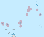
 Map 1
Map 1 -
 District Map


References
- ^ District map
- ^ "Etoile Island". Important Bird Areas factsheet. BirdLife International. 2013. Retrieved 2013-08-18.
External links
| Outer island Groups |  | ||||||||||
|---|---|---|---|---|---|---|---|---|---|---|---|
| Islands and Atolls |
| ||||||||||
This Seychelles location article is a stub. You can help Wikipedia by expanding it. |