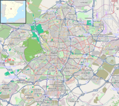
Aeropuerto T4 (Madrid Metro)
Aeropuerto T4 Barajas, Madrid Spain | |||||||||||||||||||||||||
|---|---|---|---|---|---|---|---|---|---|---|---|---|---|---|---|---|---|---|---|---|---|---|---|---|---|
| Coordinates | 40°29′30″N 3°35′37″W / 40.4917613°N 3.5935537°W | ||||||||||||||||||||||||
| Owned by | CRTM | ||||||||||||||||||||||||
| Operated by | CRTM | ||||||||||||||||||||||||
| Construction | |||||||||||||||||||||||||
| Accessible | Yes | ||||||||||||||||||||||||
| Other information | |||||||||||||||||||||||||
| Fare zone | A | ||||||||||||||||||||||||
| History | |||||||||||||||||||||||||
| Opened | 3 May 2007 (metro) 22 September 2011 (Cercanías) | ||||||||||||||||||||||||
| Services | |||||||||||||||||||||||||
| |||||||||||||||||||||||||
| Location | |||||||||||||||||||||||||
Aeropuerto T4 (Airport T1-T2-T3. It is located in fare Zone A.[1]
The Cercanías Madrid station runs in parallel to the Metro and can be seen from one platform to the other.
The station was built along with the civil works of the airport terminal and a train station.

