Alope (Thessaly)
38°52′51″N 22°47′20″E / 38.88083°N 22.78889°E

Alope (
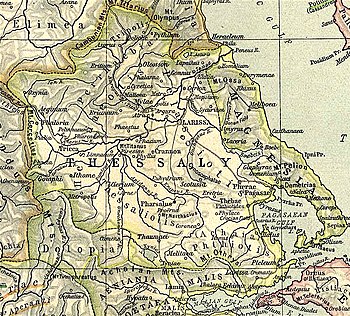
Catalog of Ships.[1][2][3] Strabo distinguishes the town from two others of the same name, Alope in the area of Opuntian Locris and Alope in that of Ozolian Locris.[4][5] The editors of the Barrington Atlas of the Greek and Roman World tentatively locate Alope with the modern village of Fournoi in the municipality of Echinaioi.[6]
References
- ^ Homer. Iliad. Vol. 2.682.
- ^ Strabo. Geographica. Vol. pp. 427, 432. Page numbers refer to those of Isaac Casaubon's edition.
- ^ Stephanus of Byzantium. Ethnica. Vol. s.v.
- ^ Strabo. Geographica. Vol. IX.4.9, pp. 426, 427. Page numbers refer to those of Isaac Casaubon's edition.
- ^ Johannes Toepffer: Alope 1.(in German) In: Realencyclopädie der classischen Altertumswissenschaft (RE). Vol. I,2, Stuttgart 1894, col. 1595.
- ISBN 978-0-691-03169-9.
![]() This article incorporates text from a publication now in the public domain: Smith, William, ed. (1854–1857). "Alope". Dictionary of Greek and Roman Geography. London: John Murray.
This article incorporates text from a publication now in the public domain: Smith, William, ed. (1854–1857). "Alope". Dictionary of Greek and Roman Geography. London: John Murray.
