
Anthoston, Kentucky
Anthoston, Kentucky | ||
|---|---|---|
FIPS code 21-01720 | | |
| GNIS feature ID | 485968[2] | |
Anthoston is an
unincorporated community and census-designated place (CDP) in Henderson County, Kentucky, United States. It is 6 miles (10 km) south of Henderson, the county seat, between U.S. Route 41 to the west and Interstate 69, the former Pennyrile Parkway
, to the east. There is no direct access to it from I-69.
Anthoston Had a radio station that went on the air in 1970 WAUZ At 103.1 MHz FM Later became WBIC, WHKC and WGBF-FM. Their tower and transmitter were moved to the present location in 1987.
Anthoston was first listed as a CDP in 2014, so no census population figures are available for it.
Demographics
| Census | Pop. | Note | %± |
|---|---|---|---|
| 2020 | 225 | — | |
| U.S. Decennial Census[3] | |||
References
- ^ "2020 U.S. Gazetteer Files". United States Census Bureau. Retrieved March 18, 2022.
- ^ U.S. Geological Survey Geographic Names Information System: Anthoston, Kentucky
- ^ "Census of Population and Housing". Census.gov. Retrieved June 4, 2016.
Municipalities and communities of Henderson County, Kentucky, United States | ||
|---|---|---|
| Cities | 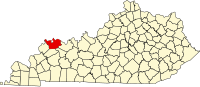 | |
| CDPs | ||
| Other communities |
| |
| Ghost town | ||
| Footnotes | ‡This populated place also has portions in an adjacent county or counties | |
| ||