
Baiern
Baiern | ||
|---|---|---|
 Community Berganger in Baiern | ||
 Coat of arms | ||
Location of Baiern within Ebersberg district 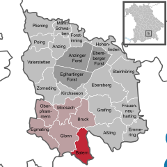 | ||
Municipal assoc. Glonn | | |
| Government | ||
| • Mayor (2018–24) | Martin Riedl[1] | |
| Area | ||
| • Total | 19.96 km2 (7.71 sq mi) | |
| Elevation | 590 m (1,940 ft) | |
| Population (2022-12-31)[2] | ||
| • Total | 1,531 | |
| • Density | 77/km2 (200/sq mi) | |
| Time zone | UTC+01:00 (CET) | |
| • Summer (DST) | UTC+02:00 (CEST) | |
| Postal codes | 85625 | |
| Dialling codes | 08093 | |
| Vehicle registration | EBE | |
| Website | www.glonn.de | |
Baiern is a community in the district of Ebersberg, Upper Bavaria, Germany. It is a member of the administrative community (Verwaltungsgemeinschaft) of Glonn.
The community's name is pronounced the same way as the German name for Bavaria ("Bayern"), although it is spelt differently. This is most likely derived from the old way of spelling Bavaria in German ("Baiern").
The constituent communities of Antholing, Berganger and Netterndorf are to be found within Baiern, as is the Jugenddorf Piusheim ("Youth Village of Piusheim").
Geography
Baiern lies in the Munich region. It includes one traditional rural land unit – Gemarkung in German – also called Baiern.
History
Baiern belonged to the Rentamt of Munich and the Court of Swabia of the Electorate of Bavaria. It was also the seat of a captaincy (Hauptmannschaft). The Weihenstephan Benedictine Monastery was until secularization in 1803 an important landlord in the community. With the municipal edict in 1818 came what is today the community of Baiern.
The painter Edgar Ende spent the last years of his life in a former schoolhouse in Netterndorf. He died there on 27 December 1965 and was buried at the graveyard in Antholing.
Population development
The community's land area was home to 986 inhabitants in 1970, 1048 in 1987 and 1402 in 2000.
Politics
The community's tax revenue in 1999, converted into euros, was €349,000, of which €29,000 was from business taxes.
The community's mayor (Bürgermeister) is Martin Riedl, elected in 2018.
Economy and infrastructure
In 1998, the fields of agriculture and forestry employed no workers on the social insurance contribution rolls. In industry it was 68 and in trade and transport none. In other fields of work there were 152. Also, 345 people on the aforesaid rolls worked from their homes. There were nine processing businesses. There were six businesses in contracting. Furthermore, in 1999, there were 61 agricultural businesses with a total productive land area of 1 546 ha, of which 466 ha was cropland and the other 1 078 ha was meadowland.
Education
In 1999, the following institutions could be found in Baiern:
- Kindergartens: 50 Kindergarten places with 50 children
References
- Bayerisches Landesamt für Statistik, accessed 19 July 2021.
- ^ Genesis Online-Datenbank des Bayerischen Landesamtes für Statistik Tabelle 12411-003r Fortschreibung des Bevölkerungsstandes: Gemeinden, Stichtag (Einwohnerzahlen auf Grundlage des Zensus 2011) (Hilfe dazu).
External links
Towns and municipalities in Ebersberg district | ||
|---|---|---|
| International | |
|---|---|
| National | |
| Geographic | |