Baker Airport
Appearance
Baker Airport | |||||||||||
|---|---|---|---|---|---|---|---|---|---|---|---|
| |||||||||||
| Coordinates | 35°17′11″N 116°04′54″W / 35.28639°N 116.08167°W | ||||||||||
| Website | cms | ||||||||||
| Runways | |||||||||||
| |||||||||||
| Statistics (2006) | |||||||||||
| |||||||||||
Baker Airport (
U.S. Department of the Interior, Bureau of Land Management.[1]
Facilities and aircraft
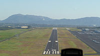
Baker Airport covers an area of 240 acres (97 ha) and has one runway designated 15/33 with a 3,157 by 50 feet (962 by 15 m) asphalt surface. For the 12-month period ending February 16, 2006, the airport had 500 general aviation aircraft operations, an average of 42 per month.[1]
References
- ^ PDF, effective 2007-12-20
External links
- Resources for this airport:
- FAA airport information for 0O2
- AirNav airport information for 0O2
- FlightAware airport information and live flight tracker
- SkyVector aeronautical chart for 0O2

