
Belsele
Belsele | ||
|---|---|---|
Town | ||
 Former town hall | ||
|
Municipality Sint-Niklaas | | |
| Area | ||
| • Total | 19.83 km2 (7.66 sq mi) | |
| Population (2021)[1] | ||
| • Total | 10.572 | |
| • Density | 0.53/km2 (1.4/sq mi) | |
| Time zone | CET | |
Belsele is a village and a deelgemeente of the municipality of Sint-Niklaas, which is situated in the Belgian province of East Flanders.
History
Around the 2nd or 3rd century CE there stood a Roman villa in Belsele, that was discovered in the 19th century. Other findings (like Roman coins) also suggest there was a Roman presence in Belsele around the 3rd century.
Belsele was first mentioned in 870. In 1217 Belsele became an autonomous parish.
Until the first half of the twentieth century, Belsele maintained its typical character of a farmers village in the Waas. Production was mainly focused on flax and wheat till 1850. This changed in the twentieth century when the emphasis was put on food, construction, and textile. Since the second world war, Belsele evolved to a green, residential area. Most of the people work in Sint-Niklaas and Antwerp (fewer). The hamlet Puivelde forms a separate entity.
Gallery
-
 Clergy house
 -
 Sport hall De Klavers
 -
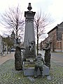 Village pump
 -
 Belsele Castle


References
- ^ a b "Bevolking per statistische sector - Sector 46021C". Statistics Belgium. Retrieved 5 May 2022.
- ^ "Belsele". Agentschap Onroerend Erfgoed (in Dutch). Retrieved 5 May 2022.
| International | |
|---|---|
| National | |
This East Flanders location article is a stub. You can help Wikipedia by expanding it. |