
Bethel, Ohio
Bethel, Ohio | ||
|---|---|---|
FIPS code 39-06068[3] | | |
| GNIS feature ID | 2398110[2] | |
| Website | bethel-oh | |
Bethel is a
History
Bethel was originally called Plainfield, and under the latter name was platted in 1798.[5] The town site was replatted in 1802 under the name Bethel.[5] The present name is after Bethel, a city in the Hebrew Bible.[6] A post office in Bethel has been in operation since 1815.[7]
Geography
According to the United States Census Bureau, the village has a total area of 1.41 square miles (3.65 km2), of which 1.40 square miles (3.63 km2) is land and 0.01 square miles (0.03 km2) is water.[8]
Demographics
| Census | Pop. | Note | %± |
|---|---|---|---|
| 1870 | 634 | — | |
| 1880 | 582 | −8.2% | |
| 1890 | 625 | 7.4% | |
| 1900 | 850 | 36.0% | |
| 1910 | 1,201 | 41.3% | |
| 1920 | 1,340 | 11.6% | |
| 1930 | 1,312 | −2.1% | |
| 1940 | 1,604 | 22.3% | |
| 1950 | 1,932 | 20.4% | |
| 1960 | 2,019 | 4.5% | |
| 1970 | 2,214 | 9.7% | |
| 1980 | 2,231 | 0.8% | |
| 1990 | 2,407 | 7.9% | |
| 2000 | 2,637 | 9.6% | |
| 2010 | 2,711 | 2.8% | |
| 2020 | 2,620 | −3.4% | |
| U.S. Decennial Census[9] | |||
2010 census
As of the
There were 1,052 households, of which 39.4% had children under the age of 18 living with them, 40.3% were married couples living together, 18.8% had a female householder with no husband present, 5.6% had a male householder with no wife present, and 35.3% were non-families. 30.2% of all households were made up of individuals, and 14.7% had someone living alone who was 65 years of age or older. The average household size was 2.56 and the average family size was 3.16.
The median age in the village was 33.8 years. 29% of residents were under the age of 18; 9.1% were between the ages of 18 and 24; 26.4% were from 25 to 44; 22.4% were from 45 to 64; and 12.9% were 65 years of age or older. The gender makeup of the village was 46.5% male and 53.5% female.
2000 census
As of the
There were 1,012 households, out of which 40.3% had children under the age of 18 living with them, 46.5% were married couples living together, 15.1% had a female householder with no husband present, and 32.6% were non-families. 29.2% of all households were made up of individuals, and 14.8% had someone living alone who was 65 years of age or older. The average household size was 2.59 and the average family size was 3.22.
In the village, the population was spread out, with 31.9% under the age of 18, 8.5% from 18 to 24, 30.9% from 25 to 44, 15.8% from 45 to 64, and 13.0% who were 65 years of age or older. The median age was 31 years. For every 100 females there were 87.2 males. For every 100 females age 18 and over, there were 81.9 males.
The median income for a household in the village was $31,385, and the median income for a family was $38,448. Males had a median income of $31,829 versus $23,844 for females. The
Education
Bethel has a public library, a branch of the Clermont County Public Library.[11]
Notable people
- Libbie C. Riley Baer(1849–1929), poet
- Ulysses S. Grant Jr. - attorney and entrepreneur, a son of President Grant
- Thomas Morris - U.S. Senator from Ohio
- Dick Scott - Cincinnati Reds pitcher[12]
Gallery
-
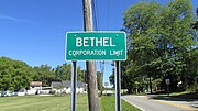 Bethel corporation limit sign
 -
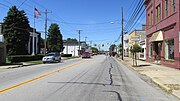 Looking west on East Plane Street in Bethel
 -
 The Starlite Drive-In


References
- ^ "ArcGIS REST Services Directory". United States Census Bureau. Retrieved September 20, 2022.
- ^ a b U.S. Geological Survey Geographic Names Information System: Bethel, Ohio
- ^ a b "U.S. Census website". United States Census Bureau. Retrieved January 31, 2008.
- ^ "Description of the town of Bethel, Ohio". YouTube. Archived from the original on December 11, 2021.
- ^ a b Everts, Louis H. (1880). History of Clermont County, Ohio, with Illustrations and Biographical Sketches of Its Prominent Men and Pioneers. Philadelphia: J.B. Lippincott & Co. p. 324.
- ^ Overman, William Daniel (1958). Ohio Town Names. Akron, OH: Atlantic Press. p. 13.
- ^ "Clermont County". Jim Forte Postal History. Retrieved January 16, 2016.
- ^ "US Gazetteer files 2010". United States Census Bureau. Archived from the original on July 2, 2012. Retrieved January 6, 2013.
- ^ "Census of Population and Housing". Census.gov. Retrieved June 4, 2015.
- ^ "U.S. Census website". United States Census Bureau. Retrieved January 6, 2013.
- ^ "Locations". Clermont County Public Library. Retrieved February 25, 2018.
- ISBN 978-0-87338-886-3.
External links
 | ||||
Villages | ||||
| Townships | ||||
| CDPs | ||||
| Unincorporated communities |
| |||
| Footnotes | ‡This populated place also has portions in an adjacent county or counties | |||
| ||||
| International | |
|---|---|
| National | |