Bhalche
Bhalche
भाल्चे | |
|---|---|
Nepal Time ) |
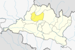
Bhalche is a village development committee in Nuwakot District in the Bagmati Zone of central Nepal. At the time of the 1991 Nepal census it had a population of 2947 living in 624 individual households.[1]
Currently bhalche is one of the ward of Kispang Rural Municipality of Nuwakot District. Years ago bhalche was known as pansyakhola. It has a Nepal’s largest sheep farm. It is also known for its unique culture,beautiful mountains. Every year in ekadasi,people worship the highest mountain there known as Singhla and fikuri as a symbol of peace.mostly people there are Buddhist and had a very old monastery established in 100bc.
Climate
| Climate data for Bhalche (Pansayakhola) (elevation 1,240 m (4,070 ft), 1976–2005 normals) | |||||||||||||
|---|---|---|---|---|---|---|---|---|---|---|---|---|---|
| Month | Jan | Feb | Mar | Apr | May | Jun | Jul | Aug | Sep | Oct | Nov | Dec | Year |
| Average precipitation mm (inches) | 22.2 (0.87) |
31.7 (1.25) |
42.7 (1.68) |
74.9 (2.95) |
210.2 (8.28) |
483.8 (19.05) |
842.9 (33.19) |
827.9 (32.59) |
472.5 (18.60) |
81.4 (3.20) |
13.0 (0.51) |
17.2 (0.68) |
3,128.4 (123.17) |
| Source: Agricultural Extension in South Asia[2] | |||||||||||||
References
- ^ "Nepal Census 2001", Nepal's Village Development Committees, Digital Himalaya, archived from the original on 12 October 2008, retrieved 15 November 2009.
- ^ "TEMPORAL AND SPATIAL VARIABILITY OF CLIMATE CHANGE OVER NEPAL (1976-2005)" (PDF). Agricultural Extension in South Asia. Archived from the original (PDF) on 13 October 2023. Retrieved 14 October 2023.
External links

