
Birampur Upazila
Birampur
বিরামপুর | |
|---|---|
UTC+6 (BST) | |
| Website | birampur |
Birampur (
Geography
Birampur has 42,140 households and total area 212.88 km2. It is an upazila of Dinajpur.
Rivers and lakes
- Jamuna
- Asholar Beel
- Chengar Beel
- Bogghar Beel
- Katuar Beel
Demographics
According to the
As of the
Administration
Birampur Thana was formed on 17 June 1981, and it was turned into an upazila in 1983.[8]
Birampur Upazilla is divided into Birampur Municipality and seven
Birampur Municipality was formed in 1995. It was subdivided into 9 wards and 26

Md. Khairul Alam Raju is now the Upazila Chairman in the Upazila Chairman election. Election held on 18 March 2019. And so on Md. Liakat Ali Sarker Tutul is working as Mayor of Birampur Pouroshova. Md. Towhidur Rahman is our running U.N.O.
| Serial | Name of Union | Chairman |
|---|---|---|
| 01 | Dior | Abul Hossain |
| 02 | Benail | Nazir Hossen |
| 03 | Jotbani | Eyakub |
| 04 | Katla | Hafizur Rahman |
| 05 | Khanpur | Shahidul Islam |
| 06 | Mukundapur | Abdur Razzaq |
| 07 | Pali Prayagpur | Rahmat Ali |
Economy
The main sources of income Agriculture 68.37%, non-agricultural labourer 2.92%, industry 0.86%, commerce 13.08%, transport and communication 2.64%, service 5.1%, construction 0.67%, religious service 0.16%, rent and remittance 0.17% and others 6.03%. Ownership of agricultural land landowner 57.24%, landless 42.76%; agricultural landowner: urban 44.34% and rural 61.34%. The main crops of Birampur are paddy, wheat, corn, jute, potato, vegetables. Mustard, sugarcane and sesame are near extinction. The main fruits are mango, banana, jackfruit, and blackberry. There are 17 fisheries, dairies and poultries.
Contributions
Liberation War 1971
History of the War of Liberation On 20 April 1971, the Pak army killed a few hundred innocent people at Charar Hat of Birampur. Seven Pakistani soldiers and 16 freedom fighters were killed in a direct encounter between the freedom fighters and the Pakistan army at Ketra Hat. On 4 December the general public of the upazila attacked a military vehicle of the Pak army at Beparitola and killed a number of Pak soldiers.
Education
The upazila has 5 colleges, 1 textile institute, 38 secondary schools, 162 primary schools, 28 madrasas. There is also a digital school in the upazila named Birampur ICT School.
Educational institutions
- Birampur Government College (1964)
- Birampur Mahila Degree College (1989)
- Birampur Technical and Management College (2001)
- Adarsha High School and Vocational Institute (1994)
- Birampur Pilot High School (1945)
- Ekair Mangalpur High School (1930)
- Shibpur High School (1951)
- Birampur Government Girl's High School (1971)
- Ideal High School (1998)
- Shiyala Government Primary School (1964)
- Bijul Darul Huda Kamil Madrasa (1958)
- Mukundapur Senior Madrasa (1974)
- Birampur ICT School (2018)
- Katla High School (1966)
Gallery
-
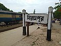 Birampur Railway Station

See also
- Upazilas of Bangladesh
- Districts of Bangladesh
- Divisions of Bangladesh
References
- ^ Shamsuzzaman (2012). "Birampur Upazila". In Sirajul Islam and Ahmed A. Jamal (ed.). Banglapedia: National Encyclopedia of Bangladesh (Second ed.). Asiatic Society of Bangladesh.
- ^ "Birampur Upazila". Banglapedia. Retrieved 8 December 2018.
- ^ "District Census Handbook 2011 Dakshin Dinajpur" (PDF). Map of Dakshin Dinajpur showing CD Blocks on the fourth page. Directorate of Census Operations. Retrieved 8 December 2018.
- ^ "District Human Development Report". Uttar Dinajpur. Page 14: Map showing locational setting of Uttar Dinajpur district (includes Dakshin Dinajpur district). Department of Planning, Statistics and Programme Implementation, Government of West Bengal. Retrieved 8 December 2018.
- ^ a b c d "Bangladesh Population and Housing Census 2011 Zila Report – Dinajpur" (PDF). bbs.gov.bd. Bangladesh Bureau of Statistics.
- ^ "Community Tables: Dinajpur district" (PDF). bbs.gov.bd. Bangladesh Bureau of Statistics. 2011.
- ^ "Population Census Wing, BBS". Archived from the original on 2005-03-27. Retrieved November 10, 2006.
- ^ "Birampur Upazila - Banglapedia". en.banglapedia.org. Retrieved 2023-02-20.
Capital: Dinajpur | ||
| Upazilas | ||
| Constituencies | ||
| Attractions and sites | ||
| History | ||
| Inhabited areas | ||
| Educational institutions | ||
| Transport | ||
| See also | ||
