
Bluemont, Arlington, Virginia
Bluemont, Arlington | |
|---|---|
703 |
Bluemont is a suburban neighborhood in
The neighborhood is bisected by both
neighborhood.Background
The neighborhood gets its name from the old Bluemont Junction on the Alexandria-Bluemont line of the Washington & Old Dominion Railway.[2]
Demographics
As of 2020[update], 72.6% of Bluemont's population is white, 9.9% is Hispanic, 8.5% is Asian, 6.5% is mixed race, 2.4% is black, and 0.1% is other.[3]
Bluemont has several subdivisions (e.e. Brockwood, Lacey Forest and Brandon Village among others).[citation needed]
Education
As of 2020, most children will go to
Points of Interest
The neighborhood is crossed by the Bluemont Junction Trail, along the path of the former Bluemont Branch of the Washington and Old Dominion Railroad.[4] It is also the western end of the Custis Trail.
The community features the Arlington Traditional School, Lacy Woods Park, Bon Air Park, Bluemont Park, Fields Park, Balls Crossing, Saint Ann's Catholic Church, and West Ballston.[1]
Gallery
-
-
![Saint Ann's Catholic Church [Wikidata]](//upload.wikimedia.org/wikipedia/commons/thumb/f/f5/Saint_Ann_statue_Arlington%2C_Virginia.JPG/120px-Saint_Ann_statue_Arlington%2C_Virginia.JPG)
-
 Neighborhood
 -
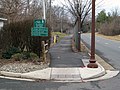
![Southern-Shreve Cemetery [Wikidata]](//upload.wikimedia.org/wikipedia/commons/thumb/7/7d/Southern-Shreve_Cemetery_marker.JPG/120px-Southern-Shreve_Cemetery_marker.JPG)
-
![Bon Air Park [ceb]](//upload.wikimedia.org/wikipedia/commons/thumb/f/fe/Bon_Air_Park_Footbridge_2017b.jpg/120px-Bon_Air_Park_Footbridge_2017b.jpg)
-
![Bluemont Park [ceb]](//upload.wikimedia.org/wikipedia/commons/thumb/4/4c/Flowers_of_Bluemont_Park_2020b.jpg/120px-Flowers_of_Bluemont_Park_2020b.jpg)
-
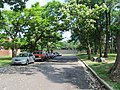
![Bluemont Junction Park [Wikidata]](//upload.wikimedia.org/wikipedia/commons/thumb/a/ad/Bluemont_Junction_Park.jpg/120px-Bluemont_Junction_Park.jpg)

![Saint Ann's Catholic Church [Wikidata]](/File:Saint_Ann_statue_Arlington,_Virginia.JPG)
.jpg)
![Southern-Shreve Cemetery [Wikidata]](/File:Southern-Shreve_Cemetery_marker.JPG)
![Bon Air Park [ceb]](/File:Bon_Air_Park_Footbridge_2017b.jpg)
![Bluemont Park [ceb]](/File:Flowers_of_Bluemont_Park_2020b.jpg)
![Bluemont Junction Park [Wikidata]](/File:Bluemont_Junction_Park.jpg)
See also
References
- ^ a b c "Neighborhood". bluemontcivic.org.
- ^ "Bluemont Junction". Historical Marker Database.
- ^ "The Demographic Statistical Atlas of the United States - Statistical Atlas".
- ^ "Bluemont Junction Caboose". Arlington County, Virginia: Arlington County Department of Parks and Recreation. Archived from the original on March 4, 2021. Retrieved March 13, 2021.
External links
Municipalities and communities of Arlington County, Virginia, United States | ||
|---|---|---|
| Unincorporated communities |
|  |
| ||