
Brooksville, Oklahoma
Brooksville, Oklahoma | ||
|---|---|---|
FIPS code 40-09400[3] | | |
| GNIS feature ID | 2411734[2] | |
Brooksville is a town in
History
One of more than fifty All-Black towns of Oklahoma, Brooksville is one of only thirteen still existing at the beginning of the twenty-first century. Located in Pottawatomie County four miles southwest of Tecumseh, Brooksville was established in 1903. Originally the town was named Sewell, after a white doctor who owned much of the surrounding land and attended the residents. In 1909 the name changed to Brooksville in honor of the first African American in the area, A. R. Brooks, a cotton buyer and farmer. Brooks served as postmaster here from March 18, 1909, until January 27, 1913, at which time his son, William M. Brooks, became postmaster. In 1906 Rev. Jedson White organized St. John's Baptist Church. Soon afterward, the congregation built a church that still exists. White also promoted the town throughout the South, urging African Americans to settle in Brooksville. Brooksville had a Santa Fe Railroad station, three hotels, two doctors, and two mills.[5]
In 1924, with the aid of the Rosenwald Fund, a new school was built. Banneker School, under management of W. T. McKenzie, was a rock building of four large rooms, a three-hundred-seat auditorium, a small library, and a well-equipped domestic science room. George W. McLaurin, the first African American graduate student at the University of Oklahoma, taught at the school. After a fire, the original building was replaced by a wooden one that served students until the school closed in 1968. The building then became a community center for the town and stands next to the new city hall. A declining cotton market and the Great Depression made life difficult in Brooksville, as in many Oklahoma communities. Most of the residents departed, but the town survived. At the beginning of the twenty-first century Brooksville was steadily increasing in population.[5]
Geography
According to the United States Census Bureau, the town has a total area of 3.0 square miles (7.8 km2), all land.
Demographics
| Census | Pop. | Note | %± |
|---|---|---|---|
| 1910 | 166 | — | |
| 1980 | 46 | — | |
| 1990 | 69 | 50.0% | |
| 2000 | 90 | 30.4% | |
| 2010 | 63 | −30.0% | |
| 2020 | 71 | 12.7% | |
| U.S. Decennial Census[6] | |||
As of the
There were 32 households, out of which 43.8% had children under the age of 18 living with them, 59.4% were married couples living together, 12.5% had a female householder with no husband present, and 28.1% were non-families. 28.1% of all households were made up of individuals, and 9.4% had someone living alone who was 65 years of age or older. The average household size was 2.81 and the average family size was 3.22.
In the town, the population was spread out, with 38.9% under the age of 18, 7.8% from 18 to 24, 18.9% from 25 to 44, 18.9% from 45 to 64, and 15.6% who were 65 years of age or older. The median age was 32 years. For every 100 females, there were 80.0 males. For every 100 females age 18 and over, there were 77.4 males.
The median income for a household in the town was $45,625, and the median income for a family was $45,417. Males had a median income of $51,250 versus $38,750 for females. The
See also
- Land Run of 1889.
References
- ^ "ArcGIS REST Services Directory". United States Census Bureau. Retrieved September 20, 2022.
- ^ a b U.S. Geological Survey Geographic Names Information System: Brooksville, Oklahoma
- ^ a b "U.S. Census website". United States Census Bureau. Retrieved January 31, 2008.
- ^ CensusViewer: Population of the City of Brooksville, Oklahoma
- ^ a b Larry O'Dell. "Brooksville," Encyclopedia of Oklahoma History and Culture. Accessed August 19, 2012
- ^ "Census of Population and Housing". Census.gov. Retrieved June 4, 2015.
External links
Municipalities and communities of Pottawatomie County, Oklahoma, United States | ||
|---|---|---|
| Cities | 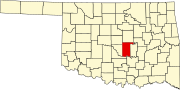 | |
| Towns | ||
| CDP | ||
| Other communities | ||
| Ghost towns | ||
| Footnotes | ‡This populated place also has portions in an adjacent county or counties | |
| ||