
Carthage, South Dakota
Carthage, South Dakota | ||
|---|---|---|
FIPS code 46-10220[4] | | |
| GNIS feature ID | 1267311[2] | |
| Website | www | |
Carthage is a city in
History
Carthage was platted in 1883.[7] It was named after Carthage, New York.[7][8]
Geography
According to the United States Census Bureau, the city has a total area of 1.49 square miles (3.86 km2), of which 1.46 square miles (3.78 km2) is land and 0.03 square miles (0.08 km2) is water.[9]
Demographics
| Census | Pop. | Note | %± |
|---|---|---|---|
| 1890 | 200 | — | |
| 1900 | 265 | 32.5% | |
| 1910 | 554 | 109.1% | |
| 1920 | 667 | 20.4% | |
| 1930 | 590 | −11.5% | |
| 1940 | 512 | −13.2% | |
| 1950 | 458 | −10.5% | |
| 1960 | 368 | −19.7% | |
| 1970 | 362 | −1.6% | |
| 1980 | 274 | −24.3% | |
| 1990 | 221 | −19.3% | |
| 2000 | 187 | −15.4% | |
| 2010 | 144 | −23.0% | |
| 2020 | 127 | −11.8% | |
| U.S. Decennial Census[10][3] | |||
2010 census
As of the
There were 80 households, of which 15.0% had children under the age of 18 living with them, 36.3% were married couples living together, 8.8% had a female householder with no husband present, 1.3% had a male householder with no wife present, and 53.8% were non-families. 46.3% of all households were made up of individuals, and 21.3% had someone living alone who was 65 years of age or older. The average household size was 1.80 and the average family size was 2.46.
The median age in the city was 52.3 years. 16% of residents were under the age of 18; 5.7% were between the ages of 18 and 24; 18.2% were from 25 to 44; 34.7% were from 45 to 64; and 25.7% were 65 years of age or older. The gender makeup of the city was 50.7% male and 49.3% female.
2000 census
At the 2000
There were 98 households, of which 14.3% had children under the age of 18 living with them, 49.0% were married couples living together, 4.1% had a female householder with no husband present, and 46.9% were non-families. 43.9% of all households were made up of individuals, and 28.6% had someone living alone who was 65 years of age or older. The average household size was 1.91 and the average family size was 2.63.
Age distribution was 16.0% under the age of 18, 6.4% from 18 to 24, 16.0% from 25 to 44, 26.2% from 45 to 64, and 35.3% who were 65 years of age or older. The median age was 51 years. For every 100 females, there were 98.9 males. For every 100 females age 18 and over, there were 84.7 males.
The median household income was $27,679, and the median family income was $32,917. Males had a median income of $26,750 versus $15,938 for females. The
Notable person
- United States district judge
- John A. Jerlow, paving company owner
References
- ^ "SD Towns" (PDF). South Dakota State Historical Society. Archived from the original (PDF) on February 10, 2010. Retrieved February 11, 2010.
- ^ a b U.S. Geological Survey Geographic Names Information System: Carthage, South Dakota
- ^ a b "Census Population API". United States Census Bureau. Retrieved October 15, 2022.
- ^ a b "U.S. Census website". United States Census Bureau. Retrieved January 31, 2008.
- ^ "ArcGIS REST Services Directory". United States Census Bureau. Retrieved October 15, 2022.
- ^ "U.S. Census Bureau: Carthage city, South Dakota". www.census.gov. United States Census Bureau. Retrieved January 16, 2022.
- ^ a b Chicago and North Western Railway Company (1908). A History of the Origin of the Place Names Connected with the Chicago & North Western and Chicago, St. Paul, Minneapolis & Omaha Railways. p. 52.
- ^ Federal Writers' Project (1940). South Dakota place-names, v.1-3. University of South Dakota. p. 30.
- ^ "US Gazetteer files 2010". United States Census Bureau. Archived from the original on July 2, 2012. Retrieved June 21, 2012.
- ^ "Census of Population and Housing". Census.gov. Retrieved June 4, 2015.
- ^ "U.S. Census website". United States Census Bureau. Retrieved June 21, 2012.
Municipalities and communities of Miner County, South Dakota, United States | ||
|---|---|---|
| Cities | 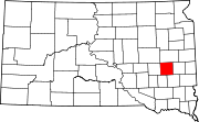 | |
| Towns | ||
| Township | ||
| CDPs | ||
| Ghost town |
| |
| ||