
Cattle Creek, Colorado
Cattle Creek, Colorado | |
|---|---|
MDT) | |
| ZIP Code[4] | Glenwood Springs 81601 |
| Area code | 970 |
| GNIS feature | 2583221[2] |
Cattle Creek is a
Zip Code 81601) serves the area.[4]
Geography
The CDP is located in southeastern Garfield County along Colorado State Highway 82 in the valley of the Roaring Fork River. Cattle Creek, a tributary of the Roaring Fork, forms the southern edge of the CDP. Highway 82 leads north 7 miles (11 km) to Glenwood Springs, the county seat, and south 6 miles (10 km) to Carbondale.
The Cattle Creek CDP has an area of 829 acres (3.355 km2), all land.[1]
Demographics
| Year | Pop. | ±% |
|---|---|---|
| 2010 | 641 | — |
| 2020 | 662 | +3.3% |
| Source: United States Census Bureau | ||
The
United States Census 2010
.
See also
References
- ^ a b c "State of Colorado Census Designated Places - BAS20 - Data as of January 1, 2020". United States Census Bureau. Retrieved December 22, 2020.
- ^ a b c U.S. Geological Survey Geographic Names Information System: Cattle Creek, Colorado
- ^ a b United States Census Bureau. "Cattle Creek CDP, Colorado". Retrieved April 16, 2023.
- ^ a b "Zip Code 81601 Map and Profile". zipdatamaps.com. 2020. Retrieved December 22, 2020.
External links
Wikimedia Commons has media related to Cattle Creek, Colorado.
Municipalities and communities of Garfield County, Colorado, United States | ||
|---|---|---|
| Cities | 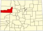 | |
| Towns | ||
| CDPs | ||
| Unincorporated communities | ||
| Ghost town | ||
| ||