
Chowringhee
Chowringhee | |
|---|---|
Neighbourhood in Kolkata (Calcutta) | |
Chowranghee and Bhabanipur |
Chowringhee (also Chourangi) is a neighbourhood of Central
Etymology
The name 'Chowringhee' has defied etymologists. There is, however, the legend of a Nath yogi, Chouranginath, who discovered an image of the goddess Kali's face and built the first Kalighat temple.[2]
History
The village

In the seventeenth century or prior to it, the area now occupied by the
Urbanisation
The strengthening of British power, subsequent to their victory in the Battle of Plassey was followed by the construction of the new Fort William, in 1758. The European inhabitants of Kalikata gradually forsook the narrow limits of the old palisades and moved to around the Maidan.[4]
The neighbourhood

New names

Indian independence saw a rush to rename streets. The process has slowed as few streets are left to be renamed. Chowringhee Road was renamed after
Geography
Park Street Flyover was inaugurated on 19 February 2005. The 1.3-kilometre (0.81 mi) long flyover above
Creative inspiration
In 1981,
Gallery
-
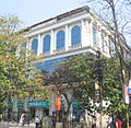
 Industry House onAbanindranath Tagore Sarani
 -
 Abanindranath Tagore Sarani
 -
 St. Thomas Church adjacent to Loreto House on Middleton Row
 -
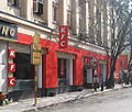 KFC outlet on Middleton Row
 -
 Middleton Street
 -
 Park Street Flyover


External links
![]() Kolkata/Esplanade travel guide from Wikivoyage
Kolkata/Esplanade travel guide from Wikivoyage
References
- ^ "Tax lawyer is CPM candidate for Chowringhee seat". The Hindu Business Line, 18 February 2006. Retrieved 16 January 2008.
- ISBN 978-0-19-563696-3.
- Cotton, H.E.A., Calcutta Old and New, 1909–1980, p. 19, General Printers and Publishers Pvt. Ltd.
- ^ Cotton, H.E.A., p. 72.
- ^ Cotton, H.E.A., pp. 230–236.
- ^ "Park Street Flyover".
- ^ "36 Chowringhee Lane (1981)". imdb.com. Retrieved 16 January 2008.