
Clontarf, Queensland
| Clontarf Federal division(s) | Petrie | ||||||||||||||
|---|---|---|---|---|---|---|---|---|---|---|---|---|---|---|---|
| |||||||||||||||
Clontarf is a coastal suburb in the City of Moreton Bay, Queensland, Australia.[2] In the 2021 census, Clontarf had a population of 8,446 people.[3]
Clontarf is in the south-west of the Redcliffe Peninsula, approximately 34.4 kilometres (21.4 mi) by road north-northeast of Brisbane, the state capital.[4] It was named after Clontarf in Ireland.[citation needed]
Geography
Clontarf is connected to Brisbane City, across Bramble Bay, by the Houghton Highway which is a 2.7 km long causeway that provides access to the southern tip of the Redcliffe Peninsula, greatly decreasing the travel time between Redcliffe and Brisbane. The current pair of bridges, Houghton Highway and its twin Ted Smout Memorial Bridge, replaced the original Hornibrook Bridge which is now closed and mostly removed except for a short span (on the north) and the two iconic bridge entrance towers that were retained to form a very popular fishing pier at the northern and southern ends of Bramble Bay.[citation needed]
The land use is a mix of residential and light industrial.
History
In 1881,108 allotments at Hayes Inlet Estate, Humpy Bong of what is now Clontarf were offered for sale.[5][6] The Clontarf estate went to auction on 26 September 1882.[7][8] The sale was widely advertised including a coloured lithograph, showing the sub-division of Dr Ward's sugar plantation and using references to the city of Redcliffe "in the near future" and a regular steam ferry service between Sandgate and Clontarf within months in the newspaper advertisements.[9][10] The success which attended this sale of the Clontarf Estate led to Clontarf North sale in December 1882.[11][12]
Clontarf Beach State School opened on 31 January 1950.[13]
St Barnabas' Anglican Church was dedicated on 5 July 1959 by Archbishop Reginald Halse.[14] In the 1990s it was decided to combine the congregations of St Barnabas' and St Mark's in Woody Point into a new St Peter the Fisherman's Anglican Church at Clontarf. This led to the closure of St Mark's on 24 April 1993 which was approved by Assistant Bishop George Browning.[15] This resulted in the closure of St Barnabas circa 1992.[14] St Peter the Fisherman's was dedicated in 1993 and consecrated in 1996.[16][17]
Clontarf Beach State High School opened on 28 January 1964.[13]
Grace Lutheran Primary School opened on 26 January 1971.[13]
Demographics
In the
In the 2016 census, Clontarf had a population of 8,279 people.[18]
In the 2021 census, Clontarf had a population of 8,446 people.[3]
Heritage listings
Clontarf has a number of heritage-listed sites, including:
- Hornibrook Highway: Hornibrook Bridge (the first of the three bridges).[19]
Economy
Clontarf's west hosts the largest industrial area in the Redcliffe area, and the area is a significant source of employment for the region. Many residents of Clontarf also commute to Brisbane daily for work. Commuters also travel to Brisbane by train, as there is now a train line that connects to the peninsula.[citation needed]
Clontarf is host to two adjacent medium-sized shopping centres, on the southern tip of the suburb. Most retail commerce in the suburb revolves around small business however, and there are many stand alone corner stores and other small businesses still in existence.[citation needed]
Education
Clontarf Beach State School is a government primary (Prep-6) school for boys and girls at Elizabeth Avenue (27°15′12″S 153°04′52″E / 27.2533°S 153.0811°E).[20][21] In 2018, the school had an enrolment of 451 students with 37 teachers (32 full-time equivalent) and 25 non-teaching staff (14 full-time equivalent).[22] It includes a special education program at Clontarf Beach State School at Elizabeth Avenue (27°15′12″S 153°04′52″E / 27.2533°S 153.0811°E).[20]
Grace Lutheran Primary School is a private primary (Prep-6) school for boys and girls at 38 Maine Road (27°15′15″S 153°05′23″E / 27.2542°S 153.0896°E).[20][23] In 2018, the school had an enrolment of 393 students with 29 teachers (25 full-time equivalent) and 23 non-teaching staff (13 full-time equivalent).[22]
Clontarf Beach State High School is a government secondary (7-12) school for boys and girls at Cnr Elizabeth Avenue & King Street (27°14′52″S 153°05′10″E / 27.2479°S 153.0861°E).[20][24] In 2018, the school had an enrolment of 923 students with 78 teachers (76 full-time equivalent) and 42 non-teaching staff (33 full-time equivalent).[22] It includes a special education program.[20]
Amenities

St Peter the Fisherman's Anglican Church is at 13 Lucinda Street (27°14′47″S 153°05′21″E / 27.2465°S 153.0892°E).[17]
Peninsula Life Church is at 3-7 Lavelle Court (27°14′48″S 153°05′38″E / 27.2467°S 153.0938°E).[25] It is part of the Wesleyan Methodist Church.[26]
The Clontarf branch of the Queensland Country Women's Association meets at the corner of Victoria Avenue and Georgina Street at Woody Point.[27]
Public transport

Clontarf is served by several bus routes: Route 694, an internal route within Redcliffe City, and Routes 690 and 691 to Sandgate railway station, an approximately 10- to 15-minute commute. All services are provided by Hornibrook Bus Lines.[28]
The Redcliffe Peninsula line is a 12 kilometres (7.5 mi) stretch of heavy gauge dual-track railway between Petrie and Kippa-Ring on the Redcliffe Peninsula. The new line is part of the QR Citytrain suburban network, branching from the Caboolture line. It starts 200 metres north of Petrie railway station, extending from (27.5 kilometres (17.1 mi) to 40.1 kilometres (24.9 mi) north of Central railway station).[citation needed]
Attractions

Clontarf Beach and Bells Beach are two of the closest beaches to Brisbane City.[citation needed]
The Hornibrook Pier is a popular fishing spot and gathering point for families developed from the remnants of the historic Hornibrook Highway bridge that was removed in 2010 when the Ted Smout Memorial Bridge was opened.[citation needed]
The challenging and historic Redcliffe Golf Course is also found in Clontarf since 1936. It is home to numerous wildlife species including grey kangaroos and koalas.[citation needed]
The Kroll gardens and large Kroll Gardens Dog park are a popular destination to unwind after work or on weekends for many.[citation needed]
Pelican Park is known for its
Events
During May, the Redcliffe Kite Club, based in Clontarf holds a two-day kite event called Kitefest.[citation needed]
See also
Redcliffe Peninsula road network
Gallery
-
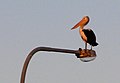 Roosting pelican on the Houghton
 -
 Houghton Highway at sunset
 -
 Coles Express Clontarf


References
- ^ Australian Bureau of Statistics (28 June 2022). "Clontarf (Moreton Bay - Qld) (suburb and locality)". Australian Census 2021 QuickStats. Retrieved 28 June 2022.
- ^ "Clontarf – suburb in Moreton Bay Region (entry 50016)". Queensland Place Names. Queensland Government. Retrieved 20 July 2021.
- ^ a b Australian Bureau of Statistics (28 June 2022). "Clontarf (SAL)". 2021 Census QuickStats. Retrieved 28 February 2023.
- ^ Google (9 December 2021). "Brisbane City to Clontarf" (Map). Google Maps. Google. Retrieved 9 December 2021.
- The Brisbane Courier. Vol. XXXV, no. 4, 302. Queensland, Australia. 5 March 1881. p. 8. Archivedfrom the original on 21 August 2021. Retrieved 30 May 2019 – via National Library of Australia.
- ^ "Plan of 108 allotments in the Hayes Inlet Estate, Humpy Bong, county of Stanley, parish of Redcliffe" (c. 1881) [Map]. Collections. State Library of Queensland.
- The Brisbane Courier. Vol. XXXVII, no. 7, 700. Queensland, Australia. 15 September 1882. p. 8. Archivedfrom the original on 21 August 2021. Retrieved 30 May 2019 – via National Library of Australia.
- ^ "Clontarf [Estate], Humpy Bong" [Map]. Collections. State Library of Queensland.
- ^ "Advertising". The Telegraph. No. 3, 104. Queensland, Australia. 25 September 1882. p. 4. Archived from the original on 21 August 2021. Retrieved 27 August 2019 – via National Library of Australia.
- ^ "Plan of Clontarf, Redcliffe, Humpy Bong facing Moreton Bay and opposite Sandgate, known as Dr. Ward's Sugar Plantation" (c. 1900) [Map]. Collections. State Library of Queensland.
- ^ "Advertising". The Telegraph. No. 3, 180. Queensland, Australia. 21 December 1882. p. 4. Archived from the original on 21 August 2021. Retrieved 30 May 2019 – via National Library of Australia.
- ^ "Clontarf North [Estate]" (1870–1890) [Map]. Collections. State Library of Queensland.
- ^ ISBN 978-1-921171-26-0.
- ^ a b "Closed Anglican Churches". Anglican Church South Queensland. Archived from the original on 3 April 2019. Retrieved 29 June 2020.
- ^ "Closed Churches". Closed Anglican Churches of Southern Queensland. Archived from the original on 3 April 2019. Retrieved 3 April 2019.
- ^ "St Peter the Fisherman Anglican Church Lucinda Street, Clontarf". Organ Historical Trust of Australia. Archived from the original on 18 September 2020. Retrieved 18 September 2020.
- ^ Anglican Archdiocese of Brisbane. 2019. p. 134. Archived(PDF) from the original on 15 September 2020. Retrieved 15 September 2020.
- ^ Australian Bureau of Statistics (27 June 2017). "Clontarf (SSC)". 2016 Census QuickStats. Retrieved 20 October 2018.
- ^ "Hornibrook Highway Bridge (entry 601246)". Queensland Heritage Register. Queensland Heritage Council. Retrieved 11 July 2013.
- ^ a b c d e "State and non-state school details". Queensland Government. 9 July 2018. Archived from the original on 21 November 2018. Retrieved 21 November 2018.
- ^ "Clontarf Beach State School". Clontarf Beach State School. 20 May 2019. Archived from the original on 5 March 2021. Retrieved 9 December 2021.
- ^ a b c "ACARA School Profile 2018". Australian Curriculum, Assessment and Reporting Authority. Archived from the original on 27 August 2020. Retrieved 28 January 2020.
- ^ "Grace Lutheran Primary School". Archived from the original on 10 October 2018. Retrieved 21 November 2018.
- ^ "Clontarf Beach State High School". Clontarf Beach State High School. 28 May 2019. Archived from the original on 19 May 2021. Retrieved 9 December 2021.
- ^ "Peninsula Life Church". Wesleyan Methodist Church Australia. Archived from the original on 24 August 2021. Retrieved 21 August 2021.
- ^ "South Queensland". Wesleyan Methodist Church Australia. Archived from the original on 21 August 2021. Retrieved 21 August 2021.
- ^ "Branch Locations". Queensland Country Women's Association. Archived from the original on 26 December 2018. Retrieved 26 December 2018.
- ^ 310/N310/315 (PDF) Archived 2007-09-01 at the Wayback Machine (315) timetable, effective 3 September 2007; 690 (PDF) Archived 2007-09-01 at the Wayback Machine, 693/696/697 (PDF) Archived 2007-09-01 at the Wayback Machine (693) and 695 (PDF) Archived 2007-09-01 at the Wayback Machine timetables, effective 20 June 2005. Retrieved on 8 September 2007.
External links
- "Clontarf". Queensland Places. Centre for the Government of Queensland, University of Queensland.
- Redcliffe Kite Club