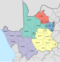
Dawid Kruiper Local Municipality
Dawid Kruiper Local Municipality | |
|---|---|
UTC+2 (SAST ) | |
| Municipal code | NC087 |
Dawid Kruiper Municipality (
//Khara Hais local municipalities.[2] The municipality is named after the San politician Dawid Kruiper
.
Politics
The municipal council consists of thirty-three members elected by
party lists so that the total number of party representatives is proportional to the number of votes received. In the election of 1 November 2021 the African National Congress (ANC) won a majority of eighteen seats on the council.[3][4][5]
The following table shows the results of the election.
| Dawid Kruiper local election, 1 November 2021 | ||||||||
|---|---|---|---|---|---|---|---|---|
| Party | Votes | Seats | ||||||
| Ward | List | Total | % | Ward | List | Total | ||
| African National Congress | 17,470 | 17,262 | 34,732 | 55.1% | 14 | 4 | 18 | |
| Democratic Alliance | 10,991 | 11,169 | 22,160 | 35.2% | 3 | 9 | 12 | |
| Khoisan Revolution | 927 | 1,017 | 1,944 | 3.1% | 0 | 1 | 1 | |
| Freedom Front Plus | 786 | 771 | 1,557 | 2.5% | 0 | 1 | 1 | |
| Economic Freedom Fighters | 523 | 556 | 1,079 | 1.7% | 0 | 1 | 1 | |
| Congress of the People | 305 | 365 | 670 | 1.1% | 0 | 0 | 0 | |
Independent South African National Civic Organisation
|
166 | 168 | 334 | 0.5% | 0 | 0 | 0 | |
| African Christian Democratic Party | 147 | 123 | 270 | 0.4% | 0 | 0 | 0 | |
| Africa Restoration Alliance | 72 | 68 | 140 | 0.2% | 0 | 0 | 0 | |
Patriotic Alliance
|
63 | – | 63 | 0.1% | 0 | – | 0 | |
| African Transformation Movement | 15 | 28 | 43 | 0.1% | 0 | 0 | 0 | |
| Total | 31,465 | 31,527 | 62,992 | 17 | 16 | 33 | ||
| Valid votes | 31,465 | 31,527 | 62,992 | 98.4% | ||||
| Spoilt votes | 490 | 555 | 1,045 | 1.6% | ||||
| Total votes cast | 31,955 | 32,082 | 64,037 | |||||
| Voter turnout | 32,259 | |||||||
| Registered voters | 59,509 | |||||||
| Turnout percentage | 54.2% | |||||||
References
- ^ a b Sum of the statistics from Census 2011 for Mier, //Khara Hais.
- ^ "The Local Government Handbook". Retrieved 6 August 2016.
- ^ "Election Result Table for LGE2021 — Dawid Kruiper". wikitable.frith.dev. Retrieved 2021-11-12.
- ^ "Results Summary - All Ballots" (PDF). Electoral Commission of South Africa. 8 November 2021. Archived (PDF) from the original on 2021-11-12. Retrieved 12 November 2021.
- ^ "Seat Calculation Detail" (PDF). Electoral Commission of South Africa. 8 November 2021. Archived (PDF) from the original on 2021-11-12. Retrieved 12 November 2021.

